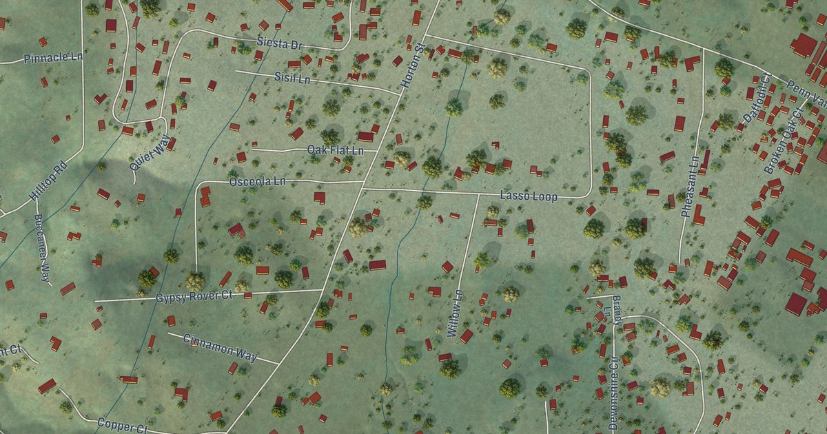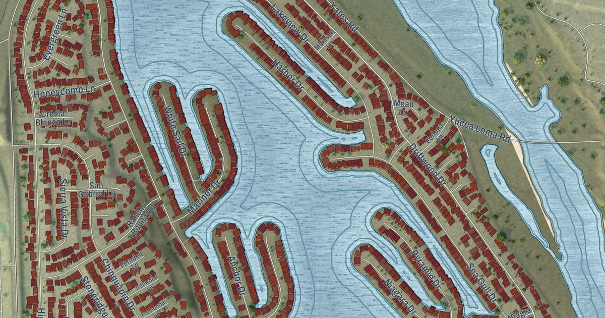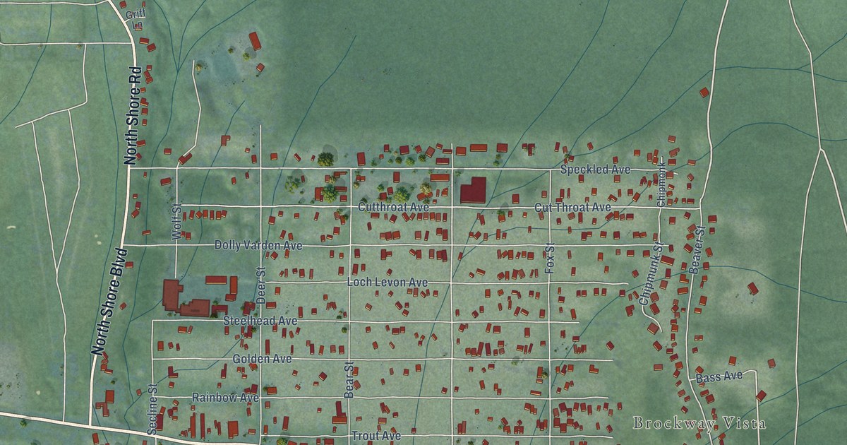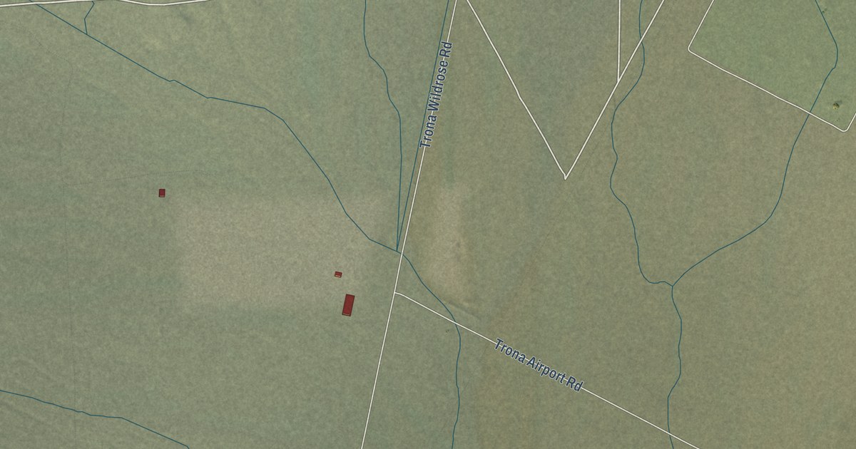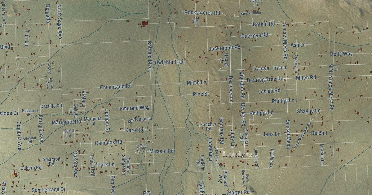
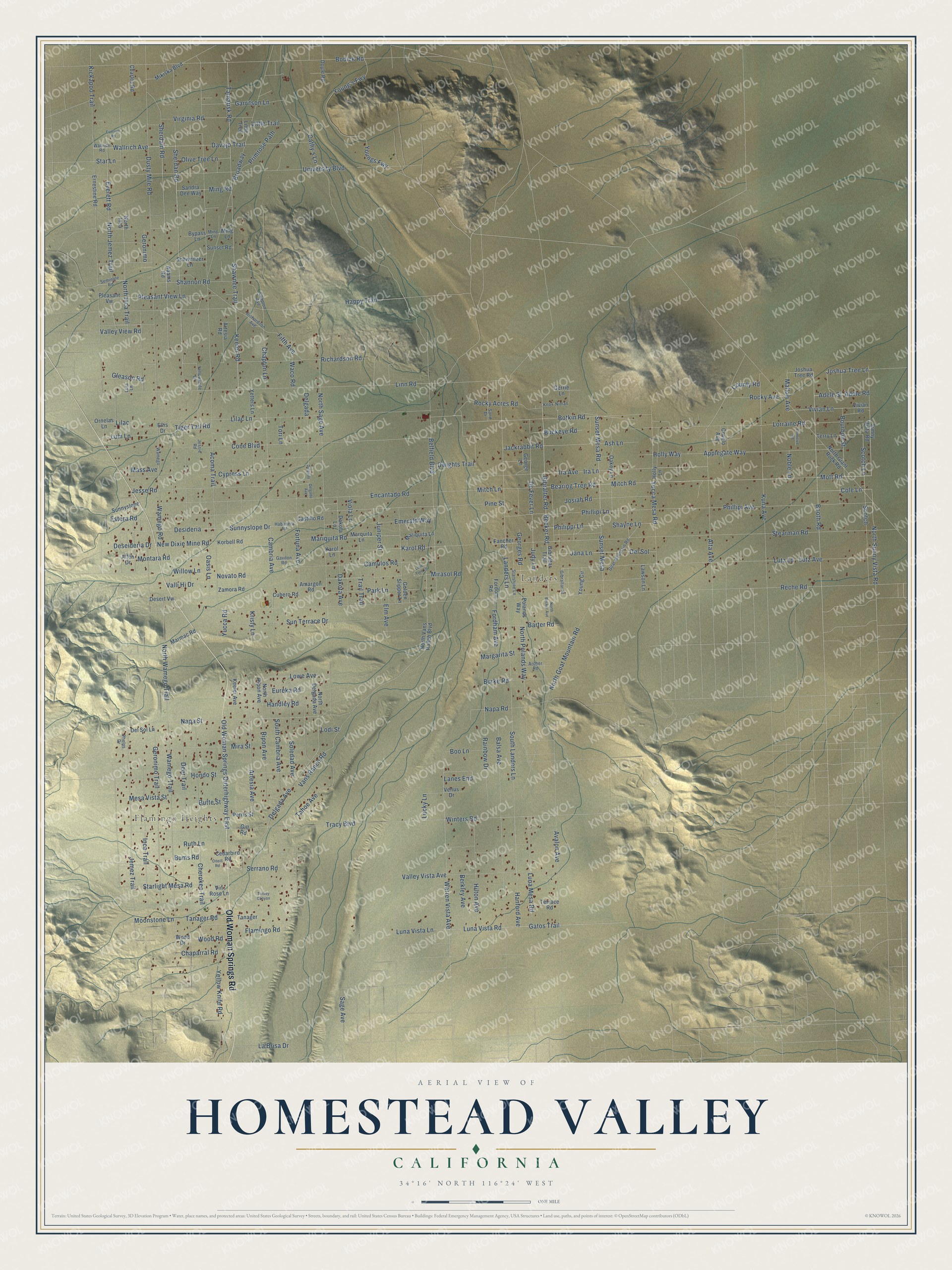
This beautifully detailed map of Homestead Valley, California was created in 2026 using aerial imagery combined with modern topographical, census, street and landmark data. It's a modern aerial view of Homestead Valley in San Bernardino County, California, that combines modern data with a vintage aesthetic. The roads feature printed names, and if you look closely you can find your exact house accurately shown in its correct location.
Explore an aerial view of Homestead Valley, California
On this map you'll find Flamingo Heights, Landers, Old Woman Springs Road, Booth Road, Gibralter Road, Judy Lane, North Sunny Vista Road, Sunset Mesa, Bearing Tree Road, Wallrich Avenue, Philippi Lane, Sunset Mesa Road, and more. Each red shape is a building, so zoom in on the preview and look for yours.
Here is a piece of Homestead Valley history. Landers grew in the 1950s as a place of weekend and part-time homes, spurred by the 1938 Five-Acre Homestead Act known as the Jackrabbit Homestead Act. In 1959 Vernette Landers took up the fight for a post office, and when it opened in an old desert cabin in 1962, she ran it for one dollar a year. It was the first post office granted in an area of government recreational tracts, and it soon became a center of community life. That's from the Morongo Basin Historical Society.
Homestead Valley is a community in San Bernardino County. The Census Bureau counted 2,789 people here in 2020.
Take a closer look at the Homestead Valley map
Names on this map
These names are printed on this map.
Places: Flamingo Heights and Landers.
Streets and roads: Old Woman Springs Road, Booth Road, Gibralter Road, Judy Lane, North Sunny Vista Road, Sunset Mesa, Bearing Tree Road, Wallrich Avenue, Philippi Lane, Sunset Mesa Road, Sherdan Road, Cherokee Trail.
More street names, A to Z
Acoma Trail, Adams Road, Adele Road, Adele Street, Allen Drive, Alta Avenue, Amargon Road, Applegate Way, Archer Road, Artesia Avenue, Artesia Road, Ash Lane, Avalon Avenue, Balsa Avenue, Barter Road, Becker Road, Belfield Boulevard, Berkley Avenue, Bodick Road, Boo Lane, Botkin Road, Bourbon Street, Broadway, Buckeye Road, Bums Road, Burke Road, Butte Street, Bypass Lane, Cambria Avenue, Camulos Road, Castillo Road, Cathy's Lane, Cedarbird Road, Chaparral Road, Chapton Avenue, Chapton Lane, Charles Road, Cole Lane, Cone Boulevard, County Road, Covelo Avenue, Cubero Road, Cypress Lane, Dakota Avenue, Dakota Lane, Davajo Trail, Deer Trail, De Fever Lane, Delgada, Delgada Avenue, Delgado, Delgado Avenue, Del Sol, Del Sol Lane, Deseideria Drive, Desert Vw, Desideria, Doyle Road, Dusty Mile Road, Dwights Trail, Ellis Drive, Elm Avenue, Emerald Way, Encantado Road, Ernestine Road, Estera Road, Eureka Road, Everett Road, Everrett Road, Fancher Road, Fifth Avenue, Flamingo Road, Fordham Avenue, Fordom Road, Fortuna Avenue, Garritson Lane, Gatos Trail, Gavilon Road, George Lane, Georges Road, Geronimo, Geronimo Trail, Gerrie Lane, Gibraltar Street, Gibraltar Trail, Gill Road, Gleason Road, Goat Mountain Road, Golden Slipper Lane, Habanera Road, Handley Road, Hanford Avenue, Happy Trail, Hilton Avenue, Holly Lane, Holly Way, Hondo Street, Inca Trail, Ira Avenue, Ira Lane, Jackrabbit Road, Jana Lane, Jemez Trail, Jesse Road, Jessie Road, Joshua Tree Lane, Joshua Tree Road, Josiah Road, Juniper Street, Karol Lane, Karol Road, Keeler Avenue, Keeler Road, Kickapoo Trail, Knox-Niman, Korbell Road, Kristy Lane, Kuna Avenue, La Brisa Drive, Landers Lane, Lanes End, Lawson Lane, Lilac, Lilac Lane, Linn Road, Little Trail, Little Tree, Lodi Street, Lone Tree Lane, Lorraine Road, Lowe Avenue, Lucky Lane, Lum Lane, Luna Mesa Road, Luna Vista Lane, Luna Vista Road, Lura Lane, Lutz Avenue, Lutz Lane, Mallow Avenue, Margarita Street, Mariquita Lane, Mariquita Road, Marmac Road, Marquita Lane, Mass Avenue, Mesa Vista Street, Mikiska Boulevard, Mine Lane, Ming Lane, Ming Road, Mirasol Road, Mira Street, Mitch Lane, Mitch Road, Montara Road, Moonstone Lane, Mott Road, Napa Road, Napa Street, New Dixie Mine Road, Noble Lane, North Becker Avenue, North Delgada Avenue, North Giant Rock Road, North Goat Mountain Road, North Inca, North Inca Trail, North Jemez Trail, North Polands Way, North Ripon Avenue, North Sage Avenue, North Vans Ranch Boulevard, North Wamego Trail, Novato Road, Oakey Lane, Oasis Lane, Old Woman Springs Outerhighway East, Olive Tree Lane, Oneill Road, Ornelas Lane, Park Lane, Perris Street, Phelps Drive, Phillipi Avenue, Phillipi Lane, Pine Street, Pleasant View Lane, Pleasant Vw, Polands Way, Primitive Road, Primrose Path, Rainbow Drive, Reche Road, Richardson Avenue, Richardson Road, Ripon Avenue, Rocky Acres Road, Rocky Avenue, Ruth Lane, Sage Avenue, Sand Drive, Sandra Dee Way, Schweitzer Lane, Scotch, Scotch Lane, Seminole Road, Serrano Road, Shannon Road, Shawnee Trail, Shayne Lane, Sherdam Road, Soledad Avenue, South Cambria Avenue, South Landers Lane, Star Lane, Starlight Mesa Road, Starshine Lane, Stearman Road, Sunnyslope, Sunnyslope Drive, Sunny Vista Road, Sunset Road, Sun Terrace Drive, Tahoe Avenue, Tamarisk Road, Tanager, Tanager Road, Terrace Road, Terry Lane, Tiger Tail Road, Tori Lane, Tracy Boulevard, Trail Trail, Turkey Canyon, University Boulevard, Valley View Road, Valley Vista Avenue, Valli Hi Drive, Vans Ranch Road, Venus Drive, Vin Rose Lane, Viola Lane, Virginia Road, Vivian Lane, Vivian Road, Waco Road, Wallrich Road, Wamego, Wamego Road, Wamego Trail, Warren Vista Avenue, Willow Lane, Winters Road, Wood Drive, Wood Road, Yellowknife Lane, Yellow Knife Road, Yetters Lane, Young's Fwy, Young Circle, Youngs Fwy, Yucca Mesa Road, Yucca Road, Zamora Road.
See it on a wall
The Homestead Valley map as a framed print. Swipe for more.


Created by KNOWOL in 2026. The buildings are small red shapes, the roads carry their printed names, and shaded relief shows the shape of the land. The title panel reads "AERIAL VIEW OF HOMESTEAD VALLEY, CALIFORNIA" with 34°16' NORTH 116°24' WEST.
It suits a den, a classroom or a front hall, and it makes a gift for anyone with Homestead Valley roots. Open the preview and find the block you know. See sizes and frames for the Homestead Valley map.