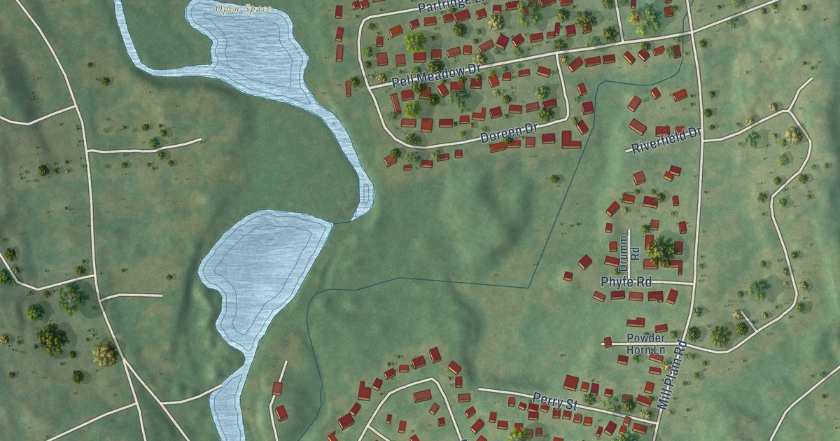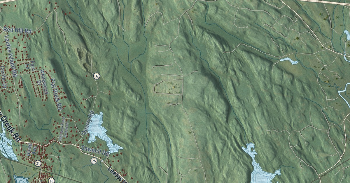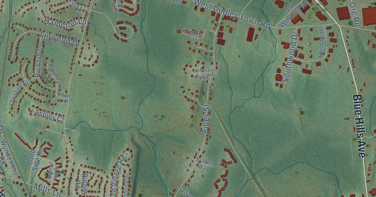
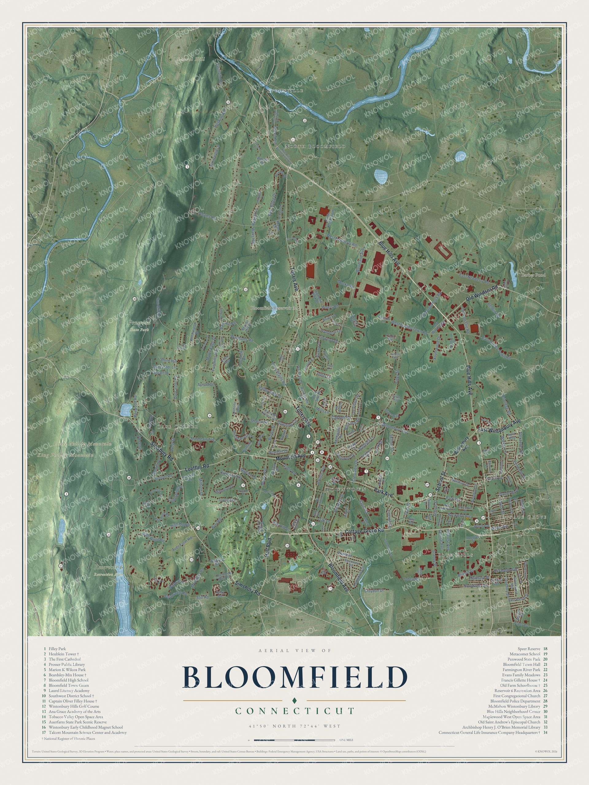
This beautifully detailed map of Bloomfield, Connecticut was created in 2026 using aerial imagery combined with modern topographical, census, street and landmark data. It’s a one-of-a-kind view of Bloomfield that combines accurate data with a vintage aesthetic. The map shows every building in its true location, many of the roads carry their names, and the shaded topographic relief shows the shape of the land.
See it on a wall
The Bloomfield map as an 18 x 24 inch print in a black frame.

Explore an aerial view of Bloomfield, Connecticut
On the map you’ll find Downtown, Blue Hills, Cottage Grove, Grant Hill, King Phillip Mountain, Laurel Hill, Little Phillip Mountain, Barber Pond, Bloomfield Reservoir 3A, Penwood State Park, Reservoir 6 Recreation Area, North Bloomfield, and more. If you look closely you can even find your house accurately drawn in its correct location. Zoom in on the preview to look for yours. Click here to learn more about the history of Bloomfield.
Take a closer look at the Bloomfield map
Click to explore a larger preview. The digital watermark does not appear on printed maps.
Names on this map
These names are printed on this map.
Places: Downtown, Blue Hills, Cottage Grove, Grant Hill, King Phillip Mountain, Laurel Hill, Little Phillip Mountain, Barber Pond, Penwood State Park, Reservoir 6 Recreation Area, North Bloomfield, Case Corner and Spoonville.
Streets and roads: Bloomfield Avenue, Cottage Grove Road, Mountain Avenue, School Street, Blue Hills Avenue, Loeffler Road, Tunxis Avenue, Old Windsor Road, Simsbury Road, Park Avenue, Hall Boulevard, East Wintonbury Avenue.
More street names, A to Z
Adams Road, Alexander Road, Alice Drive, Anthony Way, Applewood Road, April Way, Arnold Drive, Ashley Court, Auer Farm Road, Avery Road, Balbrae Drive, Banbury Lane, Banfield Lane, Barber Pond Road, Barn Hill Road, Barry Circle, Bay Hill Drive, Beacon Hill Drive, Bear Ridge Drive, Beaudry Lane, Belden Road, Birch Road, Blue Hills Avenue Extended, Boysen Drive, Brentwood Drive, Brewer Drive, Briar Lane, Brighton Park Way, Britton Drive, Brookline Avenue, Brown Street, Burnwood Drive, Burr Road, Butternut Drive, Cadwell Road, Capewell Drive, Central Avenue, Chapel Street, Chestnut Hill Drive, Christine Circle, Cliffmount Drive, Clover Lane, Cold Spring Drive, Countryview Drive, Coventry Street, Craigmore Road, Crestview Drive, Croydon Drive, Crystal Lane, Cyrus Lane, Dale Avenue, Daniel Boulevard, Deerfield Road, Diana Drive, Dorothy Drive, Douglas Street, Downing Circle, Duncaster Lane, Duncaster Road, East Dudley Town Road, East Harold Street, East Lane, East Newberry Road, Elizabeth Avenue, Ellsworth Drive, Emerson Street, Essex Lane, Evan Lane, Fern Drive, Filley Street, Foothills Way, Forest Lane, Fox Chase Road, Francis Way, Gabb Road, Gale Road, Gilbert Avenue, Goodman Street, Granby Street, Grant Hill Road, Greenbriar Drive, Greenwood Avenue, Griffin Road South, Guernsey Road, Guilmartin Road, Gun Mill Road, Habitat Lane, Hampton Lane, Harvest Lane, High Hill Road, Highland Park Drive, High Wood Road, Hillcrest Avenue, Hill Farm Road, Hoskins Road, Hubbard Street, Ivory Road, Jackson Road, Jeffrey Lane, Jerome Avenue, Jolley Drive, Jonathan Place, Joyce Street, Julie Lane, Juniper Road, Kenmore Road, Kenwood Circle, Kristins Way, Larensen Ridge, Latimer Lane, Ledyard Avenue, Lincoln Terrace, Linwood Drive, Lisa Lane, Longview Drive, Louis Drive, Lyman Lane, Lynn Circle, Mallard Drive, Maple Avenue, Maple Edge Drive, Mayfair Road, May Lane, McCormick Place, Medinah Drive, Milburn Drive, Mills Lane, Mosey Drive, Mountain Road, Mucko Road, Newport Drive, Nolan Drive, Norman Drive, Northwood Drive, Oak Lane, Old Flintlock Road, Old Iron Ore Road, Old Poquonock Road, Old Village Road, Oliver Way, Overbrook Farm Road, Packard Street, Pasture Lane, Patton Road, Pebble Beach Road, Pent Road, Penwood Road, Peters Road, Pinney Road, Pond Side Road, Privilege Road, Prospect Street, Puritan Drive, Rescue Lane, Reservoir Road, Revere Drive, Richard Lane, Ridge Road, Rockwell Avenue, Rundelane, Ryefield Hollow Drive, Savin Road, Scotland Road, Scott Drive, Sharon Road, Sherman Way, Silo Way, Skinner Drive, South Barn Hill Road, South Ridge Drive, Southwood Drive, Springwood Lane, Spruce Street, Still Road, Stone Hill, Stuart Drive, Sutton Place, Sylvan Way, Tariffville Road, Terry Plains Road, Thistle Pond Drive, Tobey Road, Tower Avenue, Tunxis Avenue Extended, Tyler Street, Utley Road, Valley View Drive, Vista Way, Wade Avenue, Wadhams Road, Walker Lane, Walsh Avenue, Walts Hill, Warbler Circle, Watkins Road, Wesleyan Terrace, West Dudley Town Road, West Eggleston Street, West Lane, West Newberry Road, West Street, Willow Lane, Winged Foot Boulevard, Wintonbury Avenue, Woodford Drive, Woodland Avenue, Woods Road, Worthington Drive, Wyndemere Road, Wynfield Lane.
This beautifully detailed map of Bloomfield makes an attractive addition to your office, library, or den, and it can even be used to teach children the geography and history of the area. It also makes a great gift for someone who left Bloomfield and still calls it home. When you’re done exploring, click here to get your copy of the Bloomfield map.