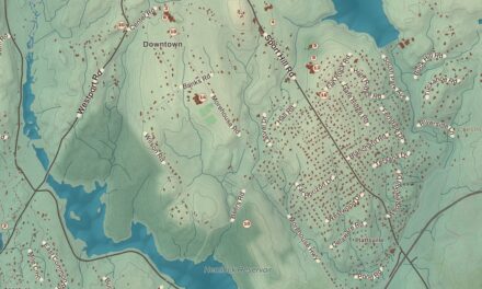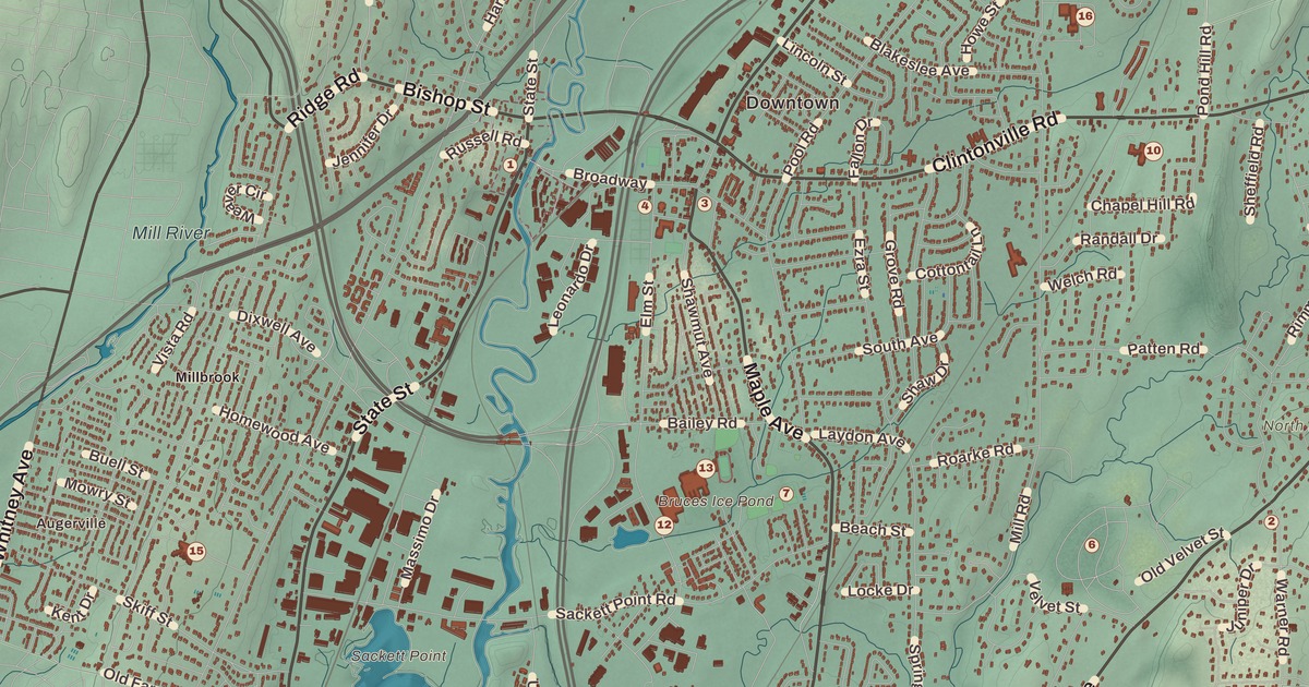
If you grew up in North Haven, or you’ve ever crossed the Quinnipiac on Broadway by the old Pines Bridge, you’ll find your town on this map just as it stands in 2026. Look for your road. State Street, Washington Avenue, Broadway, Bishop Street, Mount Carmel Avenue, Ridge Road, Clintonville Road, Bailey Road, Montowese Avenue, Patten Road, Half Mile Road and Quinnipiac Avenue are all printed by name, along with many more.
North Haven is in New Haven County, on both sides of the Quinnipiac River.
KNOWOL made this map in 2026 from public survey data, and gave it the look of an old atlas. The shaded land, from Augerville in the southwest to the traprock of Peter’s Rock in the south, comes from United States Geological Survey elevation data. The streets and the town line come from the Census Bureau, right down to roads like Hartford Turnpike. Montowese, Clintonville and Millbrook are printed by name. A guide of 31 numbered landmarks runs along the bottom, with the National Register sites marked, and we checked those against National Park Service records.
The Northeast Parish
North Haven began as part of New Haven, and it was called the Northeast Parish. In his will of 1714 the Reverend James Pierpont of New Haven gave 8 acres to his neighbors here, “provided those neighbors will set their meeting house there and do their training and burying there.” The first meeting house was finished in 1722 and stood on the green. In the early 1700s Ezra Stiles counted about forty families in North Haven, all of them farmers who raised what they needed for themselves.
On October 19, 1786, North Haven became a town of its own, and the first town meeting was held that November in the meeting house on Pierpont’s land. That’s the year on the title panel: Incorporated 1786. The Hartford Turnpike came through in 1798. The first federal census, in 1790, counted 1,236 people, but the Grand List of 1789 had found 1,620 sheep, so the sheep outnumbered the townspeople. Click here to learn more about the history of North Haven.
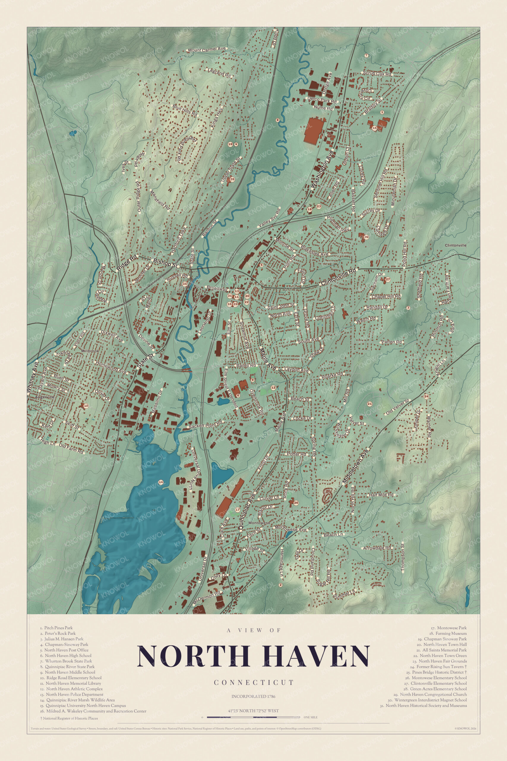
Click to explore a larger preview. The digital watermark does not appear on printed maps.
Names on this map
These names are printed on this map.
Places: Augerville, Sackett Point, Mount Carmel, All Saints Memorial Park, Chapman Sinoway Park, Clintonville Elementary School, East Haven High School, Field B, Green Acres Elementary School, Julius M. Hansen Park, Mildred A. Wakeley Community and Recreation Center, Montowese Park, New Haven Police Department, North Haven Athletic Complex, North Haven Fair Grounds, North Haven High School, North Haven Memorial Library, North Haven Middle School, North Haven Town Green, North Haven Town Hall, Peter's Rock Park, Pitch Pines Park, Quinnipiac River Marsh Wildlife Area, Quinnipiac River State Park, Quinnipiac University North Haven Campus, Ridge Road Elementary School, Rising Sun Tavern and Wharton Brook State Park.
Streets and roads: Kings Hwy, Outer Ridge Rd, Banton St, Scrub Oak Rd, Defco Park Rd, Valley Svc Rd, Washington Ave, Corey Rd, Allen Rd, Point Rd, Elm St, Vista Rd.
More street names, A to Z
Arrowdale Rd, Bailey Rd, Beach Ln, Beach St, Half Mile Rd, Laydon Ave, Middletown Ave, Mill Rd, Patten Rd, Pond Hill Rd, Potts Rd, Randall Dr, Roarke Rd, Sheffield Rd, Valley St, Velvet St, Veto St, Warner Rd.
The Green and the Town Center
The cluster of numbers in the middle of the map is the town center, which stretches along Route 5. About half of Pierpont’s gift is still there as the North Haven Town Green (22). North Haven Town Hall (20) is right by the green, and the North Haven Congregational Church (29) is close by. In the 1880s Solomon Linsley, a North Haven architect, built the Memorial Town Hall, and in all he designed and built 32 Victorian houses and public buildings in town.
Around the corner on Broadway is the Cultural Center, home of the North Haven Historical Society and Museums (31). The society is a volunteer group that collects and researches the town’s history, and its collection runs from prehistory to the middle of the 1900s, from diaries and tools to building parts like bricks and fireplaces. The North Haven Memorial Library (11), the North Haven Police Department (13) and the Mildred A. Wakeley Community and Recreation Center (16) are all in this same small cluster. The guide also lists the North Haven Post Office (5).
Pines Bridge
Just west of the green, where Broadway crosses the Quinnipiac, is the Pines Bridge Historic District (25). The first settlers came up the river from New Haven in the 1670s and started farms along its banks. One of the first groups sailed up to “the Pines,” the farthest point deep-water ships could reach and the first place north of New Haven where the river could be forded at low tide. State Street ran along the west bank as the main road between Hartford and New Haven, and by 1680 a group of speculators had built a bridge at the Pines, a little north of today’s Broadway Bridge. Bridges have crossed the river here ever since.
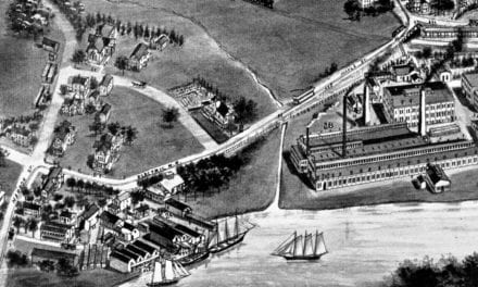
The bridge made the Pines a small commercial center. In 1762 a tidal dam was built just south of the bridge to power a grist mill and a sawmill, and a shipyard grew up below it. Late in the 1700s farmers found that the rich clay along the river was good for making bricks. By the Revolution there were at least a dozen small brickyards in North Haven, most of them on the Quinnipiac south of Pines Bridge. The town’s own history goes further and credits Theophilus Eaton, who found clay on his land on the west side of the river, though an 1892 county history names Nathaniel Thorp, about 1720, as the town’s first brickmaker.
The New Haven and Hartford Railroad laid its tracks along the sand plains by the river in 1838, and with the railroad to ship them, bricks became North Haven’s leading industry. After the Civil War the brickyards, especially the I.L. Stiles Co., brought newcomers from Ireland, Germany, Italy and Poland. Brickyard owners built their homes near the bridge, among them Erus Bishop on Bishop Street. The district was listed on the National Register in 1988. It’s 40 acres, with fine houses along State and Bishop Streets, most from the first half of the 1800s, and several late 1800s houses designed by Solomon Linsley. Its one surviving industrial building is a former carriage factory at 9 State Street, now homes.
Clintonville and the Rising Sun Tavern
East of the center is Clintonville, where small factories began making farm tools in 1830. By 1900 the Airline Railroad ran through Clintonville and Montowese on its way to Middletown. Clintonville Elementary School (27) and Julius M. Hansen Park (3) are close together here, with the Wintergreen Interdistrict Magnet School (30) a short way north and All Saints Memorial Park (21) to the south.
Out in the east, less than half a mile from the North Branford line, is the Former Rising Sun Tavern (24). It’s a Georgian farmhouse with a center hall and two end chimneys, probably built around 1760, and it served travelers on the road that became the Middletown Turnpike. The property has a shield-shaped tavern sign with a rising sun and the date 1738. Caleb Hitchcock owned the land then, and his family later sold it to Gideon Todd. The Todds ran the tavern until it closed in the 1860s, and they also took tolls on the turnpike. Inside, each of the main rooms has a corner fireplace, an unusual arrangement for a house of its age and the only example of its kind in North Haven, and the kitchen has a beehive bake oven with its own flue and its original iron door. It was listed on the National Register in 1979 and is a private home.
Montowese and Peter’s Rock
South of the center, on the way to Montowese, are North Haven High School (6), North Haven Middle School (9) and the North Haven Athletic Complex (12), all close together. Around 1900 trolleys ran from Montowese into New Haven. Montowese Park (17) and Montowese Elementary School (26) are down there now, and Ridge Road Elementary School (10) is off to the southwest.
In the far south, near the East Haven line, is Peter’s Rock Park (2). Peter’s Rock is a traprock peak that rises steeply about 300 feet above the land around it, part of the same Metacomet Ridge as East Rock. From the open summit you can see Long Island Sound, the Quinnipiac estuary and New Haven Harbor. It has gone by Rabbit Rock, Rabbit Hill, Indian Rock and Great Rock too, and local folklore says the name comes from Peter Brockett, a Revolutionary War veteran who lived up there as a hermit. In 1901 a group of New Haven businessmen built a hunting lodge on the summit called The Hermitage. It was abandoned in the Great Depression and fell to ruin, and the old wine cellar can still be seen beside a trail. Much of the rock has been conserved by the town, and the Peter’s Rock Association keeps up the trails.
Up the Quinnipiac
North of the center the river runs through Quinnipiac River State Park (8), made in 1948 from land left over when the Wilbur Cross Parkway was built. Its four sections protect 6 miles of the river, with canoeing and fishing. The guide also lists the Quinnipiac River Marsh Wildlife Area (14). The North Haven Fair Grounds (23) and Green Acres Elementary School (28) are up this way, and Chapman-Sinoway Park sits beside the river park. The guide lists it twice, as (4) and again as Chapman Sinoway Park (19).
To the northeast is the Quinnipiac University North Haven Campus (15). The university bought the 104-acre campus in 2007, and its renovated main building now houses the Frank H. Netter M.D. School of Medicine and the schools of Health Sciences, Nursing, Law and Education. In the far north, on the Wallingford line, is Wharton Brook State Park (7). It opened on August 1, 1919, as the first of a planned series of “Wayside Parks” along the state’s busiest roads, an early kind of highway rest stop with picnic grounds and camping. Its 96 acres center on Allen Brook Pond, and it’s a trout park, stocked on opening day. The guide also lists Patch Pines Park (1) and the Farming Museum (18).
This map of North Haven makes a handsome addition to a living room, office, library or den, and it can even help teach children the geography and history of the town. It’s a thoughtful gift for anyone who calls North Haven home, grew up here, or moved away. Created by KNOWOL in 2026, it’s printed on museum quality archival paper in three sizes. Zoom in on the preview above to explore the details, then click here to get your copy of the North Haven map.

Sources
- North Haven, Connecticut, Wikipedia
- North Haven, ConnecticutHistory.org
- History, Town of North Haven
- North Haven Historical Society and Museums
- Pines Bridge Historic District, Wikipedia
- Pines Bridge Historic District, National Register nomination, National Park Service
- Rising Sun Tavern (North Haven), Wikipedia
- Rising Sun Tavern, National Register nomination, National Park Service
- Peter’s Rock, Wikipedia
- Quinnipiac River State Park, Wikipedia
- Wharton Brook State Park, Wikipedia