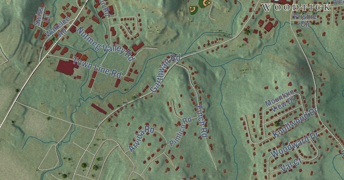
This beautifully detailed map of Wolcott, Connecticut was created in 2026 using aerial imagery combined with modern topographical, census, street and landmark data. It’s a one-of-a-kind view of Wolcott that combines accurate data with a vintage aesthetic. The map shows every building in its true location, many of the roads carry their names, and the shaded topographic relief shows the shape of the land.
See it on a wall
The Wolcott map as an 18 x 24 inch print in a black frame.

Explore an aerial view of Wolcott, Connecticut
On the map you’ll find Downtown, Woodtick, Bald Hill, Becar Hill, Birch Hill, Bucks Hill, Belleview Lake, Buttermilk Falls, and Peterson Park, along with Meriden Road, Center Street, County Road, and more. If you look closely you can even find your house accurately drawn in its correct location. Zoom in on the preview to look for yours. Click here to learn more about the history of Wolcott.
Take a closer look at the Wolcott map
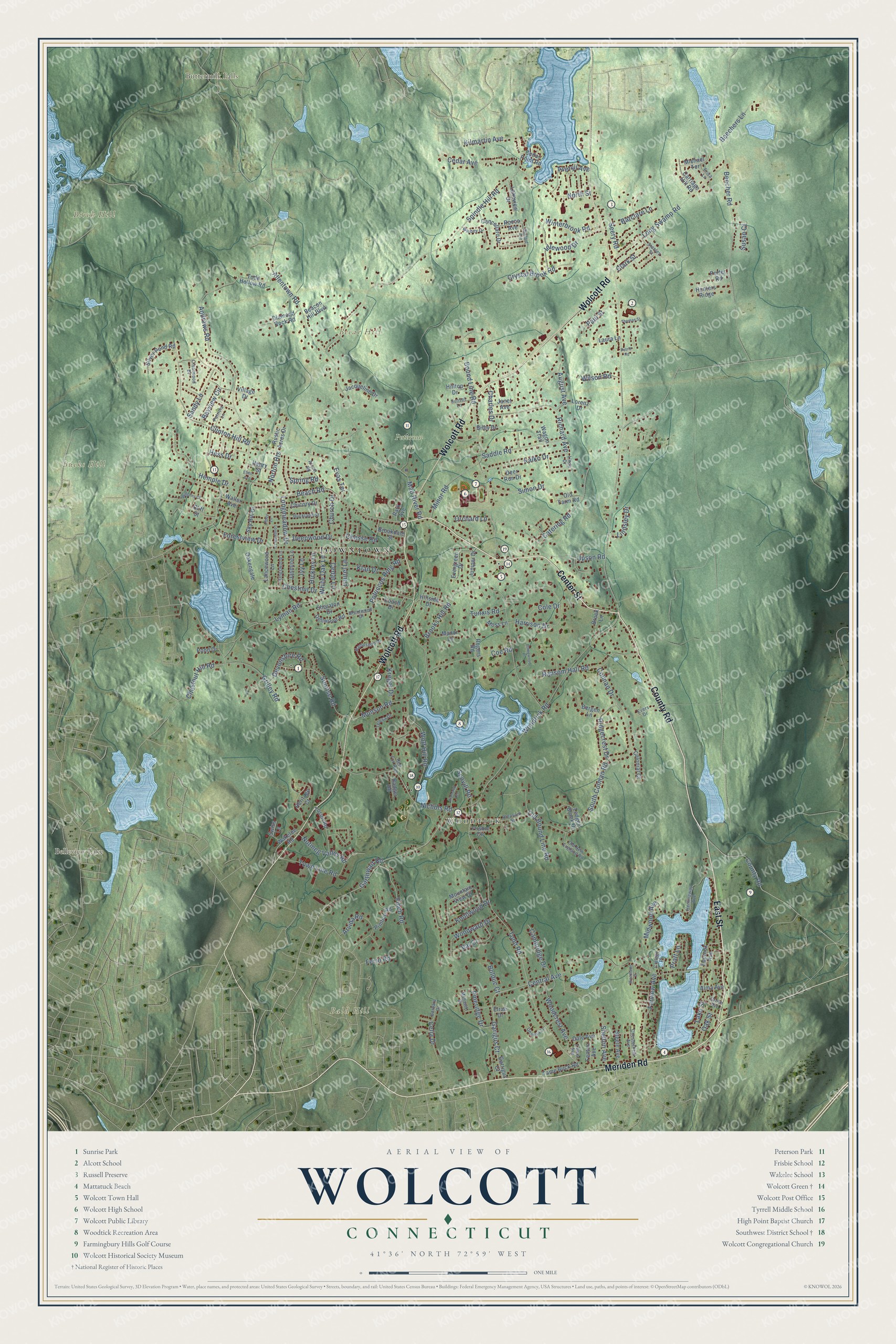
Click to explore a larger preview. The digital watermark does not appear on printed maps.
Names on this map
These names are printed on this map.
Places: Downtown, Woodtick, Bald Hill, Becar Hill, Birch Hill, Bucks Hill, Belleview Lake, Buttermilk Falls and Peterson Park.
Streets and roads: Meriden Road, Center Street, County Road, East Street, Wolcott Road, Woodtick Road, Laurel Lane, Todd Road, Spindle Hill Road, Bound Line Road, Beecher Road, Lyman Road.
More street names, A to Z
Alcott Road, Allentown Road, Alma Avenue, Andrews Road, Arvida Road, August Avenue, Averyll Avenue, Badger Road, Barbara Drive, Barclare Lane, Bayview Circle, Beach Road, Beacon Hill Boulevard, Beechers Lane, Bergen Lane, Bilby Drive, Bolduc Court, Brentwood Drive, Brookdale Street, Brook Lane, Brooks Hill Road, Buckland Street, Cambridge Drive, Cancellaro Drive, Carriage Hill Road, Catering Road, Cedar Avenue, Cedar Lane, Cedar Point Road, Celia Drive, Central Avenue, Charles Drive, Chasse Road, Chesterfield Avenue, Chestnut Drive, Chestnut Hill Road, Chicory Drive, Church Drive, Clark Street, Cliff Street, Clinton Hill Road, Coach Drive, Coe Road, Colby Lane, Cole Drive, College Place, Colman Drive, Colonial Court, Crestwood Drive, Crystal Brook Road, Dale Avenue, Deanna Lane, Deepwood Drive, Deer Run Drive, Dellwood Road, Devonshire Road, Diamond Rock Road, Diamond Terrace, Ellen Avenue, Elrae Drive, Equinox Avenue, Erica Lane, Evas Terrace, Evergreen Drive, Evers Drive, Farview Avenue, Fenton Avenue, Ferro Road, Finch Road, Forestview Drive, Frisbie Circle, Garigus Court, Garrigus Court, Garthwait Road, Grilley Road, Grove Avenue, Hampshire Drive, Harrison Drive, Hemingway Avenue, Hemple Drive, Henry Street, Heritage Court, Hess Drive, Hickory Lane, Hillside Drive, Hilltop Drive, Homewood Place, Hunters Ridge, Idlewood Drive, Ivy Lane, Jacqueline Drive, Janet Avenue, Jasmine Lane, Juniper Drive, Kalko Drive, Kilmartin Avenue, Kingswood Lane, Klan Drive, Knollwood Drive, Kreger Drive, Lake Street, Lakeview Drive, Lancewood Lane, Laura Lane, Ledger Brook Drive, Lewis Avenue, Linda Drive, Lindsley Drive, Longmeadow Drive, Long Swamp Road, Longview Lane, Lorenz Drive, Mad River Road, Manor Lane, Michael Terrace, Midwood Avenue, Minor Road, Mohawk Drive, Moss Lane, Mountain View Drive, Munson Road, Nichols Road, North Street, Norton Heights, Nutmeg Valley Road, Oakengate, Oak Street, Old Bound Line Road, Old Farm Road, Old New England Road, Orchard Lane, Park Avenue, Patricia Lane, Paul Street, Petrie Road, Pimlico Road, Pineridge Drive, Pleasant Street, Pond Drive, Porter Road, Potuccos Ring Road, Pratt Lane, Ransom Hall Road, Red Fox Run, Richard Avenue, Ridgecrest Drive, Rocco Avenue, Rogers Road, Rustic Acres Drive, Saddle Road, Sandy Lane, Sanford Avenue, Scovill Road, Seery Road, Shelton Avenue, Sheraton Drive, Silver Pond Road, Simon Drive, Sky Hill Drive, South Colman Road, Spring Road, Stanley Street, Steele Avenue, Sunrise Road, Sunset Lane, Susan Court, Swiss Lane, Tame Buck Road, Teresa Drive, Thomas Street, Todd Hollow Road, Tosun Road, Town Line Road, Tunxis Road, Upson Road, Val Court, Village Drive, Wagon Trail, Wakelee Road, Waller Avenue, White Oak Lane, Wihbey Drive, Williams Court, Wilson Road, Winterbrook Road, Wolf Hill Road, Woodcrest Avenue, Woodland Drive, Woodward Drive.
This beautifully detailed map of Wolcott makes an attractive addition to your office, library, or den, and it can even be used to teach children the geography and history of the area. It also makes a great gift for anyone with Wolcott roots. When you’re done exploring, click here to get your copy of the Wolcott map.