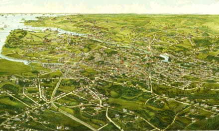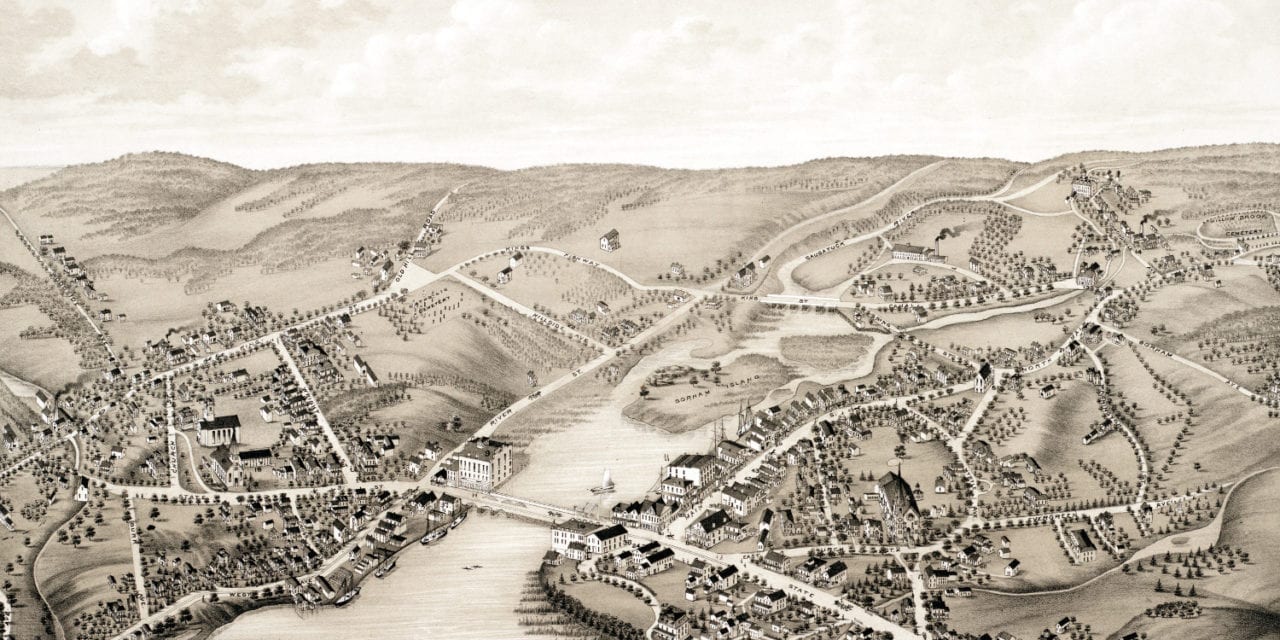
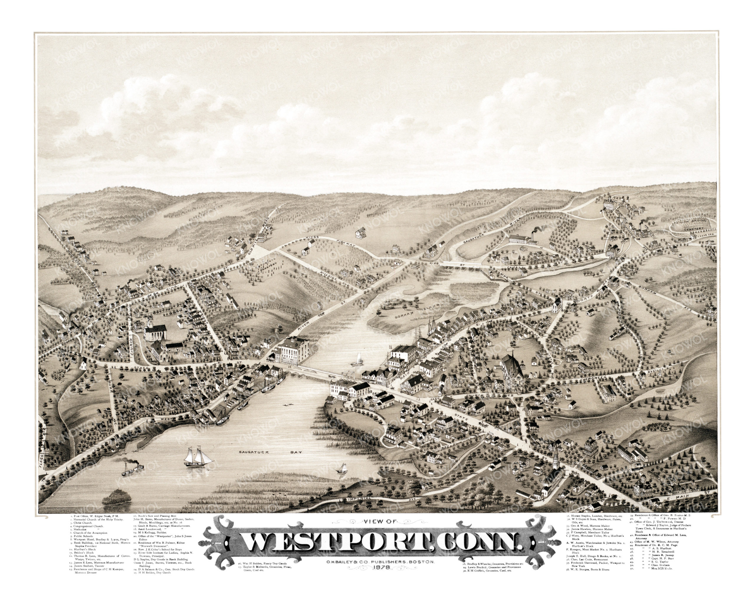
This beautiful hand drawn map of Westport, Connecticut was created in 1878 by O.H. Bailey, a prominent 19th century cartographer. The map shows a bird’s eye view of Westport as it was, including street names and old landmarks. In the late 19th and early 20th centuries, Westport became known as an artists’ colony, attracting painters, writers, and actors seeking inspiration and tranquility. Famed American Impressionist painter John Henry Twachtman was one of the artists who worked in the area.
Westport landmarks on the map include Saugatuck Bay, Gorham Island, Westport Hotel, Belden’s Block, Nash’s Saw and Planing Mill, River Side Institute for Ladies, D.L. Staples Dry Goods, Hawkes Harness Maker, Kemper Meat Market, Sturges Boots & Shoes, and the Office of the “Westporter”, a local Westport newspaper.
This historic map of Westport, CT has been restored by KNOWOL. Reproductions of the restored map are available here.
Bird’s Eye View of Westport, Connecticut in 1878
This beautifully restored map of Westport, Connecticut will make an attractive addition to your office, library, or den and can even be used to teach children the geography and history of the city. When you’re done exploring, click here to get your copy of the restored map.