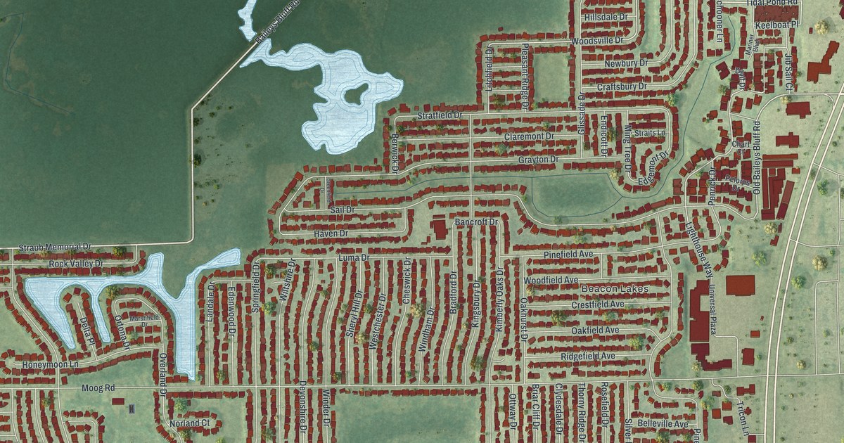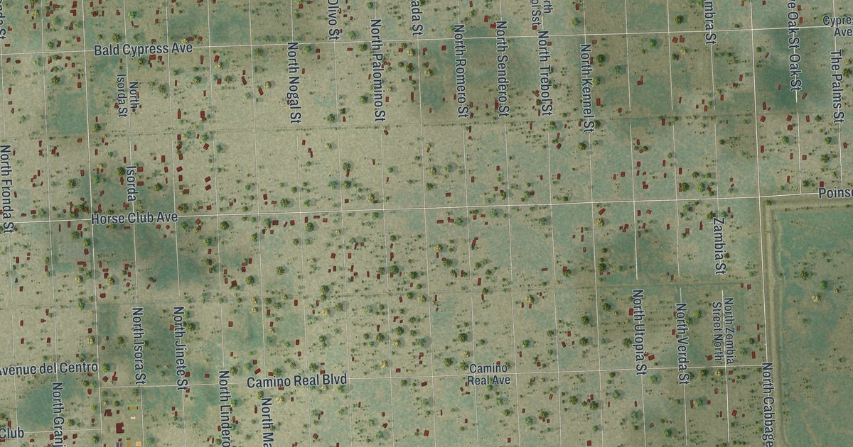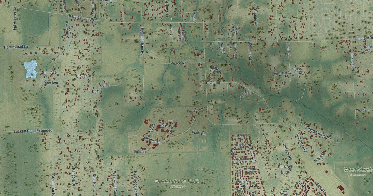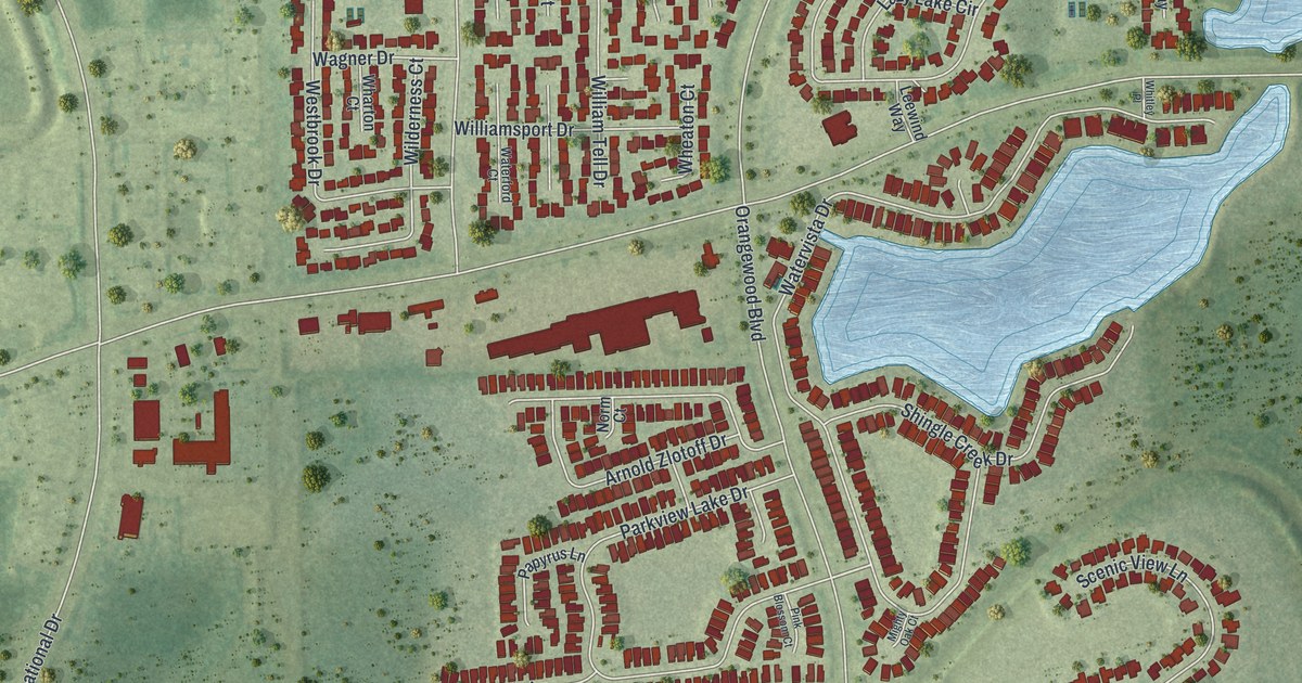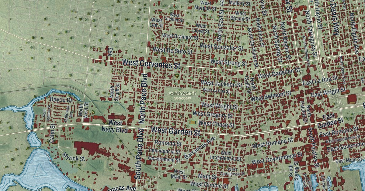
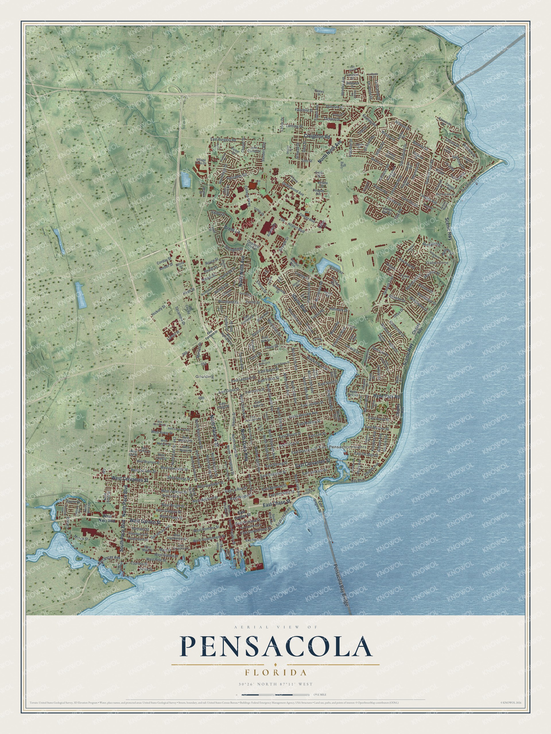
This beautifully detailed map of Pensacola, Florida was created in 2026 using aerial imagery combined with modern topographical, census, street and landmark data. It’s a one-of-a-kind view of Pensacola that combines accurate data with a vintage aesthetic. The map shows every building in its true location, many of the roads carry their names, and the shaded topographic relief shows the shape of the land.
Explore an aerial view of Pensacola, Florida
On the map you’ll find Saint John’s Cemetery, Bohemia, East Pensacola Heights, Gaberonne, and Goulding, along with West Garden Street, Brent Lane, East Chase Street, South Pace Boulevard, North Palafox Street, Bayou Boulevard, North Pace Boulevard, and more. If you look closely you can even find your house accurately drawn in its correct location. Zoom in on the preview to look for yours.
Did You Know?
Spanish explorer Tristan de Luna y Arellano landed at Pensacola Bay in August 1559 with about 1,500 people. A hurricane struck that September, sinking six ships and ruining supplies. The settlers gave up in 1561. Spain returned in 1698 and built a fortified town, which grew into the modern city.
Take a closer look at the Pensacola map
Names on this map
These names are printed on this map.
Places: Saint John's Cemetery, Bohemia, East Pensacola Heights, Gaberonne and Goulding.
Streets and roads: West Garden Street, Brent Lane, East Chase Street, South Pace Boulevard, North Palafox Street, Bayou Boulevard, North Pace Boulevard, North Davis Highway, Pensacola Bay Bridge, East Cervantes Street, West Cervantes Street, North Ninth Avenue.
More street names, A to Z
Adelyn Road, Adrian Road, Aiken Road, Airfield Road, Airlane Drive, Airport Boulevard, Amber Street, Arbutus Drive, Arizona Drive, Arriviste Way, Ash Drive, Askew Drive, Audubon Drive, Avenue Marina, Azalea Road, Balmoral Drive, Barcia Drive, Barrancas Avenue, Bay Boulevard, Bayfront Parkway, Bayou Drive, Bayview Way, Baywoods Drive, Beacon Road, Bedevere Drive, Belle Christiane Circle, Berkley Drive, Blackshear Avenue, Blaze Avenue, Bluffs Circle, Bonway Drive, Brittany Place, Brookshire Drive, Cahn Street, Calloway Avenue, Canopy Road, Carpenter Creek Drive, Chadwick Street, Chapel Street, Chipley Avenue, Christy Drive, Clematis Street, College Boulevard, College Parkway, Connell Drive, Conway Drive, Copley Drive, Corday Street, Cove Road, Creighton Road, Cypress Street, Danamar Drive, Data Street, Dewrell Square, Ditmar Street, Douglas Avenue, Dunlieth Place, Dunmire Street, Dunwody Drive, Dunwoody Drive, Durango Drive, East 34th Street, East Anderson Street, East Avery Street, East Baars Street, East Belmont Street, East Blount Street, East Bobe Street, East Burgess Road, East Cross Street, East De Soto Street, East Fairfield Drive, East Fisher Street, East Gadsden Street, East Garden Street, East Gonzalez Street, East Government Street, East Gregory Street, East Hatton Street, East Hayes Street, East Heinberg Street, East Hernandez Street, East Intendencia Street, East Jackson Street, East Jordan Street, East Lakeview Avenue, East La Rua Street, East Lee Street, East Leonard Street, East Lloyd Street, East Main Street, East Mallory Street, East Moreno Street, East Olive Road, East Romana Street, East Scott Street, East Strong Street, East Wright Street, East Yonge Street, Eleventh Avenue, Ellison Drive, Emily Street, Escalona Avenue, Euclid Street, Fairchild Street, Fairfax Drive, Fairnie Avenue, Firestone Boulevard, Flax Road, Fleance Drive, Flintwood Circle, Forest Glen Drive, Gale Drive, Gallahad Road, Galt Road, Gentian Drive, Government Street, Goya Drive, Grande Drive, Guilford Drive, Hallmark Drive, Hart Drive, Hayne Street, Hendrix Avenue, Hermitage Drive, Hewitt Street, Heyward Drive, Hibiscus Road, Hickory Street, Hidden Oak Drive, Hilltop Road, Homewood Road, Hyatt Street, Hyde Park Road, Intendencia Street, Inverness Drive, John Carroll Drive, Keating Road, Keats Drive, Keystone Road, Kilbee Lane, Knowles Avenue, La Borde Lane, La Jolla, La Mirage, Lancelot Drive, Langley Avenue, Lanier Drive, Lansing Drive, Lavallet Lane, Leesway Boulevard, Le Grande Drive, Le Jeune Drive, Logan Drive, Long Street, Lurton Street, Lynell Street, Lynn Ora Drive, Magnolia Avenue, Main Street, Manolete Street, Marcus Drive, Marjean Drive, Maule Road, McClellan Road, Mc Coy Road, Menendez Drive, Montage Drive, Montalvo Drive, Myrick Street, New Hope Road, Newton Drive, North 13th Avenue, North 14th Avenue, North 15th Avenue, North 16th Avenue, North 17th Avenue, North 18th Avenue, North 19th Avenue, North 20th Avenue, North Barcelona Street, North Baylen Street, North Coyle Street, North De Villiers Street, North East Street, North Eighth Avenue, North Eleventh Avenue, North Guillemard Street, North Hayne Street, North Reus Street, North Seventh Avenue, North Sixth Avenue, North South Street, North Spring Street, North Stillman Street, North Tarragona Street, North Tenth Avenue, North Twelfth Avenue, North West Street, Otter Point Road, Oxford Drive, Palisades Road, Parker Circle, Peacock Drive, Perry Avenue, Pickens Avenue, Piedmont Road, Port Royal Way, Potosi Road, Pvt Pointe Drive, Raines Street, Reynosa Drive, Romana Street, Rommitch Lane, Rosaflora Lane, Rothschild Drive, Royce Street, Sanders Avenue, San Gabriel Drive, Scenic Highway, Schwab Drive, Selina Street, Semoran Drive, Semur Road, Sewell Street, Shannon Place, Silverleaf Drive, Skyline Drive, Sonia Street, South Jefferson Street, South Ninth Avenue, South Palafox Street, South Spring Street, Spanish Trail, Spanish Trail Road, Springhill Drive, Stanley Avenue, Stow Avenue, Summit Boulevard, Swan Lane, Sycamore Drive, Tamara Drive, Terrasanta, Texar Drive, Tide Drive, Tippin Avenue, Toni Street, Torres Avenue, Tree Line Drive, Trinity Drive, Tronjo Road, Tunis Drive, Tyler Avenue, Underwood Avenue, University Street, Valley Drive, Van Kirk Avenue, Velasquez Street, Villafane Drive, Village Oaks Drive, Virwood Road, Walton Street, Warwick Avenue, Watson Avenue, West Avery Street, West Belmont Street, West Blount Street, West Brainerd Street, West Chase Street, West De Soto Street, West Gadsden Street, West Gimble Street, West Godfrey Street, West Gonzalez Street, West Government Street, West Gregory Street, West Hernandez Street, West Highland Drive, West Intendencia Street, West Jackson Street, West Lakeview Avenue, West La Rua Street, West Lee Street, West Lloyd Street, West Main Street, West Mallory Street, West Moreno Street, West Navy Boulevard, West Pine Street, West Romana Street, West Strong Street, West Wright Street, West Zarragossa Street, Whaley Avenue, Wimbledon Drive, Windwood Drive, Winona Drive, Woodbine Drive, Woodcliff Drive, Woodland Drive, Wynnehurst Street, Yates Avenue.
See it on a wall
The Pensacola map as a framed print. Swipe for more.


This beautifully detailed map of Pensacola makes an attractive addition to your office, library, or den, and it can even be used to teach children the geography and history of the area. It also makes a great gift for anyone with Pensacola roots. When you’re done exploring, click here to get your copy of the Pensacola map.