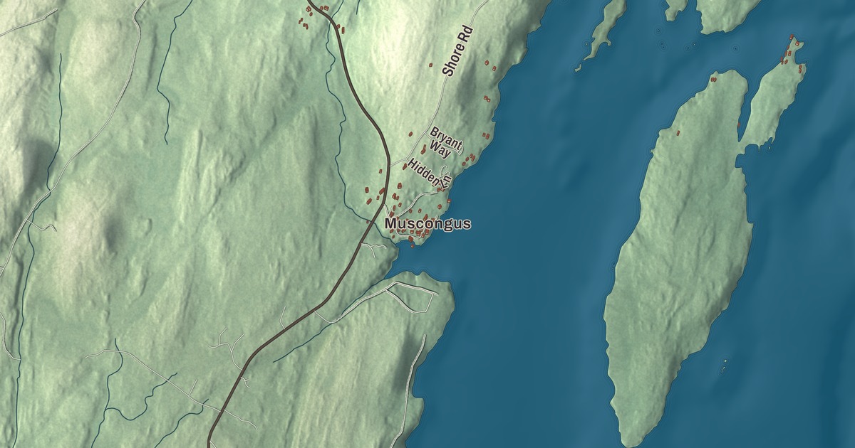
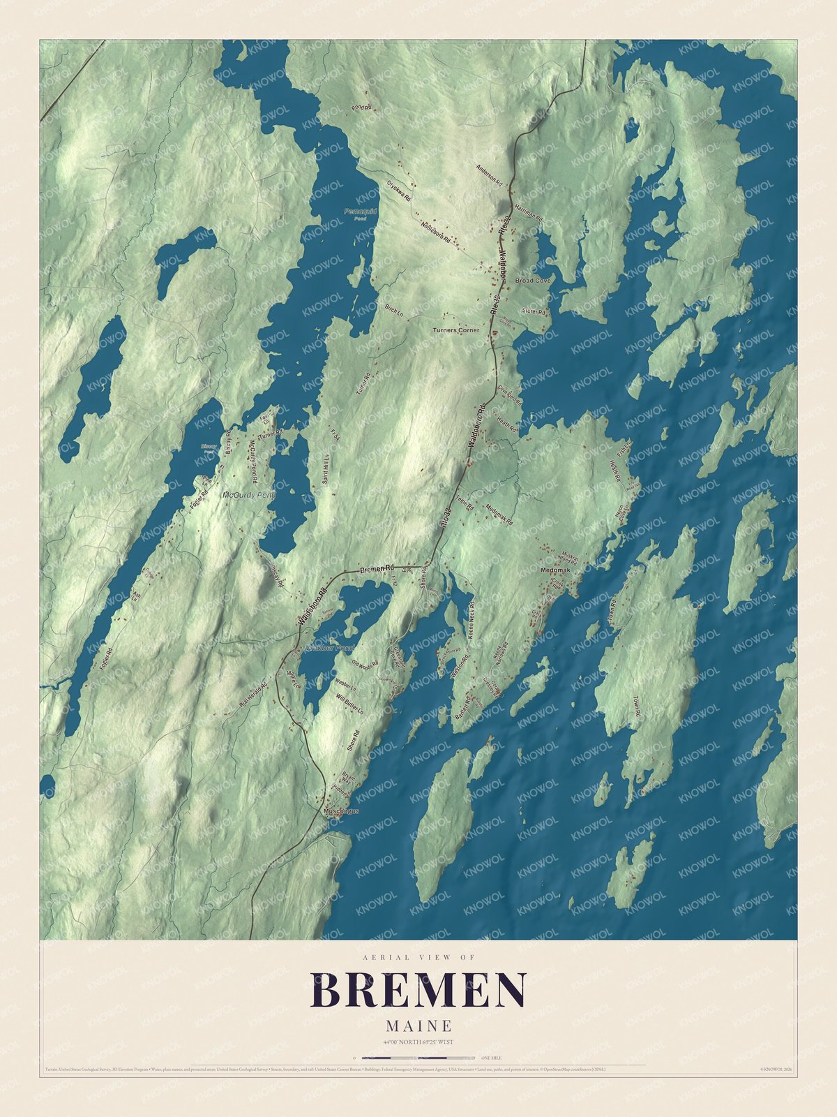
This map of Bremen prints Waldoboro Road, which runs north and south through the town, and Keene Neck Road, which runs out onto Keene Neck. It also prints the villages of Muscongus, Broad Cove, Turners Corner and Medomak, the roads called Bremen, Nobleboro, Turner and Town, and Webber Pond and McCurdy Pond. Click here to purchase a print of this map for your wall.
Bremen is a town in Lincoln County, home to 823 people at the 2020 census.
KNOWOL made this map in 2026 from public survey data and gave it the look of an old atlas. Its hills are shaded from United States Geological Survey elevation data, and its roads and town line come from the Census Bureau. The bureau counts 27.86 square miles in Bremen, and 11.39 of them are water, since the town sits on the easterly side of the Pemaquid Peninsula, facing Muscongus Bay.
Shell heaps, settlers and a German name
Long before the English came, Abenaki people spent their summers on Keene Neck gathering shellfish, and they left shell heaps behind. William Hilton of Plymouth, Massachusetts, settled the area in 1735, when it was still part of Bristol. Many of the families who followed came from Germany, and they made a living from farms and the sea. Bremen dates to 1828. On February 19 of that year it was set off and incorporated as a town of its own, named after Bremen in Germany. Lobstering, clamming and tourism are still important here.
Two of Bremen’s village names come from the Abenaki language. Muscongus was the name of an Abenaki village, meaning “fishing place” or “many rock ledges,” and the Medomak River, which reaches Bremen about 8 miles below the head of its tidewater at Waldoboro, takes its name from the Abenaki for “place of many alewives.”
People of Broad Cove
Joshua Soule was born there in 1781, when it was still part of Bristol, and became a bishop of the Methodist Episcopal Church; one biographer, Bishop DuBose, called him the man who wrote the Constitution of Methodism at the age of 27. Generations later, the surgeon Hiester Richard Hornberger settled at Broad Cove. Under the pen name Richard Hooker he wrote MASH, the 1968 novel drawn from his service in a Korean War surgical hospital, which became the film and the long-running television series. His family were among Bremen’s first settlers, according to the town page.
Others chose Bremen later in life. Samuel Tucker, who commanded a flotilla of armed schooners for George Washington in the Revolution and captured a British privateer in the War of 1812, retired to farming in Maine and died in Bremen in 1833. Elizabeth Noyce summered here with her children and later made Bremen her full-time home. She became the area’s leading philanthropist and art collector and founded the Libra Foundation. The nature writer John Hay, a co-founder of the Cape Cod Museum of Natural History, made his home in Bremen as well as on Cape Cod.
Click to explore a larger preview. The digital watermark does not appear on printed maps.
See it on a wall
The Bremen map as a framed print. Swipe for more.


Along Waldoboro Road
Waldoboro Road is printed on the map. It’s State Route 32, the main road through Bremen from north to south. On its east side, near the middle of town, stands the Bremen Town House. A chapter of the Good Templars, a temperance group, built it in 1874, and the town held its meetings there from 1877, bought it in 1884 and ran its business from it until 1959. It’s still owned by the town and still a gathering place. Also on Route 32, opposite the Shore Road junction, is the Daniel Weston Homestead, built about 1806 by a shipbuilder whose father and uncle were among the area’s first settlers. The house shows his trade: much of its woodwork is slightly curved, and the upstairs ceilings curve inward for extra height. Both are on the National Register of Historic Places.
Keene Neck and the islands
Keene Neck Road is printed on the map. At its end lies Hog Island, 330 acres in Muscongus Bay. By 1910 Mabel Loomis Todd, the original editor of Emily Dickinson’s poetry, was buying land there to save its timber from being cut. Her daughter later arranged for the National Audubon Society to open a nature camp on the island, and it opened in the summer of 1936, with Roger Tory Peterson of the Peterson Field Guides on its staff. Audubon’s seabird programs still run there each summer. At Keene Narrows, between the mainland and Oar Island, lies the hulk of the Cora F. Cressey, a five-masted schooner built at Bath in 1902. She was towed here in 1938 to serve a lobster business, and though she’s falling apart, her page calls her one of the largest surviving wooden hulls in the United States.
Muscongus, Broad Cove, Turners Corner and Medomak are printed on the map. Bremen Road, Nobleboro Road, Turner Road and Town Road are printed too, along with Webber Pond and McCurdy Pond.
This Bremen map makes a handsome addition to an office, library or den, and it can teach children the geography and history of a Muscongus Bay town. It’s made for anyone who calls Bremen home, from Keene Neck to Medomak, as it looks today. Zoom in on the preview above to explore the details, then click here to get your copy of the Bremen, Maine map.

Sources
- Bremen, Maine, Wikipedia
- Bristol, Maine, Wikipedia
- Muscongus Bay, Wikipedia
- Medomak River, Wikipedia
- Joshua Soule, Wikipedia
- Richard Hooker (author), Wikipedia
- Samuel Tucker (naval officer), Wikipedia
- Elizabeth Noyce, Wikipedia
- John Hay (nature writer), Wikipedia
- Bremen Town House, Wikipedia
- Daniel Weston Homestead, Wikipedia
- Hog Island (Lincoln County, Maine), Wikipedia
- Cora F. Cressey, Wikipedia