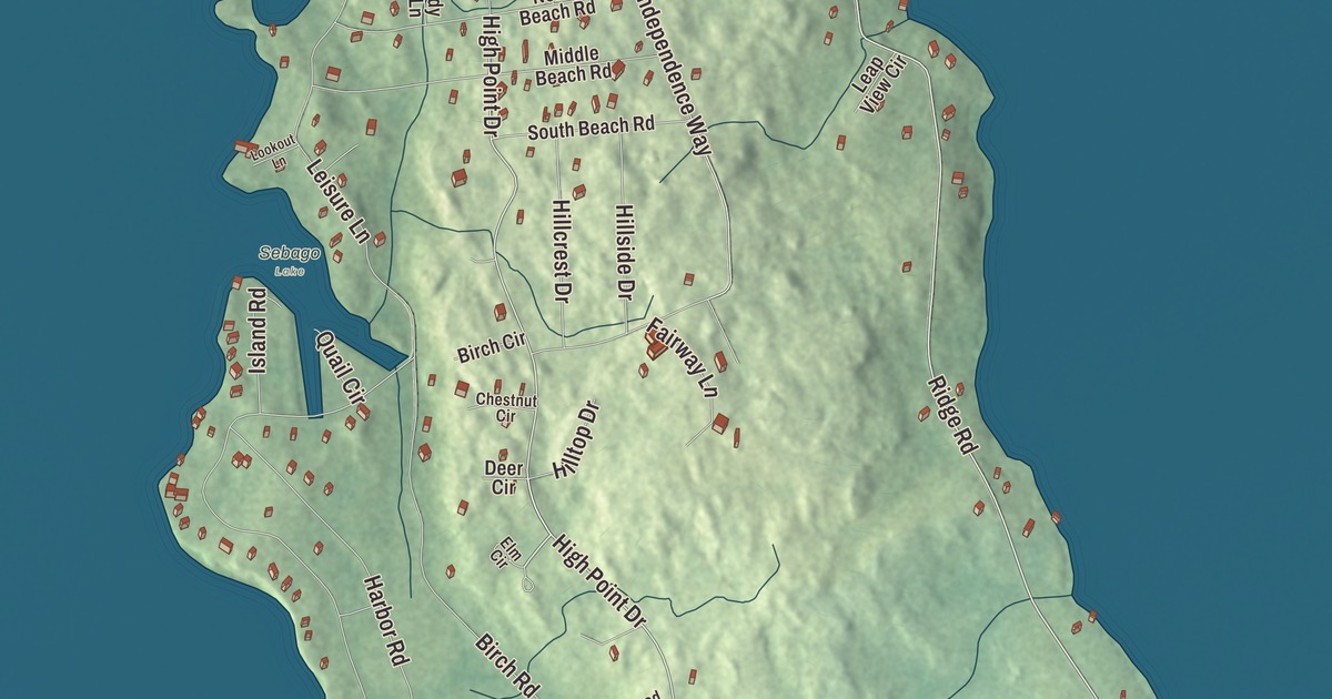
Ridge Road and Leisure Lane are two names to look for on this Frye Island map, with High Point Drive and Birch Road printed too. The aerial view brings the island’s roads and buildings together within its town boundary. Click here to purchase a print of this map for your wall.
Frye Island is a town in Cumberland County, in Sebago Lake.
KNOWOL made this map in 2026 from public survey data and gave it the look of an old atlas. United States Geological Survey elevation data shades the ground, and Census Bureau files supply the roads and town line. The 2020 census recorded 32 residents, while the island’s history describes a seasonal community with many summer homes.
A separate town in 1998
Frye Island was once part of Standish. The island was included in an eighteenth-century Massachusetts land grant to Captain Moses Pearson, Captain Humphrey Hobbs and their companies of soldiers. Pearsontown Plantation became Standish in 1785.
Named for Captain Joseph Frye, the island separated from Standish on July 1, 1998, and became its own town. It remains a distinct municipality in Maine. The town’s modern history is much shorter than the history of the island and the surrounding lake.
Across the lake by ferry
A car ferry from Raymond Neck provides public access to the island; people also arrive by private boat. The ferries are owned and operated by the town. Service is seasonal, and the town history describes the island as closing for the winter.
Summer life includes beaches, marinas, recreation facilities and a golf course. Golf carts are a common way to get around the island’s roads. Independence Day celebrations include a golf cart parade and fireworks, with spectators also watching from boats on Sebago Lake.
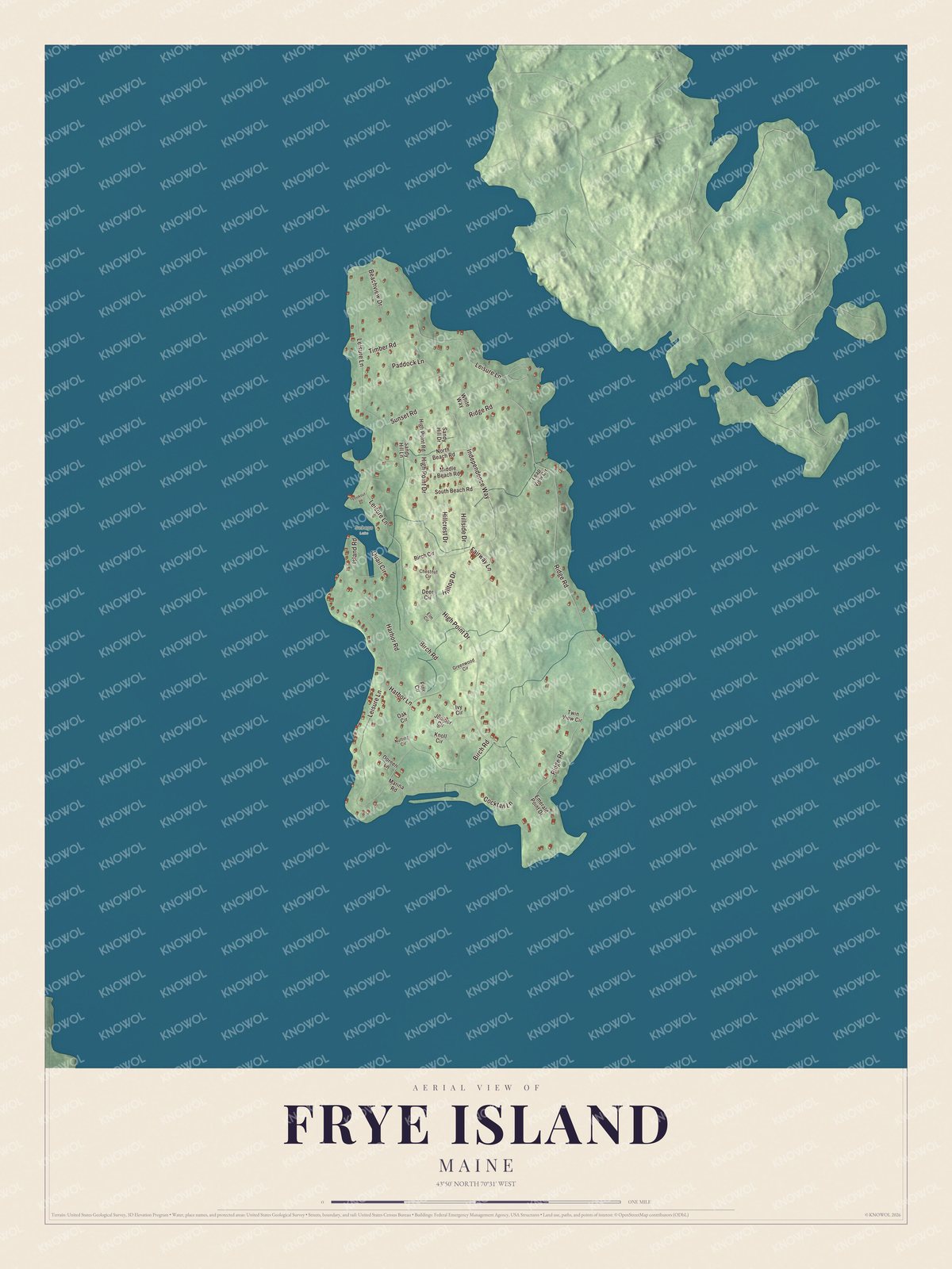
Click to explore a larger preview. The digital watermark does not appear on printed maps.
See it on a wall
The Frye Island map as a framed print. Swipe for more.


The island roads
Ridge Road, High Point Drive, Leisure Lane, Birch Road, Independence Way and Paddock Lane are printed by name. The other roads and buildings are drawn around them. Use the preview to look for a familiar home or follow a road across the island.
The town’s geography account places the island at about two and a half miles long and a mile and a half wide at its widest point. Sebago Lake surrounds it. The aerial map gives you a way to look across the road network before zooming into the part you know.
For anyone who calls Frye Island home, this map presents the island as it looks today, with its roads and buildings together. It can hang in an office, library or den and help teach children the geography and history of the lake community. Zoom in on the preview above to explore the details, then click here to get your copy of the Frye Island, Maine map.

Sources