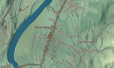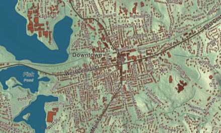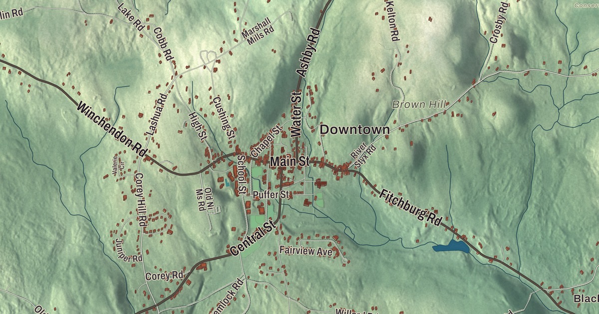
Ashburnham’s lakes and hills fill this map. It prints Upper Naukeag Lake and Lower Naukeag Lake, Cheshire Pond and Cowee Pond, Blood Hill, Brown Hill and Buck Hill, the villages of Blackburn Village and Lane Village, and the roads that tie them together: Main Street, Center Street, Gardner Road, Fitchburg Road, Winchendon Road and Rindge State Road. Click here to purchase a print of this map for your wall.
Ashburnham is in Worcester County, at the county’s northeastern corner.
KNOWOL made this map in 2026 from public survey data and gave it the look of an old atlas. The shaded terrain comes from United States Geological Survey elevation data, and the roads and the town line come from the Census Bureau. The town covers 41 square miles, more than 2 of them water. Ashburnham had 6,315 people at the 2020 census.
Dorchester-Canada
Ashburnham began as land granted to the officers and soldiers of a 1690 expedition to Canada, and until it was incorporated it was called the Plantation of Dorchester-Canada. The Town of Ashburnham’s recorded history dates European settlement to 1736, and Ashburnham was incorporated as a town in 1765. The name is British, possibly from the Earl of Ashburnham or from the village of Ashburnham in Sussex. The town remains part of Worcester County today.
Another piece of town came from a different grant. In 1734 a 1,000-acre tract here was granted to the town of Cambridge, to repay it for keeping up the first bridge across the Charles River, and the land, called the Cambridge Bridge Farm, sat empty until 1770. That year John Adams of Menotomy, no relation to the president, moved in with his bride, Joanna Munroe, and relatives from the Adams and Russell families followed, tanning goat and sheep skins into Morocco leather. Their neighborhood was tied closely to the start of the Revolution: Joanna’s brother Ebenezer Munroe, a minuteman who may have fired the first shot at the British on Lexington green, later moved to Ashburnham, and her sister-in-law’s husband, Ethan Wetherbee, had kept the Black Horse Tavern in Menotomy, where the Committee of Safety had met; by locking its door on the night of April 18, 1775, he saved Charles Lee, Azor Orne and Elbridge Gerry from capture by British troops. Today the Cambridge Grant Historic District on Russell Hill Road keeps seven Federal-period houses from 1787 to 1834, and its page calls it nearly unique for keeping so many early homes in their original settings. In the early 1900s it was a summer arts colony, where the Broadway actor Aldrich Bowker sponsored outdoor plays.
Cushing Academy and its people
Cushing Academy was chartered in 1865 with money left by Thomas Parkman Cushing, a Boston merchant, and opened in September 1875 with 66 boys and 56 girls, among the first coeducational boarding schools on the East Coast. Its 162-acre campus on the hills above the town center looks toward Mount Wachusett to the south and Mount Monadnock to the north. Bette Davis lived in Ashburnham while she attended Cushing, graduating in 1927, and the King of Bhutan, Jigme Khesar Namgyal Wangchuck, is a graduate too. The Schoolboy of 1850, a statue by Bela Pratt honoring students and the boys who fought in the Civil War, was given to the town in 1913 by Ivers Whitney Adams; the town page places it at the corner of Main and School streets, and the academy’s page near the school’s entrance. Adams founded and led the Boston Red Stockings, Boston’s first professional baseball team, and he also gave Ashburnham its own water supply. Amos Pollard, born here in 1803, became chief surgeon of the Texan garrison at the Alamo and set up its hospital. Click here to learn more about the history of Ashburnham.
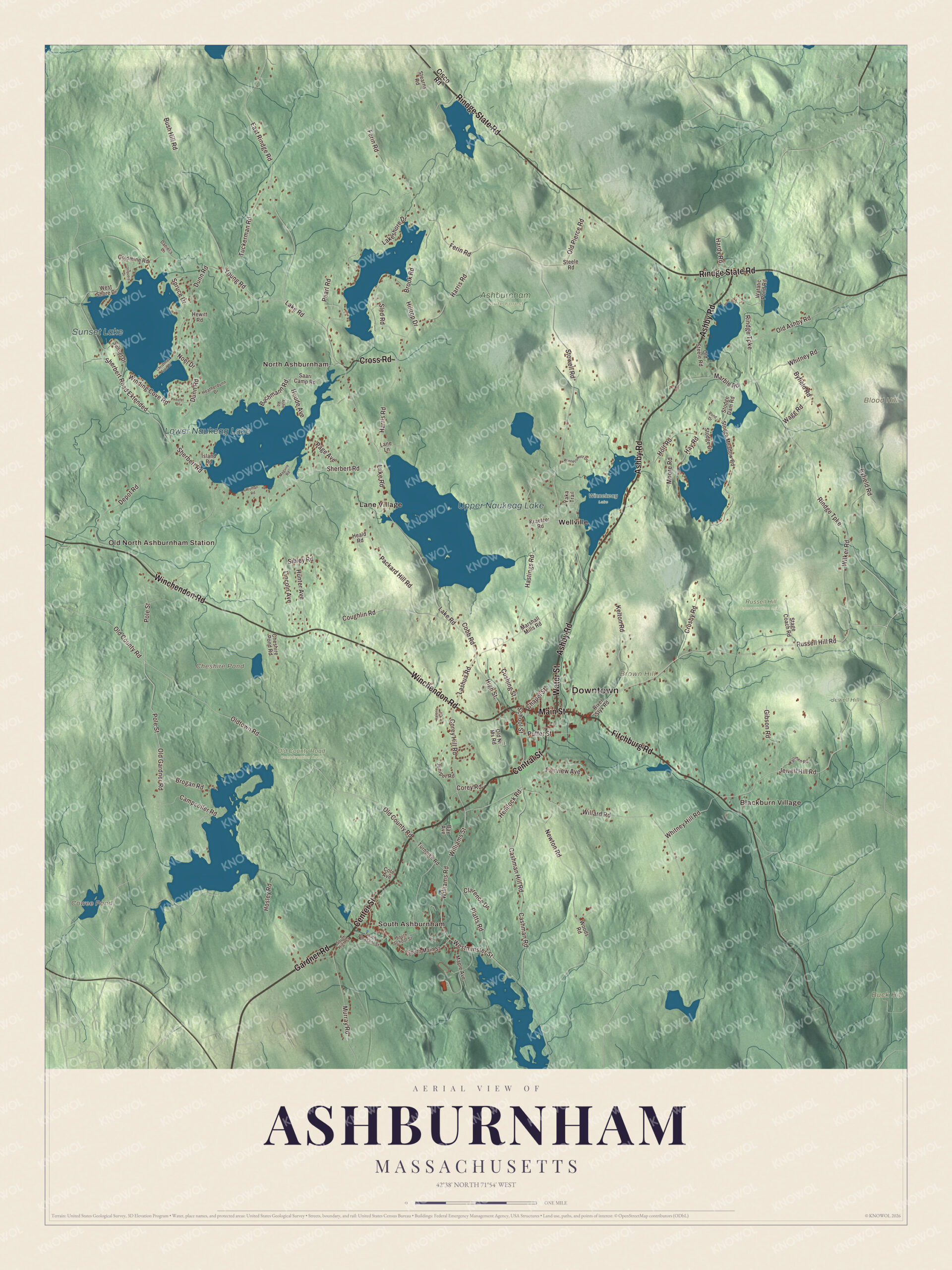
Click to explore a larger preview. The digital watermark does not appear on printed maps.
Names on this map
These names are printed on this map.
Places: Downtown, South Ashburnham, Old North Ashburnham Station, Blackburn Village, North Ashburnham, Blood Hill, Brown Hill, Buck Hill, Cheshire Pond, Cowee Pond, Upper Naukeag Lake, Lower Naukeag Lake, Sunset Lake, Ashburnham State Forest, Jewell Hill, Old County Road Conservation Area, Russell Hill Conservation Area, Winnekeag Lake, Lane Village and Wellville.
Streets and roads: Main Street, Center Street, Gardner Road, Fitchburg Road, Winchendon Road, Rindge State Road, Ashby Road, Cross Road, Central Street, Water Street, Russell Hill Road, Jewell Hill Road.
More street names, A to Z
Ashe Road, Bachmann Road, Bay Avenue, Brogan Road, Brook Road, Bush Hill Road, Byfield Road, Campcoller Road, Cashman Hill Road, Cashman Road, Chapel Street, Cheshire Pond Road, Christmas Tree Drive, Cisco Road, Clarence Drive, Cobb Road, Corey Hill Road, Corey Road, Cote Avenue, Coughlin Road, Crosby Road, Cushing Street, Daniel's Lane, Depot Road, Dunn Road, East Rindge Road, Fairview Avenue, Ferin Road, Gibson Road, Goldmine Road, Hardy Road, Harris Road, Hastings Road, Hay Road, Heald Road, Heatherdunn Drive, Hemlock Road, Hewitt Road, High Street, Hilltop Drive, Holt Road, Hosley Road, Houde Avenue, Hunter Avenue, Iriquois Drive, Island Road, Juniper Road, Kallinen Road, Kelton Road, Kraetzer Road, Lake Road, Lakeshore Drive, Lane Lane, Lashua Road, Laurel Drive, Lincoln Avenue, Maguire Road, Maple Avenue, Marble Road, Marshall Mills Road, Moore Road, Murray Road, Newton Road, Noel Drive, Old Ashby Road, Old County Road, Old Gardner Road, Old Ni Ms Road, Old Pierce Road, Old Steele Road, Oldtown Road, Packard Hill Road, Page Avenue, Pearl Road, Platts Road, Pole Street, Pond Drive, Puffer Street, Rindge Turnpike, River Styx Road, Saari Camp Road, School Street, Sherbert Road, Sherbert Road Extended, Sibley Road, Sled Road, South High Street, South Main Street, South Pleasant Street, South School Street, Spruce Drive, Stage Coach Road, Stearns Road, Steele Road, Stodge Dam Road, Stodge Drive, Stodge Meadow Road, Stowell Road, Sunset Drive, Tuckerman Road, Turnpike Road, Valerie Circle, Wagg Road, Watatic Pond Road, Westminster Street, West Shore Drive, Whitney Hill Road, Whitney Road, Wilker Road, Willard Road, Williams Road, Williams Street, Winding Cove Road, Winnecowett Drive, Woods Road, Wyman Road, Yaka Trail, Young Road.
See it on a wall
The Ashburnham map as a framed print. Swipe for more.


Lakes, hills and trails
Upper Naukeag Lake is spring-fed, and it’s the source of water for the Ashburnham and Winchendon Joint Water Authority. Lower Naukeag Lake, Cheshire Pond, Cowee Pond, Blood Hill, Brown Hill and Buck Hill are printed on the map as well. Ashburnham is the starting point of the Wapack Trail and the Massachusetts Midstate Trail, and both cross Mount Watatic, a 1,832-foot monadnock it shares with Ashby. The mountain had a ski area from the 1930s until 1984, and in 2002 the two towns, their land trusts and the state bought it to keep about 281 acres, summit included, as conservation land. Start with South Ashburnham, follow Main Street, Center Street, Gardner Road, Fitchburg Road, Winchendon Road or Rindge State Road across town, then look outward toward Old North Ashburnham Station, Blackburn Village, North Ashburnham, Lane Village and Wellville.
This Ashburnham map is made for an office, library or den, and it can help teach children the geography and history of a town built on a soldiers’ grant and a bridge grant. It’s made for people who call Ashburnham home, from South Ashburnham to the Naukeag lakes, and for everyone who went to school on Cushing’s hill. KNOWOL created it in 2026, and it’s printed on museum quality archival paper. Zoom in on the preview above to explore the details, then click here to get your copy of the Ashburnham, Massachusetts map.

Sources
- Ashburnham, Massachusetts, Wikipedia
- Cambridge Grant Historic District, Wikipedia
- Cushing Academy, Wikipedia
- Ivers Whitney Adams, Wikipedia
- Amos Pollard, Wikipedia
- Mount Watatic, Wikipedia
- City and Town Incorporation and Settlement Dates, Secretary of the Commonwealth of Massachusetts (archived copy)