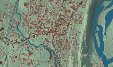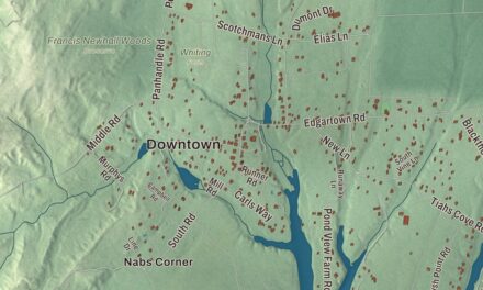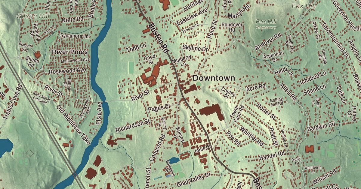
Billerica people know the town by its villages and its roads: Pinehurst down Boston Road, North Billerica by the train station and the old mills, East Billerica, and the center where Boston Road and Concord Road meet at the common. This map prints Boston Road, Salem Road, Floyd Street, Nashua Road, Chelmsford Road and Concord Road, with Nutting Lake, College Pond, Richardson Pond and Fox Hill. Click here to purchase a print of this map for your wall.
Billerica is in Middlesex County, about 20 miles north-northwest of Boston.
KNOWOL made this map in 2026 from public survey data and gave it the look of an old atlas. The relief comes from United States Geological Survey elevation data, and the roads and the town line come from the Census Bureau. Two rivers run through Billerica, the Concord and the Shawsheen, and the town meets Chelmsford, Lowell, Tewksbury, Wilmington, Burlington, Bedford and Carlisle; at one point in the middle of the Concord River, Billerica, Chelmsford, Lowell and Tewksbury all touch. The town had 42,119 people at the 2020 census.
From Shawshin to Billerica
In the early 1630s a village of Praying Indians called Shawshin stood where Billerica is now, and the name lives on in the Shawsheen River. The Town of Billerica’s recorded history, in the Secretary of the Commonwealth’s list, dates European settlement to 1637. In 1638 Governor John Winthrop and Deputy Governor Thomas Dudley were granted land along the Concord River here, and by 1652 about a dozen families from Cambridge and Charlestown had moved onto it. Some of them came from Billericay in Essex, England, and they named the place for it; the two are sister towns today. Billerica was incorporated as a town in 1655, on the same day as Chelmsford and Groton, and the town remains part of Middlesex County today. The first plantation was later divided into Billerica, Bedford, Wilmington and Tewksbury.
The common set aside in 1655 still anchors the center. It was meant for Captain Daniel Gookin, but it came back to the town when he didn’t claim it. The first meeting house went up on it in 1663, part of it became a militia training ground in 1694, and the local militia mustered there when the Revolution began in 1775. The Billerica Town Common District, bounded roughly by Cummings Street, Concord Road and Boston Road, takes in two churches, the town hall and the site of that first meeting house, and joined the National Register of Historic Places in 1973.
Yankee Doodle and the Manning Manse
In March 1775 Thomas Ditson of Billerica went to Boston and tried to buy a musket from a British soldier, which was illegal, and he was tarred and feathered for it. “Yankee Doodle,” the town page says, supposedly turned from an insult into a song of national pride because of what happened to him. The town still holds Yankee Doodle Weekend every September, and the Thomas Ditson Elementary School stands in Pinehurst, where his home was. Asa Pollard, born in North Billerica in 1735, was the first soldier killed at the Battle of Bunker Hill.
Out on Chelmsford Road, at number 56, the Manning Manse is the oldest homestead left in town. Samuel Manning built it about 1696, and it’s believed to be the first house west of the Concord River; it’s one of only two 17th-century buildings still standing in Billerica. The family kept a tavern in its lean-to from 1752 to 1800, and minutemen from New Hampshire stayed there on their way to and from the battles of April 1775. In the later 1700s it was home to William Manning, a Revolutionary War veteran who wrote The Key of Liberty in 1798, a critique of Federalist policies. A century later Warren H. Manning, a landscape architect trained in Frederick Law Olmsted’s office, restored it in 1899 and bought the land around it, which became the Warren H. Manning State Forest. The house came back again after a fire in 1994 and serves as a restaurant.
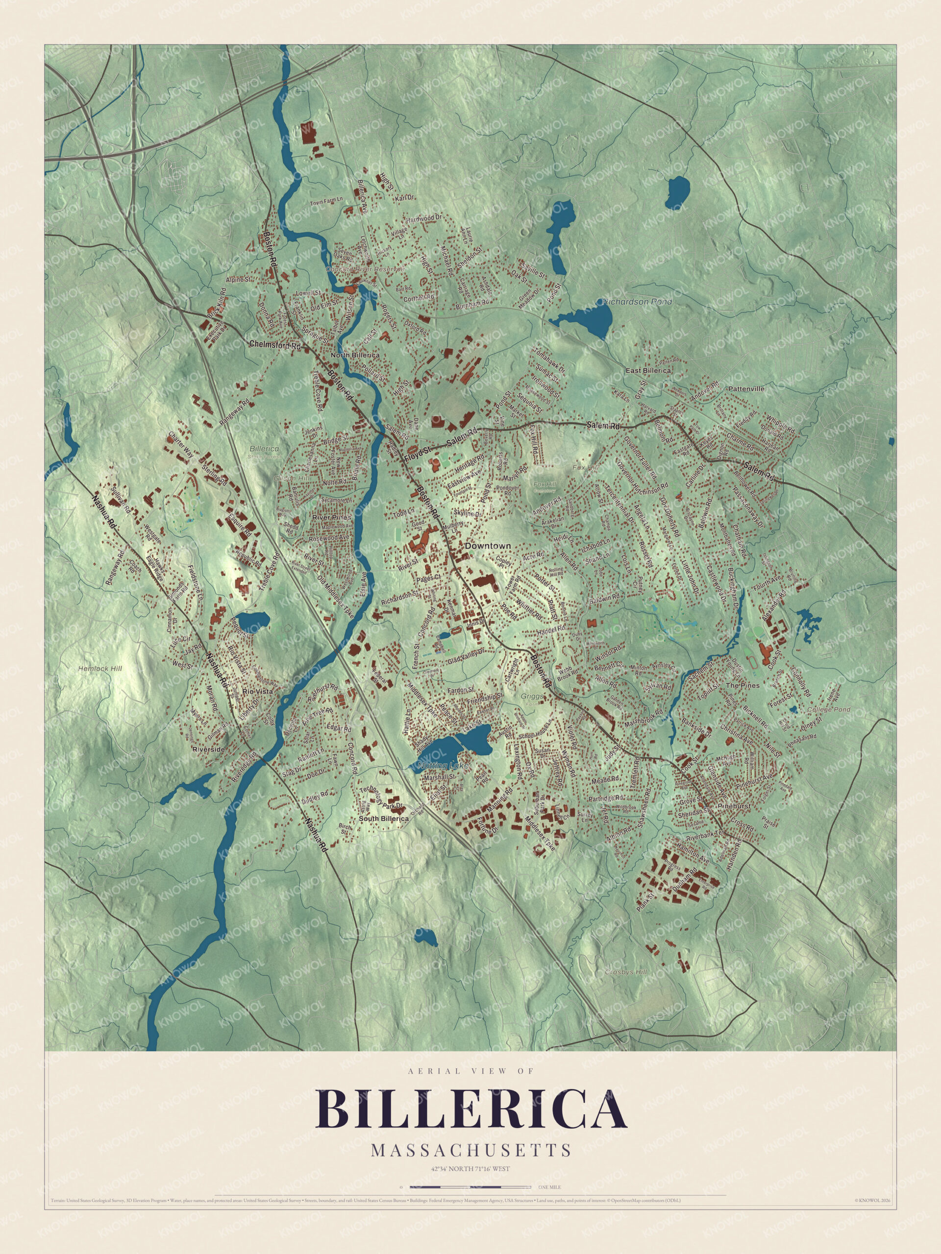
Click to explore a larger preview. The digital watermark does not appear on printed maps.
Names on this map
These names are printed on this map.
Places: Downtown, Pinehurst, Pattenville, The Pines, Crosbys Hill, Fox Hill, Gilson Hill, Hemlock Hill, College Pond, Concord River Reservoir, Nutting Lake, Richardson Pond, Billerica State Forest, Fox Hill Cemetery, Griggs Farm, East Billerica, North Billerica, Rio Vista, River Pines, Riverside and South Billerica.
Streets and roads: Boston Road, Salem Road, Floyd Street, Nashua Road, Chelmsford Road, Concord Road, Riverhurst Road, Andover Road, Lois Lane, Shane Lane, Treble Cove Road, Rangeway Road.
More street names, A to Z
Acre Road, Adelman Road, Albion Road, Alexander Road, Allendale Avenue, Allen Road, Alpine Street, Angela Lane, Apple Orchard Drive, Arakelian Drive, Arey Street, Arrow Street, Ashdale Road, Astrig Way, Austin Road, Aynsley Circle, Baldwin Road, Baniulis Road, Bankside Drive, Bart Road, Bellflower Road, Belmont Road, Bennett Circle, Beverly Road, Biagiotti Way, Bicknell Road, Billerica Avenue, Birch Street, Biscayne Drive, Bonnie Lane, Branch Street, Brick Kiln Road, Bridge Street, Bridle Road, Brittany Lane, Bruning Road, Buckingham Drive, Burnham Road, Call Street, Campbell Road, Carline Drive, Carriage Road, Cartwright Lane, Castlewood Drive, Champa Road, Charlesanna Lane, Charme Road, Charter Way, Chatham Road, Christina Avenue, Cinnamon Drive, Clermore Drive, Coach Road, Cobblestone Way, Colby Street, Comet Lane, Connolly Road, Cook Street, Copley Place, Corthell Road, Cross Road, Dane Avenue, Dignon Road, Doe Drive, Donald Road, Donna Road, Druid Hill Street, Duby Drive, Dudley Road, Dunham Road, Dustin Young Lane, Eastgate Road, Eastview Avenue, Edgar Road, Eliot Street, Elsie Avenue, Enterprise Road, Esquire Road, Executive Park Drive, Exeter Place, Fardon Street, Faulkner Street, Fawn Lane, Federal Street, Ferren Drive, Fieldstone Lane, Folger Street, Forest Park Avenue, Forest Street, Fortune Drive, Fountain Street, Fourth Avenue, Fox Hill Road, Franklin Street, Freddy Road, French Street, Friendship Street, Garden Brook Road, Gilman Road, Glad Valley Drive, Glenside Avenue, Good Street, Gov Doherty Road, Governor Fuller Road, Governor Hutchinson Road, Gray Street, Green Meadow Drive, Grove Street, Hadley Street, Hamilton Avenue, Handel Road, Hardwood Drive, Harjean Road, Harnden Road, Harvard Road, Hattie Lane, Hawks Eagle Ridge, Heidi Lane, Heritage Road, Hickory Lane, High Street, Hilltop Road, Hunt Road, Ichabod Lane, Innis Drive, Irene Avenue, Ironwood Street, Islington Street, Jay Road, Jeffrey Road, Jef Road, Jenkins Drive, Jennings Road, Jobe Lane, Judy Street, Juniper Street, Kara Lane, Karl Drive, Kazimer Drive, Kenmar Drive, Keyes Road, Lake Street, Laurie Ann Lane, Letchworth Avenue, Lexington Road, Liberty Drive, Linnell Circle, Little John Drive, Lowell Street, Luce Circle, Magnolia Avenue, Manning Road, Maplewood Avenue, Margaret Lane, Market Street, Marlyn Road, Marshall Street, Marshbrook Road, McHugh Avenue, Meade Road, Michael Road, Middlesex Turnpike, Minton Road, Montbatten Road, Moosewood Street, Moran Road, Mulberry Lane, Myers Lane, Naushon Road, New Foster Avenue, Newport Drive, Nile Street, Nolte Road, Oak Street, Old Elm Street, Old Middlesex Turnpike, Olney Street, Orchard Road, Osceola Lane, Oxford Road, Ox Road, Pages Court, Partridge Road, Passaconaway Drive, Patrick Avenue, Patten Road, Payson Road, Peace Street, Pearl Road, Pequot Street, Pheasant Road, Pinedale Avenue, Pinegrove Avenue, Pinehurst Avenue, Pines Road, Pine Tree Road, Plank Street, Poe Road, Pollard Street, Pondover Road, Pond Street, Porter Street, Praise Street, Pratt Street, Progress Road, Putney Circle, Ranlett Lane, Republic Road, Rhodes Street, Richardson Street, Rio Vista Street, Riverbank Terrace, Riveredge Road, River Street, River Street Extended, Roberts Road, Rogers Street, Rolling Hill Road, Rosewood Avenue, Russet Road, Sachem Street, Sandberg Road, Saville Street, School House Lane, Sequoia Street, Sesame Street, Seven Oaks Road, Shady Hill Avenue, Shawsheen Road, Shedd Road, Sheldon Street, Sheridan Street, Simonds Farm Road, Skyline Drive, Solar Lane, Sprague Street, Springwell Road, Stag Drive, Staples Street, Sterling Road, Suburban Park Drive, Sullivan Road, Sumac Street, Surrey Lane, Susan Drive, Sycamore Lane, Sylvan Road, Talbot Avenue, Technology Park Drive, Tercentennial Drive, Todd Lane, Tomahawk Drive, Topliff Street, Tower Farm Road, Town Farm Lane, Tow Path Drive, Tremlett Road, Village Lane, Vine Street, Violet Road, Webb Brook Road, Wentworth Drive, Westgate Road, West Street, Westwood Avenue, Whipple Road, Whiting Street, Whittier Road, Wildbrook Road, William Road, Wilson Street, Winsor Road, Wyman Road.
See it on a wall
The Billerica map as a framed print. Swipe for more.


The canal and the mills
The Middlesex Canal ran through Billerica from 1795 to 1852, by the town page’s dates, carrying goods 27 miles between the Merrimack River at Lowell and the port of Boston. Its engineers crossed the Concord River with a floating towpath, and at North Billerica the Mill Pond and dam mark where the canal crossed the river and drew most of its water. Railroads made it obsolete; the Boston and Lowell line came through North Billerica and East Billerica in the 1840s, and North Billerica’s station of 1867 still serves the commuter rail. The Talbot brothers bought the dam and the canal company’s land by the falls in 1851 and their company ran there for a hundred years, until 1956. Their brick mill with its clock tower and the workers’ housing on Wilson Street and Talbot Avenue make up the Billerica Mills Historic District, and the Middlesex Canal Museum is in the old Faulkner Mills.
Around the map
Start in Pinehurst, the village in the southeastern part of town along Boston Road, then follow Boston Road, Salem Road, Floyd Street, Nashua Road, Chelmsford Road and Concord Road across town. Look outward toward Pattenville, The Pines, East Billerica, North Billerica and Rio Vista. Nutting Lake has a public beach, with canoeing and sailing. College Pond, Nutting Lake, Richardson Pond, Crosbys Hill, Fox Hill, Gilson Hill and the Concord River Reservoir are all printed on the map.
Billerica’s map makes a fine addition to an office, library or den, and it can help teach children the geography and history of the town that gave Yankee Doodle a new meaning. It’s made for people who call Billerica home, from Pinehurst to North Billerica, and it shows the town as it looks today. Zoom in on the preview above to explore the details, then click here to get your copy of the Billerica, Massachusetts map.

Sources
- Billerica, Massachusetts, Wikipedia
- Billerica Town Common District, Wikipedia
- Manning Manse, Wikipedia
- North Billerica, Massachusetts, Wikipedia
- Asa Pollard, Wikipedia
- Middlesex Canal, Wikipedia
- Billerica Mills Historic District, Wikipedia
- Pinehurst, Massachusetts, Wikipedia
- City and Town Incorporation and Settlement Dates, Secretary of the Commonwealth of Massachusetts (archived copy)