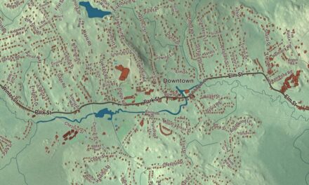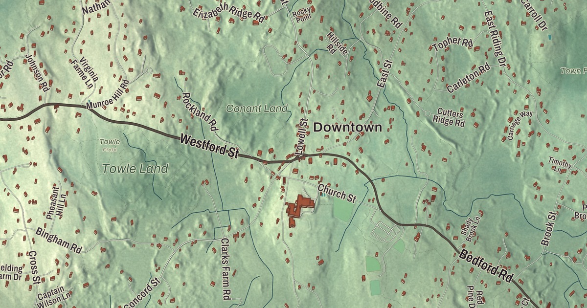
Carlisle is a small town where the weekly paper is called the Mosquito and about a quarter of the land is conservation land. This map prints Bedford Road, Westford Street, Lowell Street, Concord Street, Maple Street and Autumn Lane, with Greenough Pond, Buttrick Pond, Baptist Pond, the Town Forest, Bellows Hill, Hemlock Hill and Little Bear Hill. Click here to purchase a print of this map for your wall.
Carlisle is in Middlesex County, 19 miles northwest of Boston.
KNOWOL made this map in 2026 from public survey data and gave it the look of an old atlas. The relief comes from United States Geological Survey elevation data, and the roads and the town line come from the Census Bureau. Carlisle covers 15.5 square miles, about 8 miles south-southwest of Lowell, with Concord, Acton, Westford, Chelmsford, Billerica and Bedford around it. It had 5,237 people at the 2020 census.
Made from four towns
Carlisle was pieced together from the edges of its neighbors. English colonists first settled here on parcels belonging to Acton, Billerica, Chelmsford and Concord, in 1651 by the town page’s count. The Town of Carlisle’s recorded history, in the Secretary of the Commonwealth’s list, dates European settlement to 1650. Carlisle was incorporated as a town in 1780, the list says; the town page explains that it became a district of Concord that year and was made a full town by an act of the legislature in 1805. It took its name from Carlisle, England, the hometown of James Adams, one of its earliest settlers. The town remains part of Middlesex County today.
Farm, woods and meadow
Carlisle has kept its open land. Besides town conservation land, the Carlisle Conservation Foundation holds property here, and so do two big public preserves. Great Brook Farm State Park, set up in 1967, is still a working dairy farm, home to the first robotic milking system in Massachusetts, and its ice cream stand serves ice cream made from the farm’s milk. The park has more than 20 miles of trails for hiking, riding and mountain biking, canoeing on Meadow Pond, and in winter one of the premier cross-country ski touring centers in New England. Along the Concord River, part of the Great Meadows National Wildlife Refuge protects river wetlands that draw herons, egrets, ducks and shorebirds.
On the Concord line, Carlisle shares the Estabrook Woods, more than 1,700 acres of woodland, hills, ledge and swamp that make up the largest contiguous and undeveloped woodland within thirty miles of Boston. Henry David Thoreau wrote about it in his journal and called it “Easterbrooks Country,” and in 1996 Concord and Carlisle worked together to put another 400 acres of it into conservation. The town of Carlisle owns 188 acres of the woods.
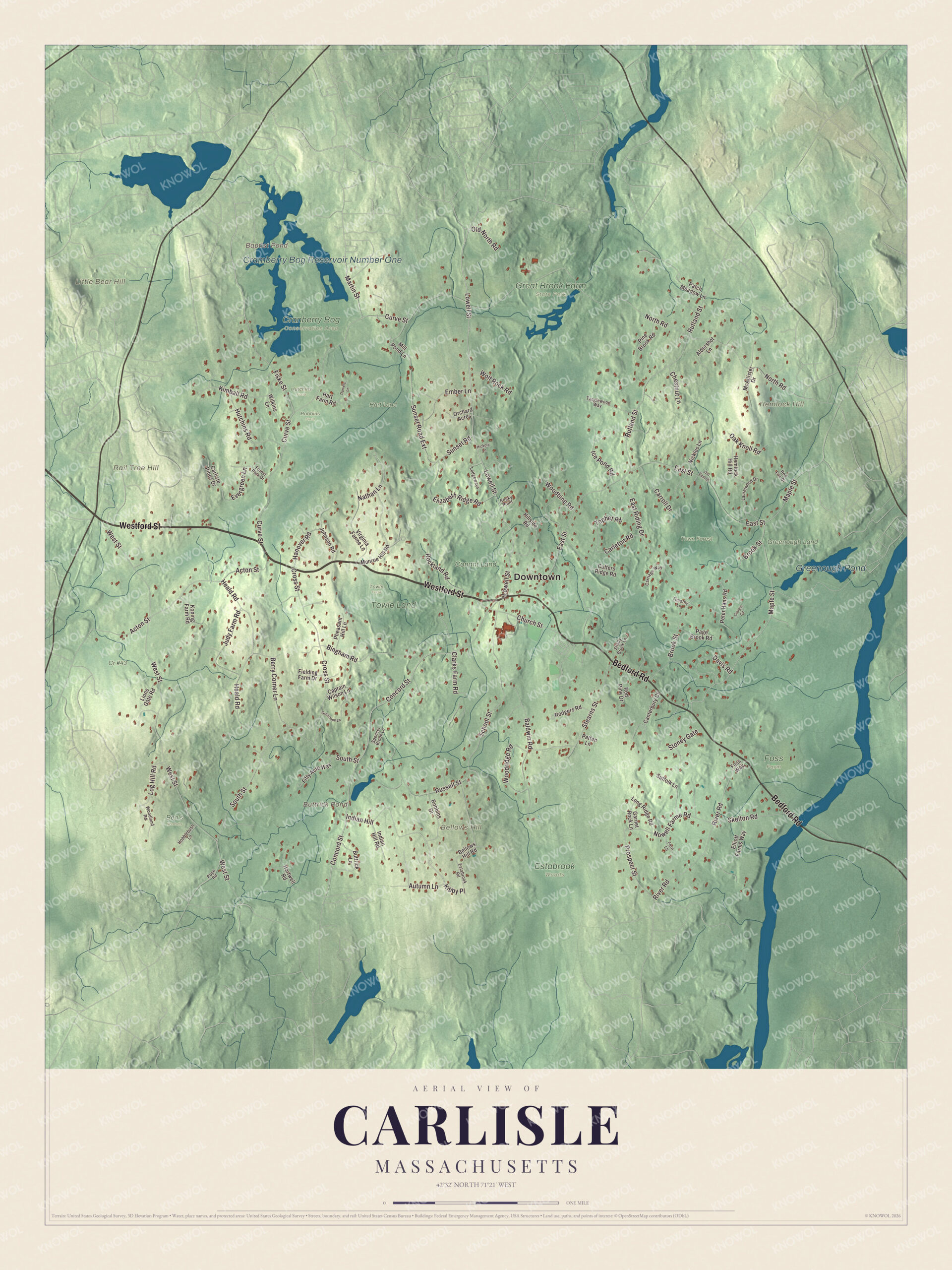
Click to explore a larger preview. The digital watermark does not appear on printed maps.
Names on this map
These names are printed on this map.
Places: Downtown, Bellows Hill, Hemlock Hill, Little Bear Hill, Rail Tree Hill, Baptist Pond, Buttrick Pond, Cramberry Bog Reservoir Number One, Greenough Pond, Ben's Woods, Conant Land, Cr #43, Cranberry Bog Conservation Area, Estabrook Woods, Foss Farm, Great Brook Farm State Park, Greenough Land, Hart Land, Hutchins Field, Robbins Field, Towle Field, Towle Land and Town Forest.
Streets and roads: Bedford Road, Westford Street, Lowell Street, Concord Street, Autumn Lane, Maple Street, West Street, Curve Street, North Road, East Street, South Street, Rutland Street.
More street names, A to Z
Acton Street, Aldershot Lane, Baldwin Road, Bellows Hill Road, Berry Corner Lane, Bingham Road, Brook Street, Buttrick Lane, Canterbury Court, Captain Wilson Lane, Carleton Road, Carlisle Pines Drive, Carriage Way, Carroll Drive, Chestnut Lane, Church Street, Clarks Farm Road, Craigie Circle, Cross Street, Cutters Ridge Road, Daniels Lane, Davis Road, East Riding Drive, Elizabeth Ridge Road, Elliott Farms Way, Ember Lane, Estabrook Road, Evergreen Lane, Fern Lane, Fielding Farm Drive, Fifty Acre Way, Fiske Street, Forest Park Drive, Foss Way, Garnet Rock Lane, Greystone Lane, Hanover Road, Hart Farm Road, Hartwell Road, Heald Road, Hemlock Hill Road, Hickory Lane, Hillside Road, Hobblebush Lane, Hutchins Road, Ice Pond Road, Indian Hill, Indian Hill Road, Johnson Road, Judy Farm Road, Kibby Place, Kimball Road, Koning Farm Road, Laurelwood Drive, Ledgeways, Lions Gate Road, Log Hill Road, Long Ridge Road, Martin Street, McAllister Drive, Mill Pond Lane, Munroe Hill Road, Nathan Lane, Nickles Lane, Nowell Farme Road, Oak Knoll Road, Old East Street, Old North Road, Orchard Acres, Page Brook Road, Patch Meadow Lane, Patten Lane, Peter Hans Road, Pheasant Hill Lane, Pine Brook Road, Pope Road, Prospect Street, Red Fox Drive, Red Pine Drive, River Road, Robbins Drive, Rockland Road, Rocky Point, Rodgers Road, Russell Street, School Street, Shady Brook Lane, Skelton Road, Spencer Brook Lane, Stearns Street, Stoney Gate, Suffolk Lane, Sunset Road, Sunset Road Extension, Tanglewood Way, Timothy Lane, Tophet Road, Virginia Farme Lane, Wilkins Lane, Wolf Rock Road, Woodbine Road, Woodland Road, Woodridge Road.
A small town’s big names
For a town of five thousand, Carlisle has heard a lot of famous music. The Blue Jay Recording Studio, on the east end of town until it closed in 2012, recorded artists from the Platters, Aerosmith and Roy Orbison to John Williams and the Boston Pops, Yo-Yo Ma, Billy Joel and Lady Gaga. The Carlisle Mosquito has been the town’s weekly independent newspaper since 1972, a nonprofit paper distributed free to all town residents, and the Gleason Public Library keeps a seismograph. Carlisle Old Home Day has been held for more than 100 years on the weekend before the Fourth of July, a free public day of games for families. The town also has its own chamber orchestra, community chorus and the Savoyard Light Opera Company.
Around the map
Start in the center of town, then follow Bedford Road, Westford Street, Lowell Street, Concord Street, Autumn Lane and Maple Street across town. Bedford Road, Route 225, runs along the northern edge of the Estabrook Woods. One of the four branches of Kimball Farm serves ice cream in Carlisle too. Buttrick Pond, Cramberry Bog Reservoir Number One, Greenough Pond, the Town Forest, Bellows Hill, Hemlock Hill, Little Bear Hill and Baptist Pond are all printed on the map.
Carlisle’s map makes a fine addition to an office, library or den, and it can help teach children the geography and history of a town built from the edges of four others. It’s made for people who call Carlisle home, and it shows the town as it looks today. Zoom in on the preview above to explore the details, then click here to get your copy of the Carlisle, Massachusetts map.

We made a map for every town and city in Massachusetts. Explore the complete Massachusetts map collection and find your town.
Sources