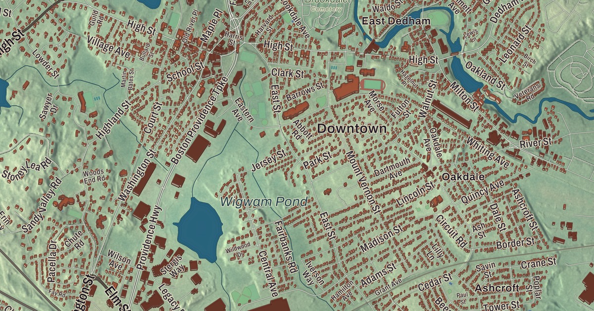
Dedham has been a town since 1636 and the seat of Norfolk County since 1793, and its old village center runs along High Street. This map prints High Street, Washington Street, Bridge Street, Elm Street, West Street and the Providence Highway, with Wigwam Pond, Weld Pond, Buckmaster Pond, Cow Island Pond, Bald Knob, Bearberry Hill, Bellevue Hill and Dedham Island. Click here to purchase a print of this map for your wall.
Dedham is in Norfolk County, on Boston’s southwestern border.
KNOWOL made this map in 2026 from public survey data and gave it the look of an old atlas. The relief comes from United States Geological Survey elevation data, and the streets and the town line come from the Census Bureau. Dedham covers 10.6 square miles, with Needham to the northwest, Westwood to the southwest, Boston to the northeast and Canton to the southeast. There are more than 550 named streets in town, and the longest, High Street, runs 3.5 miles. Dedham had 25,364 people at the 2020 census.
Contentment
People from Roxbury and Watertown settled here, and the Town of Dedham’s recorded history, in the Secretary of the Commonwealth’s list, dates European settlement to 1635. Dedham was incorporated as a town in 1636. The settlers wanted to call it “Contentment,” but the General Court named it for Dedham in Essex, England, where some of them were born. At their first public meeting, on August 15, 1636, eighteen men signed a town covenant promising to settle their differences by arbitration and each pay a fair share for the common good. The town’s first borders reached all the way to Rhode Island, and Dedham is sometimes called the “mother of towns,” since 14 of today’s communities were once inside them. It became the county seat when Norfolk County was formed in 1793, and the town remains part of Norfolk County today. “Contentment” is still on the town seal.
Dedham can claim some remarkable firsts. On January 1, 1643, the town voted unanimously to pay for a school with taxes, “the seed of American education,” and its page calls it the first public school in America. In 1639 settlers dug Mother Brook to carry water from the Charles River to the Neponset and power mills; the town’s page calls it the first man-made canal in North America, and its own page the first in the present-day United States. The Fairbanks House, which Jonathan Fairbanks built for his wife Grace and their family, has a summer beam dated by tree rings to 1637 and a main section finished by 1641, making it the oldest surviving timber-frame house in North America verified by that method. Eight generations of Fairbanks lived in it.
Liberty and conscience
In November 1798 David Brown led a group in Dedham that raised a liberty pole against the Sedition Act and other federal measures, as people had done before the Revolution; he refused to name the men who’d helped him and was sentenced to eighteen months in prison. In 1818 the town’s voters chose a minister different from the one the church members wanted, and the state’s highest court backed them in what became known as the Dedham Case, an important landmark in the separation of church and state. Fisher Ames, the statesman and friend of Washington, was a Dedham native; the 1897 Ames Schoolhouse at 450 Washington Street, named in his honor, now serves as the town hall and senior center. Louisa May Alcott, the educator Horace Mann, Supreme Court Justice Louis Brandeis and William B. Gould, a formerly enslaved man who became a Union Navy sailor, are among the town’s notable people.
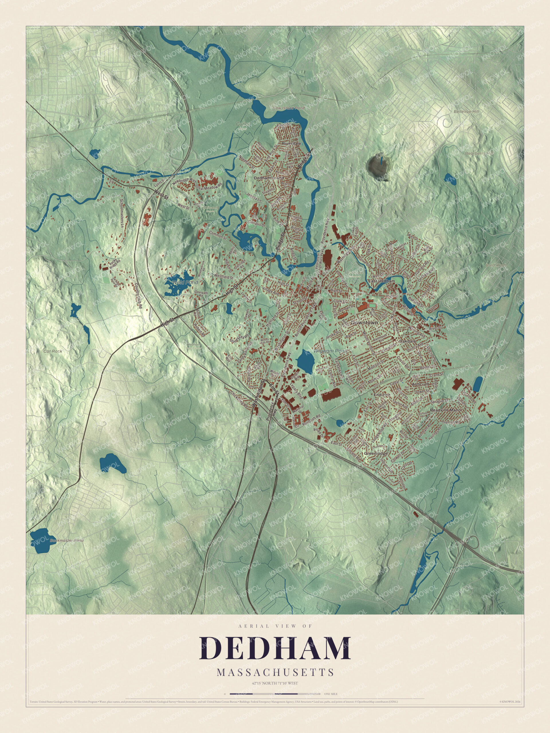
Click to explore a larger preview. The digital watermark does not appear on printed maps.
Names on this map
These names are printed on this map.
Places: Downtown, Bald Knob, Bearberry Hill, Bellevue Hill, Cat Rock, Buckmaster Pond, Cow Island Pond, Weld Pond, Wigwam Pond, Brookdale Cemetery, Cutler Park, Dedham Town Forest, Whitcomb Woods, Ashcroft, Dedham Island, East Dedham, Endicott, Greenlodge, Oakdale, Readville Manor and Riverdale.
Streets and roads: Bridge Street, Washington Street, Elm Street, High Street, West Street, Providence Highway, Boston Providence Turnpike, Dedham Boulevard, Milton Street, Oakland Street, Bussey Street, Rustcraft Road.
More street names, A to Z
Abbott Road, Adams Street, Alden Street, Allied Drive, Ames Street, Arlington Road, Ashcroft Street, Ash Street, Barrows Street, Bayard Street, Beacon Street, Beech Street, Belknap Street, Bemis Road, Bingham Avenue, Birch Street, Bonham Road, Bonney Lane, Booth Road, Border Street, Brookdale Avenue, Brookside Avenue, Bullard Street, Campus Drive, Carol Drive, Castle Road, Cedar Street, Central Avenue, Chickering Road, Chute Road, Circuit Road, Clark Street, Clisby Avenue, Colburn Street, Colwell Drive, Common Street, Coronation Drive, Country Club Road, Court Street, Crane Street, Creston Avenue, Curve Street, Dale Street, Dartmouth Avenue, Deerpath Road, Dixon Avenue, Doggett Circle, Durham Road, Eastern Avenue, East Street, Egan Terrace, Emmett Avenue, Erin Way, Fairbanks Road, Fay Road, Flintlock Lane, Flood Drive, Fulton Street, Gaffney Road, Garfield Road, Glenridge Road, Glen Road, Grant Avenue, Great Meadow Road, Greenhood Street, Greenlodge Street, Guild Road, Hale Drive, Hamilton Avenue, Harris Street, Harvard Street, Hastings Road, Haven Street, Hazelnut Place, Highland Street, Hillsdale Road, Hillside Road, Hooper Road, Hyde Park Street, Indian Path, Iverson Way, Ivy Lane, Jackson Pond Road, Jenney Lane, Jersey Street, Kiely Road, Lancaster Road, Ledgewood Road, Legacy Boulevard, Leonard Street, Lewis Lane, Liana Lane, Lilly Lane, Lincoln Street, Lowder Street, Lower East Street, Lynch Avenue, Lyons Street, Madison Street, Maple Place, Marlboro Street, Martin Bates Street, Maynard Road, Meadowbrook Road, Morse Avenue, Mount Vernon Street, National Drive, Needham Street, Newbridge Way, Oakdale Avenue, Oak Street, Old River Place, Pacella Drive, Park Street, Paul Street, Pine Hill Road, Pine Street, Poplar Street, Quincy Avenue, Ridge Avenue, Ridgeway Street, Riverside Drive, River Street, Robert Road, Rocky Ridge Road, Rosemary Road, Rosen Road, Sandy Valley Road, Savin Street, Sawyer Drive, Schoolmasters Lane, School Street, Scott Circle, Sprague Street, Station Circle, Stergis Way, Stivaletta Drive, Stoney Lea Road, Stoughton Road, Taylor Avenue, Thomas Street, Tower Street, Trenton Road, Upland Road, Veterans of Foreign Wars Parkway, Veterans Road, Village Avenue, Vincent Road, Vine Rock Street, Waldo Street, Walnut Street, Ware Street, Westchester Circle, Westfield Street, Whitcomb Road, Whiting Avenue, Wildwood Drive, Wilson Avenue, Woods End Road.
See it on a wall
The Dedham map as a framed print. Swipe for more.


East Dedham and the crackle glaze
Mother Brook powered grist, saw, paper, textile and woolen mills through the 18th and 19th centuries and made East Dedham a busy mill village. There, in 1896, Hugh C. Robertson opened Dedham Pottery, known until it closed in 1943 for its fine crackle glaze and cobalt blue borders; of more than 50 designs, the bunny was the most popular and became its best-known pattern. Today Mother Brook is part of a flood-control system between the two rivers, with parks, trails and conservation land along its banks.
Around the map
Start with Ashcroft, the neighborhood between Cedar Street and Sprague Street, then follow Bridge Street, Washington Street, Elm Street, High Street, West Street and the Providence Highway across town, and look outward toward Dedham Island, East Dedham, Endicott, Greenlodge and Oakdale. The Dedham Village Historic District runs along High Street between Bridge and Ames Streets, with the Norfolk County Courthouse, a National Historic Landmark, and the Old Village Cemetery. Oakdale sits in the middle of town, and Greenlodge, along Greenlodge Street, was once nicknamed Peanut Butter Valley, since people said that after paying for their new homes, residents could only afford peanut butter sandwiches. The Fairbanks neighborhood lies between East Street and Wigwam Pond. Buckmaster Pond, Cow Island Pond, Weld Pond, Wigwam Pond, Bald Knob, Bearberry Hill and Bellevue Hill are all printed on the map.
The Dedham map makes a fine addition to an office, library or den, and it can help teach children the geography and history of a town that dates to 1636. It’s made for people who call Dedham home, from Oakdale to East Dedham, and it shows the town as it looks today. Zoom in on the preview above to explore the details, then click here to get your copy of the Dedham, Massachusetts map.

Sources
- Dedham, Massachusetts, Wikipedia
- Fairbanks House (Dedham, Massachusetts), Wikipedia
- Mother Brook, Wikipedia
- Dedham Pottery, Wikipedia
- Ames Schoolhouse, Wikipedia
- Dedham Village Historic District, Wikipedia
- City and Town Incorporation and Settlement Dates, Secretary of the Commonwealth of Massachusetts (archived copy)