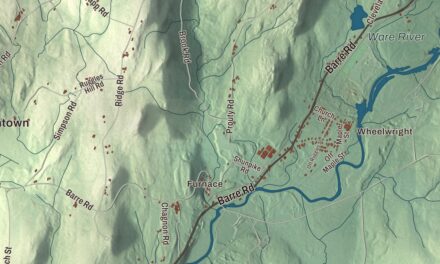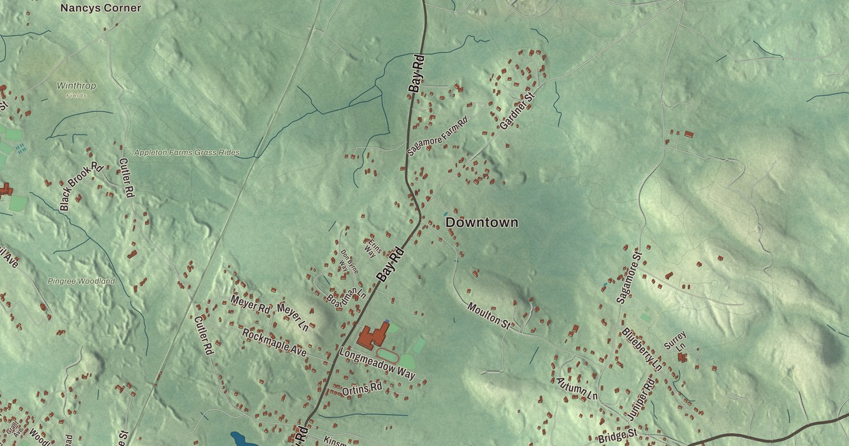
Hamilton is horse country, where drivers often share the back roads with riders, and Bay Road follows the line of a colonial stagecoach road. This map prints Bay Road, Essex Street, Woodbury Street, Highland Street, Bridge Street and Asbury Street, with Chebacco Lake, Beck Pond, Cedar Pond, Gravelly Pond, Blueberry Hill, Bradstreet Hill, Bear Hill and Averills Island. Click here to purchase a print of this map for your wall.
Hamilton is in Essex County.
KNOWOL made this map in 2026 from public survey data and gave it the look of an old atlas. The relief comes from United States Geological Survey elevation data, and the streets and the town line come from the Census Bureau. Hamilton covers 14.9 square miles, 5 miles inland from Massachusetts Bay, with the Ipswich River along its west side and Chebacco Lake and smaller ponds to the east. The town page notes it has no industrially zoned land. Hamilton shares a school system, a library and a commuter rail station with its neighbor Wenham, and it had 7,561 people at the 2020 census.
The Hamlet
In June 1638 John Winthrop the Younger bought most of today’s Essex County from Masconomet, sachem of the Agawam, for twenty English pounds. A memorial stone on Sagamore Hill, in southeastern Hamilton, marks where Masconomet was buried with his gun and tomahawk around 1658. The Town of Hamilton’s recorded history, in the Secretary of the Commonwealth’s list, dates European settlement to 1638, as the town page does. The land was a part of Ipswich known as “The Hamlet,” and the first recorded grant there was Matthew Whipple’s farm, dated 1638. Three years later the new stagecoach road from Boston to Newburyport, Bay Road, was laid out through Whipple’s land. The Appletons, Winthrops, Lamsons and Dodges followed, drawn by country that looked like the English farms they had left.
Hamilton was incorporated as a town in 1793, on June 21, and named for Alexander Hamilton, whose portrait became the town seal in 1903. When the Boston and Maine Railroad came in 1839, the center of town slowly shifted south toward the depot. The town remains part of Essex County today.
Camp meetings, polo and the hunt
Bostonians came out to the farm village for rest and recreation. Methodists began holding summer camp meetings at Asbury Grove in the late 1850s, and congregations from towns along the North Shore came each summer. The grove, named for Bishop Francis Asbury, was listed on the National Register as the Asbury Grove Historic District in 2009.
The Myopia Hunt Club, named in jest for its nearsighted founders, moved to the Gibney Farm in Hamilton in the 1880s. It began with lawn tennis and baseball and turned to polo, the hunt and golf as its members built summer estates nearby. Its course, laid out by Herbert C. Leeds in 1894, hosted the U.S. Open four times, in 1898, 1901, 1905 and 1908, and was so hard that in 1901 no professional broke 80 in any round. The club’s page says its polo field is one of the oldest continually running in the nation. The club and the town’s many horse farms keep that riding tradition strong. Myopia gave the land for the General George S. Patton Memorial Park, and Patton himself is among the town’s notable residents.
The Community House and the park
In 1921 the Mandell family built the Community House in memory of the eight men from Hamilton and Wenham who died in military service in World War I, among them their son Sam. The Boston and New York architect Guy Lowell designed it, and the family gave it in trust to the people of both towns. In 2021 Hamilton became, by its town page, the first town in Massachusetts to require composting.
Bradley Palmer State Park covers 736 acres along the Ipswich River in Hamilton and Topsfield. It was the estate of the attorney Bradley Palmer, who hosted horse races for the Myopia Hunt Club and left his lands “to the people of Massachusetts.” The highest point in Hamilton is on Blueberry Hill inside the park, at least 215 feet above sea level. Chebacco Lake, on the east side of town, lies in Essex and Hamilton and drains through Alewife Brook to the Essex River.
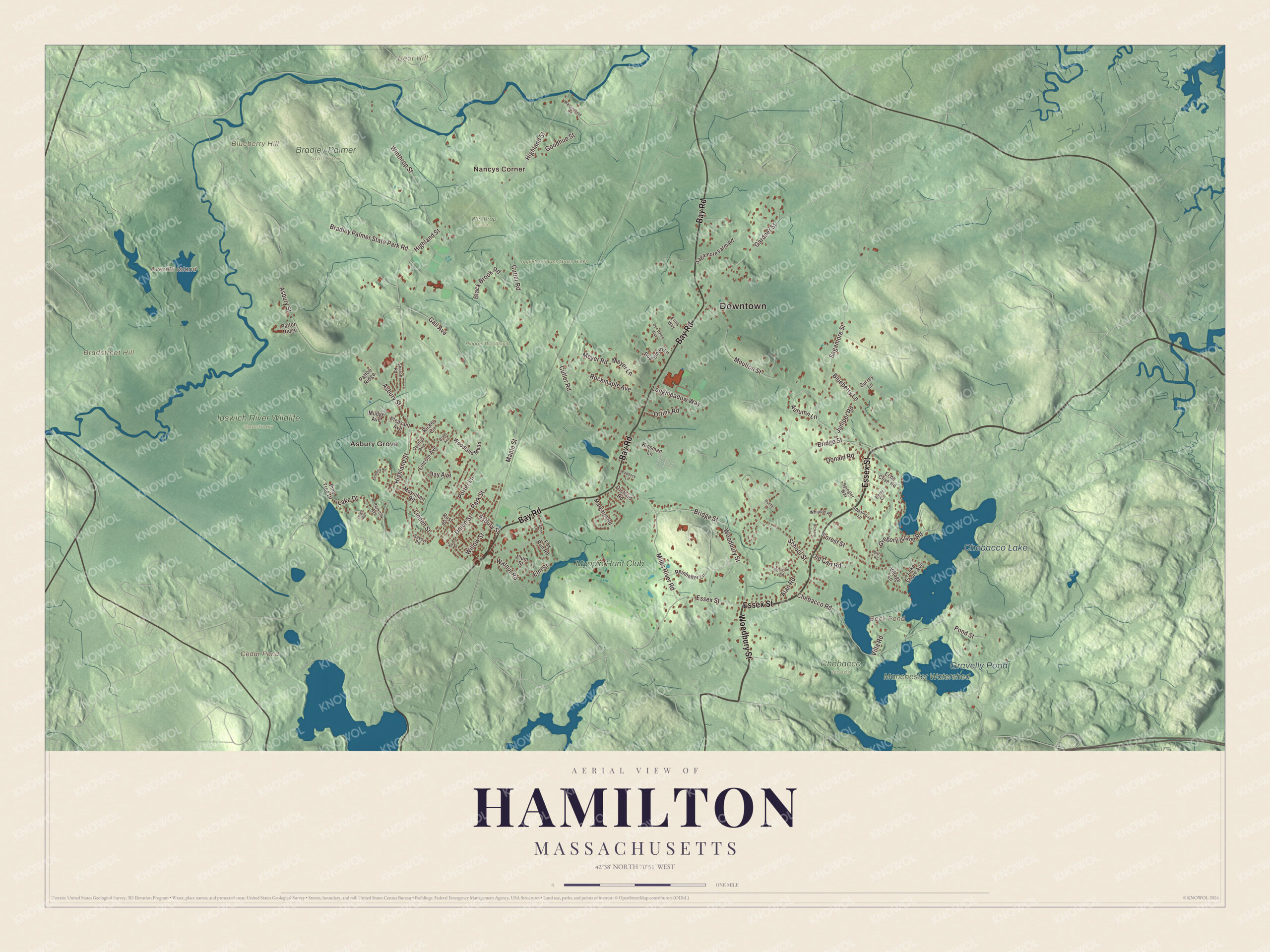
Click to explore a larger preview. The digital watermark does not appear on printed maps.
Names on this map
These names are printed on this map.
Places: Downtown, Nancys Corner, Asbury Grove, Averills Island, Bear Hill, Blueberry Hill, Bradstreet Hill, Beck Pond, Cedar Pond, Chebacco Lake, Gravelly Pond, Appleton Farms Grass Rides, Bradley Palmer State Park, Chebacco Woods, Ipswich River Wildlife Sanctuary, Manchester Watershed, Pingree Woodland, Winthrop Fields and Myopia Hunt Club.
Streets and roads: Essex Street, Woodbury Street, Bay Road, Highland Street, Bridge Street, Asbury Street, Cutler Road, Chebacco Road, Sagamore Street, Gail Avenue, Moulton Street, Winthrop Street.
More street names, A to Z
Alan Road, Anthony Road, Appaloosa Lane, Autumn Lane, Berry Circle, Birch Road, Black Brook Road, Blueberry Lane, Boardman Lane, Bradley Palmer State Park Road, Central Avenue, Day Avenue, Donald Road, Don Byrne Way, Echo Cove Road, Elm Street, Erins Way, Forest Street, Fox Run Road, Gardner Street, Goodhue Street, Grant Avenue, Gregory Island Road, Hickory Lane, Home Street, Hunter Lane, Juniper Road, Kinsman Lane, Lake Drive, Lake Shore Avenue, Leigh Road, Lincoln Avenue, Linden Street, Longmeadow Way, Maple Street, Margaret Road, Meyer Lane, Meyer Road, Miles River Road, Moynihan Road, Mudge Avenue, Old Cart Road, Orchard Road, Ortins Road, Paddock Lane, Park Street, Patton Drive, Patton Ridge, Perkins Avenue, Pine Tree Drive, Pleasant Avenue, Plum Street, Pond Street, Porter Lane, Postgate Road, Reinhalter Lane, Ricker Circle, Rockmaple Avenue, Rust Street, Sagamore Farm Road, Savoy Road, School Street, Sharon Road, Spingler Way, Surrey Lane, Union Street, Village Lane, Villa Road, Waldingfield Road, Walnut Road, Whipple Road, Willow Street, Woodland Mead.
Around the map
Start with Nancys Corner, then follow Essex Street, Woodbury Street, Bay Road, Highland Street, Bridge Street and Asbury Street across town. Look outward toward Asbury Grove. Beck Pond, Cedar Pond, Chebacco Lake, Gravelly Pond, Bear Hill, Blueberry Hill, Bradstreet Hill and Averills Island are all printed on the map. Every one of those names is right there on the artwork.
The Hamilton map makes a fine addition to an office, library or den, and it can help teach children the geography and history of the old Hamlet of Ipswich. It’s made for people who call Hamilton home, from Nancys Corner to Asbury Grove, and it shows the town as it looks today. Zoom in on the preview above to explore the details, then click here to get your copy of the Hamilton, Massachusetts map.

We made a map for every town and city in Massachusetts. Explore the complete Massachusetts map collection and find your town.
Sources