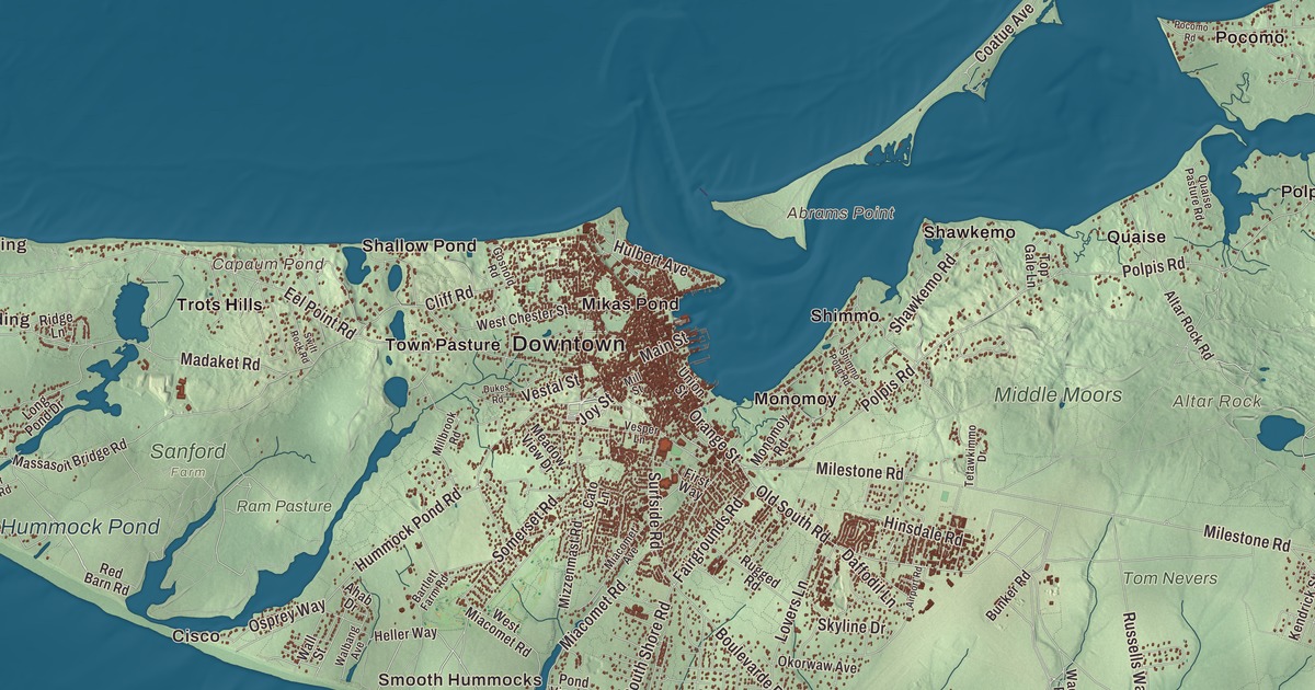
If you know Nantucket by its roads, this map has them: Madaket Road, Polpis Road, Milestone Road, Sankaty Road, Old South Road and Eel Point Road. It prints the ponds too, Capaum Pond, where the first town stood, Hummock Pond, Sesachacha Pond and Almanac Pond, along with Altar Rock, one of the island’s high points. Click here to purchase a print of this map for your wall.
Nantucket is in Nantucket County.
KNOWOL made this map in 2026 from public survey data and gave it the look of an old atlas. The low hills and the shoreline come from United States Geological Survey elevation data, and the roads and the town line come from the Census Bureau. Nantucket lies about 30 miles south of Cape Cod, and with the small islands of Tuckernuck and Muskeget it makes up both the Town and the County of Nantucket. The island itself covers 47.8 square miles. A low glacial moraine runs across its northern part, and the south is an outwash plain sloping to the sea. Altar Rock, at 100 feet, is among the island’s highest points, close behind Saul’s Hill.
Sherburne
The name probably comes from a Wampanoag word whose meaning is uncertain; one reading is “far away island.” The Wampanoag had lived here for thousands of years, as many as three thousand people in groups led by sachems. The Town of Nantucket’s recorded history, in the Secretary of the Commonwealth’s list, dates European settlement to 1641, the year Thomas Mayhew secured the islands as a proprietary colony. English settlement began in earnest in 1659, when Mayhew sold nine-tenths of his interest to Tristram Coffin and his partners for thirty pounds and two beaver hats. Nantucket was incorporated as a town in 1671. The first town stood near Capaum Pond, then a small harbor; when its entrance silted up, the settlers took their houses apart and moved them two miles northeast to the present town. The town was called Sherburne until 1795, when it became the Town of Nantucket. The Jethro Coffin House on Sunset Hill, built in 1686 as a wedding gift that joined the Coffin and Gardner families, is believed to be the oldest house on the island still on its original site.
A whaling island
Nantucket turned to the sea after farming and sheep grazing wore out the land. Wampanoag men often made up half or more of the crews of its eighteenth-century whaling ships, and by 1774, its historic district page says, Nantucket held about sixty percent of the New England whaling fleet. Herman Melville sent Ishmael from Nantucket in Moby-Dick and made Ahab and Starbuck Nantucketers. After the Great Fire of 1846 and the rise of New Bedford, the island’s population fell, and its old buildings survived, as its historic district page puts it, through neglect. The National Park Service calls Nantucket the “finest surviving architectural and environmental example of a late 18th- and early 19th-century New England seaport town.” It became a National Historic Landmark District in 1966, and since 1975 the district has taken in the whole island.
Formerly enslaved people founded a neighborhood called New Guinea on the edge of town near the windmills on Mill Hill, with shops, churches and a school, and the island, by then mostly Quaker, became part of the Underground Railroad. Absalom Boston, born here to a formerly enslaved father and a Wampanoag mother, became, as his page puts it, the first African-American captain to sail a whaling ship with an all-black crew, on the Industry in 1822. He helped found the African Meeting House, and in 1845, after their daughter Phebe was barred from a public school, he and his wife Hannah won a lawsuit to integrate the island’s public schools. In 1841, a few days after he was first encouraged to lecture against slavery, a 23-year-old Frederick Douglass spoke at the Massachusetts Anti-Slavery Society’s annual convention on Nantucket. Maria Mitchell, born here in 1818, was the first librarian of the Nantucket Atheneum for 20 years, and in 1847 she found the comet that came to be called “Miss Mitchell’s Comet”; she went on to teach astronomy at Vassar College.
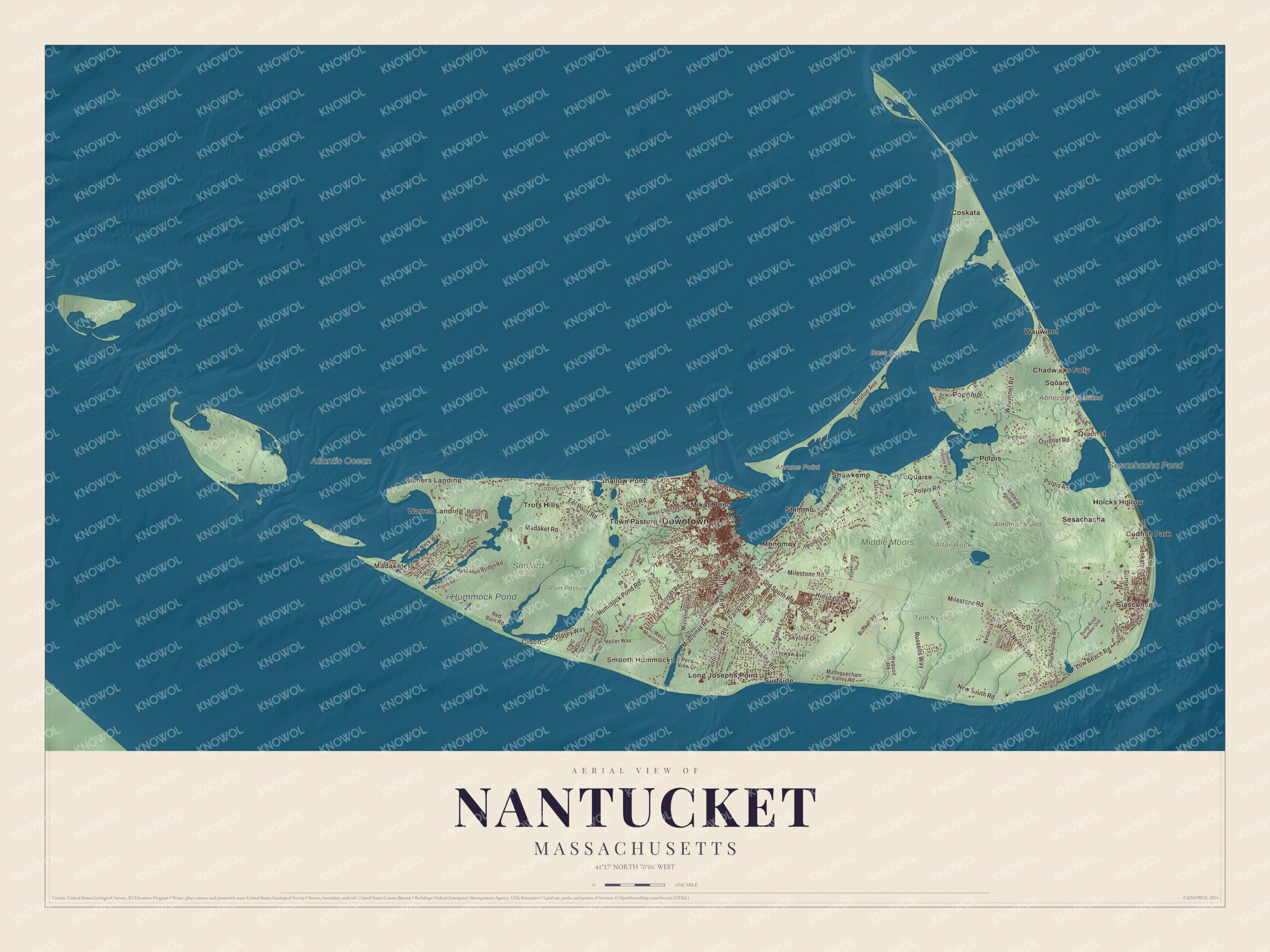
Click to explore a larger preview. The digital watermark does not appear on printed maps.
Names on this map
These names are printed on this map.
Places: Downtown, Madaket, Warren Landing, Fishers Landing, Cisco, Smooth Hummocks, Abnecotants Island, Abrams Point, Altar Rock, Bass Point, Almanac Pond, Capaum Pond, Sesachacha Pond, Hummock Pond, Atlantic Ocean, Great Point, Middle Moors, Ram Pasture, Sanford Farm, Tom Nevers, Chadwicks Folly, Codfish Park, Coskata, Hoicks Hollow, Long Josephs Point, Mikas Pond, Monomoy, Pocomo, Polpis, Quaise, Quidnet, Sesachacha, Shallow Pond, Shawkemo, Shimmo, Siasconset, Squam, Surfside, Town Pasture, Trots Hills and Wauwinet.
Streets and roads: Old South Road, Sankaty Road, Milestone Road, Polpis Road, Madaket Road, Eel Point Road, Hummock Pond Road, Wauwinet Road, New South Road, Tom Nevers Road, Somerset Road, Hinsdale Road.
More street names, A to Z
Ahab Drive, Airport Road, Almanac Pond Road, Altar Rock Road, Bartlett Farm Road, Boulevarde Road, Bunker Road, Burnell Street, Cannonbury Drive, Cato Lane, Chase Lane, Chuckhollow Road, Cliff Road, Coatue Avenue, Coffin Road, Coffin Street, Crows Nest Way, Daffodil Lane, Dukes Road, Dump Road Number One, Exeter Street, Fairgrounds Road, First Way, Gosnold Road, Head of Plains Road, Heller Way, Hulbert Avenue, Joy Street, Kendrick Street, Little Neck Way, Long Pond Drive, Longwood Drive, Lovers Lane, Low Beach Road, Lyons Lane, Madequecham Valley Road, Main Street, Massasoit Bridge Road, Meadow View Drive, Miacomet Avenue, Miacomet Road, Millbrook Road, Mill Street, Mizzenmast Road, Monomoy Road, Ocean Avenue, Okorwaw Avenue, Orange Street, Osprey Way, Pocomo Road, Pond View Drive, Quaise Pasture Road, Quidnet Road, Red Barn Road, Ridge Lane, Rugged Road, Russells Way, Shawkemo Road, Shimmo Pond Road, Skyline Drive, South Shore Road, Squam Road, Starbuck Road, Surfside Road, Swift Rock Road, Tetawkimmo Drive, Top Gale Lane, Union Street, Vesper Lane, Vestal Street, Walbang Avenue, Wall Street, Wanoma Way, Waquoit, Waquoit Road, West Chester Street, West Miacomet Road.
See it on a wall
The Nantucket map as a framed print. Swipe for more.


Around the map
Start with Madaket, then follow Old South Road, Sankaty Road, Milestone Road, Polpis Road, Madaket Road and Eel Point Road across town. Then look outward toward Warren Landing, Fishers Landing, Cisco, Smooth Hummocks and Chadwicks Folly. Almanac Pond, Capaum Pond, Sesachacha Pond, Hummock Pond, Altar Rock and Abnecotants Island are all labeled on the map, and every one of those names is printed directly on the artwork, along with Eel Point. Madaket, on the western end, is home to the Madaket Ditch, which its page counts among the earliest public works projects in America, and to the memory of “Madaket Millie,” Mildred Carpenter Jewett, who patrolled these shores for the Coast Guard in World War II and kept serving it until her death in 1990. Abnecotants Island is a very small island in the middle of Squam Swamp. Out at the eastern end, Sankaty Head Light has stood in Siasconset since 1850, and in 2007 the ‘Sconset Trust moved it back from the eroding bluff. Polpis is a village 3.5 miles northwest of Siasconset.
The Nantucket map makes a fine addition to an office, library or den, and it can help teach children the geography and history of a whaling island 30 miles out to sea. It’s made for people who call Nantucket home, from Madaket to ‘Sconset, and it shows the island as it looks today. Zoom in on the preview above to explore the details, then click here to get your copy of the Nantucket, Massachusetts map.

Sources
- Nantucket, Wikipedia
- Nantucket Historic District, Wikipedia
- Jethro Coffin House, Wikipedia
- Absalom Boston, Wikipedia
- Frederick Douglass, Wikipedia
- Maria Mitchell, Wikipedia
- Madaket, Massachusetts, Wikipedia
- Abnecotants Island, Wikipedia
- Sankaty Head Light, Wikipedia
- Polpis, Massachusetts, Wikipedia
- City and Town Incorporation and Settlement Dates, Secretary of the Commonwealth of Massachusetts (archived copy)