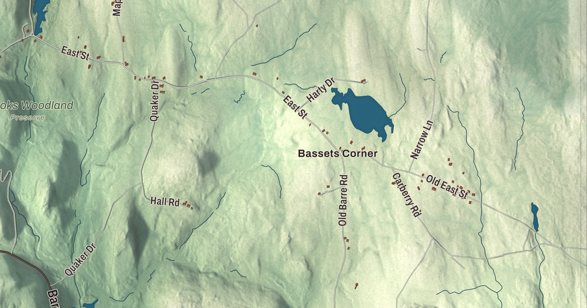
Petersham is the largest town by land area in Worcester County, and much of its land is protected for conservation. This map prints North Main Street, Barre Road, Hardwick Road, New Salem Road, Popple Camp Road and Spring Street, along with Harvard Forest, the Barre Town Reservoir, and Allen Hill, Babbitt Hill and Bald Hill. Click here to purchase a print of this map for your wall.
Petersham is in Worcester County.
KNOWOL made this map in 2026 from public survey data and gave it the look of an old atlas. The hills come from United States Geological Survey elevation data, and the roads and the town line come from the Census Bureau. Petersham covers 68.3 square miles, 14.1 of them water, and by land area it’s the fifth-largest of the 351 cities and towns in the Commonwealth. Camels Hump Hill, at 1,044 feet, is the highest point in town. It had 1,194 people at the 2020 census, the largest share of them living near the common.
The common
Land here was first granted to colonists in 1733, and the town common was laid out that year, with house lots running north and south along what’s now Main Street, Route 32. The Town of Petersham’s recorded history dates European settlement to 1733. The town’s first meeting house went up on the common, and every one of its town halls has stood there since. Petersham was incorporated as a town in 1754. The town remains part of Worcester County today. The common has been cared for by a village improvement society since 1878, and the Petersham Common Historic District, stretching along Main Street from New Salem Road to North Street, holds 45 buildings, most of them built before 1850 and most of them Greek Revival. The Country Store, an 1842 Greek Revival building east of the common, has held a general store on its main floor since it opened, and the stone Petersham Memorial Library, built in 1889 to 1891, honors the town’s Civil War soldiers.
Lincoln’s march
In the winter of 1787 the rebel farmers of Shays’ Rebellion moved north and east and made camp at Petersham. General Benjamin Lincoln, who had raised 3,000 troops, marched his militia to Petersham through a bitter snowstorm on the night of February 3 and arrived early the next morning, and on February 4 he routed the rebels there. In 1927 the New England Society of Brooklyn, New York, put up a memorial in town to Lincoln’s victory; it ends with the line “Obedience to the law is true liberty.”
Solomon Willard, born here in 1783, trained as a carpenter with his father and later designed and oversaw the Bunker Hill Monument, the first monumental obelisk put up in the United States. Emmeline B. Wells, born here as Emmeline Blanche Woodward in 1828, edited the Woman’s Exponent in Utah for 37 years, argued in its pages for women’s suffrage, was among the first women to vote in Utah’s local elections in 1870, and worked for 30 years to link Latter-day Saint women with the national suffrage movement.
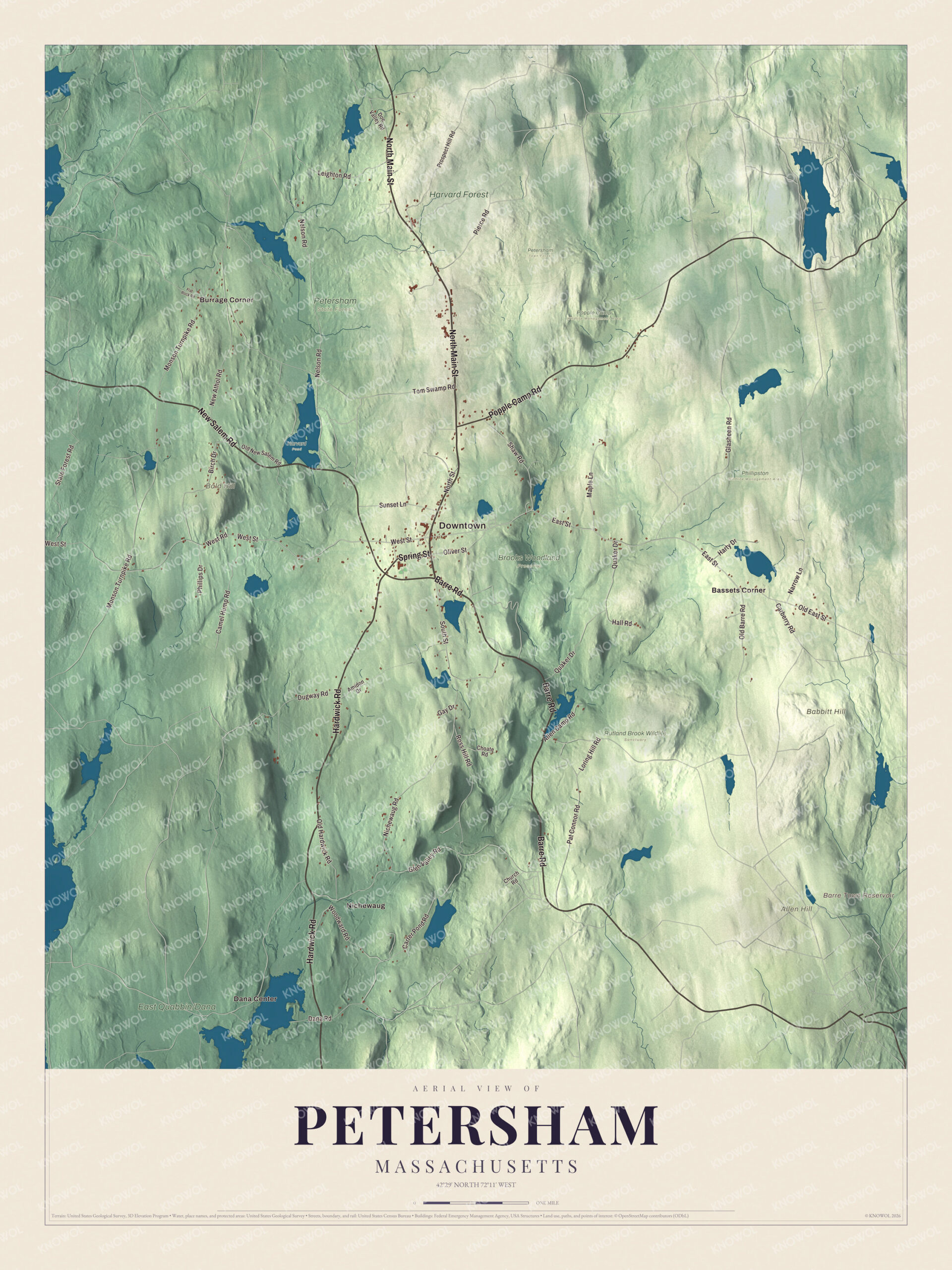
Click to explore a larger preview. The digital watermark does not appear on printed maps.
Names on this map
These names are printed on this map.
Places: Downtown, Allen Hill, Babbitt Hill, Bald Hill, Barre Town Reservoir, Brooks Woodland Preserve, Harvard Pond, Harvard Forest, Petersham State Forest, Petersham Town Forest, Phillipston Wildlife Management Area, Popple Camp Wildlife Management Area, Rutland Brook Wildlife Sanctuary, Bassets Corner, Burrage Corner, Dana Center and Nichewaug.
Streets and roads: North Main Street, Barre Road, Hardwick Road, New Salem Road, Popple Camp Road, Spring Street, West Street, East Street, West Road, South Street, Old East Street, Nelson Road.
More street names, A to Z
Allen Camp Road, Amidon Drive, Birch Drive, Camel Hump Road, Carberry Road, Carter Pond Road, Choate Road, Church Road, Dana Road, Doe Valley Road, Dugway Road, Flat Rock Road, Gay Drive, Glasheen Road, Glen Valley Road, Hall Road, Harty Drive, Leighton Road, Loring Hill Road, Maple Lane, Monson Turnpike Road, Narrow Lane, New Athol Road, Nichewaug Road, North Street, Old Barre Road, Old Hardwick Road, Old New Salem Road, Oliver Street, Pat Connor Road, Phillips Drive, Pierce Road, Prospect Hill Road, Quaker Drive, Ross Hill Road, Shaw Road, State Forest Road, Sunset Lane, Tom Swamp Road, Woodward Road.
Around the map
Start with Bassets Corner, then follow North Main Street, Barre Road, Hardwick Road, New Salem Road, Popple Camp Road and Spring Street across town. Then look outward toward Burrage Corner, Dana Center and Nichewaug. The Barre Town Reservoir, Harvard Forest, Allen Hill, Babbitt Hill and Bald Hill are all printed on the map. Harvard University has run Harvard Forest, 4,000 acres of research land, since 1907; it includes one of North America’s oldest managed forests, and its Fisher Museum, on Route 32 north of the center, tells the story of New England’s woodlands in 23 model dioramas. Dana Center recalls the town of Dana, which was disincorporated on April 28, 1938, for the Quabbin Reservoir, with all of its land going to Petersham. Most of old Dana is still above water; the houses were moved or razed, and a stone marker now stands at the site of Dana Common, which the public can reach only on foot. Parts of Greenwich and Prescott came to Petersham too, and the town’s southwestern line now follows the former East and Middle branches of the Swift River. The Trustees of Reservations care for the Swift River Reservation and the Brooks Woodland Preserve, and the Hotel Nichewaug, built in 1899 for summer visitors, stood in the historic district until it was torn down in 2022.
The Petersham map makes a fine addition to an office, library or den, and it can help teach children the geography and history of a town whose land reaches into the Quabbin Reservoir. It’s made for people who call Petersham home, from Bassets Corner to Dana Center, and it shows the town as it looks today. Zoom in on the preview above to explore the details, then click here to get your copy of the Petersham, Massachusetts map.

We made a map for every town and city in Massachusetts. Explore the complete Massachusetts map collection and find your town.
Sources
- Petersham, Massachusetts, Wikipedia
- Petersham Common Historic District, Wikipedia
- Shays’ Rebellion, Wikipedia
- Solomon Willard, Wikipedia
- Emmeline B. Wells, Wikipedia
- Harvard Forest, Wikipedia
- Dana, Massachusetts, Wikipedia
- Swift River Reservation, Wikipedia
- Brooks Woodland Preserve, Wikipedia
- City and Town Incorporation and Settlement Dates, Secretary of the Commonwealth of Massachusetts (archived copy)