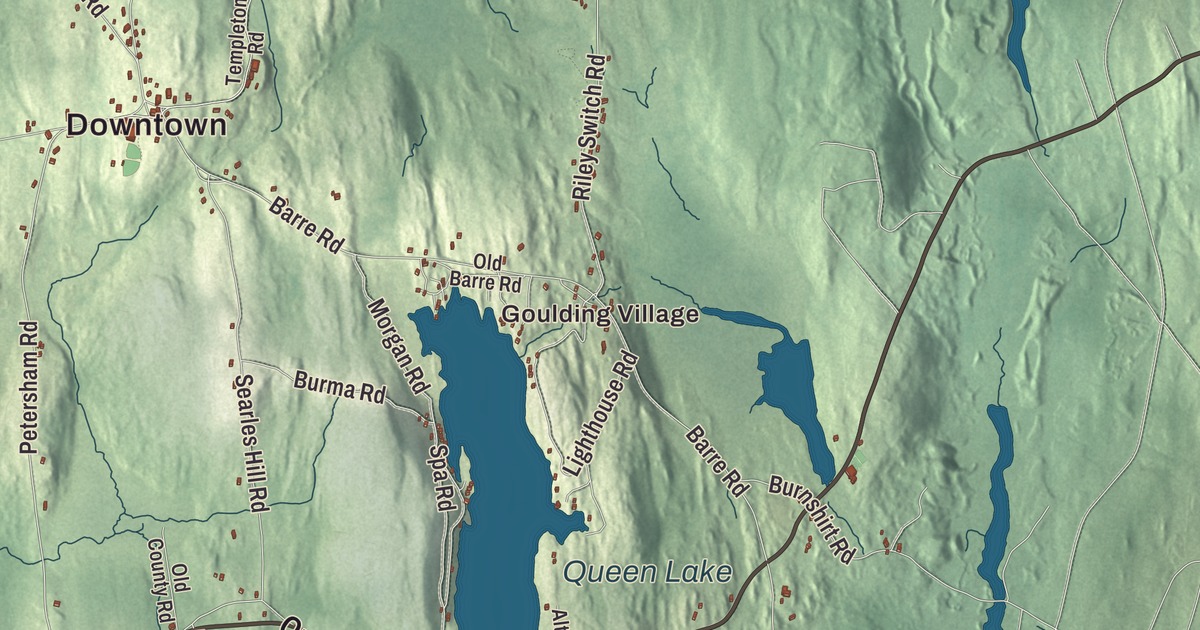
Phillipston has carried two names, and the second came from a lieutenant governor who also became the first president of Massachusetts General Hospital. This map of the town prints State Road, Main Road, Petersham Road, Queen Lake Road, Colony Road and Willis Road, with Queen Lake, Bourn-Hadley Pond, the Bates Powers Reservoir and Goulding Village. Click here to purchase a print of this map for your wall.
Phillipston is in Worcester County.
KNOWOL made this map in 2026 from public survey data and gave it the look of an old atlas. Its hills are drawn from United States Geological Survey elevation data, and the roads and the town line come from the Census Bureau. Phillipston covers 24.6 square miles between Athol, Royalston, Templeton, Hubbardston, Barre and Petersham, and it had 1,724 people at the 2020 census.
Gerry, then Phillipston
Phillipston was first part of Templeton. Settlers came on land grants made in the 1730s, and in 1759 Charles Baker, one of the first settlers, gave land for a burying ground. The Town of Phillipston’s recorded history dates European settlement to 1751. The town split from Templeton on October 20, 1786, under the name Gerry, after the politician Elbridge Gerry. Phillipston was incorporated as a town in 1786. The town remains part of Worcester County today. On February 5, 1814, the name was changed to Phillipston, for William Phillips Jr., a Boston merchant who was the tenth lieutenant governor of Massachusetts.
The town grew only a little until 1830, and then its population fell and didn’t climb back to that level until 1980, 150 years later. Because it grew so little, most of the buildings in the Phillipston Center Historic District are Federal and Greek Revival. The center grew up around what’s now the meeting of the Baldwinville, Petersham and Templeton roads. Its grassy common has the Congregational Church, built in 1786 and given its Greek Revival look in 1837, at its north end and the 1891 Victorian Gothic town hall at its south end. Next to the church, the library was once a district school; it was built in the 1830s and has a four-column Greek Revival temple front. Searles Hill Cemetery, on the land Charles Baker gave, is the town’s oldest; its oldest dated marker is from 1777, and at least four Revolutionary War veterans are buried there.
Thomas H. White, born in Phillipston as the oldest of eight children, invented a small hand-operated sewing machine, founded the White Sewing Machine Company in Cleveland in 1876, and later went into motor vehicles through the White Motor Company. Charlotte Barnum, born in Phillipston in 1860, became in 1895 the first woman to receive a Ph.D. in mathematics from Yale University.
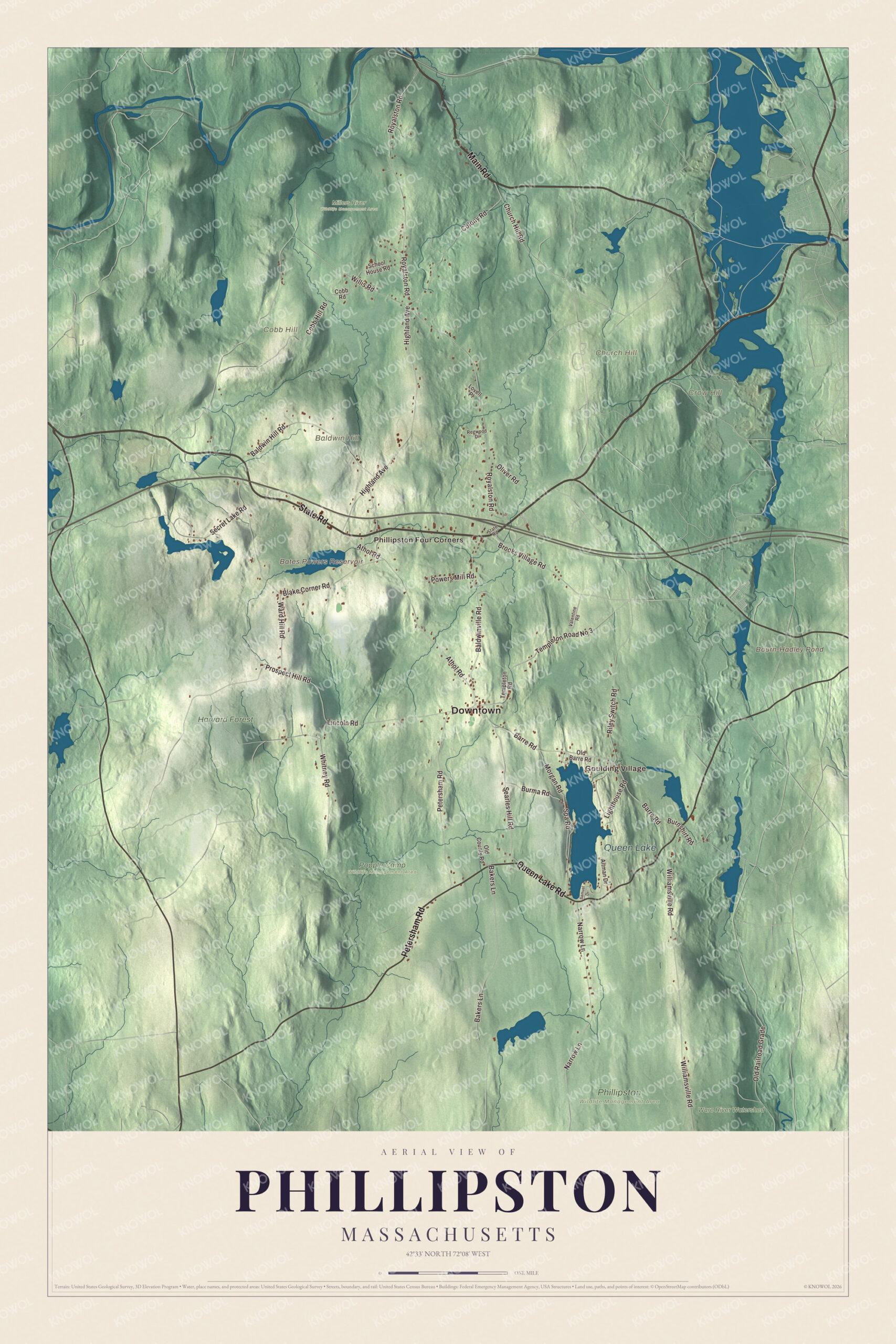
Click to explore a larger preview. The digital watermark does not appear on printed maps.
Names on this map
These names are printed on this map.
Places: Downtown, Goulding Village, Phillipston Four Corners, Baldwin Hill, Church Hill, Cobb Hill, Crow Hill, Bates Powers Reservoir, Bourn-Hadley Pond, Queen Lake, Harvard Forest, Millers River Wildlife Management Area, Phillipston Wildlife Management Area, Popple Camp Wildlife Management Area and Ware River Watershed.
Streets and roads: State Road, Main Road, Petersham Road, Queen Lake Road, Colony Road, Willis Road, Bakers Lane, Riley Switch Road, Templeton Road No 3, Highland Avenue, Barre Road, Baldwinville Road.
More street names, A to Z
Altman Drive, Athol Road, Baldwin Hill Road, Blake Corner Road, Brooks Village Road, Burma Road, Burnshirt Road, Church Hill Road, Cobb Hill Road, Cobb Road, Lighthouse Road, Lincoln Road, Lovell Place, Morgan Road, Narrow Lane, Old Barre Road, Old County Road, Old Railroad Grade, Oliver Road, Powers Mill Road, Prospect Hill Road, Regwood Drive, Royalston Road, Samuel Drive, School House Road, Searles Hill Road, Secret Lake Road, Spa Road, Templeton Road, Valentine Road, Ward Hill Road, Whitney Road, Williamsville Road.
Around the map
Start with Goulding Village, then follow State Road, Main Road, Petersham Road, Queen Lake Road, Colony Road and Willis Road across town. Then look outward toward Phillipston Four Corners. The Bates Powers Reservoir, Bourn-Hadley Pond, Queen Lake, Harvard Forest, Baldwin Hill, Church Hill and Cobb Hill are all printed on the map. Harvard Forest is Harvard University’s research forest, based in Petersham and reaching into its neighbors. In 1941 Frederick W. Elliott gave the Trustees of Reservations the first land of Elliott Laurel, a 33-acre preserve known for its stands of mountain laurel, where a mile of trails climbs along a series of ledges to a view.
The Phillipston map makes a fine addition to an office, library or den, and it can help teach children the geography and history of a small Worcester County town with a historic center. It’s made for people who call Phillipston home, from Goulding Village to Queen Lake, and it shows the town as it looks today. Zoom in on the preview above to explore the details, then click here to get your copy of the Phillipston, Massachusetts map.

We made a map for every town and city in Massachusetts. Explore the complete Massachusetts map collection and find your town.
Sources
- Phillipston, Massachusetts, Wikipedia
- William Phillips Jr., Wikipedia
- Phillipston Center Historic District, Wikipedia
- Searles Hill Cemetery, Wikipedia
- Thomas H. White, Wikipedia
- Charlotte Barnum, Wikipedia
- Petersham, Massachusetts, Wikipedia
- Harvard Forest, Wikipedia
- Elliott Laurel, Wikipedia
- City and Town Incorporation and Settlement Dates, Secretary of the Commonwealth of Massachusetts (archived copy)