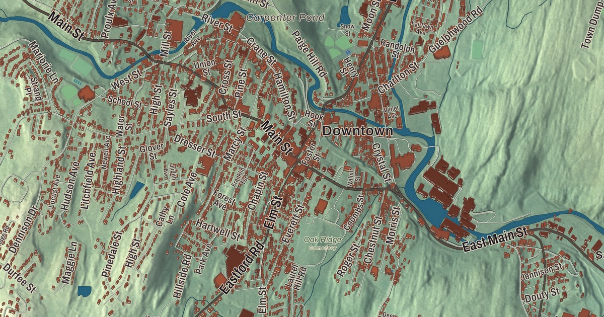
Follow Main Street through Southbridge and you’ll pass through Globe Village and downtown and out East Main Street to Sandersdale, while this map adds Worcester Street, Eastford Road, North Woodstock Road, Fiske Hill, Dennison Hill and Cohasse Brook Reservoir. Click here to purchase a print of this map for your wall.
Southbridge is in Worcester County.
KNOWOL made this map in 2026 from public survey data and styled it after an old atlas. Its hills are shaped with United States Geological Survey elevation data, and the roads and the town line come from the Census Bureau. Southbridge covers 20.9 square miles along the Quinebaug River, with Sturbridge to the west, Charlton to the north, Dudley to the east and Woodstock, Connecticut, to the south. It has a city form of government, though its legal name is still the Town of Southbridge, and it had 17,740 people at the 2020 census.
Honest Town
The Nipmuck and Mohegan peoples lived here first, and the Quinebaug River divided their lands. The Town of Southbridge’s recorded history, in the Secretary of the Commonwealth’s list, dates European settlement to 1730. Moses Marcy, one of the first settlers, had his home where Notre Dame church stands now. The Quinebaug’s water power made the valley a good place for sawmills and gristmills in the 1700s and for textile mills in the 1800s. In 1801 a parish called the Second Religious Society of Charlton, popularly called Honest Town, was formed from the west part of Dudley, the southwest part of Charlton and the southeast part of Sturbridge. Southbridge was incorporated as a town in 1816, made from those pieces of its three neighbors.
After the Civil War, Irish and French Canadian families came to work in the mills, and by the 1930s Polish, Greek and Italian families had joined them. New neighbors arrived from Puerto Rico, Laos and Vietnam in the 1970s and 1980s, and the town has a significant Hispanic and Puerto Rican community today. The Jacob Edwards Library serves the town, and its public library goes back to 1870.
Eye of the Commonwealth
Lens makers were working in Southbridge by the 1830s, and their companies grew into the American Optical Company, known as AO. Under the Wells family it became the world’s largest maker of ophthalmic products, with more than 6,000 workers around the world at its height, and Southbridge earned the nickname “Eye of the Commonwealth.” During World War II many AO workers were kept out of the draft because they were doing vital defense work, including Norden bombsights. The company’s Original Pilot sunglasses were worn by the whole Apollo 11 crew. AO’s works spread over about 80 acres on both sides of the Quinebaug and onto an island in the river, and the old main plant on Mechanic Street, a big Romanesque brick building, now holds a hotel and conference center. The Optical Heritage Museum is in Southbridge too.
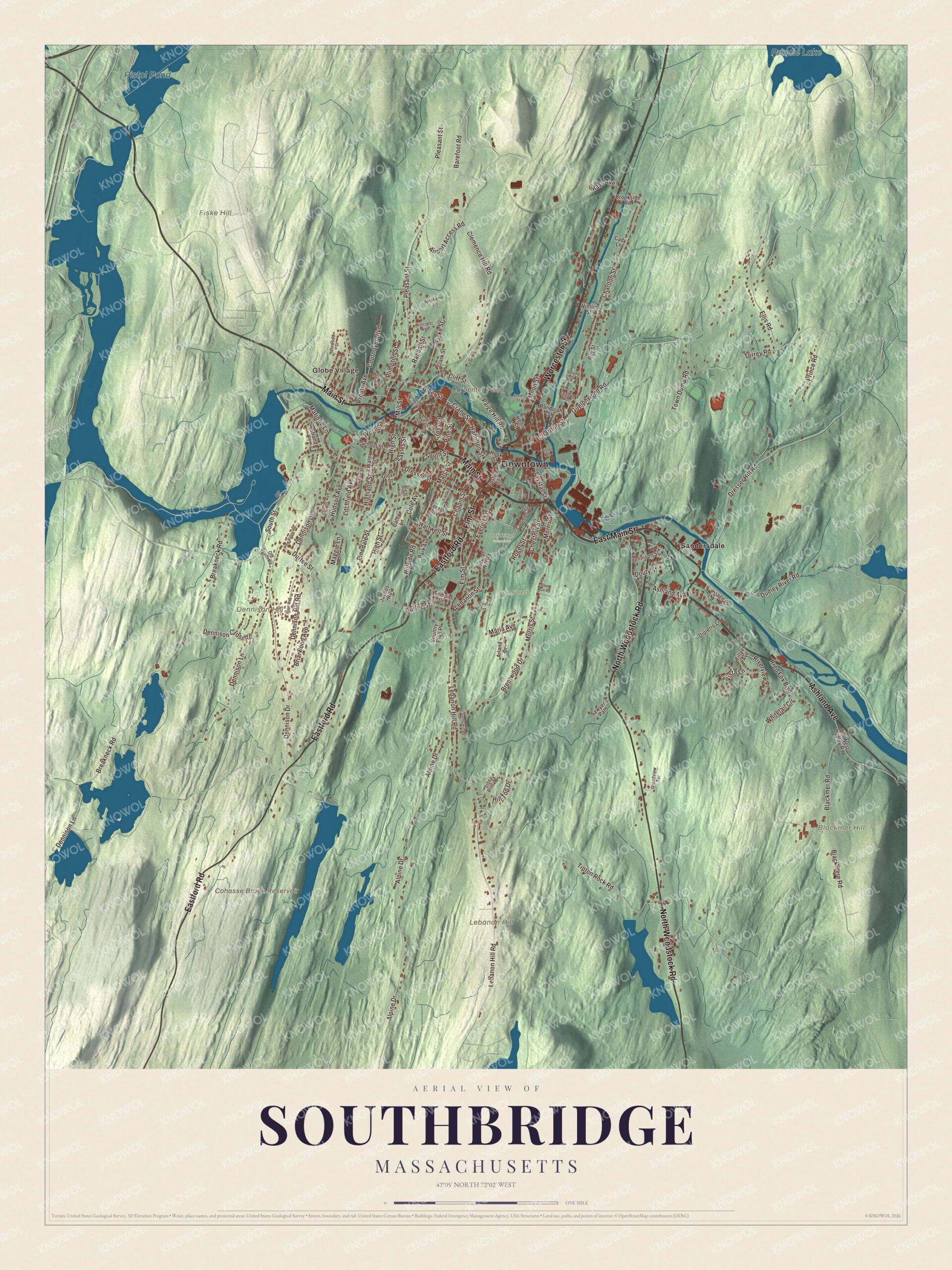
Click to explore a larger preview. The digital watermark does not appear on printed maps.
Names on this map
These names are printed on this map.
Places: Downtown, Globe Village, Blackmer Hill, Dennison Hill, Fiske Hill, Lebanon Hill, Carpenter Pond, Cohasse Brook Reservoir, Pistol Pond, Prindle Lake, Cole Forest, Oak Ridge Cemetery and Sandersdale.
Streets and roads: East Main Street, Main Street, Worcester Street, Ashland Avenue, Eastford Road, North Woodstock Road, Elm Street, Lebanon Street, Breakneck Road, Morris Street, Charlton Street, Dresser Hill Road.
More street names, A to Z
Airport Access Road, Alpine Drive, Arland Drive, Barefoot Road, Blackmere Road, Blackmer Road, Brentwood Drive, Briarwood Avenue, Brookside Road, Cady Lane, Cathy Lane, Chapin Street, Chestnut Street, Clark Street, Clemence Hill Road, Cliff Street, Cole Avenue, Coombs Street, Country Club Place, Cournoyer Boulevard, Crane Street, Cross Street, Crystal Street, Deer Run Road, Dennison Cross Road, Dennison Drive, Dennison Hill Road, Dennison Lane, Dipietro Lane, Douty Street, Dresser Street, Dudley River Road, Durfee Street, Ellis Road, Everett Street, Fairlawn Avenue, Fiske Street, Forest Avenue, Foster Street, Franklin Terrace, Glover Street, Grandview Terrace, Guelphwood Road, Hamilton Street, Hartwell Street, Henry Street, Highland Street, High Street, Hillcrest Avenue, Hillside Road, Hill Top Drive, Hook Street, Hudson Avenue, Idlewood Street, Jacobs Road, Jennison Street, Jerome Street, Judith Avenue, Laurel Hill Road, Lebanon Hill Road, Litchfield Avenue, Locust Avenue, Maggie Lane, Marc Avenue, Marcy Street, Maria Avenue, Marjorie Lane, Mass Avenue, Mill Street, Moon Street, Newell Avenue, Off South Street, Old South Road, Old West Dudley Road, Paige Hill Road, Park Avenue, Pinedale Street, Pine Ridge Road, Pine Street, Pleasant Street, Plimpton Street, Prince Road, Proulx Avenue, Randall Street, Randolph Street, River Avenue, River Street, Riverview Place, Roger Street, Roy Street, Rred Fox Boulevard, Sawyer's Path, Sayles Street, School Street, Snow Street, South Street, Stoney Brook Drive, Strand Place, Sunny Hill Road, Temple Drive, Therese Avenue, Tillyer Avenue, Tipton Rock Road, Torrey Road, Town Dump Road, Union Street, Village Drive, Vinton Street, Violet Avenue, Vista Lane, Wall Street, Walnut Street, Water Street, West Street, Whitetail Circle, Wildberry Lane.
See it on a wall
The Southbridge map as a framed print. Swipe for more.


Around the map
Start with Globe Village. Follow East Main Street, Main Street, Worcester Street, Ashland Avenue, Eastford Road and North Woodstock Road across town. Then look outward toward Sandersdale. Carpenter Pond, Cohasse Brook Reservoir, Pistol Pond, Prindle Lake, Cole Forest, Blackmer Hill, Dennison Hill and Fiske Hill are all printed on the map. Route 131 is Main Street through downtown and East Main Street past the “AO Rotary” and through Sandersdale, the village on the town’s east side. Eastford Road carries Route 198, and Worcester Street and North Woodstock Road are part of Route 169. Globe Village, west of downtown, is a business center of its own. Its brick fire house of 1894 on West Street near Main Street was the second home of the Globe Village Fire Company, founded in 1832. The Westville Lake recreation area lies along the Quinebaug, and the Gateway Players Theatre and the arts center of the Quinebaug Valley Council for the Arts and Humanities are both in town.
The Southbridge map makes a proud addition to an office, library or den, and it can help teach children the geography and history of a mill town on the Quinebaug. It’s made for people who call Southbridge home, from Globe Village to Sandersdale, and it shows the town as it looks today. Zoom in on the preview above to explore the details, then click here to get your copy of the Southbridge, Massachusetts map.

Sources