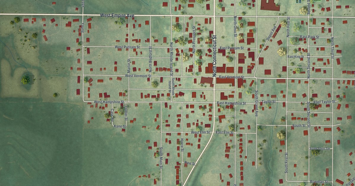
If you grew up in King City or still have family here, you'll find plenty of streets you know on this map. It's a modern aerial view of King City in Gentry County, Missouri, made from modern data and given a vintage look. The map includes 567 buildings. West Empire Avenue crosses the upper part of the map, and East Empire Avenue carries on to the right. North Connecticut Street runs up through the middle of town.
North Connecticut Street and West Empire Avenue
Start downtown, where North Connecticut Street meets East Vermont Street. That's the tightest cluster of red buildings on the sheet. Head north on Connecticut past West Putnam and East Putnam Streets. You'll reach West Empire Avenue, which continues as East Empire Avenue to the right. Just north of it, West Fairview and East Fairview Avenues run along a smaller grid. North Grand Avenue is also named on the print.
Now go back downtown and head south. West Hampshire and East Hampshire Streets cross first, then West Elm and East Elm Streets. South Connecticut Street angles off to the southwest and runs to the bottom edge. South Ohio Street is printed east of Connecticut Street. Farther down the sheet, Locust Street is named near the lower center. East of downtown, East Queen Street runs out toward the fields, with East King Street a block north. Look at the street names and you'll spot a few states: Connecticut, Vermont, Rhode Island and Ohio. Many of the roads are labeled, and each red shape is a building, so zoom in on the preview and look for yours.
The Opera Hall Block on Connecticut Street
The Opera Hall Block was listed at 101-03 West Vermont Street and 101-03 South Connecticut Street, near the downtown crossing of Vermont and Connecticut Streets. It was added to the National Register of Historic Places in 2002. On the map, find the spot where West Vermont Street meets Connecticut, right in that downtown cluster.
A 1922 history of Daviess and Gentry counties has a few lines about King City. It says the Presbyterian Church of King City was the largest of its kind in the county. It also praises the Commercial Club of King City. For one show, the club freely gave a large amount of cash and "ideal accommodations." The book says every business man in town took a personal interest in it. Cary Berry of King City took first in the class for the best barrow. Look on the map for the tight cluster of red buildings around Connecticut and Vermont Streets.
For anyone who knows West Vermont Street
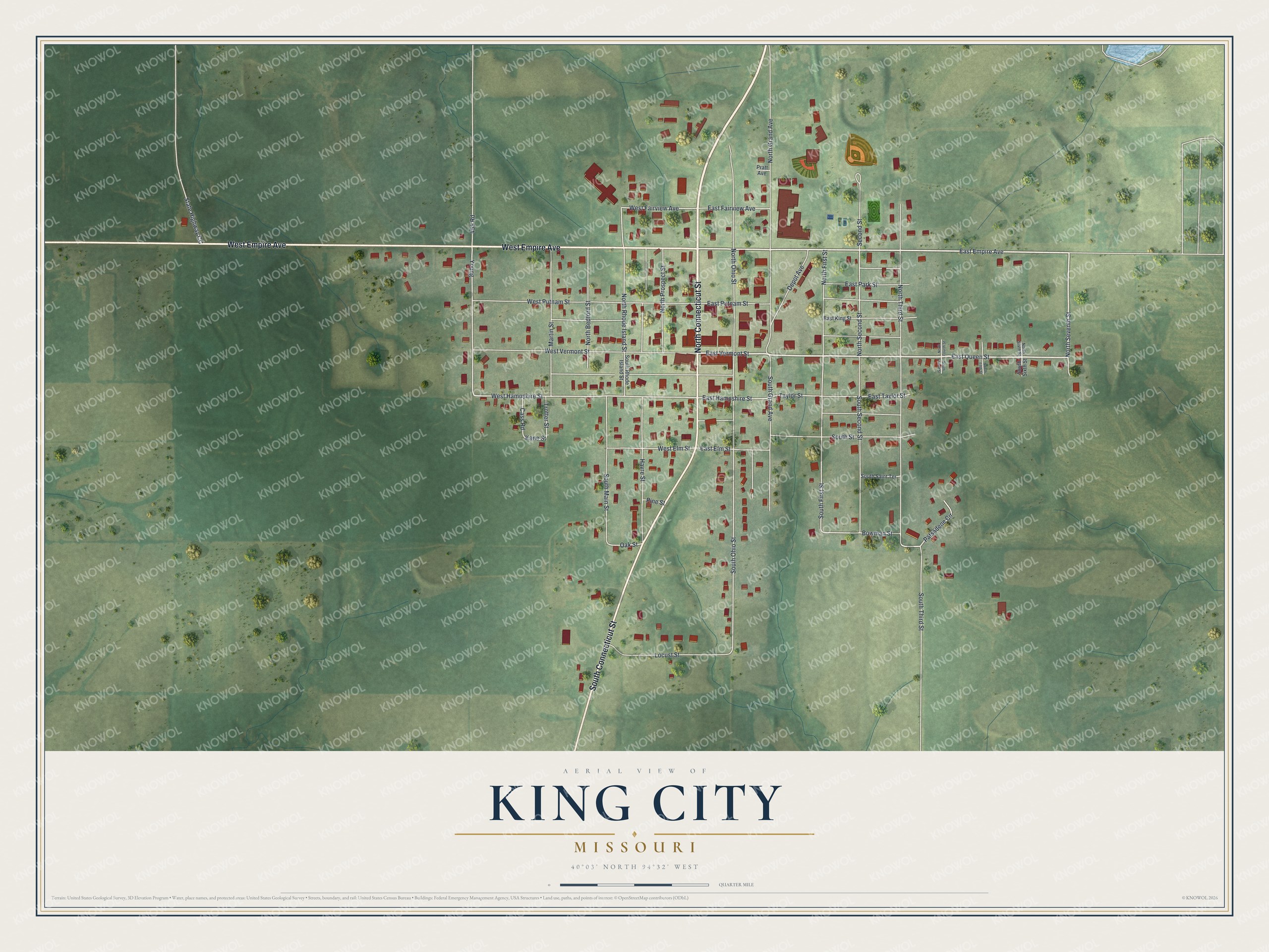
Created by KNOWOL in 2026, this King City map includes 567 buildings and names Connecticut and Vermont Streets and Empire Avenue. The title panel reads "Aerial View of King City, Missouri," with the coordinates 40°03' North, 94°32' West and a quarter-mile scale bar.
It suits a kitchen, an office or a den. It's a good gift for someone who grew up here and moved away, or who knows the Opera Hall Block on Connecticut Street. Open the preview, zoom in and find the street you know. See sizes and frames for the King City map.