This historic map of Kansas City, Missouri was created in 1869 by Albert Ruger, a prominent 19th century map maker. The map shows a bird’s eye view of the area as it once was, including street names and old landmarks.
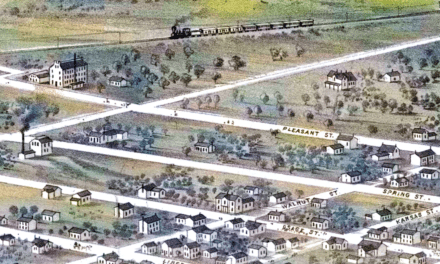
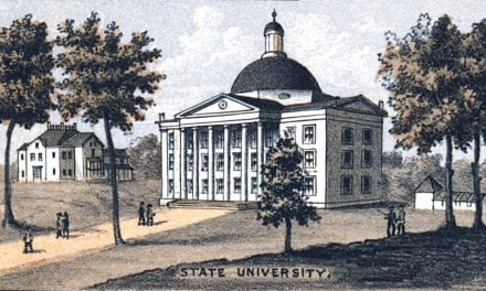
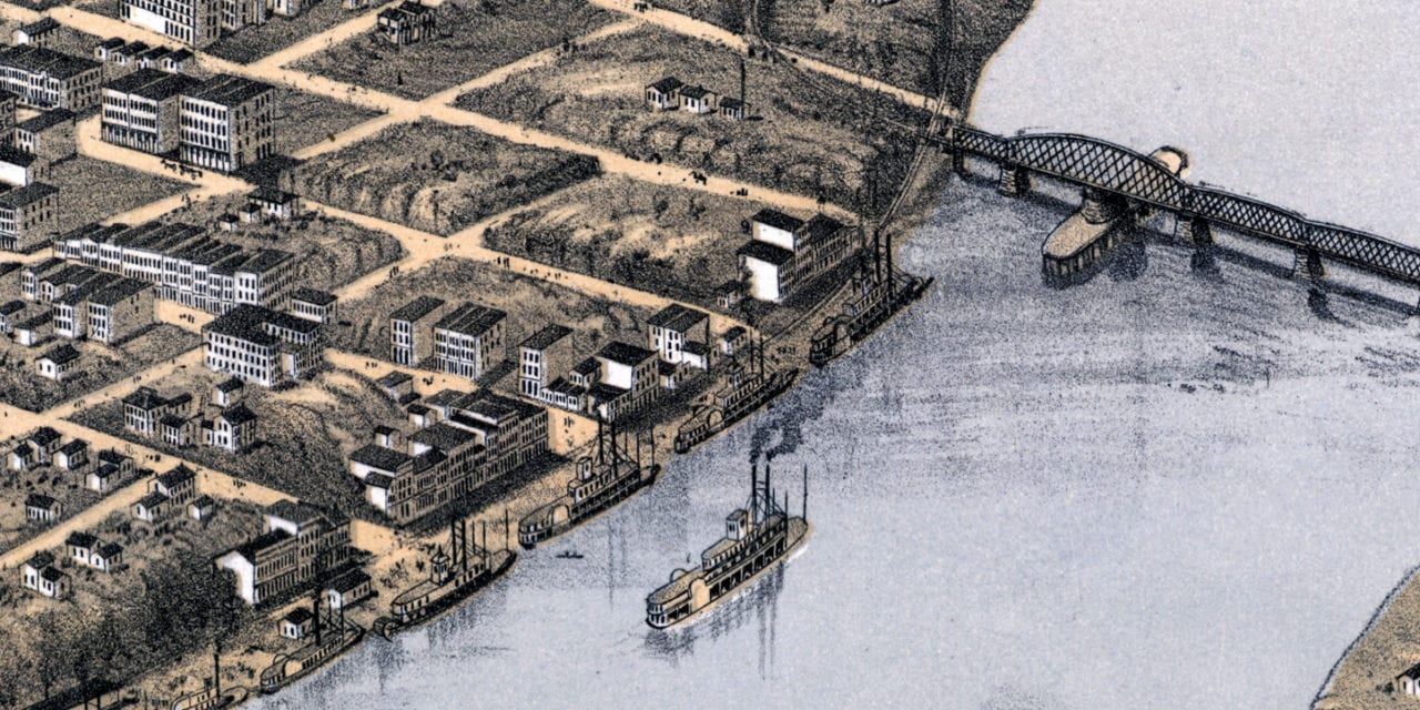
Historic Kansas City landmarks on the map include Turners Hall, City Gas Works, Christian College, Public School, Market House, Missouri River, State Line Depot, Harlem, St. Teresa’s Academy, Kansas City Public School, and more. An inset drawing toward the bottom of the map also shows a view of the area in 1855.
This historic map of Kansas City was restored by KNOWOL. Reproductions of the restored map are available here.
Historic Old Map of Kansas City, Missouri from 1869
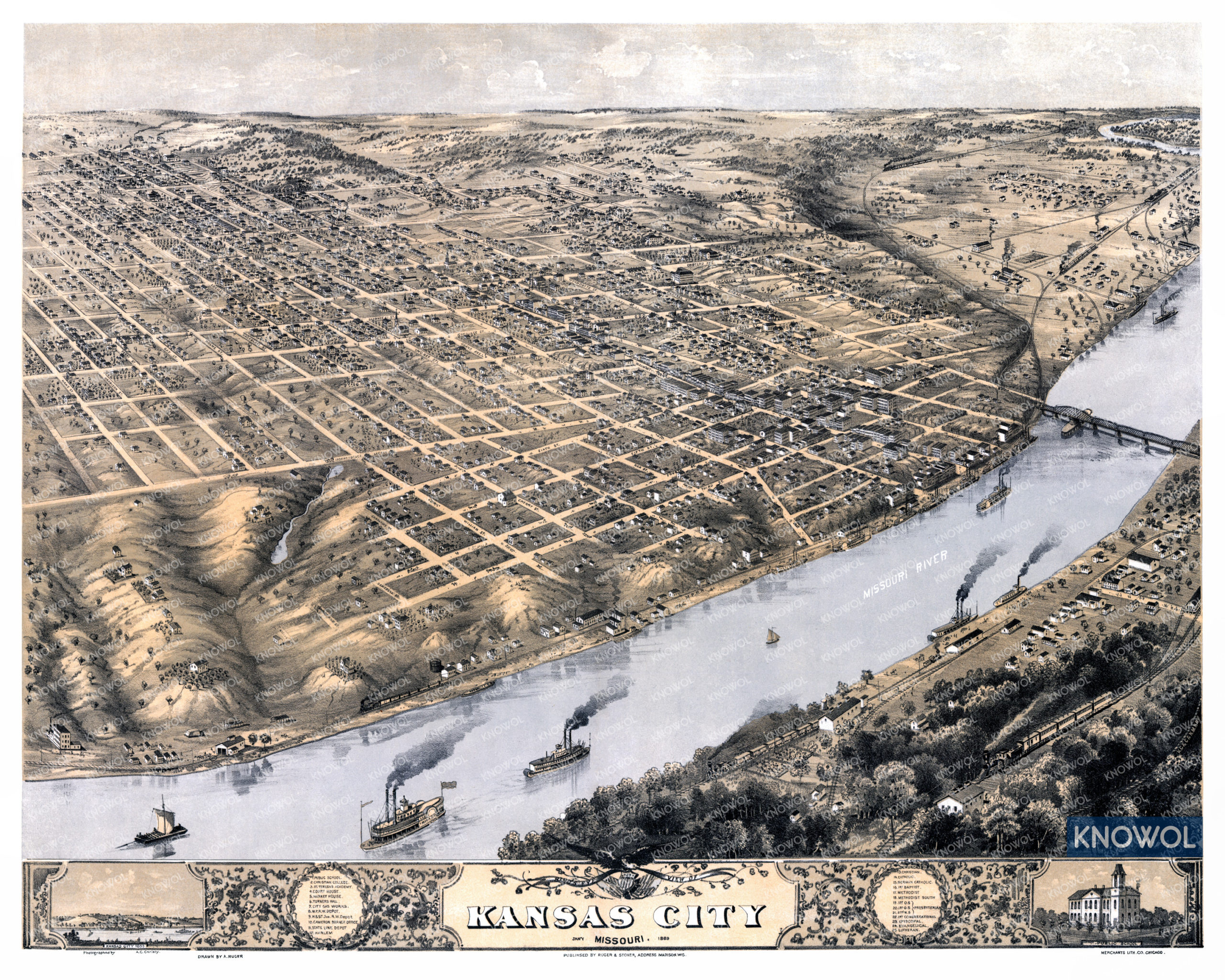
This map of Kansas City will make an attractive addition to your office, library, or den and can even be used to teach children the geography and history of the area. When you’re done exploring, click here to get your copy of the restored map.