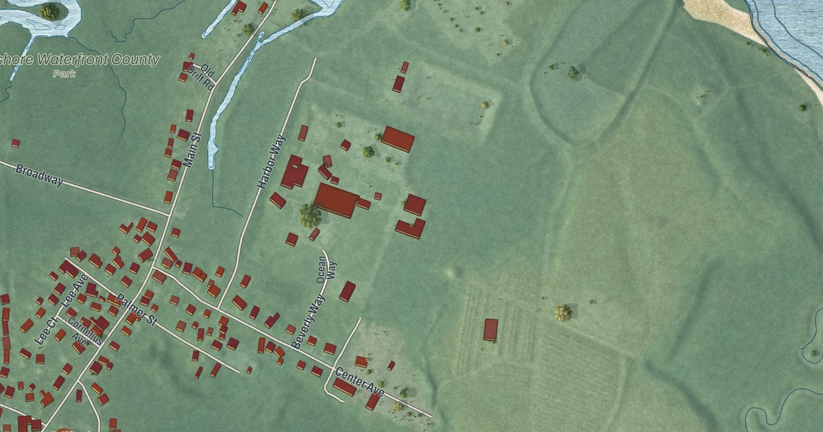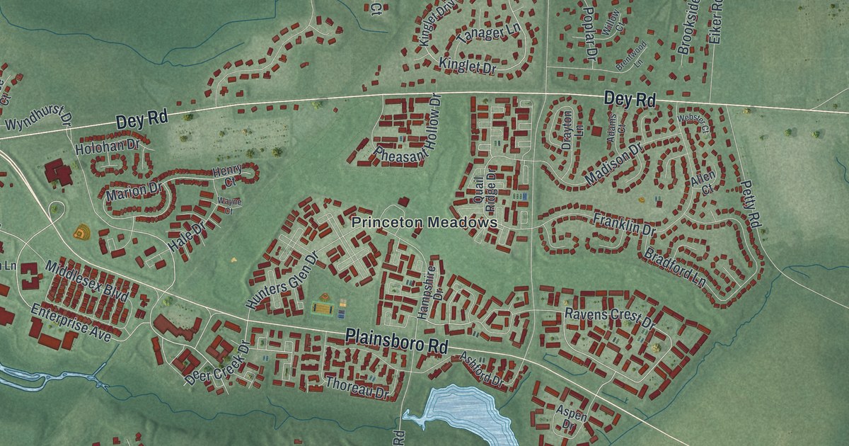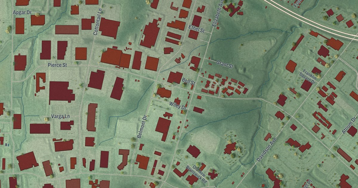
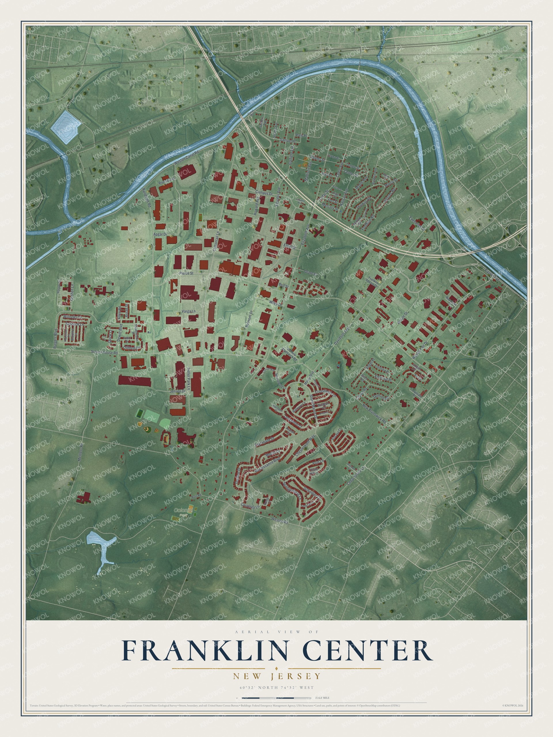
This beautifully detailed map of Franklin Center, New Jersey was created in 2026 using aerial imagery combined with modern topographical, census, street and landmark data. It's a modern aerial view of Franklin Center in Somerset County, New Jersey, that combines modern data with a vintage aesthetic. The roads feature printed names, and if you look closely you can find your exact house accurately shown in its correct location.
Explore an aerial view of Franklin Center, New Jersey
On this map you'll find Colonial Park, Easton Avenue, Samuel Place, Elizabeth Avenue, Pierce Street, Cedar Grove Lane, Weston Road, Weston Canal Road, School House Road, Davidson Avenue, Cottontail Lane, New Brunswick Road, and more. Each red shape is a building, so zoom in on the preview and look for yours.
Every town has a first chapter, and Franklin Center is no exception. Hendrick Fisher, born in the Palatinate in 1697, made his home in Franklin Township, below Bound Brook on the south side of the river. He was one of three men New Jersey sent to a congress in New York in 1765, and the Provincial Congress of New Jersey later chose him as its president. During the Revolution, the British army took milk cows and cash from his farm and house. That's from the History of Hunterdon and Somerset Counties.
Franklin Center is a community in Somerset County. The Census Bureau counted 6,803 people here in 2020.
Take a closer look at the Franklin Center map
Names on this map
These names are printed on this map.
Places: Colonial Park.
Streets and roads: Easton Avenue, Samuel Place, Elizabeth Avenue, Pierce Street, Cedar Grove Lane, Weston Road, Weston Canal Road, School House Road, Davidson Avenue, Cottontail Lane, New Brunswick Road, Atrium Drive.
More street names, A to Z
Adams Street, Allen Road, Angel Place, Apgar Drive, Avalon Court, Avery Court, Baldwin Avenue, Bates Court, Bell Street, Belmont Drive, Biltmore Lane, Birch Terrace, Blairsden Court, Bort Road, Boudinot Lane, Breakers Lane, Brenner Court, Broad Street, Campus Drive, Canal Road, Cedar Avenue, Cedar Street, Center Street, Chesterwool Way, Clifford Circle, Conrad Way, Corporate Place, Courtney Lane, Crossfields Lane, Crown Road, Darwin Road, Daulton Drive, Dewitt Boulevard, Domino Road, Emerald Place, Equator Avenue, Esplanade Drive, Ethel Street, Executive Drive, Fehervari Court, Fir Court, Fordham Road, Fort Street, Fountain Drive, Franklin Square Drive, Garfield Avenue, Goshen Lane, Grant Street, Griggs Street, Hall Street, Heller Park Lane, Hooper Street, Hopkinson Lane, Howard Avenue, Jensen Drive, Jerome Avenue, Juniper Court, Lafayette Avenue, Leona Street, Lisi Court, Longwood Court, Madison Avenue, Manor Boulevard, Maple Avenue, Marcy Street, Martine Street, Medici Drive, Mercury Street, Merriewold Lane, Mettlers Road, Napoleon Court, Nassau Avenue, Norfolk Road, Old New Brunswick Road, Park Place, Post Lane, Quick Court, Randolph Road, Renaissance Boulevard, Riverview Drive, Rosecliff Court, Rutgers Boulevard, Sanders Avenue, Schenck Lane, Schindler Court, Shadowlawn Drive, Spangenberg Lane, Stone Manor Drive, Temple Street, Thistle Hill Lane, Thomas Road, Tudor Drive, Ulysses Road, Varga Lane, Viscaya Court, Wiley Drive, Willocks Circle, Windfall Lane, Worlds Fair Drive.
See it on a wall
The Franklin Center map as a framed print. Swipe for more.


Created by KNOWOL in 2026. The buildings are small red shapes, the roads carry their printed names, and shaded relief shows the shape of the land. The title panel reads "AERIAL VIEW OF FRANKLIN CENTER, NEW JERSEY" with 40°32' NORTH 74°32' WEST.
Hang it in the hallway, the office or the cabin, or give it to someone who left Franklin Center and still calls it home. Open the preview and look for a street you know. See sizes and frames for the Franklin Center map.