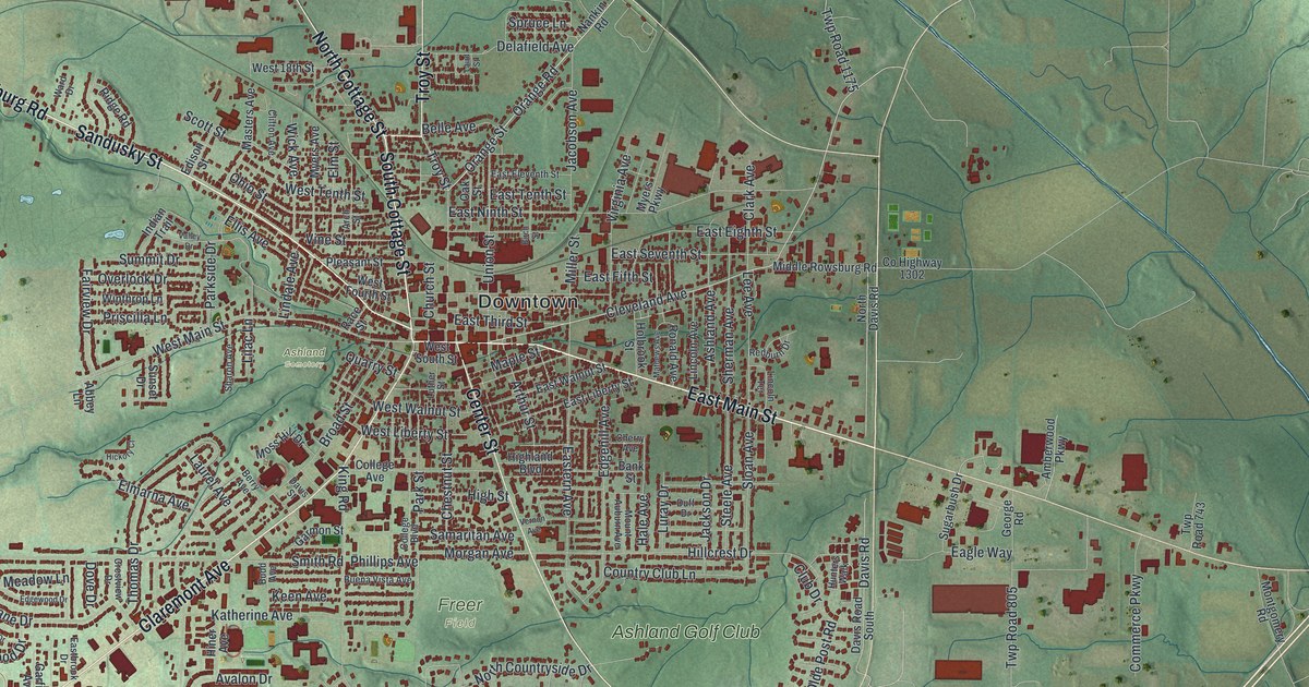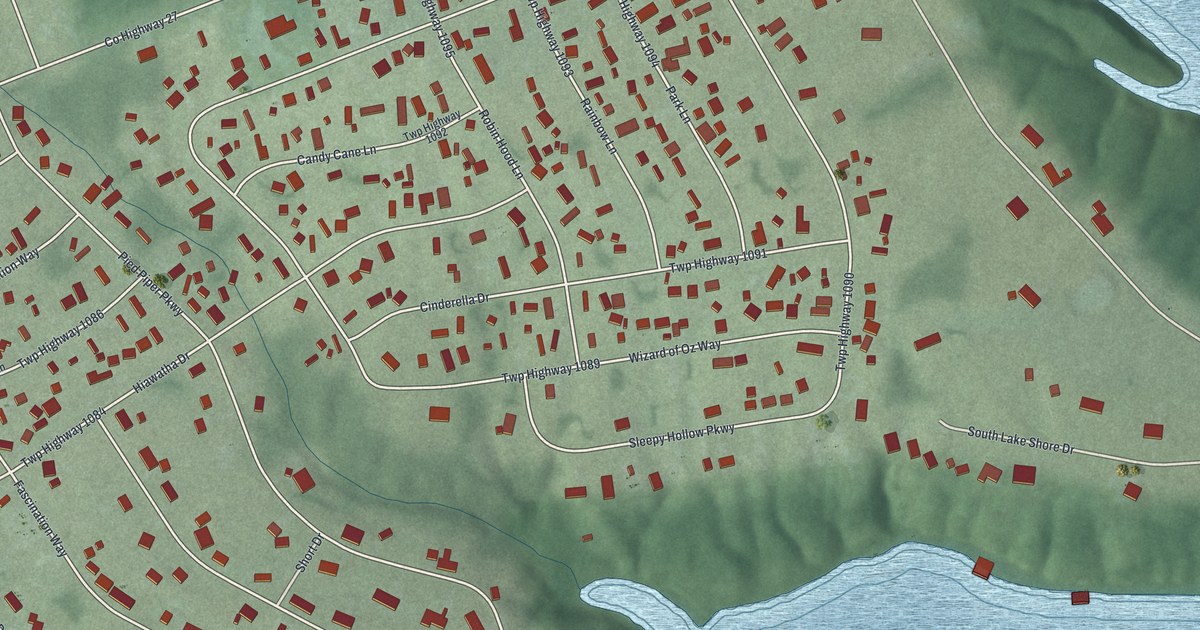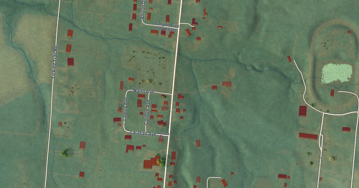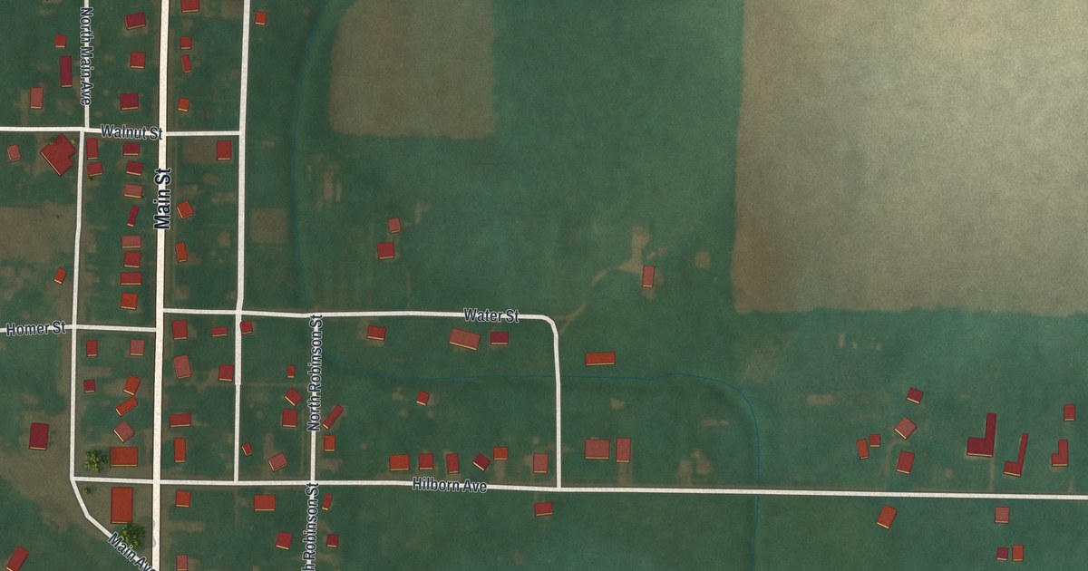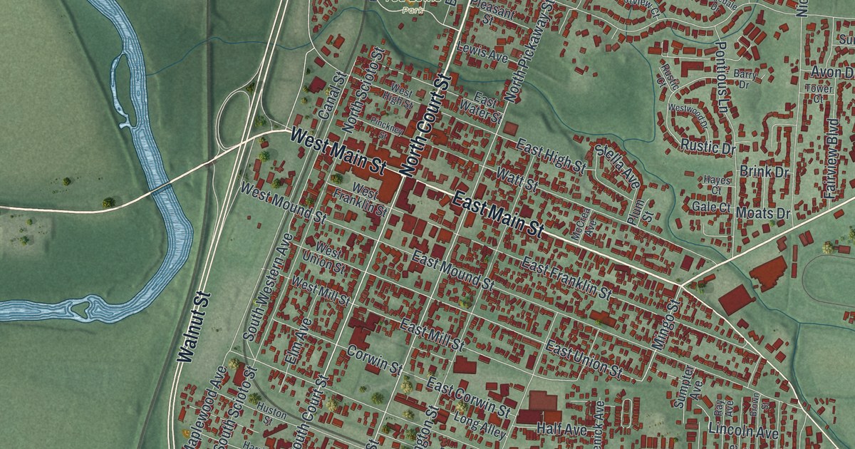
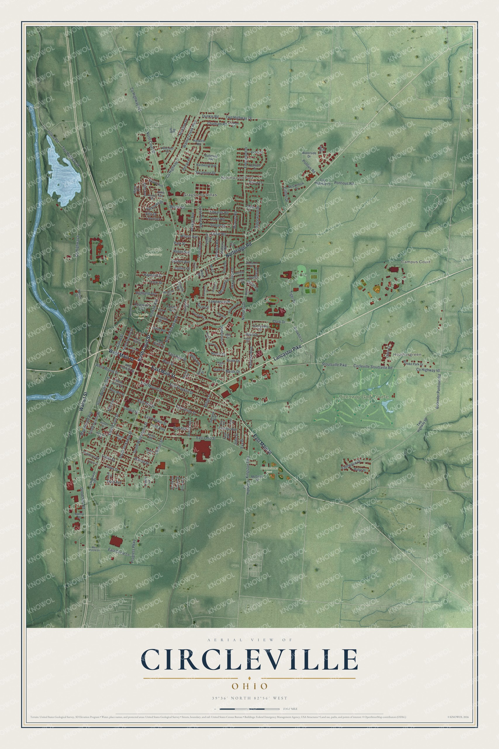
This beautifully detailed map of Circleville, Ohio was created in 2026 using aerial imagery combined with modern topographical, census, street and landmark data. It’s a one-of-a-kind view of Circleville that combines accurate data with a vintage aesthetic. The map shows every building in its true location, many of the roads carry their names, and the shaded topographic relief shows the shape of the land.
Explore an aerial view of Circleville, Ohio
On the map you’ll find Heathergreen, Northwood Park, Barthelmas Park, Forest Cemetery, Ted Lewis Park, Graystone Villas, and Pickaway Golf Course, along with Campus Court, North Court Street, West Main Street, Lancaster Pike, Northridge Road, and more. If you look closely you can even find your house accurately drawn in its correct location. Zoom in on the preview to look for yours.
Did you know this piece of Circleville, Ohio history?
Circleville was laid out in 1810 inside a round earthwork built by the Hopewell people. The circle was 1,100 feet across, and the courthouse stood at its center. Residents later found the curved lots awkward. Between 1838 and 1856 the town was squared into a grid, and the earthwork was lost.
Take a closer look at the Circleville map
Street and place names on the Circleville, Ohio map
These names are printed on the map of Circleville, Ohio.
Places: Campus Court, Heathergreen, Northwood Park, Barthelmas Park, Forest Cemetery, Ted Lewis Park, Graystone Villas and Pickaway Golf Course.
Streets and roads: North Court Street, West Main Street, Lancaster Pike, Northridge Road, East Main Street, Walnut Street, South Court Street, South Pickaway Street, Wilson Avenue, Mingo Street, North Pickaway Street, Lincoln Drive.
More street names, A to Z
Alma Avenue, Arbor Road, Atwater Avenue, Avon Drive, Barnes Avenue, Barry Drive, Beverly Road, Bolender Pontious Road, Bolens Avenue, Brink Drive, Brokaw Avenue, Brooke Park Drive, Brookhaven Place, Brookhill Lane, Brown Street, Butternut Avenue, Canal Street, Caroline Court, Cedar Heights, Chatham Court, Chatham Road, Circle Drive, Circleville Stoutsville Road, Claire Court, Clark Drive, Clifton Drive, Clinton Street, Collins Court, Corwin Street, County Highway 4, County Highway 7, County Highway 9, County Highway 40, County Highway 511, County Highway 512, Douglas Drive, Dunkle Road, Dunmore Road, East Circle Lane, East Corwin Street, East Franklin Street, East High Street, East Mill Street, East Mound Street, East Ohio Street, East Union Street, East Water Street, Eastwood Drive, Edgewood Drive, Edison Avenue, Edwards Road, Elm Avenue, Eva Drive, Fairview Boulevard, Faye Avenue, Folsom Avenue, Forest Drive, Forestview Court, Gale Court, Garden Parkway, Georgia Road, Glenmont Drive, Goodchild Road, Greenacre Court, Gumm Place, Half Avenue, Hardwood Avenue, Harrison Street, Harwich Road, Hassle Drive, Hayes Court, Hayward Street, Highland Avenue, Hillcrest Drive, Holiday Lane, Huston Street, Island Road, John Street, Joy Court, Juhl Road, Kingston Pike, Lawnwood Court, Lawnwood Drive, Lewis Avenue, Lewis Road, Lincoln Avenue, Logan Street, Lone Pine Road, Long Alley, Lowery Lane, Lynwood Avenue, M-47, Mace Drive, Maize Court, Maplewood Avenue, McCormick Drive, McCrea Avenue, McGuire Drive, Meadow Drive, Meadow Lane, Moats Drive, Montclair Avenue, Morris Road, Mowrer Road, Mulberry Road, Nicholas Drive, Norfolk Avenue, Northfield Drive, North Scioto Street, Pacer Court, Parklawn Drive, Park Place, Park Street, Pecan Place, Pershing Drive, Pinckney Street, Plaza Drive, Pleasant Street, Plum Street, Pontious Lane, Pontious Road, Pontius Road, Progress Parkway, Ray Avenue, Reber Avenue, Recreation Drive, Remle Road, Renick Avenue, Ridgedale Drive, Ridge Drive, Ridgewood Drive, Rosewood Avenue, Rustic Court, Rustic Drive, Seyfert Avenue, South Scioto Street, South Street, South Washington Street, South Western Avenue, Sperry Drive, Springhollow Road, Stella Avenue, Stihl Avenue, Stoutsville Pike, Sumpter Avenue, Sunnyview Drive, Sunset Drive, Sycamore Drive, Sylvan Circle, Third Avenue, Tiger Drive, Timberline Drive, Tower Court, Town Street, Turner Drive, Twp Highway 38, Twp Highway 66, Twp Highway 75, Twp Highway 79, Victor Drive, Villa Drive, Walnut Creek Pike, Waterside Drive, Watt Street, Weldon Avenue, West Circle Lane, West Franklin Street, West High Street, West Mill Street, West Mound Street, West Union Street, Westwood Drive, Williams Drive, Willow Lane, Wood Lane, York Street.
See the Circleville, Ohio map on a wall
The Circleville map as an 18 x 24 inch print in a black frame.

This beautifully detailed map of Circleville makes an attractive addition to your office, library, or den, and it can even be used to teach children the geography and history of the area. It also makes a great gift for anyone with Circleville roots. When you’re done exploring, click here to get your copy of the Circleville map.