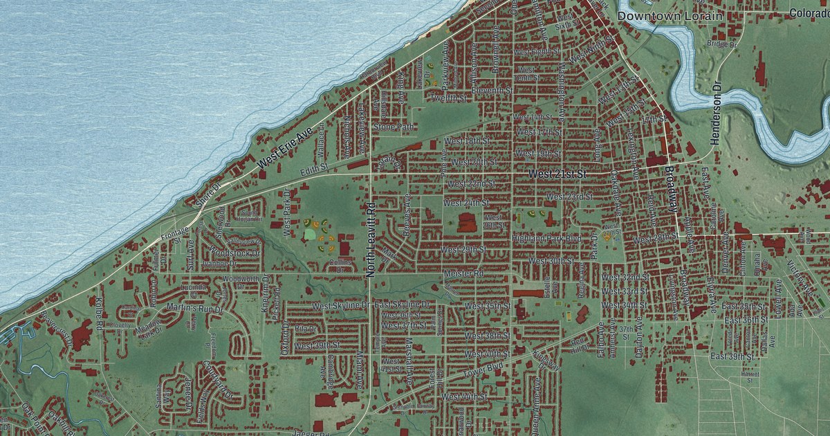
If you grew up in Lorain, or you still have family near Broadway or out in South Lorain, this map gives you plenty to find. It's a modern aerial view of Lorain in Lorain County, Ohio, made from modern data with a vintage artistic feel. Lake Erie fills the top left of the sheet in soft blue. The Black River winds in from the east and meets the lake right by Downtown Lorain. The lake and the river aren't labeled, but they're easy to spot. More than 37,000 buildings are drawn in deep red, from the shore down to Cooper Foster Park Road. A plat for the town was filed in 1834. The town was called Black River, and it became Lorain fifty years later. Explore the print options for Lorain.
Downtown Lorain, Broadway and South Lorain
Start at the Downtown Lorain label near the top, where the river opens into the lake. Colorado Avenue heads east from there, and Cromwell Park sits below it by the river bend. Back downtown, follow Broadway south. Henderson Drive joins it from across the river, and Elyria Avenue branches off to the southeast. Keep going past 17th Street to 37th Street, near the South Lorain label. Pearl Avenue and 36th Street cross just east of there, and Grove Avenue runs south near the right edge of town. Now go back to the lake. West Erie Avenue follows the shore to the west, and North Leavitt Road runs south through the west side. Near the bottom, Calvary Park sits just above Cooper Foster Park Road. Kennedy Park is out to the left, along Kolbe Road. Many roads are labeled, and each red shape is a building, so zoom in on the preview and look for yours.
The Lorain tornado of June 28, 1924
Just after 5 p.m. on June 28, 1924, a tornado came off Lake Erie straight into downtown Lorain. Within five minutes, 78 people were killed. Fifteen of them died in the old State Theatre on Broadway. About 200 people were inside, watching a Saturday afternoon musical show. More than 1,000 people were hurt. The storm did heavy damage to the business district. It destroyed 500 homes and damaged a thousand more. The American Shipbuilding yards, the city's largest industry, were badly hit. The tornado had already struck Sandusky. After Lorain, it kept going along the shore to Sheffield and Avon. An Ohio historical marker tells the story. It says accounts at the time counted 82 deaths, and it calls the storm the deadliest tornado in Ohio's history.
The marker stands at 383 Broadway, where the State Theatre used to be. On the map, find the Downtown Lorain label and follow Broadway south from the lake. That's the business district the storm hit. The theatre and the marker aren't labeled, but Broadway is printed right through downtown. Near the lake end, Broadway meets West Erie Avenue. The Broadway Building on that corner is listed on the National Register.
For someone who knows Broadway and South Lorain
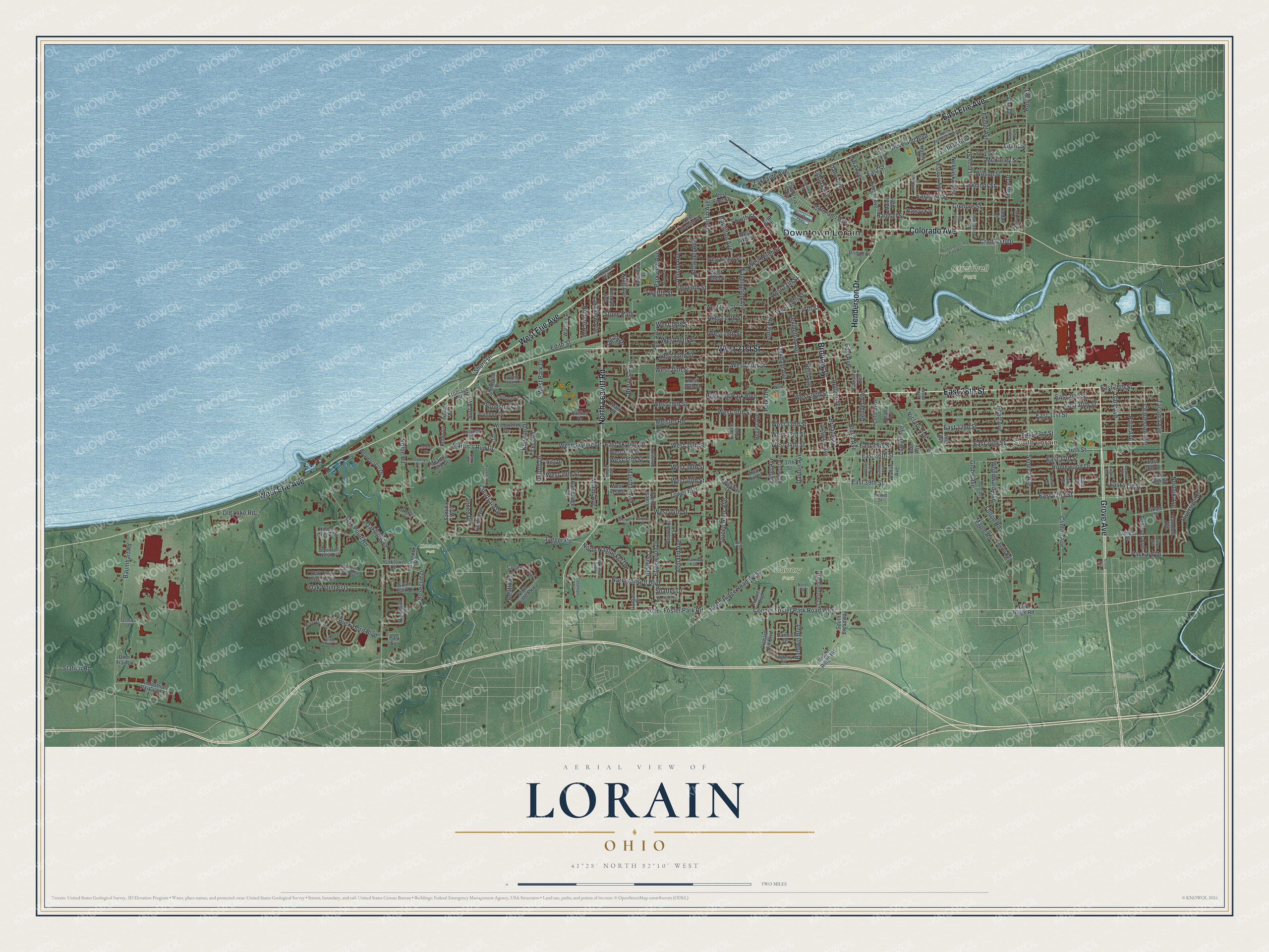
Created by KNOWOL in 2026, this Lorain print shows the city in deep red on green shaded land, with the lake in blue across the top. The shading comes from USGS elevation data, and the streets come from Census Bureau records. You can follow the river as it winds east from the harbor past Cromwell Park. The title panel reads "Aerial View of Lorain, Ohio," with 41°28' North 82°10' West and a two-mile scale bar.
It suits a den, a home office or a kitchen wall. It's a good gift for someone who grew up in Lorain and moved away, or for a family with roots in South Lorain. Open the preview, find Broadway and follow it to a street you know. Shop the Lorain, Ohio map.