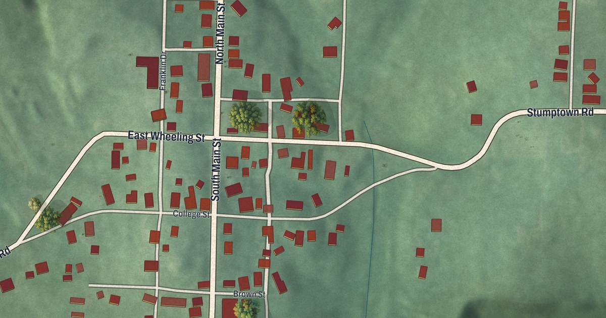
If you grew up in New Athens, or your family's roots run along Main Street, this map is for you. It's a modern aerial view of New Athens in Harrison County, Ohio, made with modern data and given a vintage look. The village's buildings line North Main Street and South Main Street, with East Wheeling Street and Stumptown Road crossing near the center. Soft green hills fold in on every side, and Longview Cemetery sits near the top.
Main Street, College Street and Longview Cemetery
On this map you'll find North Main Street, South Main Street, East Wheeling Street, College Street, Stumptown Road, Longview Cemetery, Brown Street, Franklin Drive, Burdette Drive, Culbertson Drive, McFarland Road, Grove Road, Groves Road, Webb Road, and more. Each red shape is a building, so zoom in on the preview and look for yours.
Franklin College, one of Ohio's earliest colleges
New Athens was a college town. Alma Academy started here in 1818. In 1825 it became Franklin College. An Ohio historical marker calls it one of Ohio's earliest colleges. Its founders were mostly Scots-Irish Presbyterians from western Pennsylvania and eastern Ohio. In 1891, Henry Howe wrote that New Athens sat on the St. Clairsville and Cadiz pike, seven miles south of Cadiz. He called it the seat of Franklin College.
John Bingham and the Franklin College students
Many leaders studied here. The marker counts 8 U.S. Senators, 9 U.S. Representatives and 2 Governors. John Bingham went here. He wrote the Fourteenth Amendment to the U.S. Constitution. He also led the case against the people who killed President Lincoln. Joseph Ray studied here too. He published Ray's Arithmetic, a school book the marker calls universally popular.
The school also came through hard times. The marker says the slavery question bitterly divided it. Fewer students came after the Civil War, and Franklin College closed in 1921. Its charter later went to Muskingum College in New Concord. Franklin College Building No. 5 is on the National Register of Historic Places. The marker stands at the Franklin Museum, 187 North Main Street. On the map, look along North Main Street, above East Wheeling Street.
Keep North Main Street in New Athens close

Created by KNOWOL in 2026, this print shows New Athens in soft greens, with shaded hills, pale roads and small red buildings. The title panel at the bottom reads Aerial View of New Athens, Ohio, with the coordinates 40°11' North 81°00' West.
It suits a living room, a hallway or a home office. It's a kind gift for anyone who grew up near the Franklin Museum on North Main Street and later moved away. Open the preview and find the streets you know. See sizes and frames for the New Athens map.