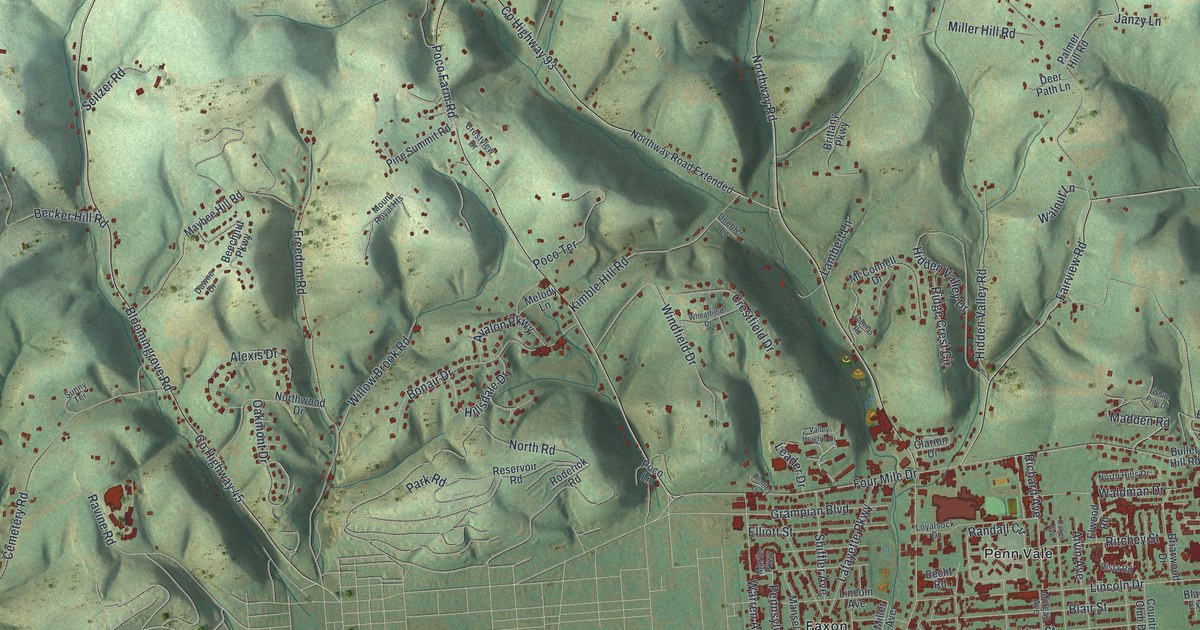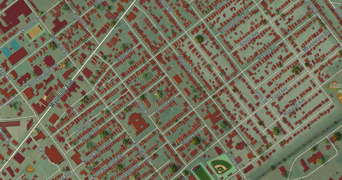
If you grew up in Kingston, went to school here, or still have family on these blocks, this map gives you a lot to find. It's a modern aerial view of Kingston borough in Luzerne County, Pennsylvania, made from modern data and finished with a vintage look. More than 8,000 buildings are drawn in deep red, packed into a tight grid of streets. Wyoming Avenue cuts across the middle on a long diagonal, and a wide blue river curves along the bottom right. The view reaches up to Forty Fort in the top right corner.
Wyoming Avenue, Pierce Street and Hamilton Park
Start at the top right, where Wyoming Avenue comes in from Forty Fort. Follow it down toward the bottom left. It's the long diagonal road through the middle of Kingston. Church Street, Butler Street and James Street cross it first. Near the center of the sheet you'll pass Pierce Street, then Division and Pringle Streets. On the left side it meets Market Street, and Northampton Street comes in lower down.
Now go back to Pierce Street and follow it toward the river at the bottom right. It crosses Tioga, Warren, Wright and Ridge Avenues on the way to Parkway Boulevard. On the right side of the sheet, Lathrop Street and Hamilton Avenue lead to Hamilton Park and Church Street Park, both named on the map. Many of the roads are labeled, and each red shape is a building, so zoom in on the preview and look for yours.
The swing gate on Kingston's old Blind Town road
Before 1818, the only road from Kingston to Wilkes-Barre was the old Blind Town road. It ran along the line between Kingston and Plymouth townships and led to a ferry across the river. A swing gate hung across it, near where the main Kingston road came in. There were no fences on the wide, flat bottom lands back then. The gate kept wandering cattle out of the crops. By law, anyone who went through had to shut it behind them, or face a heavy penalty. That gate stayed up from 1770 to 1818, says the History of Luzerne County printed in 1893.
In 1818 a bridge was built to Wilkes-Barre, and a new avenue opened from the bridge to Kingston. The old road to the ferry was closed, and the gate came down. From then on, farmers had to build their own fences. The same history says Henry M. Hoyt was born in a frame house on the triangle. He was governor of Pennsylvania from 1879 to 1883, and a state marker on Wyoming Avenue marks the spot. Four Hoyts signed the 1857 petition that made Kingston a borough. Look for East Hoyt Street and West Hoyt Street on the map.
For anyone who grew up off Wyoming Avenue
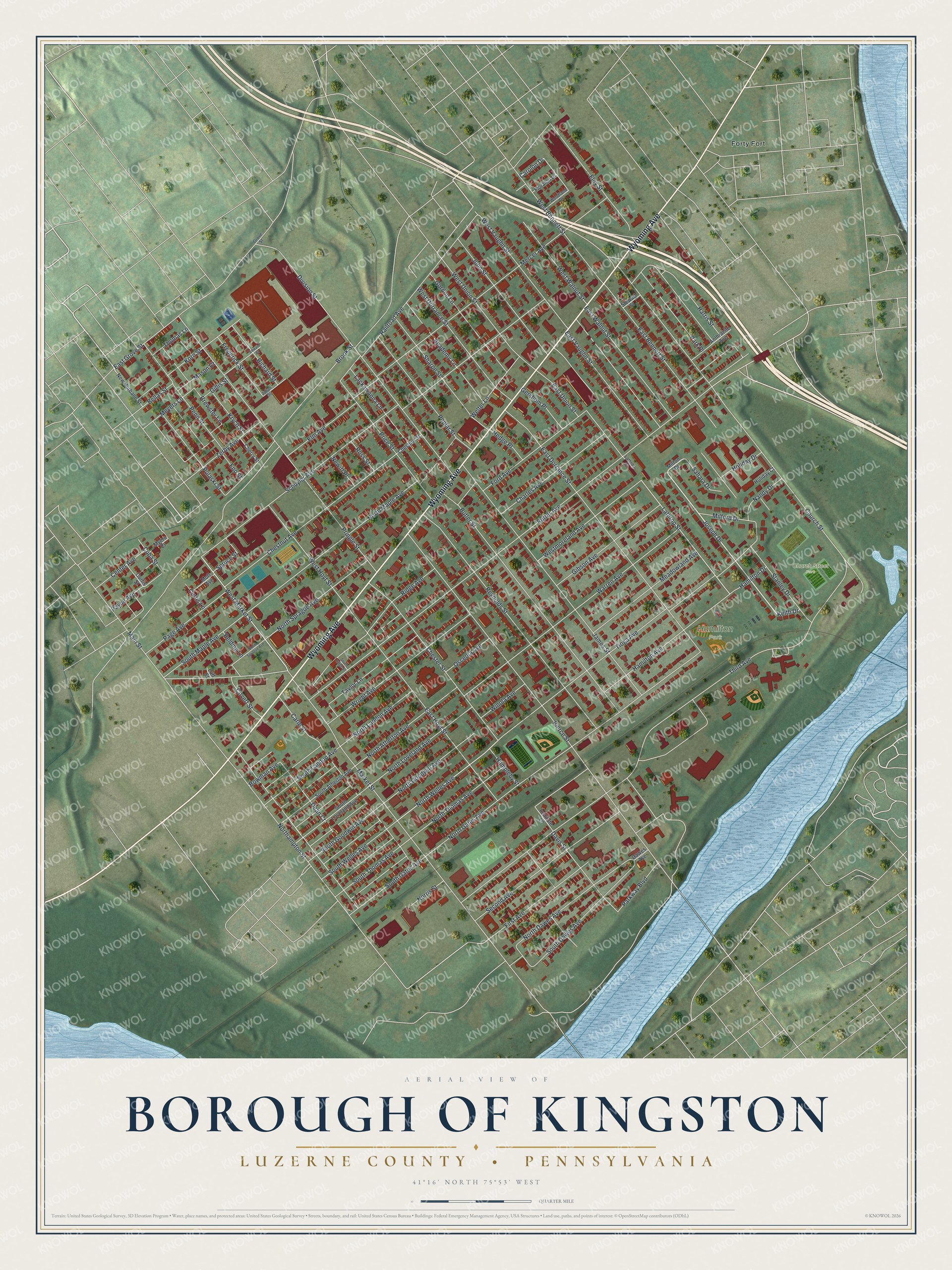
Created by KNOWOL in 2026, this Kingston map shows the borough's red buildings on soft green ground, with shaded hills from USGS elevation data and streets from Census Bureau road lines. The river curves in blue along the lower right. The title panel reads "Aerial View of Borough of Kingston" over "Luzerne County, Pennsylvania," with the coordinates 41°16' North, 75°53' West and a quarter-mile scale bar.
It fits a front hall, a den or a kitchen wall where someone can stop and find their street. It's a good gift for a Wyoming Seminary graduate, for someone who grew up near Hamilton Park, or for family who moved away from the Wyoming Valley. Open the watermarked preview and trace the route from Forty Fort down Wyoming Avenue. See sizes and frames for the Borough of Kingston, Luzerne County map.