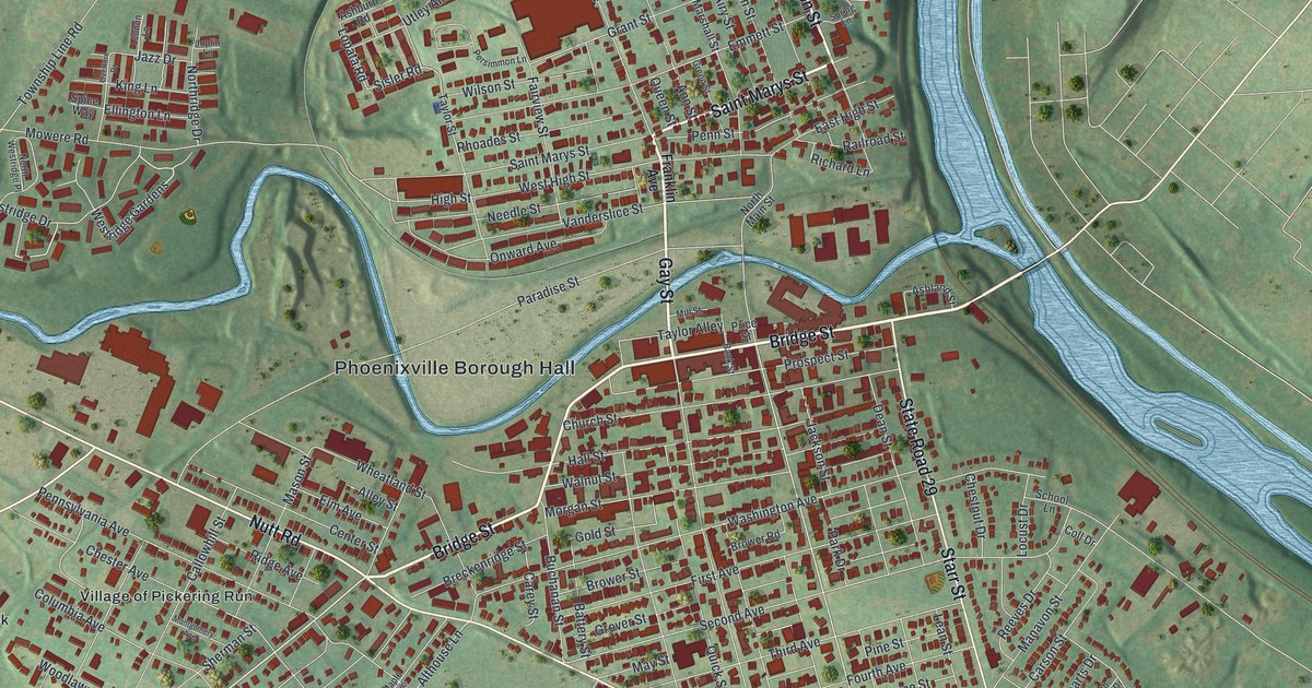
If you've walked Bridge Street, crossed French Creek, or moved away and still know the way back, take a close look at this Phoenixville map. Phoenixville is a borough in Chester County, Pennsylvania. You can pick out the tight downtown blocks, the creek winding past them, and the much bigger bend of the Schuylkill to the north. The little red shapes mark buildings, so there's plenty to find once you zoom in. Explore the print options for Phoenixville.
Bridge Street, French Creek and the foundry crane
Start with Bridge Street on the south side of French Creek. Church Street, Hall Street and Walnut Street line up below it, while Gay Street crosses the creek toward Saint Marys Street, West High Street, Needle Street and Vanderslice Street. State Road 29 runs down the east side of those downtown blocks. Follow one familiar turn and see where the buildings thin out.
Phoenixville's foundry was built along French Creek in 1882. According to Phoenixville Foundry's history, Phoenix Iron & Steel poured castings there into the 1970s. A huge wooden cantilever crane is still inside the building in its original position.
The foundry building isn't labeled on this map, so you can't pick it out by its red footprint. But you can follow the same French Creek named in the foundry's account as it winds between the downtown streets and meets the Schuylkill on the east side of the sheet.
Church Street gives you another way into that history. The Historical Society of the Phoenixville Area says its collection at 204 Church Street includes a Phoenix Column and old photographs of Phoenix Iron Co. Church Street is printed just below Bridge Street here, though the society building isn't singled out on the map. Farther north, the Schuylkill wraps around the winding streets of Riverwalk. Cromby and Reservoir Park appear across the water from that bend, in the wider area shown around the borough.
A Phoenixville gift for someone who knows Bridge Street
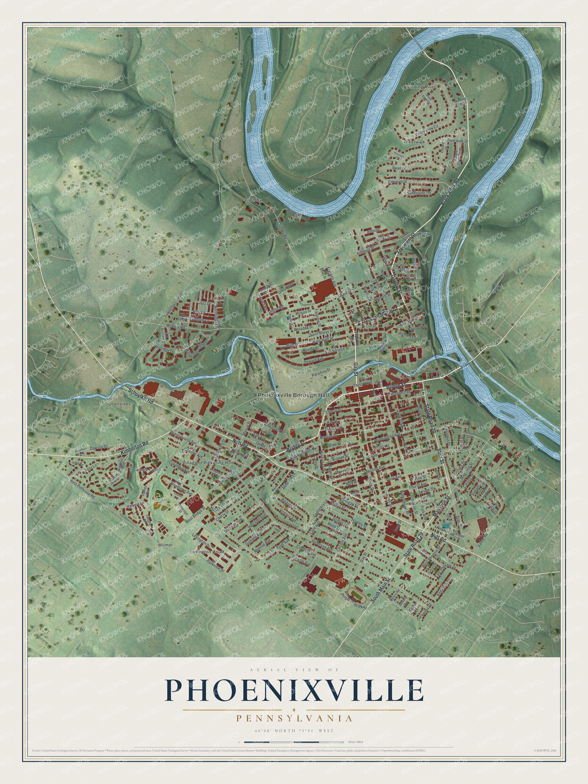
Created by KNOWOL in 2026 from geographic records of streets, buildings, water and terrain, this map shows Phoenixville's downtown and the surrounding bends of French Creek and the Schuylkill. It would look at home in an office or a living room, especially for someone who'd enjoy finding their old block. The title panel reads "Aerial View of Phoenixville, Pennsylvania," and the scale bar marks a half mile.
If you're buying for someone who grew up here, moved away, or still takes the familiar route through town, open the full preview and look for their street. Then shop the Phoenixville map. The roads and waterways are accurately drawn. Shop the Phoenixville, Pennsylvania map.