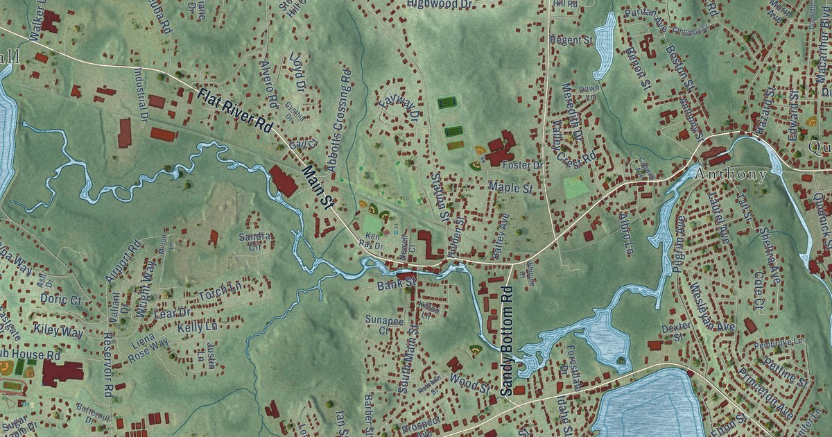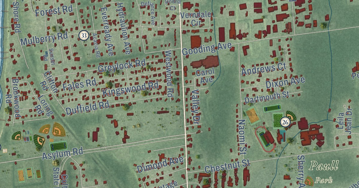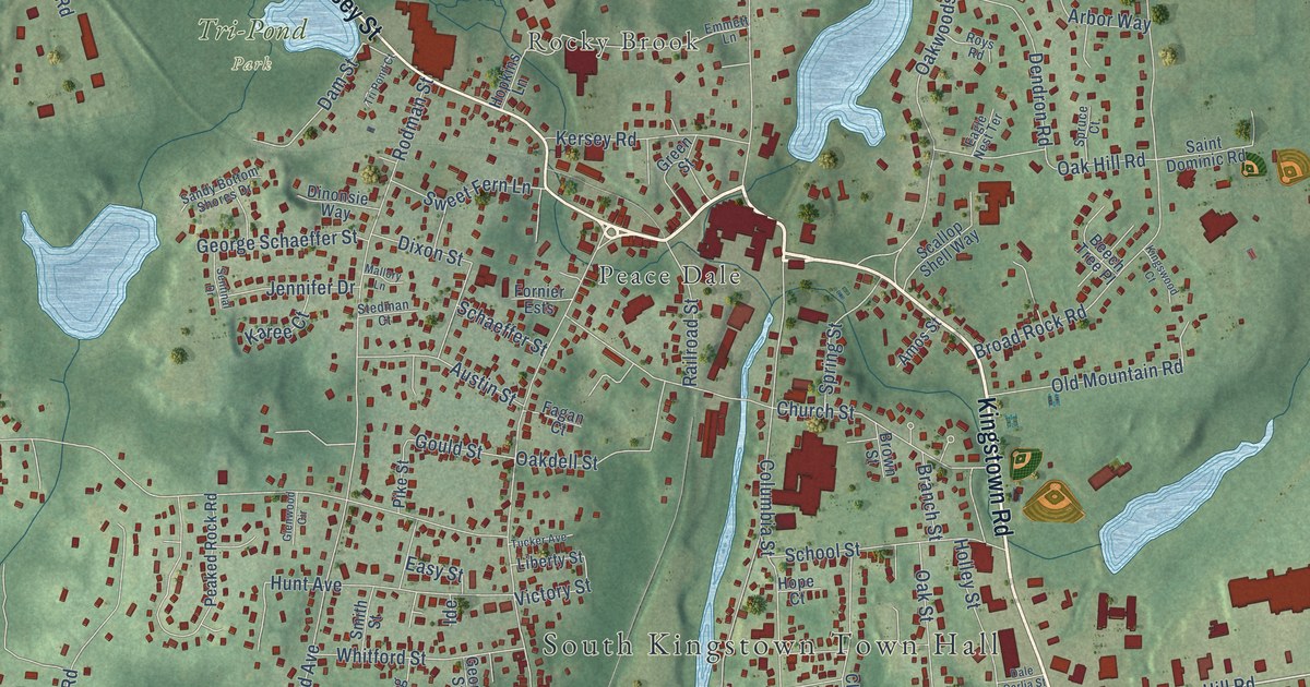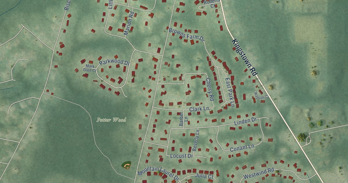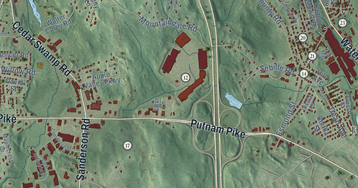
This beautifully detailed map of Smithfield, Rhode Island was created in 2026 using aerial imagery combined with modern topographical, census, street and landmark data. It’s a one-of-a-kind view of Smithfield that combines accurate data with a vintage aesthetic. The map shows every building in its true location, many of the roads carry their names, and the shaded topographic relief shows the shape of the land.
See the Smithfield, Rhode Island map on a wall
The Smithfield map as an 18 x 24 inch print in a black frame.

Explore an aerial view of Smithfield, Rhode Island
On the map you’ll find Smithfield Town Hall, West Greenville, Esmond, Greenville, Conaty Park, Wolf Hill, Stillwater, Spragueville, and Georgiaville, along with Douglas Pike, Farnum Pike, Waterman Avenue, and more. If you look closely you can even find your house accurately drawn in its correct location. Zoom in on the preview to look for yours.
Did you know this piece of Smithfield, Rhode Island history?
Smithfield honors John Smith, one of the six men who founded the first Providence settlement with Roger Williams. Williams granted Smith land. Farmers first settled the Smithfield area in 1663. It broke away from Providence and became its own town in 1731.
Take a closer look at the Smithfield map
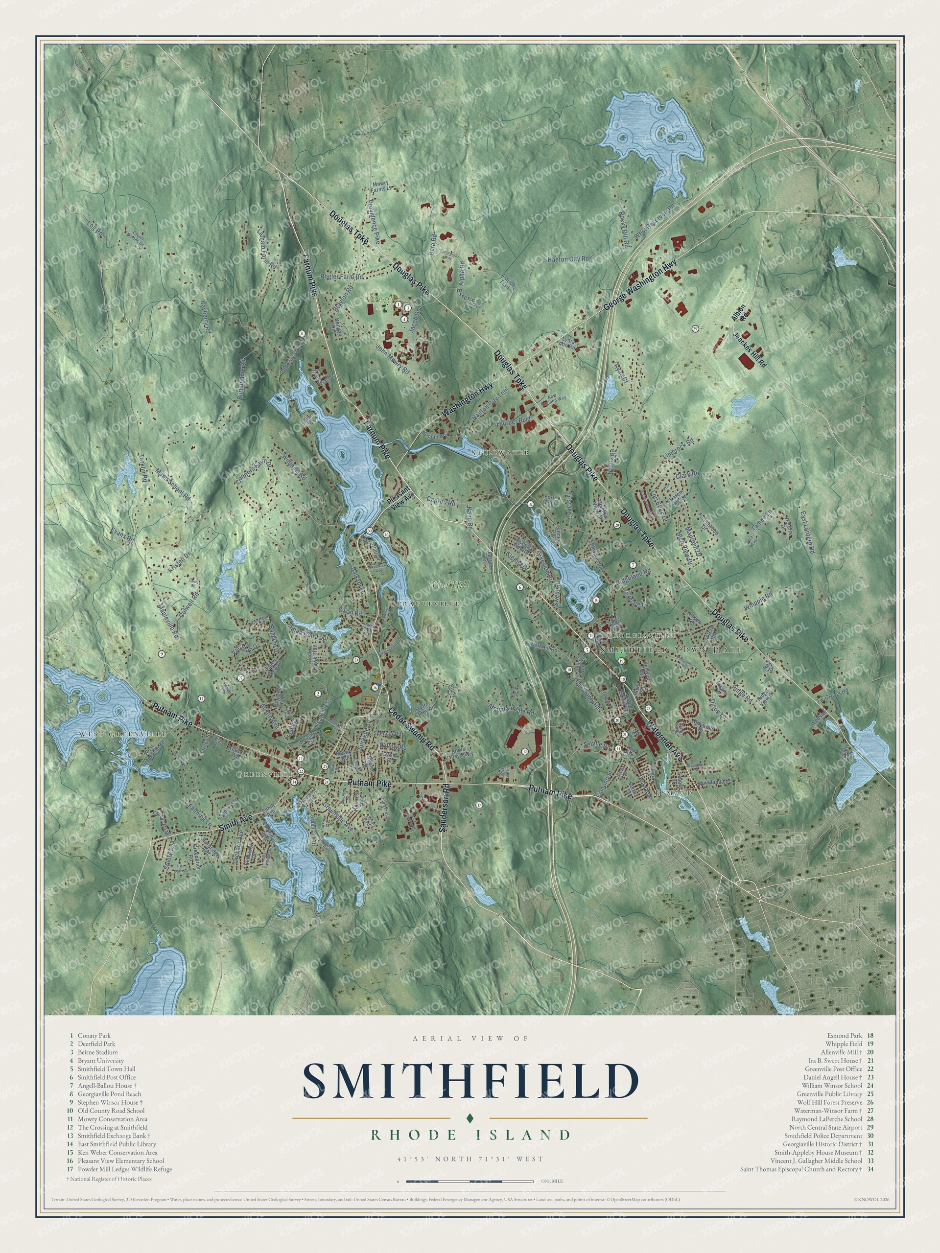
Click to explore a larger preview. The digital watermark does not appear on printed maps.
Street and place names on the Smithfield, Rhode Island map
These names are printed on the map of Smithfield, Rhode Island.
Places: Smithfield Town Hall, West Greenville, Esmond, Greenville, Conaty Park, Wolf Hill, Stillwater, Spragueville and Georgiaville.
Streets and roads: Douglas Pike, Farnum Pike, Waterman Avenue, Douglas Turnpike, Putnam Pike, Sanderson Road, George Washington Highway, Washington Highway, Smith Avenue, Cedar Swamp Road, Alpha Road, Jacob Drive.
More street names, A to Z
Albion Road, Aldrich Trail, Alpine Ridge, Appian Way, Apple Valley Parkway, Aspen Lane, Austin Avenue, Baldwin Drive, Balsam Lane, Barnes Street, Battey Drive, Bayberry Road, Bertha Street, Beta Road, Beverly Circle, Black Hawk Trail, Brayton Road, Burlingame Road, Capron Road, Carltons Trail, Cavalry Drive, Cider Lane, Clark Road, Colwell Road, Commerce Street, Connors Farm Drive, Coolridge Avenue, Cortland Lane, Crabapple Lane, Crest Circle, Cross Street, David Street, Dean Avenue, Deerfield Drive, Dillon Lane, Dongay Road, Douglas Circle, East Lantern Road, Elmhurst Drive, Ernest Street, Esmond Street, Essex Road, Evans Road, Factory Pond Circle, Fair Oaks Lane, Fanning Lane, Farrar Lane, Fenwood Avenue, Forestwood Drive, Forte Trail, Garden Avenue, Glenna Drive, Greenbrier Road, Greenlake Drive, Greenville Avenue, Hanton City Road, Hanton City Trail, Harris Road, Haven Road, Hawkins Street, Higgins Street, High View Drive, Hill Avenue, Hillcrest Avenue, Indian Run Trail, Industrial Drive, Jenckes Hill Road, John Mowry Road, Kane Road, Karen Ann Drive, Kristen Drive, Lakeside Drive, Lantern Road, Lark Industrial Drive, Latham Farm Road, Laura Court, Laurel Hill Drive, Laurel Woods Drive, Leland Mowry Drive, Levi Lane, Limerock Road, Lisa Ann Circle, Lodgepole Lane, Log Road, Lori Ellen Drive, Louise Ann Drive, Lucille Drive, Lydia Ann Road, Macarthur Drive, Mann School Road, Maplecrest Drive, Mapleville Road, Maureen Drive, Mayfield Street, Meadow View Drive, Mountaindale Road, Mowry Farms Lane, Mowry Road, New England Way, Nicole Circle, Oak Street, Old County Road, Old Forge Road, Orchard Avenue, Orchard Gate, Orchard Meadow Drive, Pheasant Run, Pine Drive, Pinewood Drive, Pleasant View Avenue, Price Lane, Providence Pike, Randall Street, Ray Drive, Richard Street, Ridgeland Road, Ridge Road, Ridge View Court, Rimwood Drive, River Street, Riverview Avenue, Rocky Hill Road, Roger Williams Drive, Rogler Farm Road, Rosemary Lane, Ruffstone Road, Ryan Court, Scenic View Drive, School Street, Sebille Road, Sidney Street, Sophia Lane, Spencer Road, Sprague Street, Spragueville Road, Spring Street, Steere Avenue, Stillwater Road, Stony Lane, Sturbridge Avenue, Swan Road, Sweet Street, Tameo Lane, Tarklin Road, Technology Way, Thurber Boulevard, Tristan Court, Tunmore Road, Twin River Road, Ursula Road, Val Jean Drive, Valley View Drive, Vera Way, Vernon Street, Victoria Drive, Walter Carey Road, Webster Lane, Welcome Road, West Greenville Road, West Reservoir Road, Whipple Road, Williams Road, Willow Road, Wolf Hill Road, Woodland Avenue.
This beautifully detailed map of Smithfield makes an attractive addition to your office, library, or den, and it can even be used to teach children the geography and history of the area. It also makes a great gift for anyone with Smithfield roots. When you’re done exploring, click here to get your copy of the Smithfield map.