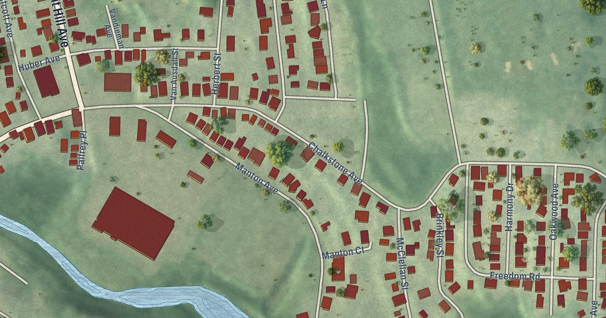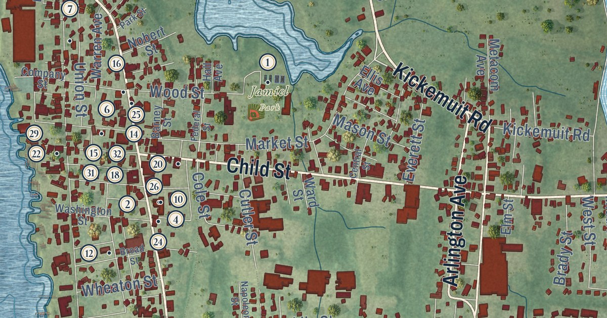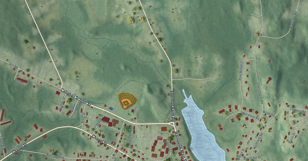
This beautifully detailed map of West Warwick, Rhode Island was created in 2026 using aerial imagery combined with modern topographical, census, street and landmark data. It’s a one-of-a-kind view of West Warwick that combines accurate data with a vintage aesthetic. The map shows every building in its true location, many of the roads carry their names, and the shaded topographic relief shows the shape of the land.
See the West Warwick, Rhode Island map on a wall
The West Warwick map as an 18 x 24 inch print in a black frame.

Explore an aerial view of West Warwick, Rhode Island
On the map you’ll find West Warwick Town Hall, Natick, Harris, Bartons Corner, Crompton, Centerville, River Point, Westcott, Arctic, Phenix, Lippitt, Clyde, and more. If you look closely you can even find your house accurately drawn in its correct location. Zoom in on the preview to look for yours.
Did you know this piece of West Warwick, Rhode Island history?
West Warwick became a town in 1913, the youngest in Rhode Island. It had been the industrial center of the larger town of Warwick. Local Democrats split it off from the Republican farm country to the east.
Take a closer look at the West Warwick map
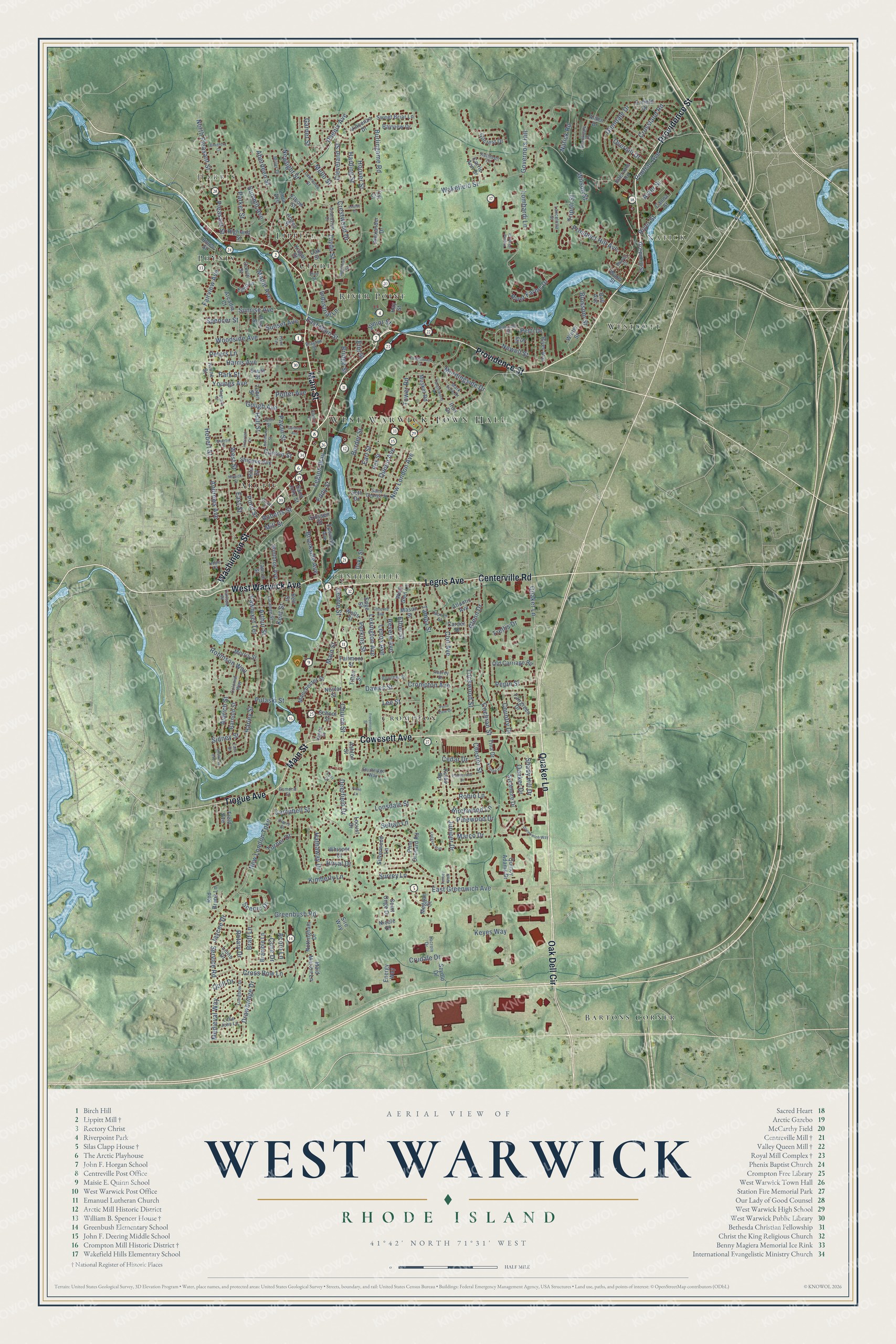
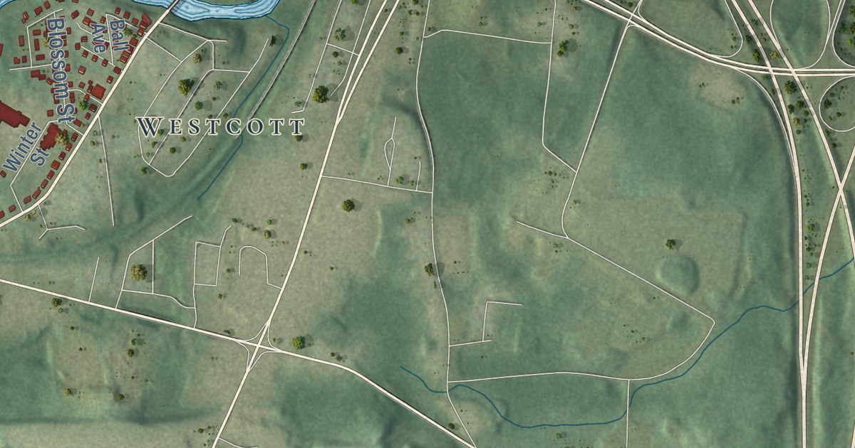
Click to explore a larger preview. The digital watermark does not appear on printed maps.
Street and place names on the West Warwick, Rhode Island map
These names are printed on the map of West Warwick, Rhode Island.
Places: West Warwick Town Hall, Natick, Harris, Bartons Corner, Crompton, Centerville, River Point, Westcott, Arctic, Phenix, Lippitt and Clyde.
Streets and roads: Providence Street, Main Street, Oak Dell Circle, Quaker Lane, Cowesett Avenue, Legris Avenue, Washington Street, Centerville Road, West Warwick Avenue, Tiogue Avenue, Birchwood Lane, Legion Way.
More street names, A to Z
Aberdeen Street, Acorn Lane, Alden Drive, Aldrich Street, Alexander Drive, Ames Street, Andrews Avenue, Angell Street, Arcadia Court, Arthur Street, Ashton Street, Aster Street, Atlantic Avenue, Audrey Drive, Babcock Street, Ball Avenue, Barnold Street, Bayview Drive, Bell Street, Blossom Street, Border Street, Boucher Street, Bowen Court, Bradford Court, Bramble Lane, Bratt Lane, Brayton Street, Bridge Street, Brookdale Drive, Brookside Avenue, Burlingame Road, Campbell Street, Canna Street, Capron Street, Carder Street, Carlton Place, Carrie Ann Drive, Cedar Drive, Centre Street, Chester Street, Church Street, Claire Street, Cleveland Street, Clyde Street, Cochran Street, Coit Avenue, Colonial Way, Colvin Street, Concord Avenue, Cone Drive, Country Drive, Crestwood Drive, Crompton Avenue, Cross Bow Lane, Crossen Street, Crossland Road, Crudale Drive, Curson Street, Cyr Court, Dawes Street, Deerfield Drive, Drawbridge Drive, Duke Street, Earl Street, East Greenwich Avenue, East Main Street, East Street, Echo Lane, Eddy Street, Edge Street, Elbow Street, Ellison Street, Elm Street, Energy Way, Enfield Drive, Epworth Avenue, Esmond Street, Ethel Street, Fairgreen Drive, Fairmont Street, Fairview Avenue, Fawn Lane, Field Avenue, Flynn Terrace, Freemont Street, Gardner Avenue, Garnet Street, Gilcrest Drive, Glendale Drive, Glenn Drive, Gough Avenue, Governors Hill, Grandview Drive, Greenbush Road, Greenhill Street, Greenwich Way, Guertin Street, Hall Street, Harding Street, Harley Street, Harris Avenue, Hathaway Drive, Hay Street, Hebert Street, Highland Street, Hillcrest Drive, Hoover Street, Hope Court, Industrial Lane, Intervale Road, Iron Drive, Ivy Street, Jaycee Drive, John Street, Junior Street, Juniper Drive, Kathleen Court, Kenmore Street, Kent Street, Keyes Way, Kimberly Lane, Kinne Street, Knight Street, Kristee Circle, Krystal Pond Drive, Kulas Road, Lacroix Drive, Lada Drive, Lancelotta Street, Laramee Street, Lawrence Street, Lee Street, Lenox Avenue, Lexington Avenue, Lima Avenue, Lions Drive, Little John Lane, Lockwood Street, Locust Drive, Loggers Run, Lombardi Lane, Longbow Drive, Lonsdale Street, Lori Court, Louise Drive, Maid Marion Lane, Manchester Street, Maple Avenue, Marco Drive, Mark Fore Drive, Mason Street, Medieval Way, Meggan Court, Mello Street, Miller Drive, Mill Street, Morningside Drive, Morris Street, Musket Road, Natick Road, Nestor Street, Newell Street, Newlight Street, New London Avenue, New London Turnpike, Nicole Drive, North Pleasant Street, Nottingham Drive, Nowicki Street, Noxon Street, Oak Street, Old Carriage Road, Ottawa Street, Overhill Drive, Parker Street, Park Street, Pawtuxet Terrace, Payan Street, Pepin Street, Perkins Street, Peters Lane, Petti Drive, Phenix Avenue, Pine Orchard Road, Pine Street, Pinewood Drive, Pleasant Street, Ponderosa Drive, Pond Street, Pond View Drive, Pontiac Avenue, Potter Avenue, Prospect Hill Avenue, Pulaski Street, Quaker Drive, Queen Avenue, Quill Drive, Quincy Adams Drive, Red Brook Lane, Regnaire Court, Revere Avenue, Rex Street, Rita Street, River Avenue, River Farms Drive, River Street, Roberts Street, Robin Lane, Robinson Way, Rotary Drive, Royal Drive, Saint George Street, Saint John Street, Saint Onge Drive, Scenic Drive, School Street, Service Road, Seth Drive, Setian Lane, Shady Hill Drive, Sheffield Avenue, Shippee Avenue, Sidney Street, Silverwood Lane, Sire Way, South Street, Spencer Street, Spring Street, Sturbridge Way, Summit Avenue, Sunrise Avenue, Sunset Avenue, Surrey Lane, Sweet Briar Lane, Sycamore Drive, Szydlo Drive, Tampa Street, Tanglewood Court, Tanglewood Drive, Tilton Street, Timber Walk, Tina Drive, Tobin Street, Tower Road, Trellis Drive, Tripoli Street, Turner Drive, Vincenzo Drive, Vine Street, Wakefield Street, Water Street, Wells Street, West Glen Lane, West Street, Whisper Court, Wightman Street, Wilson Street, Winter Street, Winthrop Avenue, Woodside Avenue, Youngs Avenue.
This beautifully detailed map of West Warwick makes an attractive addition to your office, library, or den, and it can even be used to teach children the geography and history of the area. It also makes a great gift for anyone who grew up in West Warwick or moved away. When you’re done exploring, click here to get your copy of the West Warwick map.