
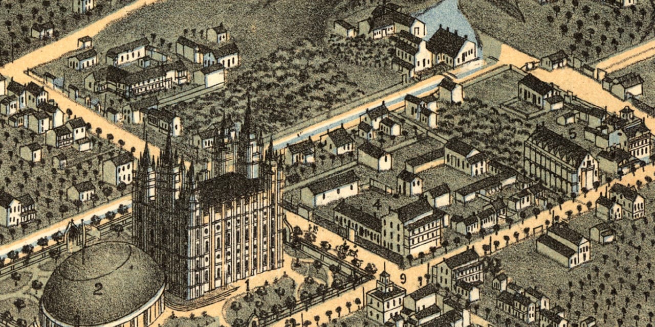
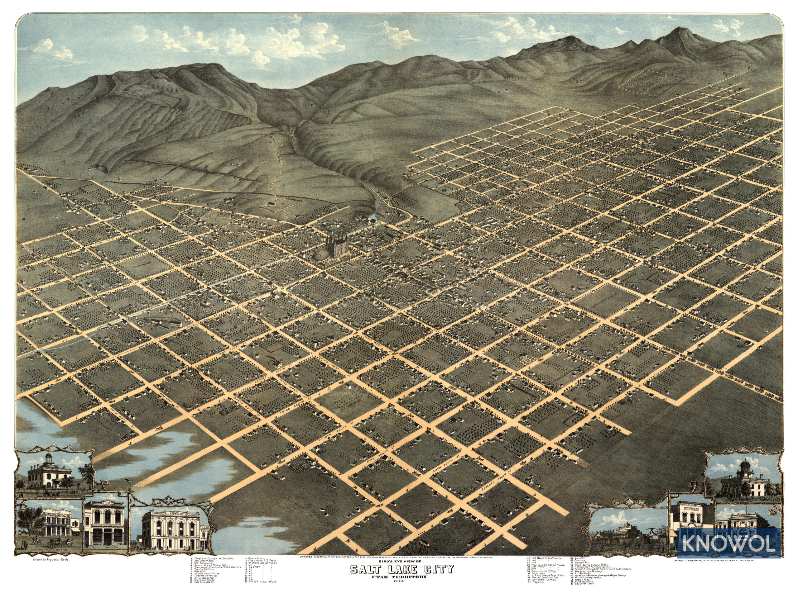
This historic map of Salt Lake City, Utah was created in 1870 by Augustus Koch, a prominent 19th century map maker. The map shows a detailed bird’s eye view of Salt Lake City as it used to be, including street names and old landmarks.
Landmarks on the map include the Desert News & Tithing Office, President Young’s Residence & Head Quarters, City Hall, Deseret University, Theatre Building, Union Academy, Revere House, Utah Central Railroad Depot, Ensign Peak, Black Mountain, Warm Spring Sulphur Baths, and more.
This map of Salt Lake City was restored by KNOWOL. Reproductions of the restored map are available here.
Historic Old Map of Salt Lake City, Utah from 1870
This old map of Salt Lake City makes an attractive addition to your office, library, or den and can even be used to teach children the geography and history of the area. When you’re done exploring, click here to get your copy.


