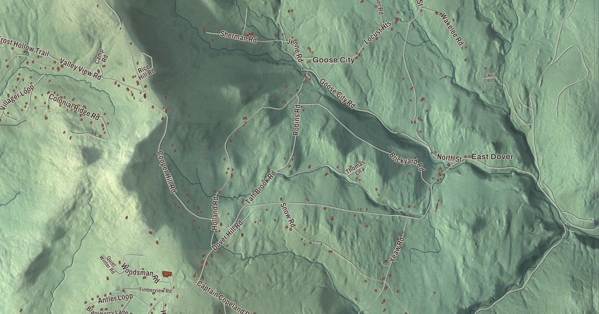
Dover is home to Mount Snow, and the town is also West Dover’s old village street, East Dover, Goose City and a set of back roads with names like Handle Road and Far Beyond Road. This map prints them, along with Crosstown Road, Valley View Road, Snow Road, North Access Road and the North Branch Deerfield River.
Dover is a town in Windham County, Vermont.
KNOWOL made this map in 2026 from public survey data and gave it the look of an old county atlas. The relief comes from United States Geological Survey elevation data, and the roads and town line come from the Census Bureau. Dover covers 35.3 square miles, all land, and it had 1,798 people at the 2020 census. Click here to purchase a print of this map for your wall.
Out of Wardsboro
Dover began as the South District of Wardsboro, which kept its own set of town officers from 1789. The legislature made it a separate town on October 30, 1810, and Dover organized on March 4, 1811. West Dover had been settled in 1796, when it was still part of Wardsboro, and its first mill, a sawmill, went up that same year along the river. Through the first half of the 19th century the mill grew to process wool. The mills are long gone, with only traces of them left, but the village keeps a fine set of Federal and Greek Revival buildings, and its center on Route 100 at Crosstown and Valley View roads was listed on the National Register of Historic Places in 1985 as the West Dover Historic District.
Two old buildings show the town’s age. The Dover Town Hall, near the common in Dover village, was built in 1828 as a union meeting house shared by Baptist, Methodist and Universalist congregations, and it’s an unusually early example of the Gothic Revival style. The town voted in 1872 to hold its meetings there and did so until 1971. In West Dover, the Corse-Shippee House of 1860, built by Orville Corse, is the only two-story Greek Revival house in the village, and members of the Shippee family have owned it since 1907.
The mountain that took a farmer’s name
Mount Snow, the ski area in Dover, sits on a peak once called Mount Pisgah. In 1953 Walter Schoenknecht, looking for a ski hill with more snow than places farther south but still within reach of New England’s cities, bought land at its foot from a farmer named Reuben Snow, and the ski area and later the mountain itself took Snow’s name. Mount Snow opened in December 1954 with five trails, a rope tow and two double chairlifts. It went on to co-host the first Extreme Games in 1995 and to host the X Games in 2000 and 2001, and its summit stands at 3,600 feet. The Rock River and the North Branch of the Deerfield River both have their sources in Dover, and West Dover stretches along Route 100 as it follows the North Branch.
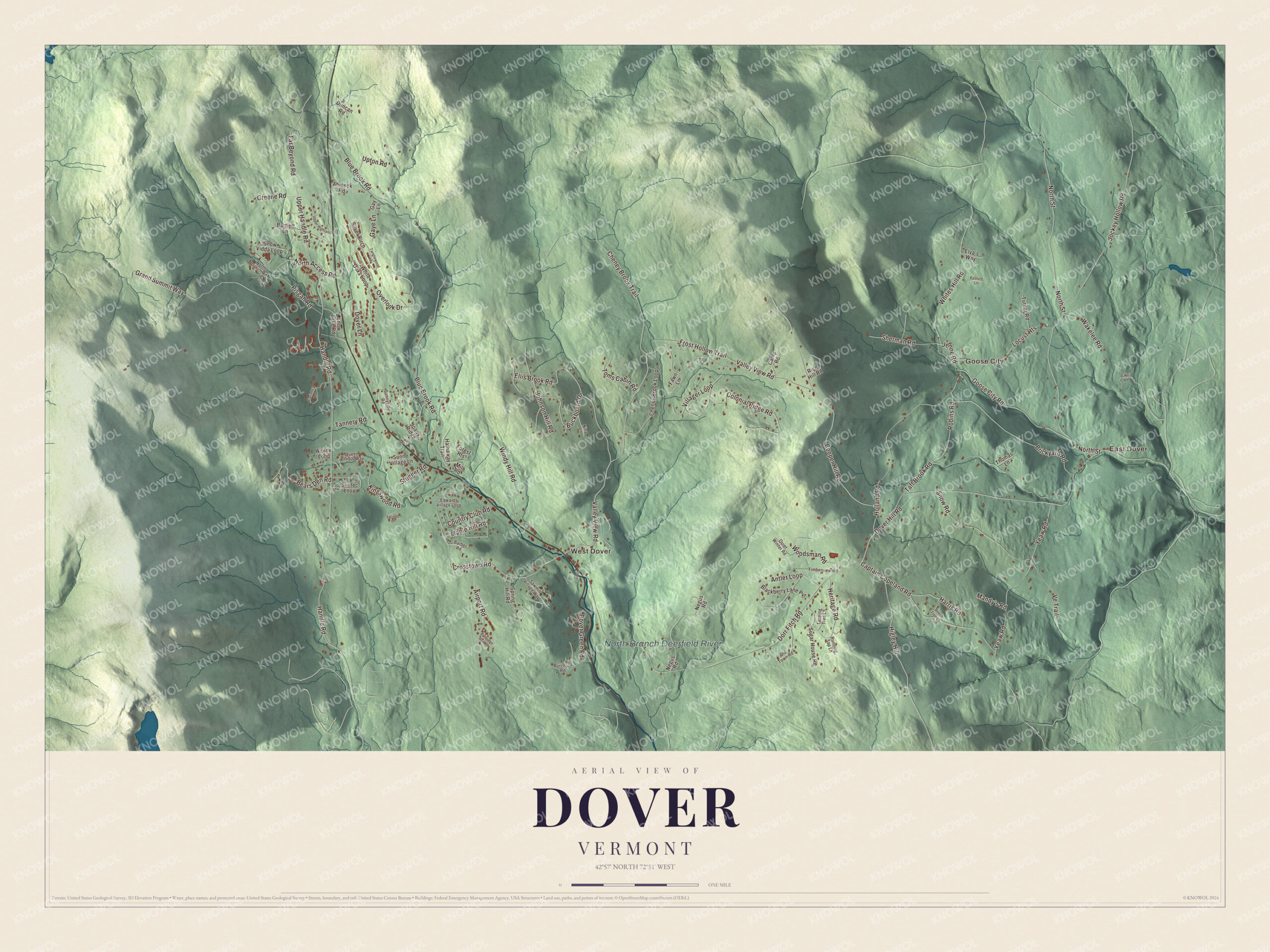
Click to explore a larger preview. The digital watermark does not appear on printed maps.
Names on this map
These names are printed on this map.
Places: East Dover, Goose City, West Dover and North Branch Deerfield River.
Streets and roads: Handle Road, Far Beyond Road, Snow Road, Crosstown Road, North Access Road, Valley View Road, Cooper Hill Road, North Street, Dover Hill Road, Blue Brook Road, Dorr Fitch Road, Taft Brook Road.
More street names, A to Z
Ahmeek Road, Airport Road, Alpine Loop, Antler Loop, Barber Road, Bartlett Lane, Bears Den Road, Beech Tree Lane, Blackberry Lane Pvt, Brickyard Road, Buckboard Drive, Burchard Road, Camp Road, Captain Copeland Road, Carinthia Road, Cheney Brook Loop, Cheney Brook Trail, Colonial Ridge Road, Country Club Road, Dover Green Road, Dover Lane, Duncan Road, Edwards Village Loop, Ellis Brook Road, Elva's Way, Fawn Lane, Foliage Lane, Forest Heights, Frost Hollow Trail, Gaye Lane, Gay Lane, Goose City Road, Grand Summit Way, Greene Road, Harris Road, Hathaway Trail, Heritage Road, Higley Hill, Holland Road, Jenne Road, Joans Ridge, Jockey Hollow Road, Johnson Hill Road, Kingswood Road, Locust Heights, Mandy's Road, Maple Hill Road, Mill Road, Negus Road, Nina Lane, North Branch Road, O'Neil Road, Old Town Road, Overlook Drive, Partridge Run Road, Pasture Lane, Pisgah Road, Queen Anne's Way, Quiet Winter Road, Rice Hill Road, Robins Road, Running Sap Lane, Sawmill Village Way, Sherman Road, Silver Birch, Snow Lake Road, Snow Vidda Loop, Spring Hill Road, Stugger Road, Sugar House Road, Sunne Village Lane, Sunnyside Road, Suntec Loop, Tanglewood Lane, Tannery Road, Tapping Tree Lane, Thomas Lane, Timberview Road, Toms Cabin Road, Turner Road, Upper Handle Road, Upper Highlands, Upton Road, Ve Trail, Villager Loop, Wakelee Road, White Oaks Loop, Whites Hill Road, Windy Hill Road, Woodsman Road, Yeaw Road.
See it on a wall
The Dover map as a framed print. Swipe for more.


Dover has turned out some well-known people. Sherman Adams was born in East Dover in 1899; he became the 67th governor of New Hampshire and later White House Chief of Staff for President Dwight D. Eisenhower. Devin Logan moved to Vermont before high school to train at the Mount Snow Academy, and she won silver in the first Olympic slopestyle competition, at Sochi in 2014. Kelly Clark also trained at the academy and won halfpipe gold at the 2002 Winter Olympics. The writer Stoyan Christowe, born in what’s now Greece, moved to Vermont in 1939, wrote about the immigrant’s life and served two terms in the legislature, and in 2006 a landmark to him went up in a joint project with the town of Dover.
On the map, find Handle Road, Far Beyond Road, Snow Road, Crosstown Road, North Access Road and Valley View Road. East Dover, Goose City and West Dover are printed too, and so is the North Branch Deerfield River.
Whether you live here year round or come up every winter, this map is made for everyone who calls Dover home, and it shows the town as it looks today, from East Dover to the slopes. Hang it in an office, library or den, or use it to teach children the geography and history of the town. KNOWOL created it in 2026, and it’s printed on museum quality archival paper. Zoom in on the preview above to explore the details, then click here to get your copy of the Dover, Vermont map.

Sources
- Dover, Vermont, Wikipedia
- Town histories and representatives, D towns, Vermont Legislature
- West Dover, Vermont, Wikipedia
- Dover Town Hall, Wikipedia
- Corse-Shippee House, Wikipedia
- Mount Snow, Wikipedia
- Sherman Adams, Wikipedia
- Devin Logan, Wikipedia
- Kelly Clark, Wikipedia
- Stoyan Christowe, Wikipedia