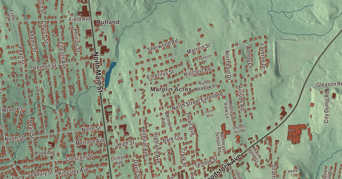
Rutland Town wraps all the way around Rutland City, a separate municipality, and its villages work as the city’s inner suburbs. This map prints Marolin Acres, North Main Street, South Main Street, West Street, Woodstock Avenue, Dorr Drive and Grove Street, with Rocky Pond and Combination Pond.
Rutland Town is a town in Rutland County, Vermont.
KNOWOL made this map in 2026 from public survey data and gave it the look of an old county atlas, shading the hills from United States Geological Survey elevation data and drawing the roads and town line from the Census Bureau. The town covers 19.3 square miles, and 3,924 people lived here at the 2020 census. Click here to purchase a print of this map for your wall.
The old town of Rutland
Benning Wentworth, New Hampshire’s governor, granted Rutland on September 7, 1761, as one of the New Hampshire Grants. He named it for John Manners, the 3rd Duke of Rutland, though it’s also recorded that John Murray, the first named proprietor, came from Rutland and named it. It turned out to be one of the most successful of those grants, because of its excellent farmland and gentle land. Settlers came in 1770, and the town served as one of the capitals of the Vermont Republic.
The town was once much larger. Marble was found in Rutland early in the 1800s, but the quarries only paid once the railroad came in 1851, and in 1886 the marble companies saw to it that the center incorporated as a village while most of the rest split off as West Rutland and Proctor, which held most of the quarries. In 1892 the village became Rutland City, and the town of Rutland that was left, circling the new city, was mainly rural. Otter Creek, Moon Brook, Tenney Brook, East Creek and Mussey Brook drain it, and Routes 4, 7 and 4A cross it.
Born in Rutland
John Deere was born in Rutland on February 7, 1804, and grew up in his father’s tailor shop, where he polished needles by running them through sand. Years later in Illinois, when cast-iron plows failed in the tough prairie soil, he remembered that trick, and in 1837 he made the first commercially successful steel plow. James Meacham, born in Rutland Town in 1810, became a Congregational minister, a Middlebury professor and a United States congressman from 1849 until his death. Cephas Washburn, born here in 1793, went on to be a missionary teacher among the Cherokee in Arkansas and Oklahoma.
Walter Flanders, born in Rutland in 1871, left school as a teenager to work as a machinist and became an expert in machine tools; Henry Ford hired him in 1906 as production manager, and he helped turn Ford toward mass production. William Henry Jackson spent part of his childhood in Rutland and came back after serving in the 12th Vermont Infantry, before going west, where he became known for his photographs of the American West. Merritt A. Edson was born in Rutland and grew up in Chester; he led the Marine Raiders in World War II and received the Medal of Honor for the defense of the ridge on Guadalcanal that bears his name. Carlene King Johnson of Rutland was Miss Vermont in 1953 and Miss USA in 1955, the only Vermonter so far to win the national title. The violin maker Russell de Gree Flagg, a Rutland resident, began in 1933 to make instruments from old wood taken from local covered bridges, and he built more than 200 violins.
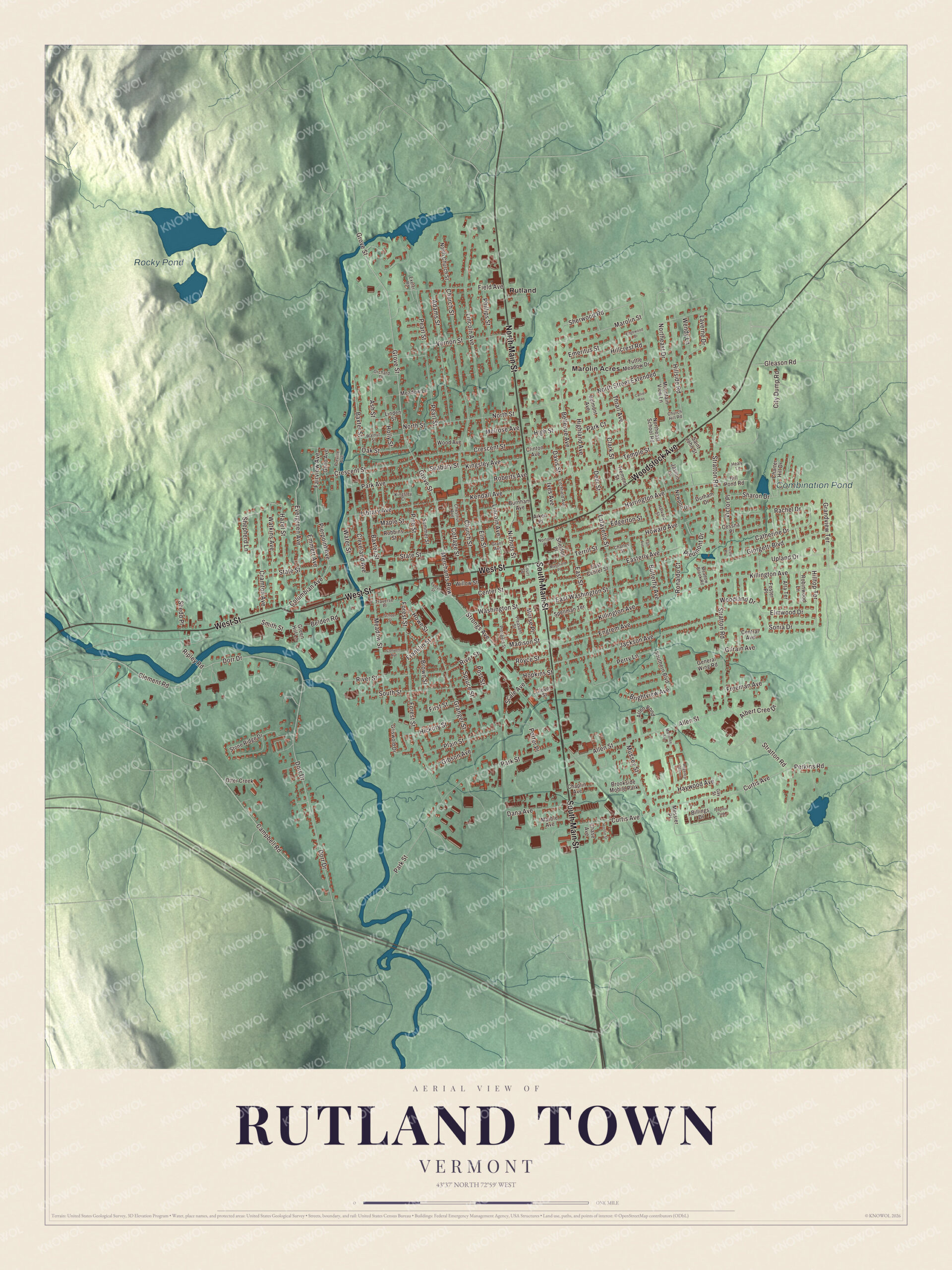
Click to explore a larger preview. The digital watermark does not appear on printed maps.
Names on this map
These names are printed on this map.
Places: Rocky Pond, Combination Pond, Marolin Acres, Rutland, Brookside Mobile Park and Preston Park.
Streets and roads: West Street, South Main Street, North Main Street, Woodstock Avenue, Dorr Drive, Grove Street, Washington Street, Merchants Row, Sherwood Road, Marolin Street, Sonia Drive, Campbell Road.
More street names, A to Z
Adams Street, Aiken Place, Albert Cree Drive, Allen Pond, Allen Street, Alta Terrace, Ash Street, Baxter Street, Belden Road, Bellevue Avenue, Belmont Avenue, Billings Drive, Brightview Avenue, Brown Street, Burnham Avenue, Butterfly Avenue, Callie Way, Catherine Drive, Center Street, Central Avenue, Cessna Place, Chaplin Avenue, Charles Street, Charter Hill Drive, Chase Avenue, Chestnut Avenue, Church Hill Road, Church Street, City Dump Road, Clark Street, Clement Road, Cleveland Avenue, Clinton Avenue, Clover Street, Columbian Avenue, Convent Avenue, Cottage Street, Court Square, Cramton Avenue, Crescent Street, Curtis Avenue, Dana Avenue, Davis Street, Deer Street, Durham Drive, East Center Street, Easterly Avenue, East Street, East Washington Street, Edgerton Street, Edgewood Drive, Elm Street, Elmwood Drive, Emeritus Street, Emmett Avenue, Engrem Avenue, Evelyn Street, Evergreen Avenue, Exeter Road, Fairview Avenue, Field Avenue, First Street, Forest Street, Foster Place, Franklin Street, Freeman Avenue, Gay Street, General Wing Road, Geno Avenue, Gibson Avenue, Gilrain Avenue, Giorgetti Boulevard, Gleason Road, Grandview Terrace, Granger Street, Grant Avenue, Green Hill Lane, Griswold Drive, Harrington Avenue, Harvard Street, Haywood Avenue, Hazel Street, Healy Lane, Hickory Street, Highland Avenue, High Street, Hillcrest Road, Hill Pond Road, Hillside Road, Hilltop Terrace, Holly Street, Hopkins Street, Horton Street, Howard Avenue, Howe Street, Ives Avenue, Jackson Avenue, Jasmin Lane, Kendall Avenue, Killington Avenue, Kingsley Avenue, Kingsley Court, Lafayette Street, Laverne Drive, Library Avenue, Lincoln Avenue, Linden Street, Litchfield Avenue, Madison Street, Mahoney Avenue, Mansfield Place, Maple Street, Marble Avenue, Meadow Brook Road, Meadow Lane, Meadow Street, Melrose Avenue, Messier Place, Morse Place, Mountain View Lane, Mussey Street, Newport Drive, Nichols Street, Nicole Place, North Church Street, Northeast Drive, Northeast School Road, North Street, North Street Extended, Norton Place, Oak Street, Orchard Drive, Otter Creek, Park Avenue, Park Court, Park Street, Pearl Street, Perkins Road, Perry Lane, Phillips Street, Piedmont Drive, Pierpoint Avenue, Pine Street, Plain Street, Pleasant Street, Porter Place, Post Street, Preville Avenue, Prospect Street, Rachel Drive, Regency Manor, Ripley Road, River Street, Robbins Street, Roberts Avenue, Robinwood Lane, Ronaldo Court, Royce Street, Saint John Street, Scale Avenue, School Street, Seabury Street, Sharon Drive, Shedd Place, Sheldon Place, Shepherd Lane, Smith Street, Southern Boulevard, South Street, Spellman Terrace, Spruce Street, State Street, Stone Ridge Drive, Stratton Road, Strongs Avenue, Summer Street, Taft Avenue, Temple Street, Terrill Street, Thrall Avenue, Traverse Place, Tremont Street, Tuttle Meadow Drive, Upland Drive, Vernon Street, Victor Place, Walnut Street, Water Street, Watkins Avenue, Wendy Lane, Willow Street, Wood Avenue, Woodland Drive.
See it on a wall
The Rutland Town map as a framed print. Swipe for more.


Around the map
The southern end of Rutland Town is home to the former Diamond Run Mall, which opened in 1995 as the community’s second enclosed mall after the Rutland Mall, and to Castleton University’s Spartan Arena, where the Castleton hockey teams practice. Routes 4 and 7 come together and run along Main Street between the former mall and Woodstock Avenue, the two main ways into the city.
On the map, start with Marolin Acres and Rutland, then follow West Street, South Main Street, North Main Street, Woodstock Avenue, Dorr Drive and Grove Street across town. Rocky Pond and Combination Pond are printed too. Rutland Town dates to 1761.
This map of Rutland Town is made for everyone who calls Rutland Town home, and it shows the town as it looks today, from Marolin Acres and Dorr Drive to Rocky Pond and Combination Pond. Hang it in an office, library or den, or use it to teach children the geography and history of their town. It’s printed on museum quality archival paper. Zoom in on the preview above to explore the details, then click here to get your copy of the Rutland Town, Vermont map.

Sources
- Rutland (town), Vermont, Wikipedia
- Town histories and representatives, R towns, Vermont Legislature
- Rutland (city), Vermont, Wikipedia
- John Deere (inventor), Wikipedia
- James Meacham, Wikipedia
- Cephas Washburn, Wikipedia
- Walter Flanders, Wikipedia
- William Henry Jackson, Wikipedia
- Merritt A. Edson, Wikipedia
- Carlene King Johnson, Wikipedia
- Russell de Gree Flagg, Wikipedia
- Diamond Run Mall, Wikipedia