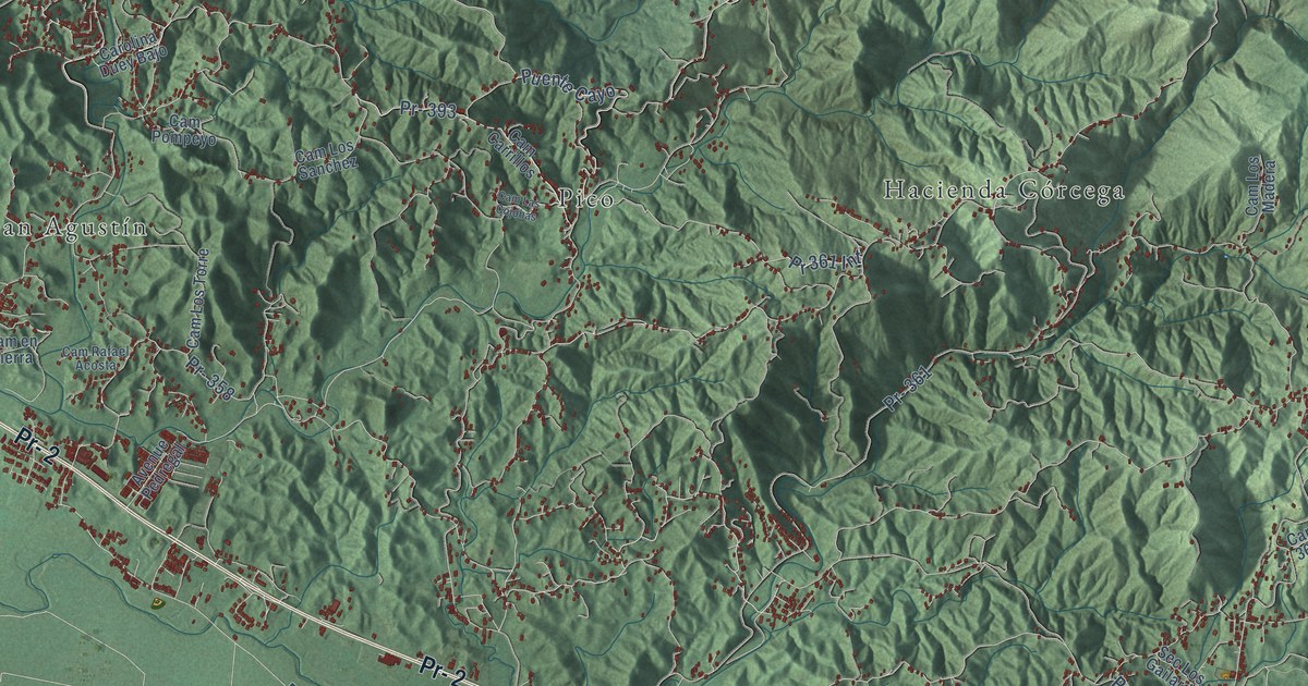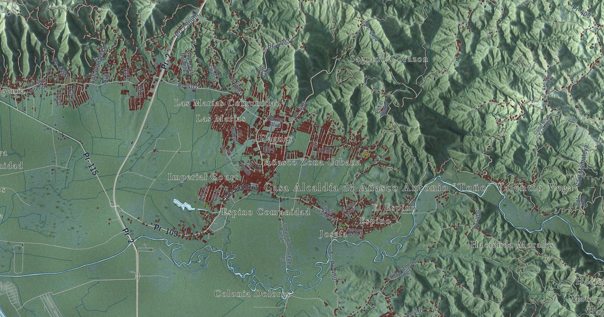
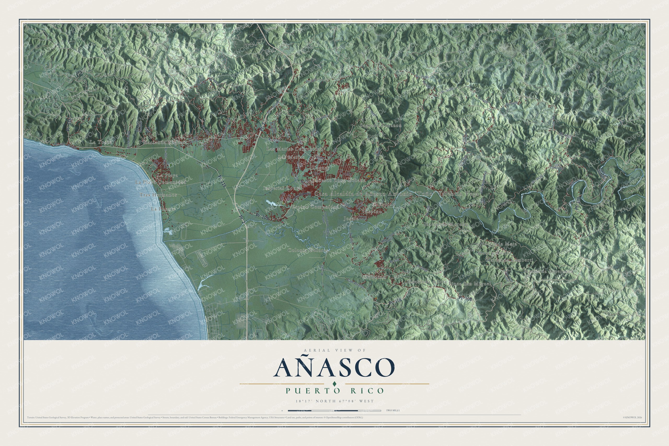
This beautifully detailed map of Añasco, Puerto Rico was created in 2026 using aerial imagery combined with modern topographical, census, street and landmark data. It's a modern aerial view of the municipio of Añasco, Puerto Rico, that combines modern data with a vintage aesthetic. The roads feature printed names, and if you look closely you can find your exact house accurately shown in its correct location.
Explore an aerial view of Añasco, Puerto Rico
On this map you'll find Casa Alcaldía de Añasco Antonio "Toño" Valentín Vega, Aquilino, Añasco Zona Urbana, Colonia Dolores, Daguey, El Espino, Espino, Espino Comunidad, Finca San Miguel, Hacienda Alicia, Hacienda Esperanza, Hacienda Eugenia, and more. Each red shape is a building, so zoom in on the preview and look for yours.
Every town has a first chapter, and Añasco is no exception. The record at topuertorico.org puts it this way: "The municipality takes its name from Spanish settler Luis de Añasco, who received lands in the region during the early colonial period."
Añasco is one of the 78 municipios of Puerto Rico. The Census Bureau counted 25,596 people here in 2020.
Take a closer look at the Añasco map
Names on this map
These names are printed on this map.
Places: Casa Alcaldía de Añasco Antonio "Toño" Valentín Vega, Aquilino, Añasco Zona Urbana, Colonia Dolores, Daguey, El Espino, Espino, Espino Comunidad, Finca San Miguel, Hacienda Alicia, Hacienda Esperanza, Hacienda Eugenia, Hacienda Lamberti, Hacienda Mata, Hacienda Morales, Imperial Court, Josefa, La Playa, La Playa Comunidad, La Puente, La Tosca, Las Marias, Las Marías Comunidad, Mata y Orsini, Sagrado Corazon and Tres Hermanos.
Streets and roads: Pr- 2, Pr- 108, Pr- 109, Pr- 115, Pr- 411, Cam Arraras, Pr- 4411, Pr- 4405, Pr- 4403, Pr- 495, Ent Juan Vega, Pr- 4020.
More street names, A to Z
Baxter Boulevard, Cam Los Reyes Magos, Camp Ninas Escuchas, Carr 109, Carr Ajies, Carr Mamateya, Cll 1, Cll 2, Cll 3, Cll 4, Cll 5, Cll 6, Cll 7, Cll 12, Cll 17, Cll 65 de Infanteria, Cll 65 Infanteria, Cll Cipres, Cll el Fard, Cll Isabel, Cll Los Robles, Cll Luis Muñoz Marin, Cll Nueva, Cll Pagan, Cll Villa Locura, Comunidad Pagan, Ent el Batey, Ent el Chatisy, Ent la Ferrer, Ent Los Vasques, Entr Raul Balaguer, Pr- 2 South, Pr- 110, Pr- 342, Pr- 401, Pr- 402, Pr- 402 Interior, Pr- 404, Pr- 405, Pr- 406, Pr- 420, Pr- 429, Pr- 430, Pr- 4109, Pr- 4401, Pr- 4402, Pr- 4404, Pr- 4420, Pr- 4430, Pr 429, Pr 430, Pr 4603, Sec Contreras, Sec Pepe Trabal, Sec Picheto Floies.
Created by KNOWOL in 2026. The buildings are small red shapes, the roads carry their printed names, and shaded relief shows the shape of the land. The title panel reads "AERIAL VIEW OF AÑASCO, PUERTO RICO" with 18°17' NORTH 67°08' WEST.
Hang it in the hallway, the office or the cabin, or give it to someone who left Añasco and still calls it home. Open the preview and look for a street you know. See sizes and frames for the Añasco map.