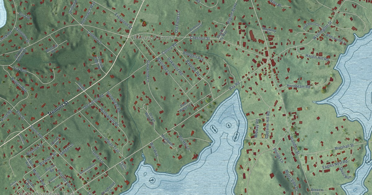
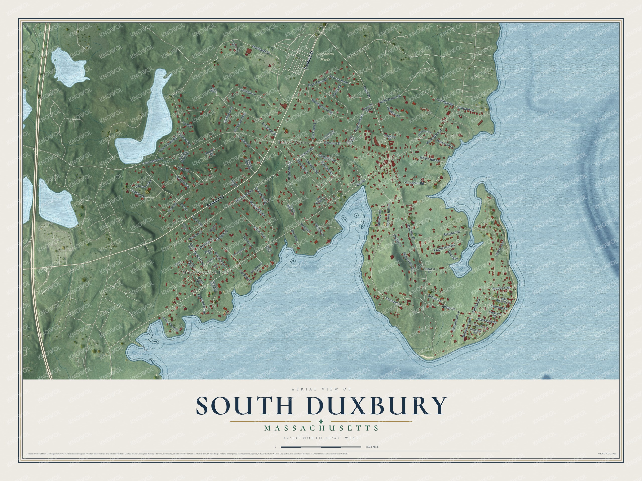
This beautifully detailed map of South Duxbury, Massachusetts was created in 2026 using aerial imagery combined with modern topographical, census, street and landmark data. It's a modern aerial view of South Duxbury in Plymouth County, Massachusetts, that combines modern data with a vintage aesthetic. The roads feature printed names, and if you look closely you can find your exact house accurately shown in its correct location.
Explore an aerial view of South Duxbury, Massachusetts
On this map you'll find Lapham Woods, Miles Standish Park, Baileys Corner, Tremont Street, Depot Street, Bay Road, Puritan Road, Island Creek Road, Colony Road, Myles View Drive, Allens Lane, Pond Road, and more. Each red shape is a building, so zoom in on the preview and look for yours.
South Duxbury is a community in Plymouth County. The Census Bureau counted 3,463 people here in 2020. The map prints the town name in its title panel, with the coordinates below it.
Take a closer look at the South Duxbury map
Names on this map
These names are printed on this map.
Places: Lapham Woods, Miles Standish Park and Baileys Corner.
Streets and roads: Tremont Street, Depot Street, Bay Road, Puritan Road, Island Creek Road, Colony Road, Myles View Drive, Allens Lane, Pond Road, Standish Street, Marshall Street, Toby Garden Street.
More street names, A to Z
Alden Avenue, Arrowhead Road, Bayberry Lane, Bayridge Lane, Bayview Road, Beachwood Lane, Blodgett Avenue, Bradford Road, Bradford Street, Brewer Lane, Brewers Lane, Brewster Street, Bryant Avenue, Captains Hill Road, Chestnut Street, Cranberry Hill, Crescent Street, Cushing Drive, Driftwood Drive, Eagles Nest Road, Elder Brewster Road, Elm Street, Evergreen Street, Federal Eagle Road, Ford Street, Fox Run, Goosepoint Lane, Grandview Avenue, Hardin Hill Road, Hawkins Place, Heritage Lane, Hicks Point Road, Hornbeam Road, Huckleberry Lane, Ice House Road, Indian Trail, Ingalls Grove, James Road, Landing Road, Lantern Lane, Massasoit Road, Mayflower Avenue, Mayflower Lane, Mayflower Street, Meetinghouse Road, Midway Road, Mullins Avenue, Oakwood Road, Ocean Avenue, Ocean Woods Drive, Old Coach Way, Old Colony Road, Old Fields Lane, Old Meeting House Hill Street, Old Toby Garden Street, Partridge Road, Phelps Lane, Pilgrim by Way, Pilgrim Bywy, Pilgrim Road, Pill Hill Lane, Pine Ridge Lane, Pinewood Lane, Plymouth Bywy, Prence Street, Prior Farm Road, Priscilla Avenue, Priscilla Lane, Pryor Farm Road, Puritan Way, Quail Run, Rogers Way, Sagamore Road, Samoset Road, Sampson Street, Sangar Lane, Seabury Point Road, Shipyard Lane, Soule Avenue, South Station Street, Spruce Lane, Standish Road, Summerhouse Lane, Torrey Lane, Uriahs Drive, Wadsworth Lane, Wadsworth Road, Washington Street, Water Supply, Whitepine Lane, White Street, Winslow Road, Winslow Street, Wirt Way.
See it on a wall
The South Duxbury map as a framed print. Swipe for more.


Created by KNOWOL in 2026. The buildings are small red shapes, the roads carry their printed names, and shaded relief shows the shape of the land. The title panel reads "AERIAL VIEW OF SOUTH DUXBURY, MASSACHUSETTS" with 42°01' NORTH 70°41' WEST.
It suits a den, a classroom or a front hall, and it makes a gift for anyone with South Duxbury roots. Open the preview and find the block you know. See sizes and frames for the South Duxbury map.