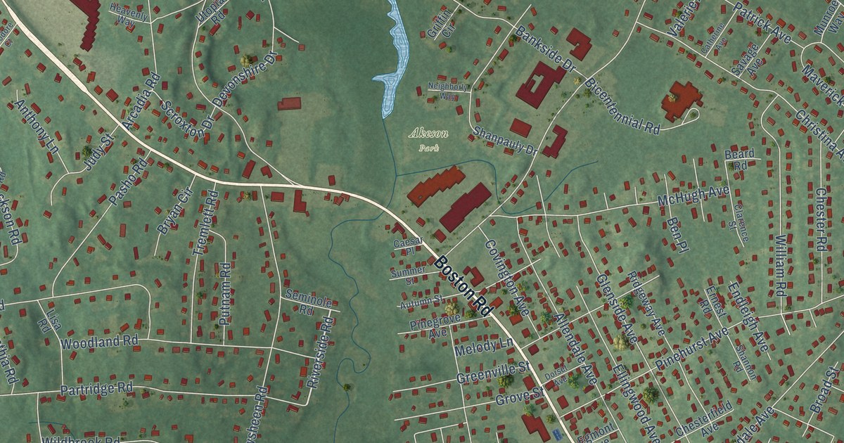
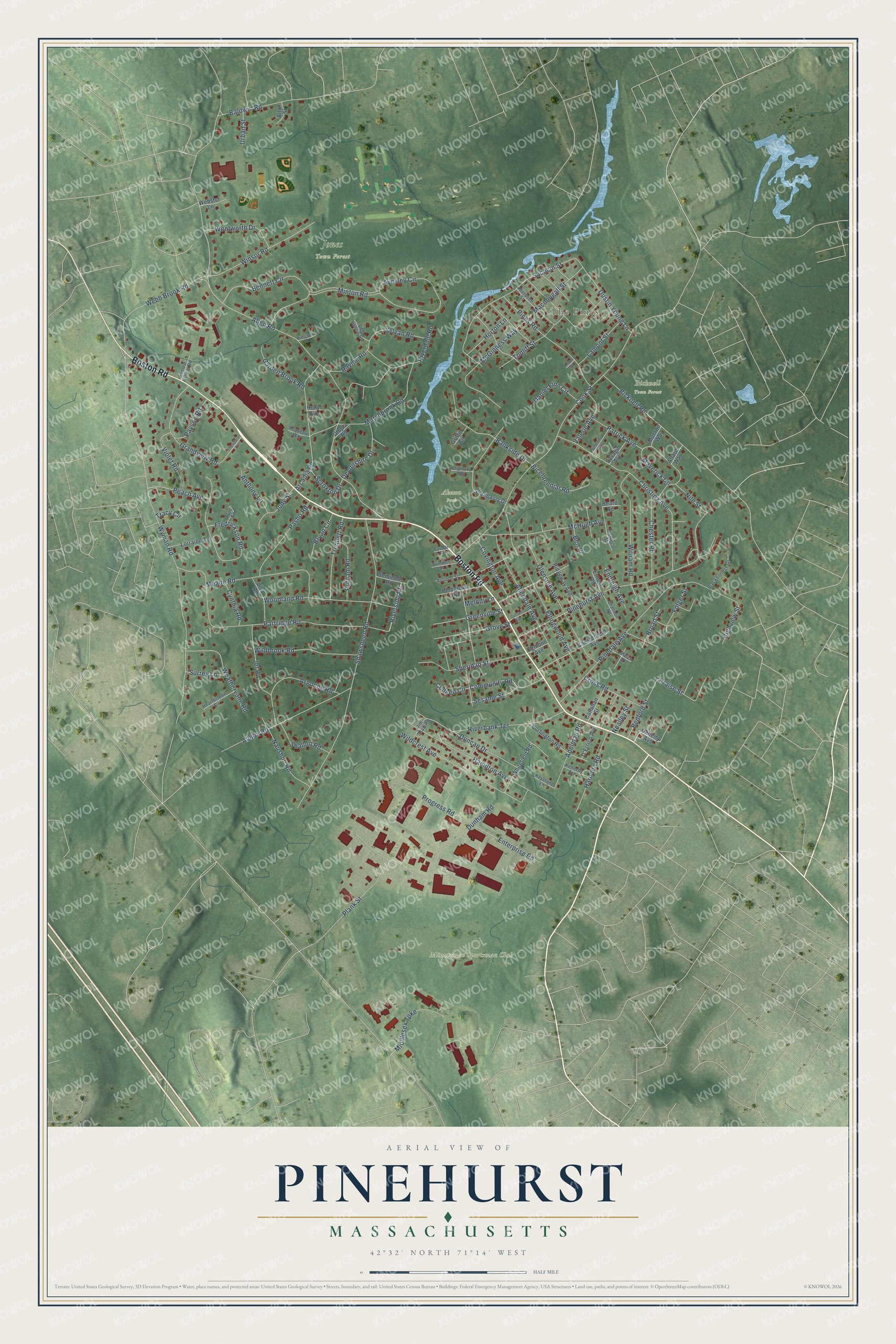
This beautifully detailed map of Pinehurst, Massachusetts was created in 2026 using aerial imagery combined with modern topographical, census, street and landmark data. It's a modern aerial view of Pinehurst in Middlesex County, Massachusetts, that combines modern data with a vintage aesthetic. The roads feature printed names, and if you look closely you can find your exact house accurately shown in its correct location.
Explore an aerial view of Pinehurst, Massachusetts
On this map you'll find The Pines, Bicknell Town Forest, Jones Town Forest, Minuteman Sportsman Club, Akeson Park, Boston Road, Riverside Road, Allen Road, Wyman Road, Shawsheen Road, Cook Street, Partridge Road, and more. Each red shape is a building, so zoom in on the preview and look for yours.
Pinehurst is a community in Middlesex County. The Census Bureau counted 7,368 people here in 2020. The map prints the town name in its title panel, with the coordinates below it.
Take a closer look at the Pinehurst map
Names on this map
These names are printed on this map.
Places: The Pines, Bicknell Town Forest, Jones Town Forest, Minuteman Sportsman Club and Akeson Park.
Streets and roads: Boston Road, Riverside Road, Allen Road, Wyman Road, Shawsheen Road, Cook Street, Partridge Road, Bicknell Road, Pinedale Avenue, Pinehurst Avenue, Christina Avenue, Dunham Road.
More street names, A to Z
Aberdeen Street, Adelman Road, Albion Road, Allard Way, Allendale Avenue, Alton Street, Anthony Lane, Arcadia Road, Argonne Road, Autumn Street, Aynsley Circle, Baldwin Road, Bankside Drive, Battcock Road, Beard Road, Bedford Street, Bennett Circle, Ben Place, Bicentennial Road, Breckenridge Drive, Broad Street, Bryan Circle, Burlington Road, Caesar Place, Callahan Street, Catherine Avenue, Chesterfield Avenue, Chester Road, Clarence Street, Colleen Circle, Community Road, Covington Avenue, Cross Road, Cynthia Road, D'Errico Avenue, Daniel Finn Circle, Dell Hollow Road, Devonshire Drive, Doherty Avenue, Dorset Avenue, Duncan Drive, Dustin Young Lane, Egmont Avenue, Ellingwood Avenue, Endleigh Avenue, Enterprise Road, Ernest Road, Everett Farmer Road, Folger Street, Fredrickson Road, Garden Brook Road, Glenside Avenue, Grandview Road, Greenville Street, Griffin Circle, Grove Street, Hamilton Avenue, Harnden Road, Hearthstone Circle, Heavenly Way, Highview Street, Horton Lane, Hunt Road, Jef Road, Jim Shaw Road, Judy Street, Kennedy Avenue, Keystone Lane, Knoll Street, Lamont Street, Lisa Road, Lorraine Terrace, Macdougall Street, March Street, Marshbrook Road, Maverick Circle, McGinness Way, McHugh Avenue, Meade Road, Melody Lane, Middlesex Turnpike, Minton Road, Munroe Way, Naushon Road, Nealley Street, Neighborly Way, Nile Street, Pasho Road, Patrick Avenue, Payson Road, Peach Avenue, Pinegrove Avenue, Pines Road, Plank Street, Praise Street, Progress Road, Putnam Road, Ravine Road, Ridgeway Avenue, Riverbank Terrace, Riverdale Road, Rural Avenue, Sachem Street, Savage Avenue, Scroxton Drive, Seminole Road, Sesame Street, Shalloo Road, Shannon Road, Shanpauly Drive, Sheridan Street, Summer Street, Surrey Lane, Sylvan Road, Theodore Court, Topliff Street, Tracy Circle, Tremlett Road, Urban Street, Utopia Road, Valerie Avenue, Violet Road, Weathervane Road, Webb Brook Road, Webster Lane, Wentworth Drive, Whitefield Road, Wildbrook Road, Wildcrest Avenue, William Road, Winsor Road, Woodland Road.
See it on a wall
The Pinehurst map as a framed print. Swipe for more.


Created by KNOWOL in 2026. The buildings are small red shapes, the roads carry their printed names, and shaded relief shows the shape of the land. The title panel reads "AERIAL VIEW OF PINEHURST, MASSACHUSETTS" with 42°32' NORTH 71°14' WEST.
It looks right in a kitchen, an office or a den, and it's a gift for anyone who grew up in Pinehurst or moved away. Open the preview and find your street. See sizes and frames for the Pinehurst map.