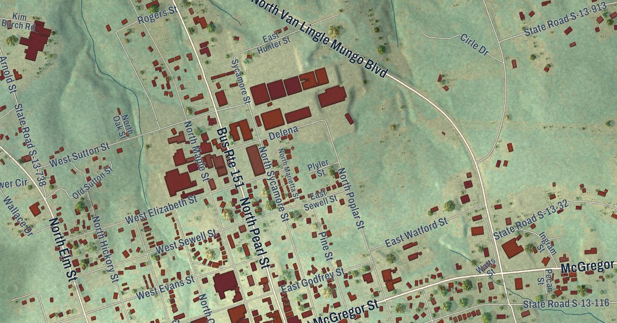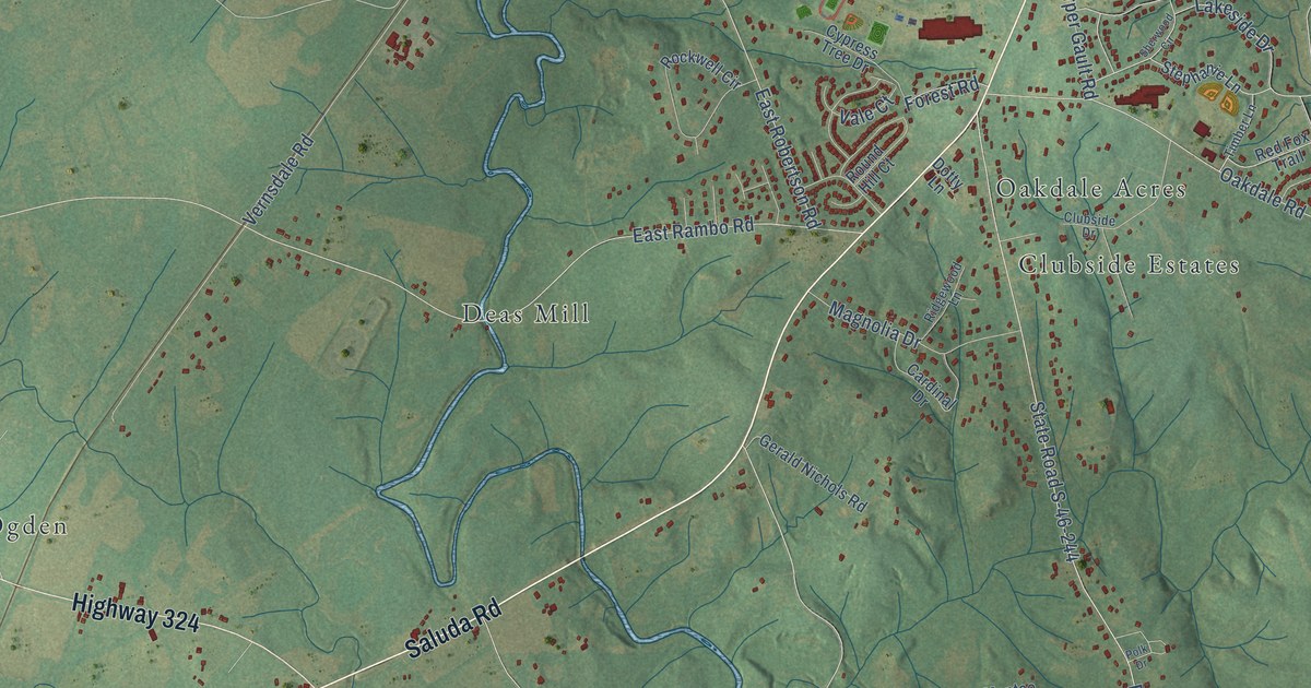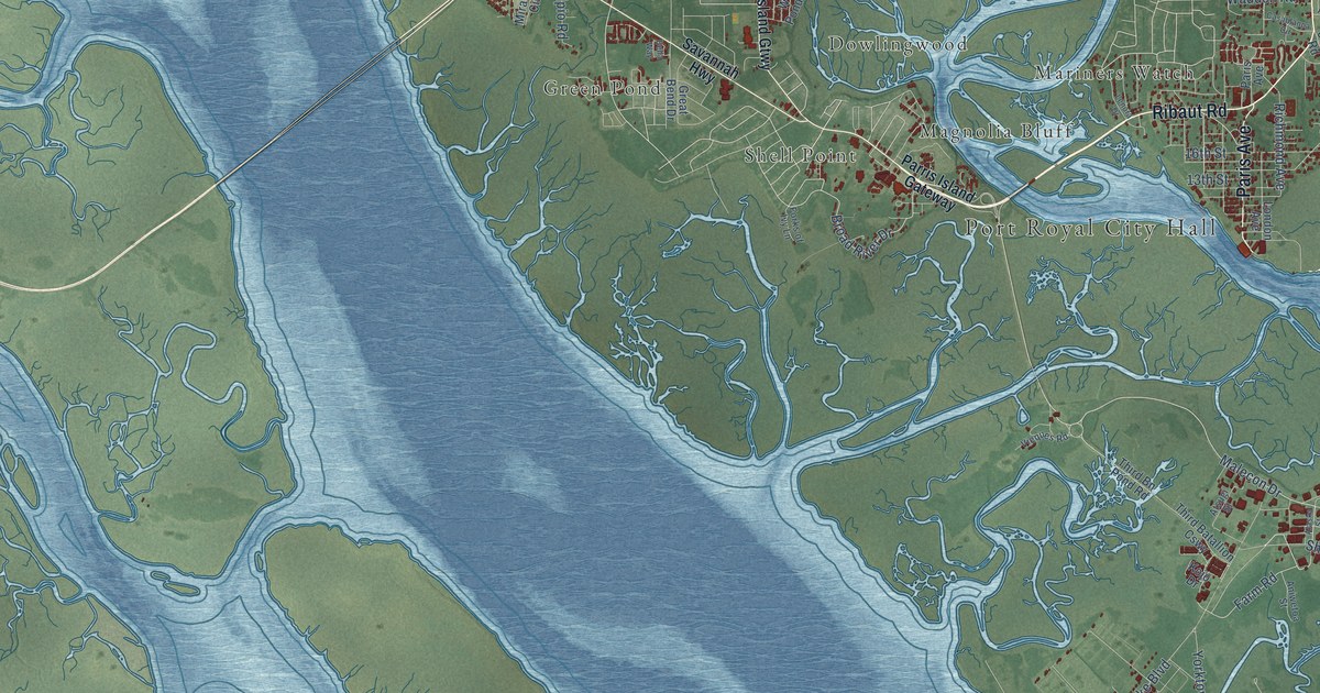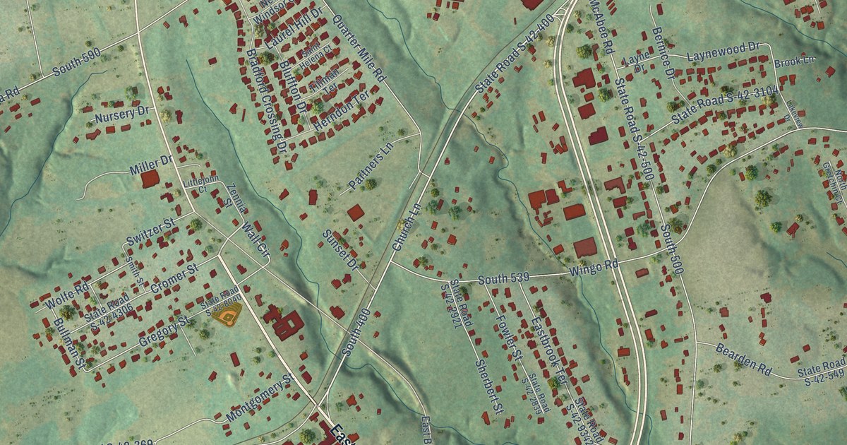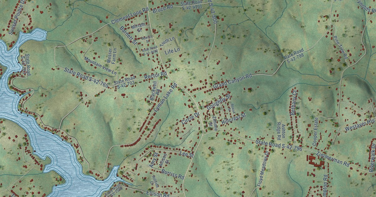
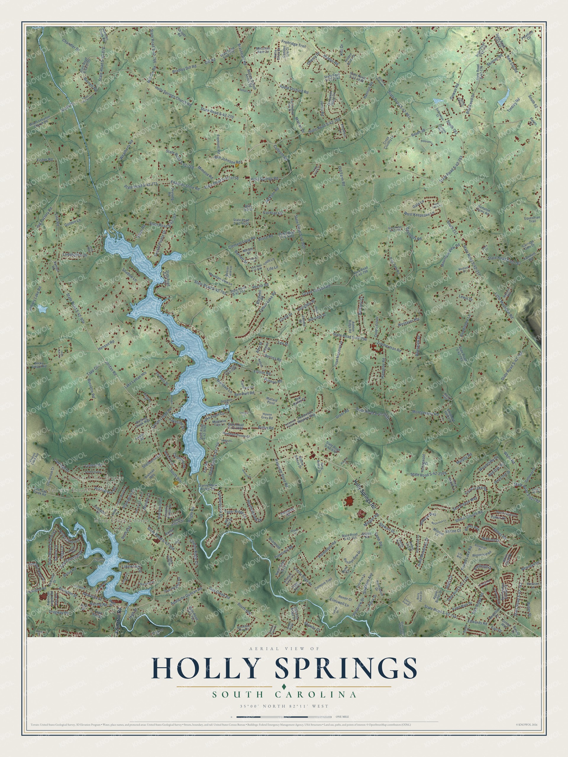
This beautifully detailed map of Holly Springs, South Carolina was created in 2026 using aerial imagery combined with modern topographical, census, street and landmark data. It’s a one-of-a-kind view of Holly Springs that combines accurate data with a vintage aesthetic. The map shows every building in its true location, many of the roads carry their names, and the shaded topographic relief shows the shape of the land.
Explore an aerial view of Holly Springs, South Carolina
On the map you’ll find Fairway Estates, Country Club Estates, Mink Creek Estates, and Greer Golf, along with Arlington Road, Holly Springs Road, Hannon Road, State Road S-42-769, Holly Circle, State Road S-42-792, Shiloh Church Road, State Road S-42-875, and more. If you look closely you can even find your house accurately drawn in its correct location. Zoom in on the preview to look for yours.
Did You Know?
From Internet Archive: "Craig continued the pastor of these united churches until 1870, when he became pastor of Holly Springs, Miss., whence he was called in 1883 to become Secretary of Home Missions of the Southern Presbyterian Church."
Holly Springs is a community in Spartanburg County.
Take a closer look at the Holly Springs map
Names on this map
These names are printed on this map.
Places: Fairway Estates, Country Club Estates, Mink Creek Estates and Greer Golf.
Streets and roads: Arlington Road, Holly Springs Road, Hannon Road, State Road S-42-769, Holly Circle, State Road S-42-792, Shiloh Church Road, State Road S-42-875, White Road, Jordan Road, State Road S-42-904, South 904.
More street names, A to Z
Allison Street, Amber Lea Drive, American Legion Road, Amethyst Lane, Amy Street, Apalache Duncan Road, Apalache Street, Apollo Avenue, Apple Butter Drive, Apple Grove Drive, Apple Orchard Road, Aqua Street, Arlington Street, Ashlan Woods Court, Ashton Ridge Road, Bailey Drive, Baker Ridge, Barnett Road, Barnett Street, Becky Gibson Road, Belue Road, Ben Hurt Road, Ben Johnson Road, Berry Patch Drive, Bethany Court, Bird Street, Blackwell Drive, Blackwell Road, Bradford Forest Lane, Bradley Dill Road, Brashears Road, Brenda Way, Brennan Way, Briarwood Court, Bridgetowne Court, Brookdale Acres Drive, Bruce Road, Bumblebee Lane, Burnette Road, Burriss Road, Butler Road, Butler Street, Camden Lee Court, Canyon Ridge Trail, Carlsson Drive, Carolina Sky Drive, Carriage Drive, Carriage Gate Drive, Carshalton Drive, Cashton Drive, Celestial Drive, Chandler Drive, Charles Street, Chatim Ridge Court, Cherry Plum Drive, Cinnamon Ridge Circle, Circle Drive, Clairbrook Court, Clement Loop Road, Cochran Road, Collinsdale Court, Colmore Trail, Cooper Estate, Cooper Road, Country Club Drive, Country Forest Lane, Cross Country Lane, Culbreth Road, Dennis Hills Drive, Deyoung Road, Dill Road, Dorset Way, Dragway Road, Dunn Court, Earl Drive, East Celestial Drive, East Fleming Farm Drive, East Fox Ridge Drive, East Gap Creek Road, East Pyrenees Drive, Edwards Road, Edwards Store Road, Ellison Road, Elmswell Lane, Emerald Creek Avenue, Equestrian Trail, Fernwood Drive, Fisher Lake Road, Fisher Road, Floyd Meadows Drive, Fond Hart Drive, Fowler Road, Fox Road, Fremont Road, Fruitridge Trail, Gala Lane, Galloway Drive, Gap Creek Road, Glengary Court, Golden Lane, Golightly Street, Gowan Road, Grand Canyon Road, Granny Mack Bridge Road, Green Oak Drive, Greer Road, Hallie Olivia Drive, Hammett Pointe Court, Hammett Road, Hammett Store Road, Hampton Farms Road, Hampton Ridge Drive, Hampton Road, Hartleigh Drive, Haven Grey Road, Hawkins Court, Heatherbrook Drive, Henderson Meadow Way, Henderson Place Drive, Henson Road, High Street, Hillcrest Street, Hillside Court, Hobson Way, Holcombe Road, Holden Acres Drive, Holden Road, Holly Lane, Holly Meadows Drive, Holly Springs Church Road, Honeybush Drive, Jackson Road, James Road, Jarvis Road, Jewelwood Drive, Joe Roy Drive, Johnny Lake Road, Judy Way, Jug Factory Road, Kaleb Mark Drive, Kay Brooke Circle, King Arthur Drive, Kite Drive, Lakecrest Drive, Lakeforest Drive, Lake Front Circle, Lake Lyman Heights, Lakeside Drive, Lakewood Circle, Lamb Road, Lamplighter Drive, Lantern Drive, Laurel Crest Drive, Lee Street, Leigh Marie Court, Lemon Creek Drive, Lewis Drive, Life Lane, Lilly Lane, Lily Way, Lindsey Ridge Road, Line Road, Little Mountain Road, Long Creek Court, Lyman Lake Road, Lyman Lodge Road, Lynton Lane, Magnolia Tree Lane, Main Street, Malcolm Way, Mallard Point, Marcus Drive, Marlowe Lane, Matalin Court, McCormick Lane, Medallion Drive, Medlock Court, Messer Farm Lane, Milky Way, Mill Gin Road, Mimosa Road, Miriam Street, Montgomery Road, Morgan Road, Morrow Ridge Drive, Mosque Lane, Motlow School Annex Road, Mountain View Circle, Mountain View Lane, Mountain View Road, Mount Lebanon Church Road, Mount Lebanon Road, Murphy Road, New Cut Road, Newman Drive, North Celestial Drive, North Tiger Lily Lane, Ohenry Drive, Old Farm Road, Oliver Street, Palmetto Drive, Panorama Lane, Phantom Drive, Pin Alley, Pinecrest Road, Pinefield Circle, Pine Ridge Road, Pine Tree Road, Pittman Road, Plantation Drive, Plemmons Road, Plumley Court, Powell Lake Road, Quail Valley Drive, Racing Road, Raven Court, Rector Road, Red Oak Drive, Reeves Lane, Reflection Drive, Renoir Court, Reynolds Road, Riverwalk Drive, Rockleigh Drive, Rollingreen Road, Rollingwood Drive, Rosalyn Dew Drive, Rowan Street, Samuel Road, Saturn Lane, Sea Breeze Way, Sellars Drive, Shadow Lane, Shane Drive, Shane Lane, Shelburne Lane, Shepherd Valley Drive, Shrine Court, Skinner Road, Skyway Court, Sloan Road, Snake Lane, Solesbee Road, South 38, South 52, South 75, South 77, South 217, South 783, South 850, South 908, Spencer Creek Road, Springlakes Estates Drive, Staghorn Avenue, State Road S-42-52, State Road S-42-217, State Road S-42-480, State Road S-42-703, State Road S-42-743, State Road S-42-744, State Road S-42-751, State Road S-42-754, State Road S-42-757, State Road S-42-763, State Road S-42-765, State Road S-42-766, State Road S-42-767, State Road S-42-768, State Road S-42-770, State Road S-42-771, State Road S-42-772, State Road S-42-775, State Road S-42-776, State Road S-42-782, State Road S-42-783, State Road S-42-788, State Road S-42-793, State Road S-42-796, State Road S-42-798, State Road S-42-799, State Road S-42-800, State Road S-42-861, State Road S-42-908, State Road S-42-1850, State Road S-42-2031, State Road S-42-2086, State Road S-42-2088, State Road S-42-2269, State Road S-42-2633, State Road S-42-2762, State Road S-42-4131, State Road S-42-4423, State Road S-42-7128, State Road S-42-9092, State Road S-42-9705, State Road S-42-9756, State Road S-42-9757, State Road S-42-9760, State Road S-42-9771, State Road S-42-9781, Stewart Drive, Sunset Pointe Drive, Surrey Drive, Sutton Road, Tapp Circle, Terra Woods Lane, Timothy Paul Drive, Tinsley Road, To Rest Street, Truth Lane, Tyger Fox Drive, Tyger Ridge Lane, Tymberbrook Drive, Vega Lane, Walcott Drive, Waterwheel Street, Weatherly Road, Weisser Lane, Westayer Heights, West Keepsake Lane, Westview Drive, Westwood Road, White Cloud Drive, Wild Cherry Circle, Williams Bottom Road, Willow Breeze Drive, Wills Hill Drive, Winding Creek Way, Woodcliffe Drive, Wright Road, Yukon Drive, Zimmerman Road, Zimmie Street, Zoar Heights Road, Zoey Park Drive, Zoie Bailey Drive.
See it on a wall
The Holly Springs map as a framed print. Swipe for more.


This beautifully detailed map of Holly Springs makes an attractive addition to your office, library, or den, and it can even be used to teach children the geography and history of the area. It also makes a great gift for someone who left Holly Springs and still calls it home. When you’re done exploring, click here to get your copy of the Holly Springs map.