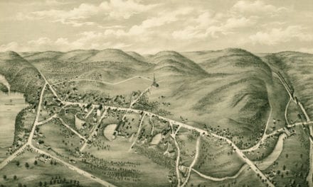
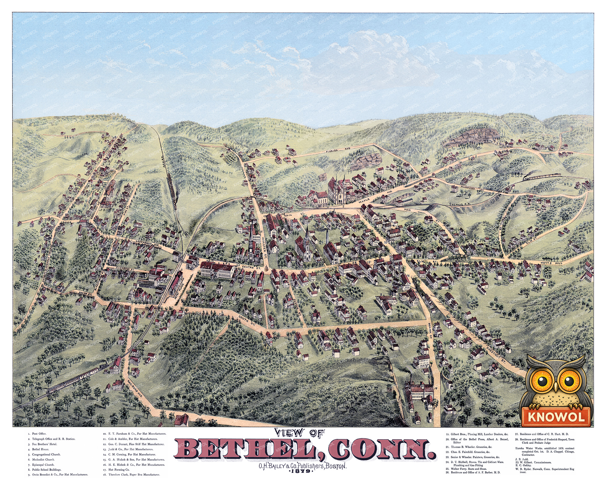
This vintage map of Bethel, Connecticut was created in 1879 by O.H. Bailey, a prominent 19th century map maker. The map shows a bird’s eye view of Bethel as it once was, including street names, railroads, factories, churches, homes, and old landmarks. The map captures Bethel during the height of its 19th century growth, when the town was closely tied to the hat-making industry and the Danbury & Norwalk Railroad.
Historic Bethel landmarks on the map include Bethel House, Fox Brothers’ Hotel, the Telegraph Office and Railroad Station, Danbury & Norwalk Railroad, Congregational Church, Methodist Church, Episcopal Church, Public School Buildings, E.T. Farnham & Co. Fur Hat Manufacturers, Cole & Ambler Fur Hat Manufacturers, Clark Paper Box Manufacturer, Gilbert Bros. Planing Mill, Eureka Water Works, Bethel Press, and many of the streets and neighborhoods that still shape the town today.
This vintage map of Bethel has been lovingly restored and colorized by KNOWOL. Reproductions of the restored map are available here. You can click on the image below to view a large version.
Vintage Map of Bethel, Connecticut 1879
Explore a restored 1879 bird’s-eye view map of Bethel, Connecticut by O.H. Bailey, featuring historic streets, churches, railroads, factories, homes, and landmarks.
At the time this map was drawn, Bethel was a busy New England manufacturing town with deep ties to the hat industry. The Danbury & Norwalk Railroad ran directly through the community, connecting Bethel’s factories, shops, and residents to the surrounding region. Along the streets shown on this map were fur hat manufacturers, planing mills, paper box makers, churches, schools, hotels, doctors’ offices, stores, and the railroad station that helped keep the town moving. The result is a detailed snapshot of Bethel in 1879, showing the town before modern development changed the landscape forever.
This beautiful old map of Bethel makes an attractive addition to your office, library, or den and can even be used to teach children the geography and history of the area. When you’re done exploring, click here to get your copy of the restored map.