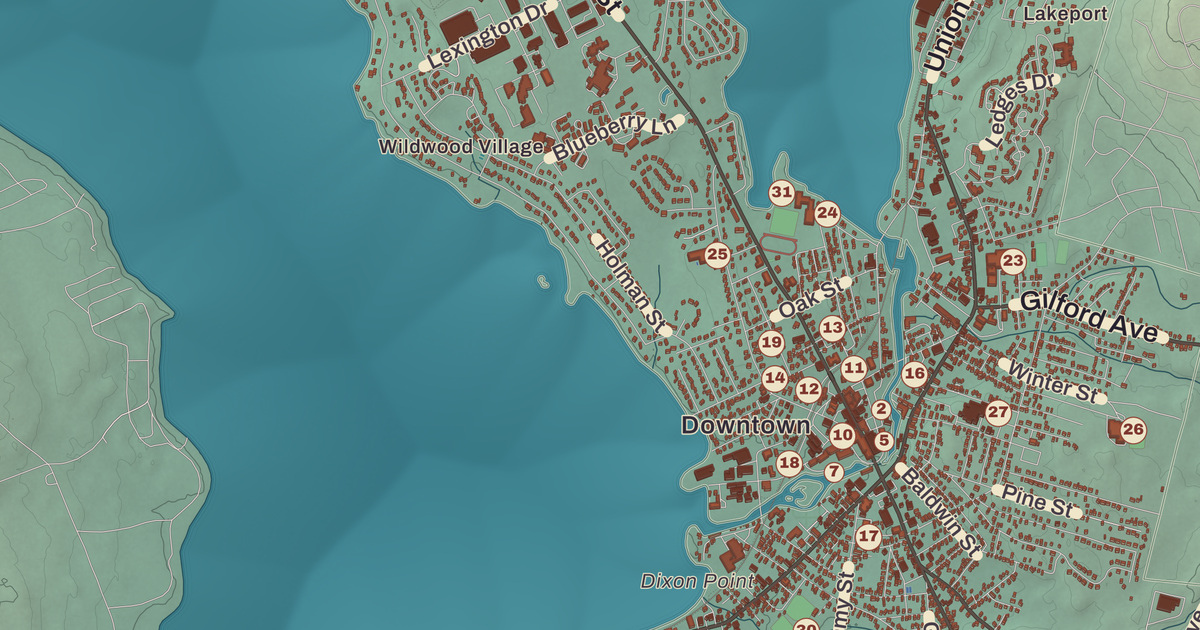
Laconia sits between two big lakes, Winnipesaukee to the northeast and Winnisquam to the southwest, with Paugus Bay and Opechee Bay strung between them and three villages along the water: downtown on the Winnipesaukee River, Lakeport at the dam, and Weirs Beach at the top of the city. This map prints Weirs Beach, Endicott Rock, Funspot, the Belknap Mill, Laconia City Hall and the Colonial Theatre, along with Pendleton Beach, Interlaken Park and Wildwood Village.
Laconia is in Belknap County, and it’s the county seat.
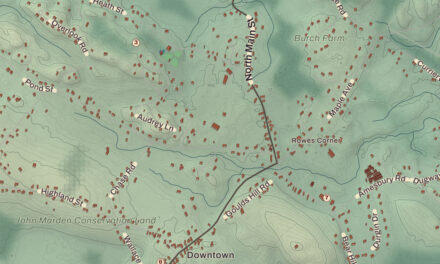
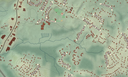
KNOWOL made this map in 2026 from public survey data and gave it the look of an old atlas. The shaded terrain around Pendleton Beach and Weirs Beach comes from United States Geological Survey elevation data; the highest ground is a 960-foot hill in the north of the city, west of Pickerel Cove on Paugus Bay. Nearly a quarter of the city is water. The roads and the city line come from the Census Bureau, right down to Leigh Court. The Veterans’ Association Historic District and the Belknap Mill are on the National Register of Historic Places, and we checked them against National Park Service records. Laconia had 16,871 people at the 2020 census, up from 15,951 in 2010.
See it on a wall
The Laconia map as a framed print. Swipe for more.


Aquadoctan and Meredith Bridge
A large Abenaki settlement called Aquadoctan once stood at the place now called The Weirs, a name colonists gave it for the fishing weirs they found at the outlet of the Winnipesaukee River. About 1652 a surveying party sent by Governor John Endecott of the Massachusetts Bay Colony came here and cut letters into a rock in the lake, among them “IOHN ENDICUT GOV,” believing they had found the head of the Merrimack River. The rock was forgotten until the 19th century, when the Weirs Channel was dredged, and the state built a pavilion over it. Endicott Rock is now a small state park, listed on the National Register in 1980.
Conflict between the English, the French and their Native allies kept settlers away until 1761, and for years afterward this was part of Meredith and Gilford, called Meredith Bridge. Lumber and grist mills went up on Mill Street from 1765, taverns followed on Parade Street, and a courthouse was built about 1822 that became the county seat when Belknap County was formed in 1840. In 1855 Laconia became a town, made from Meredith Bridge, Lakeport, Weirs and part of Gilmanton, and in 1893 it became a city. Its name goes back to the Greek region of Laconia, probably by way of the Laconia Company that Captain John Mason and his partners formed to sell land in colonial times.
The mills on the river
The first mill on this site by the Winnipesaukee River was a wooden one of 1811, and when it burned in 1823 the brick Belknap Mill replaced it; it was reported in full operation by 1828. It made textiles, later hosiery, until 1969, and opened as a museum in 1991. Inside are an intact water power plant and a bell cast by George Holbrook, an apprentice of Paul Revere, and the state’s historical marker calls it the oldest unaltered brick textile mill in the United States. Next door, between the Belknap Mill and Laconia City Hall on Beacon Street East, John W. Busiel’s hosiery mill went up in stages from 1853; it was one of the first to use the new circular knitting machines, and its success helped bring the knitting-needle makers to town. Busiel’s son Charles became mayor of Laconia and governor of New Hampshire. Together, the two mills were responsible for the growth of Meredith Bridge into Laconia.
The city’s largest employer was the Laconia Car Company, which began building railway cars when the railroad reached town in the late 1840s. By 1893 it was turning out 125 passenger cars a year, mostly for New England railways and trolley lines, its electric cars ran as far away as Los Angeles, and by 1912 it had a thousand workers.
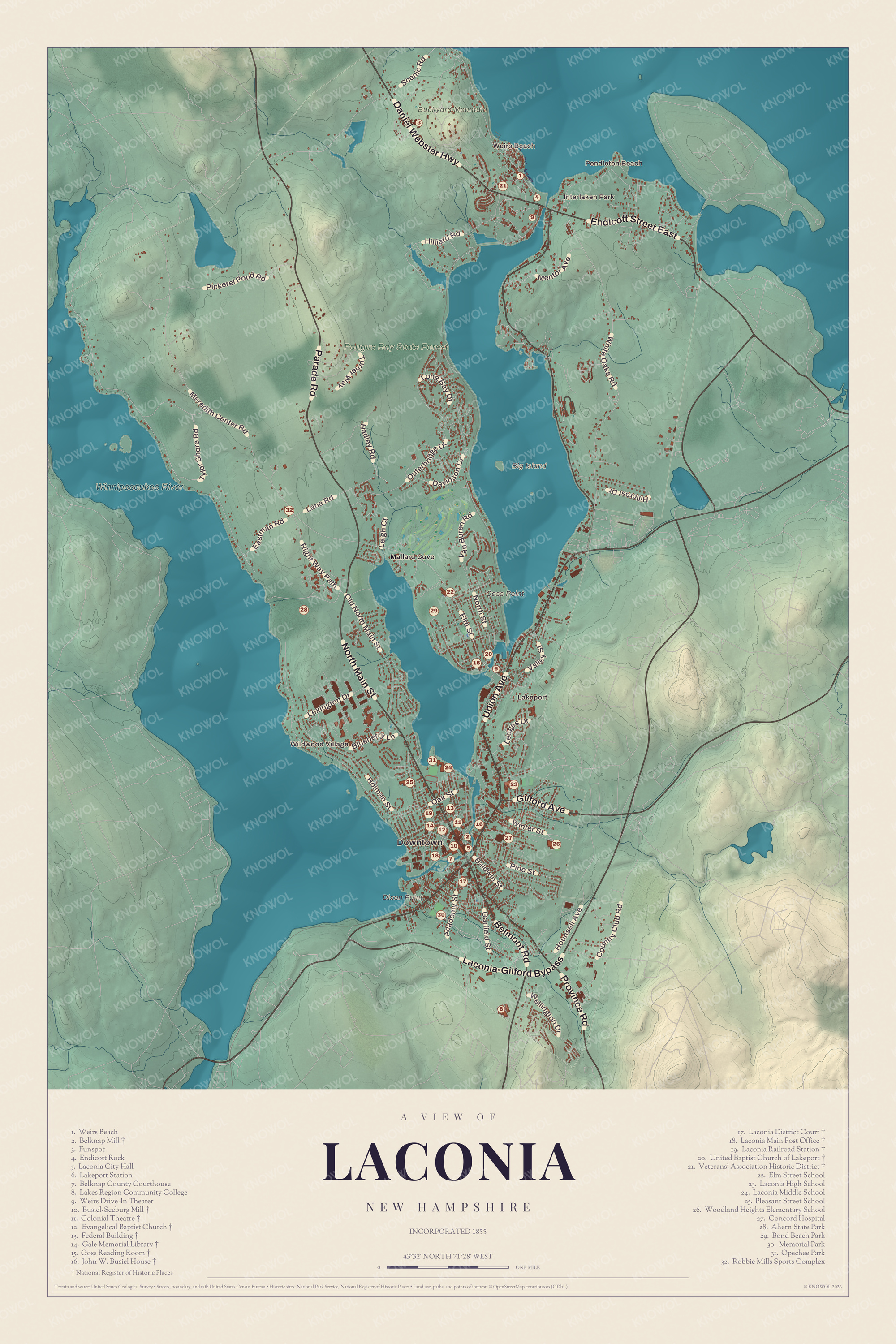
Click to explore a larger preview. The digital watermark does not appear on printed maps.
Names on this map
These names are printed on this map.
Places: Downtown, Pendleton Beach, Weirs Beach, Interlaken Park, Wildwood Village, Lakeport, Big Island, Buckyard Mountain, Cass Point, Dixon Point, Winnipesaukee River, Paugus Bay State Forest, Mallard Cove, Belknap Mill, Funspot, Endicott Rock, Laconia City Hall, Lakeport Station, Belknap County Courthouse, Lakes Region Community College, Weirs Drive-In Theater, Busiel-Seeburg Mill, Colonial Theatre, Evangelical Baptist Church, Federal Building, Gale Memorial Library, Goss Reading Room, John W. Busiel House, Laconia District Court, Laconia Main Post Office, Laconia Railroad Station, United Baptist Church of Lakeport, Veterans' Association Historic District, Elm Street School, Laconia High School, Laconia Middle School, Pleasant Street School, Woodland Heights Elementary School, Concord Hospital, Ahern State Park, Bond Beach Park, Memorial Park, Opechee Park and Robbie Mills Sports Complex.
Streets and roads: Daniel Webster Highway, Parade Road, Union Avenue, North Main Street, Laconia-Gilford Bypass, Endicott Street East, Belmont Road, Province Road, Gilford Avenue, Meredith Center Road, White Oaks Road, Elm Street.
More street names, A to Z
Academy Street, Baldwin Street, Blueberry Lane, Country Club Road, Davidson Drive, Eastman Road, Garfield Street, Hadley Road, Hillcrest Drive, Hilliard Road, Holman Street, Hounsell Avenue, Lane Road, Ledges Drive, Leigh Court, Lexington Drive, Long Bay Drive, Mentor Avenue, North Street, Oak Street, Old North Main Street, Outerbridge Drive, Pickerel Pond Road, Pine Street, Right Way Path, Scenic Road, Turner Way, Tyler Shore Road, Valley Street, Van Buren Road, Wellington Drive, Winter Street.
Downtown
The Colonial Theatre on Main Street was built in 1914, and its big marquee spelling out “COLONIAL” fronts the Piscopo Block, which holds the main entrance. A little north, at Main and Church streets, the Gale Memorial Library was built from 1901 to 1903 with a bequest from Napoleon Bonaparte Gale, a local banker. The Boston architect Charles Brigham designed it in red New Brunswick granite trimmed with white Maine granite, and it’s counted among the most impressive Romanesque buildings in the state.
The Weirs
Weirs Beach, “The Weirs” to locals, takes its name from a wide public sand beach on Lake Winnipesaukee, with a boardwalk along a quarter mile of Lakeside Avenue. The cruise ship Mount Washington makes its summer port there, and the Winnipesaukee Pier, built in 1925, once drew the big bands. The New Hampshire Veterans’ Association, founded in 1875 to bring Civil War veterans together each summer, began holding its reunions at the Weirs the next year, and from the mid-1880s the old regiments built Queen Anne style houses there to lodge their members, on Lakeside Avenue and Veterans Avenue behind it. Its state marker calls it the oldest organization of its kind in the country, and it now welcomes all New Hampshire veterans. Up on Route 3, Funspot began in 1952 when Robert M. Lawton, 21, opened a miniature golf course and penny arcade with $750 borrowed from his grandmother. Guinness World Records named it the largest arcade in the world in 2008.
Every June, Laconia Motorcycle Week runs for nine days. It goes back to June 1916, when a few hundred riders gathered at Weirs Beach, and it’s one of the country’s largest motorcycle rallies. Two Laconia women made their own kind of history. Penny Pitou, as a freshman at Laconia High in 1953, tucked her hair under her hat to make the boys’ ski team, and in 1960 she became the first American to win an Olympic medal in the downhill. Doris Haddock, born in Laconia and known as “Granny D,” walked more than 3,200 miles across the country between the ages of 88 and 90 to call for campaign finance reform.
Lakeport, once called Lake Village, grew around the power dam between Paugus Bay and Opechee Bay, about a mile and a half north of downtown, and in summer the Winnipesaukee Scenic Railroad runs down to its station. Pendleton Beach, Interlaken Park and Wildwood Village are printed on the map as well. Meredith lies to the north, Gilford to the east, Belmont to the south and Sanbornton to the west.
This Laconia map makes a striking addition to an office, library or den, and it can teach children the geography and history of a city built between the lakes. It’s made for anyone who calls Laconia home, from downtown to The Weirs. KNOWOL created it in 2026, and it’s printed on museum quality archival paper. Zoom in on the preview above to explore the details, then click here to get your copy of the Laconia map.

Sources
- Laconia, New Hampshire, Wikipedia
- Endicott Rock, Wikipedia
- Belknap-Sulloway Mill, Wikipedia
- Busiel-Seeburg Mill, Wikipedia
- List of New Hampshire historical markers (126 to 150), Wikipedia
- Laconia Car Company, Wikipedia
- Colonial Theatre Complex, Wikipedia
- Gale Memorial Library, Wikipedia
- Weirs Beach, New Hampshire, Wikipedia
- New Hampshire Veterans’ Association Historic District, Wikipedia
- List of New Hampshire historical markers (151 to 175), Wikipedia
- Funspot, Wikipedia
- Laconia Motorcycle Week, Wikipedia
- Penny Pitou, Wikipedia
- Doris Haddock, Wikipedia
- Lakeport, New Hampshire, Wikipedia