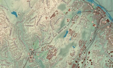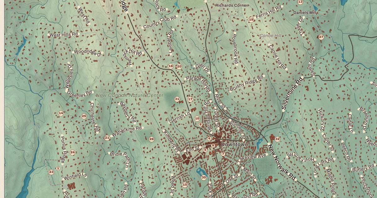
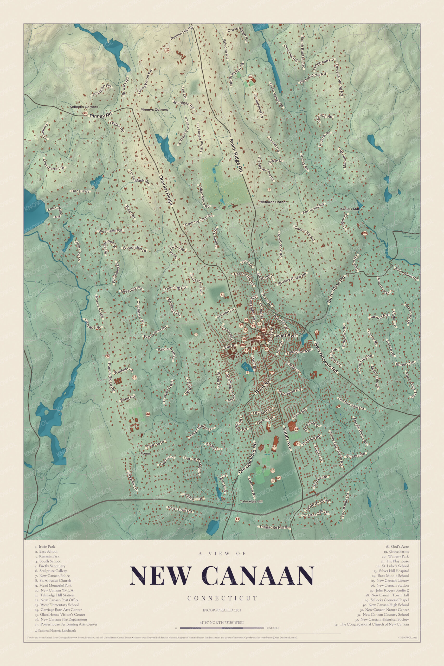
If you grew up in New Canaan, or you’ve ever sung carols on God’s Acre on Christmas Eve, you’ll find your town on this map just as it stands in 2026. Look for your road. West Hills Road, East Avenue, Nursery Road, Michigan Road, Benedict Hill Road, Weed Street, Oenoke Ridge, South Avenue, Ponus Ridge Road and Smith Ridge Road are all printed by name, along with many more.
New Canaan is in Fairfield County, on the New York line, and it’s the only town on the Connecticut Panhandle that doesn’t touch the coast.
KNOWOL made this map in 2026 from public survey data, and gave it the look of an old atlas. The shaded hills, from Waveny Park in the south to the New Canaan Nature Center and the ridges to the north, come from United States Geological Survey elevation data. The streets and the town line come from the Census Bureau, right down to roads like Cherry Street. Talmadge Hill, Pinneys Corners, Sellecks Corners, Richards Corner and Ponus are printed by name. A guide of 34 numbered landmarks runs along the bottom, with the National Historic Landmark marked, and we checked it against National Park Service records.
Canaan Parish
In 1731 the colonial legislature set up Canaan Parish as a church community for the few families scattered through northwestern Norwalk and northeastern Stamford. They could have their own Congregational church, but they still voted, paid taxes and recorded deeds in Norwalk or Stamford. In 1801 the parish was incorporated as the town of New Canaan. That’s the year on the title panel: Incorporated 1801. Because the parish was never planned as a town, it began with no central common, no main street and no town hall.
Until the Revolution New Canaan was a farming town, and afterward shoemaking was its main industry. Instead of one village, small districts of houses, a mill and a school grew up on Ponus Ridge, West Road, Oenoke Ridge, Smith Ridge, Talmadge Hill and Silvermine. The railroad reached New Canaan in 1868, and wealthy New Yorkers came to build summer homes, many of them later staying year-round. In the 1890s an editor of the local paper answered a jibe that New Canaan was the “next station to hell” by calling it the “Next Station to Heaven,” and residents have used the nickname fondly ever since.
Click to explore a larger preview. The digital watermark does not appear on printed maps.
Names on this map
These names are printed on this map.
Places: Waveny Park, Talmadge Hill, New Canaan Nature Center, Canoe Hill, Silvermine, Daniels Mill, East School, Firefly Sanctuary, God's Acre, Irwin Park, Kiwanis Park, Mead Memorial Park, New Canaan High School, New Canaan Historical Society, New Canaan Library, New Canaan Town Hall, New Canaan YMCA, Pinneys Corners, Powerhouse Performing Arts Center, Richards Corner, Rock Lake, Saxe Middle School, Sellecks Corners, Silver Hill Hospital, South School and The Playhouse.
Streets and roads: Pinney Rd, Hill Rd, Colonial Dr, Spring Rd, Wade Rd, Stonleigh Rd, Park St, Mill Rd, Nursery Rd, Tamadge Hill, Talmadge Hill Rd, Norwalk Ave.
More street names, A to Z
Lapham Rd.
God’s Acre and the Center
The cluster of numbers in the middle of the map is the town center. At its north end is God’s Acre (18), where the town gathers to sing carols every Christmas Eve with the New Canaan Town Band, founded in 1831, a tradition more than a century old. The Congregational Church of New Canaan (34) stands beside it, and New Canaan Town Hall (28) and The Playhouse (21) are a short walk south.
Up Oenoke Ridge from God’s Acre is the New Canaan Historical Society (33), founded in 1889 and housed in the town’s first town hall. On its grounds is the John Rogers Studio (27), a little Gothic-Victorian studio built in 1878 for the sculptor John Rogers, called “the people’s sculptor.” Rogers made small plaster groups of everyday life, painted the color of putty to hide the dust, and sold some 80,000 copies of them for middle-class parlors across the country. The studio became a National Historic Landmark in 1965. In 1960, after the Rogers house had been torn down, the historical society saved the studio and moved it about 300 feet south of where it first stood. Its collection is one of the finest collections of Rogers Groups in the nation.
In the center are New Canaan Station (26), at the end of the branch line from Stamford, which opened on July 4, 1868, the New Canaan Library (25) and St. Aloysius Church (8). Mead Memorial Park (9) is just south. The guide also lists the New Canaan Post Office (12), New Canaan Police (7), the New Canaan Fire Department (16) and the Sculpture Gallery (6).
The Glass House and the Harvard Five
From the late 1940s into the 1960s, New Canaan was a center of modern architecture. A group of architects from the Harvard Graduate School of Design, Philip Johnson, Marcel Breuer, Landis Gores, John M. Johansen and Eliot Noyes, known as the Harvard Five, settled here and built houses with new materials and open floor plans. Dozens of modern homes went up in town, and Johnson’s own Glass House on Ponus Ridge Road takes center stage. He built it in 1948 and 1949 as his weekend retreat, and it was named a National Historic Landmark in 1997. It now belongs to the National Trust for Historic Preservation, and its guided tours begin at the Glass House Visitor’s Center (15) on Elm Street in the town center.
Waveny Park and the South
South of the center is Waveny Park (20), 300 acres of fields, ponds and trails around “the castle,” the house Lewis Lapham, one of the founders of Texaco, built in 1912. Frederick Law Olmsted Jr. designed the grounds. The Lapham family gave most of the estate land to the town in 1967 and sold it the house and its 300 acres, and the park was listed on the National Register in 2019. New Canaan High School (30) was built on part of the property, and the Carriage Barn Arts Center (14) and Powerhouse Performing Arts Center (17) are close by.
Just south of the Merritt Parkway is Talmadge Hill Station (11), the town’s other stop on the New Canaan branch. Saxe Middle School (24), South School (4), the New Canaan YMCA (10) and Kiwanis Park (3) are south of the center, and East School (2) is to the east.
The Ridges to the North and West
North of the center, on Oenoke Ridge, is the New Canaan Nature Center (31), 40 acres of meadows, ponds, woods, an old orchard and a cattail marsh, with a wildflower garden of mostly native plants and a Fall Fair every October. Irwin Park (1) is west of the center, and West Elementary School (13) and New Canaan Country School (32) are farther west.
Up in the north is Grace Farms (19), an 80-acre cultural and humanitarian center, whose long, curving River building, designed by the Japanese firm SANAA, opened in 2015. St. Luke’s School (22), founded in 1928, is close by, and the Firefly Sanctuary (5) is to the south of them. Silver Hill Hospital (23), founded in 1931, is in the northeast in the Silvermine River valley, and Sellecks Corners Chapel (29) is in the far north.
This map of New Canaan makes a handsome addition to a living room, office, library or den, and it can even help teach children the geography and history of the town. It’s a thoughtful gift for anyone who calls New Canaan home, grew up here, or moved away. Created by KNOWOL in 2026, it’s printed on museum quality archival paper in three sizes. Zoom in on the preview above to explore the details, then click here to get your copy of the New Canaan map.

Sources
- New Canaan, ConnecticutHistory.org
- New Canaan, Connecticut, Wikipedia
- John Rogers Studio, Wikipedia
- John Rogers Studio, National Register nomination, National Park Service
- John Rogers (sculptor), Wikipedia
- New Canaan station, Wikipedia
- Harvard Five, Wikipedia
- Glass House, Wikipedia
- Waveny Park, Wikipedia
- Talmadge Hill station, Wikipedia
- New Canaan Nature Center, Wikipedia
- Grace Farms, Wikipedia
- St. Luke’s School, Wikipedia
- Silver Hill Hospital, Wikipedia