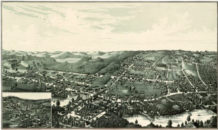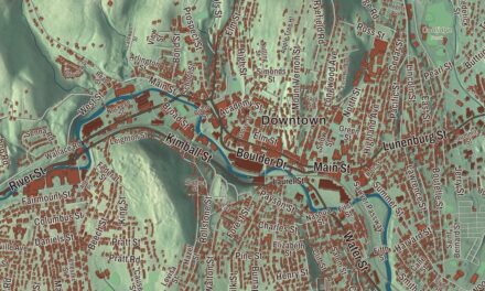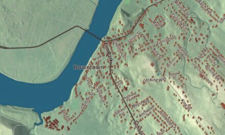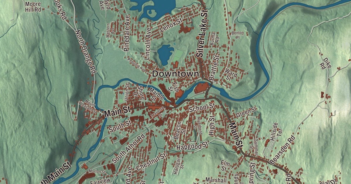
If you grew up in Athol, you know Uptown up on its hill above the old factories, and you’ve probably stood on the bank of the Millers River on an April morning to watch the canoes go by. This map prints Main Street, South Main Street, Silver Lake Street, Petersham Road, Templeton Road and West Royalston Road, along with Silver Lake, Tully Lake, the Bates Powers Reservoir, Davenport Pond, Sportsmans Pond, Baldwin Hill, Chestnut Hill and Cobb Hill. Click here to purchase a print of this map for your wall.
Athol is in Worcester County, along its western edge where Franklin County begins.
KNOWOL made this map in 2026 from public survey data and gave it the look of an old atlas. The shaded hills come from United States Geological Survey elevation data, and the roads and the town line come from the Census Bureau. The land runs from about 500 feet above sea level at the edge of the Millers River to 1,282 feet at the top of Pratt Hill near Bearsden Forest, and most of the town’s 11,945 people (2020 census) live close to the downtown.
From Pequoiag to Athol
Native people called this place Pequoiag. The Millers River page notes that the name Paquoag belongs to the site of Athol itself, and it gives Pakwaik, “arrows place,” for the arrowwood that grew here and was used for arrow shafts, a meaning Grand Chief Henry Lorne Masta confirmed in 1932. Five families settled in September 1735, the same year the Secretary of the Commonwealth’s list of settlement dates gives for the start of European settlement. When the township was incorporated in 1762, it took the name Athol, picked by John Murray, one of the proprietors. The name was believed to mean “New Ireland,” though some historians, James E. Fraser among them, dispute that. The town remains part of Worcester County today.
Water power and precision tools
The early families farmed and hunted, and by 1791 water power ran four gristmills, six sawmills, a fulling mill and a shop with a trip hammer. The Athol Cotton Factory, built in 1811, was one of the first industries here to sell to a market beyond the local one, and textile, leather, wood and metal shops followed through the 1800s. The town page says the Vermont and Massachusetts Railroad, built in the 1840s, gave that growth a big push and prompted a second line to Springfield in 1870. The Fitchburg Railroad came through in 1879 on its way to the Hoosac Tunnel and the Berkshires, and the old depot still stands downtown beside the freight main.
Athol’s nickname came from its tool makers. The Athol Machine Company was set up in 1868 to make a chopping machine he had invented, and his company’s history says he patented the first combination square in 1878. He then founded the L. S. Starrett Company in Athol to make it and other precision tools; the company page gives 1880 and the town page 1881. Starrett and Union Twist Drill, drawn by water power and rail service, made Athol “Tool Town.” Starrett is still the town’s largest employer, and the L.S. Starrett Tool Museum at the company office shows machine tools of the past, by appointment. As the mills grew along the river, shops and the first bank went up on the hill southeast of the factories, the part of town now called Uptown, and from 1894 trolleys ran from Athol to Orange.
Born in Athol
Lysander Spooner was born on a farm here in 1808. He became an abolitionist lawyer and writer, the author of The Unconstitutionality of Slavery, and in 1844 he started the American Letter Mail Company to compete with the Post Office and its high rates. Ellen Cheney Johnson, born here in 1829, the daughter of a mill agent, led the fight for a separate prison for women: she and her allies gathered over 7,000 signatures, the bill passed in 1874, and she later ran the Massachusetts Reformatory Prison for Women for fifteen years, earning a bronze medal at the World’s Columbian Exposition. Ginery Twichell, born here in 1811, left school in 1827 for a job in a local mill, ran a stage line between Barre and Worcester from 1830, and went on to lead the Boston and Worcester Railroad and the Atchison, Topeka and Santa Fe Railway. At home, the Athol Public Library opened in 1882 with 1,063 books and $300 and was rebuilt in 1918 with private gifts, and the Athol Historical Society keeps a museum in the old town hall uptown.
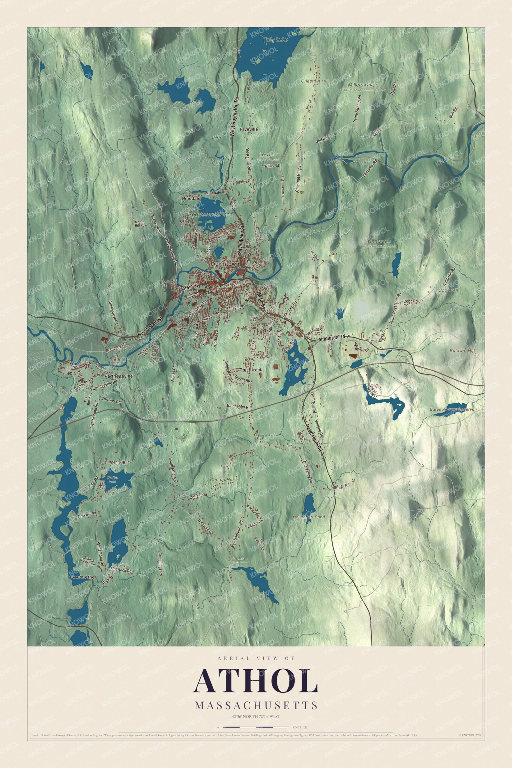
Click to explore a larger preview. The digital watermark does not appear on printed maps.
Names on this map
These names are printed on this map.
Places: Downtown, South Athol, Baldwin Hill, Chestnut Hill, Cobb Hill, Conant Hill, Bates Powers Reservoir, Davenport Pond, Tully Lake, Sportsmans Pond, Bearsden Conservation Area, Lawton State Forest, Millers River Wildlife Management Area, Petersham State Forest, White Pond, Fryeville, Partridgeville, Pinedale and The Street.
Streets and roads: West Royalston Road, South Main Street, Silver Lake Street, Petersham Road, Main Street, Templeton Road, North Orange Road, Brattle Street, Chestnut Street, Chestnut Hill Avenue, Partridgeville Road, South Athol Road.
More street names, A to Z
Adams Drive, Adams Road, Barnes Road, Batchelder Road, Beach Street, Beacon Street, Bearsden Road, Benton Place, Bigelow Road, Branch Bridge Road, Brickyard Road, Briggs Road, Brookside Road, Brooks Road, Burma Road, Byrd Avenue, Carpenter Road, Chase Road, Cobb Hill Road, Cobb Road, Colonial Drive, Conant Road, Cottage Street, Cummings Road, Daniel Shays Highway, Dike Road, Doe Valley Road, Dorset Road, Dyer Road, Earl Drive, Elm Street, Fairview Avenue, Fielding Way, Fish Street, Flat Rock Road, Forest Avenue, Fox Run Road, Garfield Road, Glendale Avenue, Green Street, Gulf Road, Hapgood Street, Harugari Street, Harvard Avenue, High Street, Hillside Terrace, Hill Street, Jeanne Drive, Jeri Drive, King Road, Lake Ellis Road, Lenox Street, Lincoln Avenue, Lindsay Lane, Lyons Hill Road, Marble Street, Market Drive, Marshall Street, Millers River Drive, Moore Hill Road, Morton Street, Mount Pleasant Street, New Sherborn Road, Northern Avenue, Old Keene Road, Orchard Street, Paine Swamp Road, Pequoig Avenue, Perry Road, Pheasant Lane, Philip Road, Pinedale Avenue, Pinedale Road, Pleasant Street, Rice Street, Riceville Road, Ridge Road, Riverbend Street, Riverview Avenue, Sanders Street, School Street, Secret Lake Road, Shore Drive, Simonds Street, South Royalston Road, South Street, Spring Street, Stockwell Road, Summer Street, Thrower Road, Tom Swamp Road, Townsend Road, Traverse Street, Union Street, Vaughn Road, Victoria Avenue, Vine Street, Ward Street, Western Avenue, White Pond Road, Willis Road.
A walk around the map
Start at the water. Parts of Tully Lake lie in Athol; its page describes the lake as a 1,262-acre reservoir and flood control project that the Army Corps of Engineers built in 1949, and the 22-mile Tully Trail runs along its northern shore. Closer to the center, the town owns Silver Lake, Fish Park and Lake Ellis, where people swim, skate and play ball, and the Silver Lake Wiffleball League plays at Silver Lake Park on Tuesday and Thursday nights from April to September. The River Rat Race covers 6 miles of the Millers River, from Cass Meadow in Athol to Hachey’s Landing in Orange, with a parade in the morning and thousands of people along the banks. Down in South Athol, Goodwill Industries of Boston runs its Fresh Air Camps. The Bates Powers Reservoir, Davenport Pond, Sportsmans Pond, Baldwin Hill, Chestnut Hill and Cobb Hill are printed on the map as well. Then follow Main Street, South Main Street, Silver Lake Street, Petersham Road, Templeton Road and West Royalston Road out toward Fryeville, Partridgeville, Pinedale and The Street.
This Athol map makes a fine addition to an office, library or den, and it can help teach children the geography and history of the town where Lysander Spooner and Ellen Cheney Johnson were born. It’s made for people who call Athol home, from Uptown to South Athol, and it shows the town as it looks today. Zoom in on the preview above to explore the details, then click here to get your copy of the Athol, Massachusetts map.

We made a map for every town and city in Massachusetts. Explore the complete Massachusetts map collection and find your town.
Sources
- Athol, Massachusetts, Wikipedia
- Millers River, Wikipedia
- L. S. Starrett Company, Wikipedia
- Tully Lake, Wikipedia
- Lysander Spooner, Wikipedia
- Ellen Cheney Johnson, Wikipedia
- Ginery Twichell, Wikipedia
- City and Town Incorporation and Settlement Dates, Secretary of the Commonwealth of Massachusetts (archived copy)