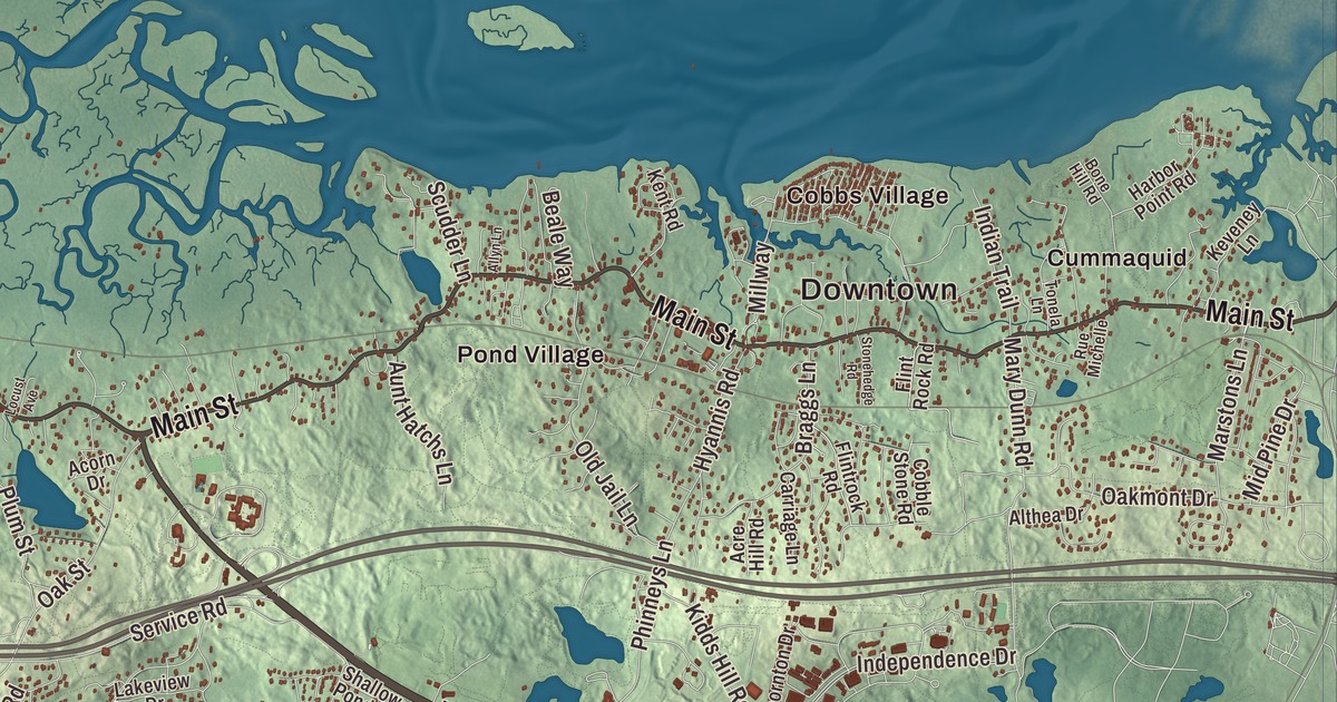
Barnstable is a town of villages, and if you’re from here you probably say Centerville, Cotuit or Hyannis before you ever say Barnstable. This map prints Iyannough Road, Falmouth Road, Main Street, Cotuit Road, Cranberry Highway and Prospect Street, with Wequaquet Lake, Santuit Pond, Amos Pond, Aunt Bettys Pond, Baxter Neck and Beach Point. Click here to purchase a print of this map for your wall.
Barnstable is the county seat of Barnstable County, about halfway along the arm of Cape Cod.
KNOWOL made this map in 2026 from public survey data, finished with the look of an old atlas. The relief comes from United States Geological Survey elevation data, and the roads and the town line come from the Census Bureau. Barnstable reaches from Cape Cod Bay on the north to Nantucket Sound on the south, and it’s the largest community on the Cape in both land area and population, with 48,916 people at the 2020 census. More than a fifth of its 76.3 square miles is water.
Iyannough’s country
Before the English came, this was the land of the Mattakeese, a Wampanoag group whose sachem, Iyannough, led them from Cummaquid. In 1621, when a boy from the Plymouth colony wandered off and was lost, Iyannough helped find him and welcomed the searchers to a meal, and the Pilgrims’ own account remembered him as gentle and courteous. The village of Hyannis, the Wianno section of Osterville and Iyannough Road, Route 132, are all named for him, and his statue stands on the Hyannis village green. Bartholomew Gosnold was the first European to explore the area, in 1602.
The founding dates depend on the source. The Town of Barnstable’s recorded history, in the Secretary of the Commonwealth’s list, dates European settlement to 1637, and that list says Barnstable was incorporated as a town in 1638. The town page says it was settled in 1638, one of the first towns of the Plymouth Colony, and incorporated on September 4, 1639, the same day as Sandwich and Yarmouth. The Reverend Joseph Hull’s page says he and Thomas Dimmock led the first colonists to Mattakeese in May 1639 and named the town for Barnstaple, in Devon, England. That October the Reverend John Lothrop arrived with families from Scituate, and in December a service of thanksgiving and a feast were held at Hull’s house; the rock Hull preached from still stands along the highway. The house built for Lothrop in 1644 is now part of the Sturgis Library, organized in 1863, which its page calls the oldest building housing a public library in the United States. The town remains part of Barnstable County today, and the state’s list counts it among the communities with a city form of government that still call themselves towns.
The Otis family and the summer people
Two voices of the Revolution grew up here. James Otis Jr., born in West Barnstable in 1725, fought the writs of assistance that let officials search homes without cause, and he’s often credited with the slogan “taxation without representation is tyranny.” His sister, Mercy Otis Warren, born in 1728 while the family lived in Barnstable, wrote poems and plays against royal rule and in 1805 published one of the earliest histories of the American Revolution. Farming, fishing and salt works carried the town at first, and by the end of the 19th century some 804 ships were harbored here. The railroad arrived in 1854, and by the late 1800s summer visitors were coming, among them presidents Ulysses S. Grant and Grover Cleveland. The Kennedy family made Hyannis Port its summer home, and the Kennedy Compound there was President John F. Kennedy’s summer home during his administration.
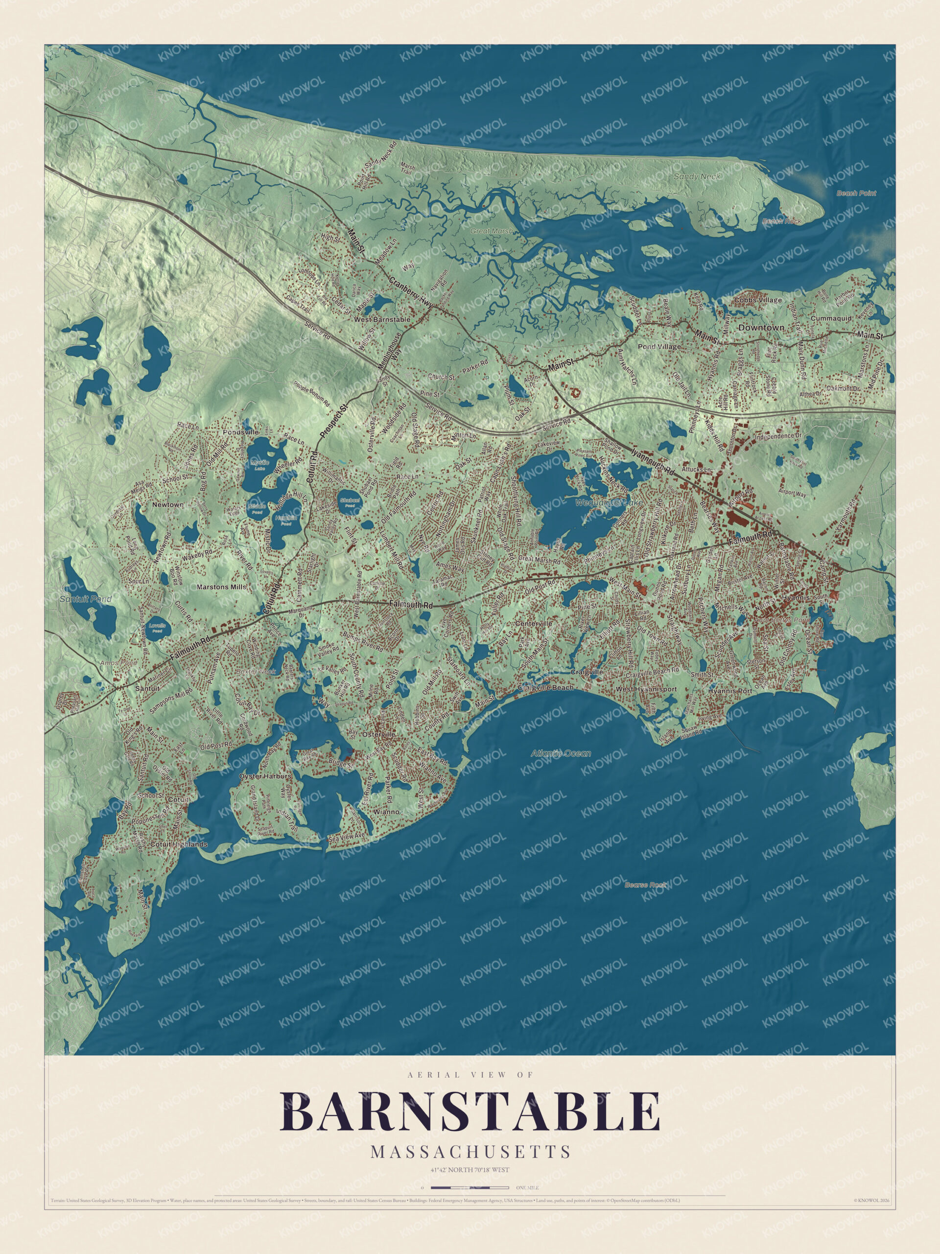
Click to explore a larger preview. The digital watermark does not appear on printed maps.
Names on this map
These names are printed on this map.
Places: Downtown, Baxter Neck, Beach Point, Bearse Rock, Bench Rock, Amos Pond, Aunt Bettys Pond, Wequaquet Lake, Santuit Pond, Atlantic Ocean, Cr #32, Great Marsh, Hamblin Pond, Lovells Pond, Middle Pond, Mystic Lake, Sandy Neck, Shubael Pond, Centerville, Cobbs Village, Cotuit, Cotuit Highlands, Craigville, Craigville Beach, Cummaquid, Hyannis, Hyannis Port, Marstons Mills, Newtown, Osterville, Oyster Harbors, Pond Village, Pondsville, Santuit, West Barnstable, West Hyannisport and Wianno.
Streets and roads: Falmouth Road, Iyannough Road, Main Street, Cranberry Highway, Cotuit Road, Prospect Street, West Main Street, South County Road, Scudder Avenue, Pine Street, Barnstable Road, Parker Road.
More street names, A to Z
Abbey Gate Road, Acorn Drive, Acre Hill Road, Airport Access Road, Airport Road, Airport Way, Allan Road, Allyn Lane, Althea Drive, Ames Way, Annable Point Road, Arrowhead Drive, Asa Meigs Road, Attucks Lane, Audreys Lane, Aunt Hatchs Lane, Bacon Road, Baird Way, Bates Street, Baxters Neck Road, Bay Lane, Bay Road, Bay Shore Road, Bay Street, Beale Way, Bearses Way, Berry Hollow Drive, Beth Lane, Blackthorn Road, Bog Road, Bone Hill Road, Braggs Lane, Bridge Street, Bridle Path, Bristol Avenue, Brittany Drive, Bumps River Road, Bunker Hill Road, Cammett Road, Camp Street, Capes Trail, Capn Lijah's Road, Captain Ellis Lane, Cardinal Lane, Carlisle Drive, Carriage Lane, Carriage Road, Cedar Street, Cedric Road, Center Street, Chase Street, Childs Street, Church Street, Clamshell Cove Road, Clifton Lane, Coachman Lane, Cobble Stone Road, Conners Road, Cordwood Road, Cotuit Bay Drive, County Road, Craigville Beach Road, Curtis Road, Danvers Way, Darica Way, Dumont Drive, Dunns Pond Road, East Bay Road, East Lane, Eel River Road, Elliott Road, Estey Avenue, Field Road, Fifth Avenue, Five Corners Road, Flint Rock Road, Flintrock Road, Flint Street, Flume Avenue, Franklin Avenue, Fuller Road, Garden Lane, Garrison Lane, Grand Island Drive, Great Bay Road, Great Marsh Road, Greenwood Avenue, Gunstock Road, Harbor Point Road, Hayes Road, Highland Drive, High Street, Hollidge Hill Lane, Holly Hill Road, Huckins Neck Road, Hyannis Road, Ice Valley Road, Independence Drive, Indian Trail, Irving Avenue, Island Avenue, James Otis Road, Jones Road, Kent Road, Kettle Hole Road, Keveney Lane, Kidds Hill Road, Kilkore Drive, Lakeside Drive, Lakeview Drive, Liam Lane, Lillian Road, Linden Lane, Links Lane, Little River Road, Locust Avenue, Long Pond Road, Longview Drive, Lothrops Lane, Lovell's Lane, Lumbert Mill Road, Maple Street, Marchants Mill Way, Mariner Circle, Marquand Drive, Marsh Trail, Marstons Lane, Mary Dunn Road, May Lane, Meadow Lane, Meetinghouse Way, Megan Road, Mid Pine Drive, Millway, Milne Road, Minton Lane, Mistic Drive, Mitchells Way, Navigation Road, Newtown Road, North Bay Road, North Street, Nottingham Drive, Nye Road, Nyes Neck Road, Oakland Road, Oakmont Drive, Oak Street, Ocean Avenue, Ocean Street, Old Colony Road, Old Falmouth Road, Old Jail Lane, Old King's Road, Old Mill Road, Old Oyster Road, Old Post Road, Old Shore Road, Old Stage Road, Old Strawberry Hill Road, Old Toll Road, Old Town Road, Osprey Drive, Osterville Road, Oyster Way, Packet Landing Way, Park Avenue, Patriot Way, Pheasant Hill Circle, Phinneys Lane, Pine Lane, Pineleigh Path, Pitchers Way, Pleasant Pines Avenue, Plum Street, Point Hill Road, Pond Street, Poponessett Road, Popple Bottom Road, Prince Avenue, Putnam Avenue, Race Lane, Regency Drive, River Road, River View Lane, Robbins Street, Rosa Lane, Rue Michelle, Rushy Marsh Road, Sampsons Mill Road, Sandy Neck Road, Sandy Street, Sandy Valley Road, Santuit-Newtown Road, Santuit Road, Sawmill Road, School Street, Scudder Lane, Scudder Road, Seapuit River Road, Seapuit Road, Sea Street, Sea View Avenue, Service Road, Settlers Lane, Shallow Pond Drive, Shell Lane, Shootflying Hill Road, Shubael Pond Road, Skunknet Road, Smith Street, Smoke Valley Road, South Flint Rock Road, South Main Street, South Street, Spring Street, Spur Lane, Starboard Lane, Starlight Drive, Statice Lane, Stetson Street, Stonehedge Road, Stoney Cliff Road, Straightway, Strawberry Hill Road, Sudbury Lane, Swift Avenue, Taramac Road, Thankful Lane, Thornton Drive, Tobey Way, Tonela Lane, Tracy Road, Tupelo Road, Ty-Dee Lane, Vineyard Road, Wakeby Road, Walnut Street, Walton Avenue, Waquoit Road, Washington Avenue, Waters Edge, Way, West Barnstable Road, West Bay Road, West Street, Wheeler Road, White Oak Trail, Wianno Avenue, Willimantic Drive, Willow Street, Winding Cove Road, Winslow Boo Road, Winter Street, Woodland Avenue, Woodside Road, Yarmouth Road.
Village by village
Start in Centerville, on the town’s south side, first named Chequaquet, “pleasant harbor.” It has its own library, the Centerville Historic District and a historical museum, and it takes in Craigville and Craigville Beach. The composer Amy Beach often spent her summers in Centerville in the 1920s and 1930s. Wequaquet Lake, northwest of Hyannis, covers 654 acres and is also called Chequaquet Lake, Great Pond or Nine Mile Pond; it drains south by the Centerville River, and sea-run alewives and herring come up that river into the lake. To the west, Cotuit, “place of the council,” sits on a peninsula between the Santuit River and Osterville. In 1648 Paupmunnuck and his brother agreed to a sale to Myles Standish of about twenty square miles in what is now southwestern Barnstable, and the price was finally set at one great brass kettle and one broad hoe; the village’s Kettle-Ho restaurant is named for the story. Sampson’s Folly, built around 1793, earned its name for being so grand, with a ballroom upstairs, and the Cotuit Historic District joined the National Register of Historic Places in 1987. The Cotuit Oyster Company dates to 1837, and its page calls Cotuit oysters the oldest brand name of oyster in the United States. Santuit, the village’s northwestern corner, counts as the westernmost village in the town of Barnstable.
On the north shore, the long dunes of Sandy Neck shelter Barnstable Harbor, with shell middens that go back to the Woodland period. Amos Pond, Aunt Bettys Pond, Baxter Neck and Beach Point are printed on the map too. Then follow Iyannough Road, Falmouth Road, Main Street, Cotuit Road, Cranberry Highway and Prospect Street out toward Cobbs Village and Cotuit Highlands.
This Barnstable map makes a handsome addition to an office, library or den, and it can help teach children the geography and history of the town where James Otis and Mercy Otis Warren grew up. It’s made for people who call Barnstable home, from Centerville to Cotuit, and it shows the town as it looks today. Zoom in on the preview above to explore the details, then click here to get your copy of the Barnstable, Massachusetts map.

We made a map for every town and city in Massachusetts. Explore the complete Massachusetts map collection and find your town.
Sources
- Barnstable, Massachusetts, Wikipedia
- Iyannough, Wikipedia
- Joseph Hull, Wikipedia
- Sturgis Library, Wikipedia
- James Otis Jr., Wikipedia
- Mercy Otis Warren, Wikipedia
- Hyannis Port, Massachusetts, Wikipedia
- Centerville, Massachusetts, Wikipedia
- Wequaquet Lake, Wikipedia
- Cotuit, Massachusetts, Wikipedia
- Sandy Neck Cultural Resources District, Wikipedia
- City and Town Incorporation and Settlement Dates, Secretary of the Commonwealth of Massachusetts (archived copy)