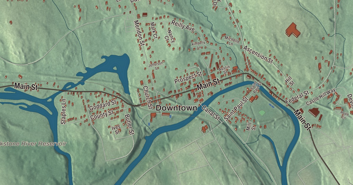
Ask where someone lives in Blackstone and the answer may be a village with an old name: Millerville, Waterford, Wheelockville, Farnum’s Gate, Privilege, New City and East Blackstone. This map prints Main Street, Mendon Street, Blackstone Street, Canal Street, Farm Street and Gaskill Street, with Harris Pond, Briggs Pond, Walsh Pond, the Mill River and Candlewood Hill. Click here to purchase a print of this map for your wall.
Blackstone is in Worcester County, on the Rhode Island line, and part of the Providence metropolitan area.
KNOWOL made this map in 2026 from public survey data and gave it the look of an old atlas. The relief comes from United States Geological Survey elevation data, and the roads and the town line come from the Census Bureau. Blackstone covers 11.2 square miles. Woonsocket and North Smithfield, Rhode Island, lie to the south, Millville to the west, Mendon to the north and Bellingham to the east, and the town had 9,208 people at the 2020 census.
Out of Mendon
The Nipmuc people lived here first. The Town of Blackstone’s recorded history, in the Secretary of the Commonwealth’s list, dates European settlement to 1662, and the town page agrees. The land was part of Mendon until Blackstone was incorporated as a town in 1845, and the town remains part of Worcester County today. It was larger at first: in 1916 its western part was split off as the town of Millville.
The man the river is named for
The town, like the river on its southern edge, carries the name of William Blaxton, also spelled Blackstone, an English clergyman who came to New England in 1623. By 1625 he was living alone at the western end of the Shawmut Peninsula, the first colonist to settle where Boston now stands. In 1630 he invited the Puritans across the river from Charlestown to share his land, and in 1634 he sold most of it back to them; it became the bulk of Boston Common. In 1635 he moved about 35 miles south to the river the Native people called the Pawtucket, in what is now Cumberland, Rhode Island, becoming the first European settler there a year before Roger Williams founded Providence. At his home, Study Hill, he was said to keep the largest library in the colonies, and he raised cattle, planted an orchard and grew the first variety of American apple, the Yellow Sweeting.
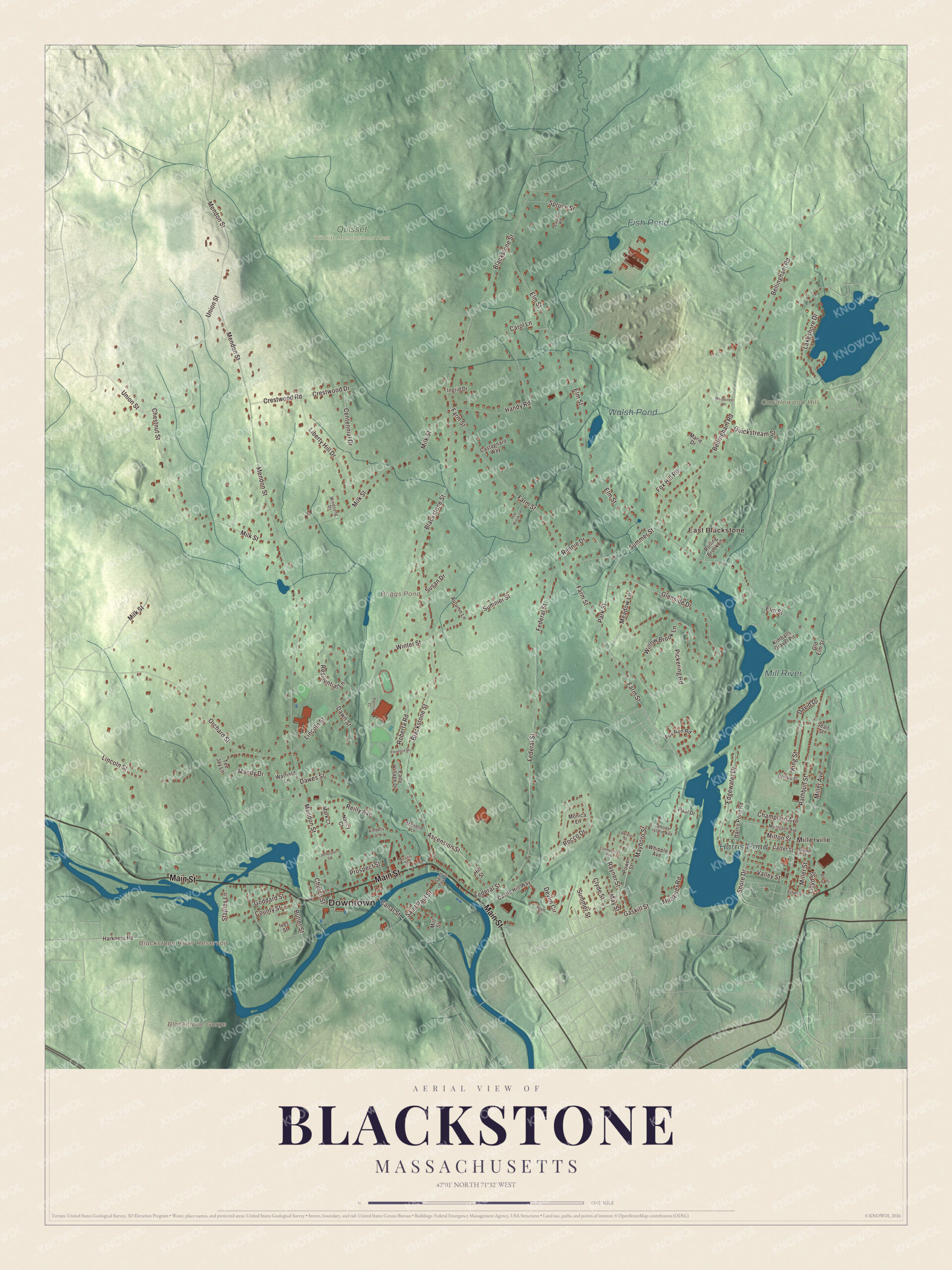
Click to explore a larger preview. The digital watermark does not appear on printed maps.
Names on this map
These names are printed on this map.
Places: Downtown, Millerville, East Blackstone, Blackstone Gorge, Candlewood Hill, Blackstone River Reservoir, Briggs Pond, Harris Pond, Walsh Pond, Mill River, Fish Pond and Quisset Wildlife Management Area.
Streets and roads: Main Street, Gaskill Street, Farm Street, Blackstone Street, Canal Street, Mendon Street, Elm Street, Milk Street, Bellingham Road, Federal Street, Lincoln Street, Summer Street.
More street names, A to Z
Ascension Street, Auclair Street, Austin Street, Autumn Lane, Butler Street, Carol Lane, Carter Street, Castagnaro Way, Castle Hill Way, Centennial Drive, Champlain Avenue, Chestnut Street, Church Street, Clyde Street, Connecticut Avenue, County Street, Crestwood Drive, Crestwood Road, David Drive, Dawes Street, Dawn Street, Devlin Circle, Diana Street, Dollard Street, Early Village Drive, Edgewater Drive, Ethel Street, Florence Drive, Fox Hill Road, Fox Run Road, Glenside Drive, Goddard Street, Handy Road, Harkness Road, Harris Pond Road, Hill Street, Hop Brook Lane, Hoyle Circle, Ingrid Drive, Ives Street, Jean Street, Jefferson Street, Kimballs Gravel Pit, Kimberly Lane, King Street, Lakeshore Drive, Laurel Road, Lewiston Street, Liberty Hill Drive, Lloyd Street, Mandy Drive, Marie Drive, Mark Court, Mayboro Street, May Street, Meadow Lane, Michelle Lane, Miller Avenue, Miller Street, Mill River Road, Mill Street, Milton Street, Monica Lane, Montcalm Avenue, Nancy Court, Old Elm Street, Orchard Street, Park Street, Patricia Court, Paul Drive, Pickering Road, Power Street, Prospect Street, Quickstream Street, Rathbun Street, Rayner Street, Reilly Avenue, Rennie Drive, Residential Lane, Rhode Island Avenue, Roberta Road, Rocco Drive, Rolling Brook Lane, Saint Paul Street, Shore Drive, Spruce Street, Staples Lane, Susan Drive, Tee Jay Lane, Union Street, Valley Street, Warfield Lane, Whipple Avenue, Willow Brook Lane, Windsong Drive, Winter Street, Woodcrest Lane.
On the Blackstone River
The Blackstone River meanders from west to southeast along the town’s southern border on its 48-mile run from Worcester to Pawtucket. The town page calls it the birthplace of the Industrial Revolution in the United States. Samuel Slater opened the first successful water-powered cotton mill in America on it at Pawtucket Falls in 1790, and many more mills followed along its banks. The Blackstone Canal, opened in 1828, ran 45 miles beside and in the river between Worcester and Providence, until a parallel railroad took its business and it closed in 1848; neighboring Millville still has one of its locks. Congress created the Blackstone River Valley National Heritage Corridor in 1986 to preserve and interpret the valley’s history across 25 cities and towns in Massachusetts and Rhode Island, and Blackstone lies within it.
Around the map
Start in Millerville, then follow Main Street, Gaskill Street, Farm Street, Blackstone Street, Canal Street and Mendon Street across town, and look outward toward East Blackstone. Other named places in town include Blackstone Village, Central Village, Five Corners, High Rocks, the Rural District and Woonsocket Junction, a junction on the New York and New England Railroad. The East Blackstone railroad station itself stood in Bellingham. Briggs Pond, Harris Pond, Walsh Pond, the Mill River, Candlewood Hill and the Blackstone River Reservoir are all printed on the map.
Blackstone’s map makes a fine addition to an office, library or den, and it can help teach children the geography and history of the town on the river that started America’s mills. It’s made for people who call Blackstone home, from Millerville to East Blackstone, and it shows the town as it looks today. Zoom in on the preview above to explore the details, then click here to get your copy of the Blackstone, Massachusetts map.

We made a map for every town and city in Massachusetts. Explore the complete Massachusetts map collection and find your town.
Sources
- Blackstone, Massachusetts, Wikipedia
- Millville, Massachusetts, Wikipedia
- William Blaxton, Wikipedia
- Blackstone River, Wikipedia
- Blackstone Canal, Wikipedia
- Blackstone River Valley National Heritage Corridor, Wikipedia
- City and Town Incorporation and Settlement Dates, Secretary of the Commonwealth of Massachusetts (archived copy)