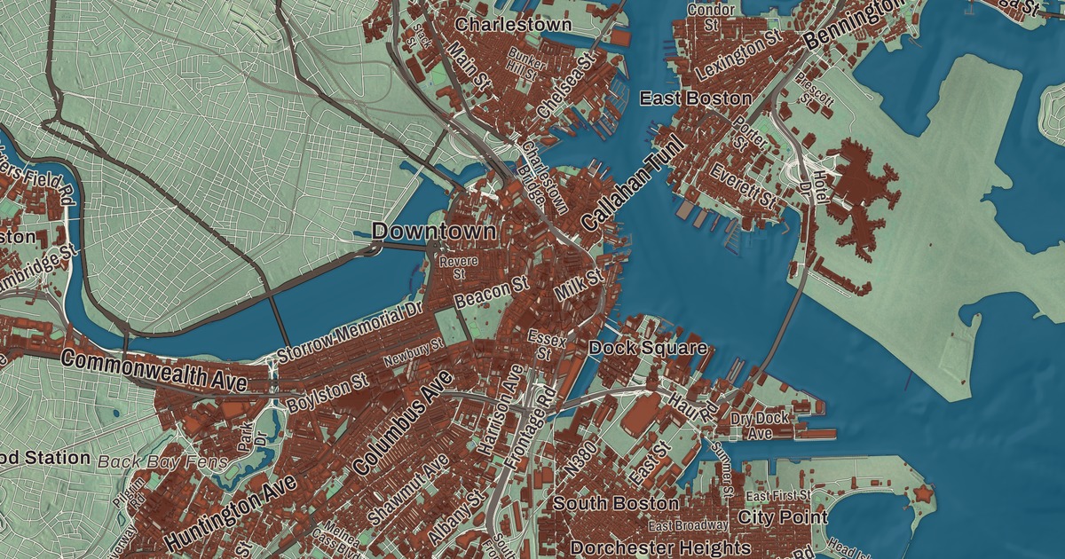
Boston is sometimes called a city of neighborhoods, and this map reaches from Aberdeen and Brighton in the northwest to Ashmont near the Milton line. It prints the long avenues that tie them together, Commonwealth Avenue, Huntington Avenue, Columbus Avenue and Blue Hill Avenue, along with Morton Street and Gallivan Boulevard, the Back Bay Fens, Academy Hill and the Atlantic Ocean. Click here to purchase a print of this map for your wall.
Boston is in Suffolk County, the capital and largest city of Massachusetts.
KNOWOL made this map in 2026 from public survey data and gave it the look of an old atlas. The Census Bureau supplies the streets and the city line, and United States Geological Survey elevation data shapes the land, from sea level at the harbor to Bellevue Hill, at 330 feet the highest point in the city. Boston covers 89.63 square miles, and 46 percent of that is water, with Boston Harbor, an arm of Massachusetts Bay, right beside it. It had 675,647 people at the 2020 census.
Blaxton’s peninsula
The Massachusett people kept small seasonal camps here, and on Boylston Street archaeologists found one of the oldest fishweirs in New England, built thousands of years before Europeans came. The City of Boston’s recorded history, in the Secretary of the Commonwealth’s list, dates European settlement to 1625. That’s when William Blaxton, an English clergyman, began living alone on the Shawmut Peninsula, the first colonist to settle where Boston stands. In 1630 he invited Isaac Johnson’s Puritans, whose Charlestown colony was failing, to cross the river and share his land and his good spring, and they did. Johnson named the new town for his home, Boston in Lincolnshire, whose name came from St. Botolph’s town. Boston was incorporated as a town in 1630, and in 1634 Blaxton sold most of his land back to the settlers. It became Boston Common, the oldest city park in the country.
The firsts followed. Boston Latin School opened on April 23, 1635, and has run without a break ever since; the city page calls it America’s first public school. The city page says the Boston Public Library, founded in 1852 by its count and in 1848 by the library’s own page, was the first free library in the United States; it now holds about 24 million items. The Tremont Street subway, opened on September 1, 1897, is the oldest subway tunnel in North America.
The Revolution’s city
Boston was at the center of the American Revolution: the Boston Massacre in 1770, the Boston Tea Party in 1773, and the siege that began in April 1775. That winter Henry Knox brought cannon through the snow from Fort Ticonderoga, and the Continental Army set them on Dorchester Heights under cover of darkness. The British left the city on March 17, 1776, a day Boston still celebrates as Evacuation Day. The Freedom Trail, a 2.5-mile red line in the pavement first proposed in 1951, now links 16 of the city’s historic sites from Boston Common to the Old North Church and the Bunker Hill Monument.
The city became a center of the abolitionist movement as well. On Beacon Hill, the African Meeting House, built in 1806 by a Black Baptist congregation led by the Reverend Thomas Paul, is the oldest Black church building still standing in the United States, and today it’s part of the Museum of African American History. In 1822 Bostonians voted to turn the Town of Boston into the City of Boston and accepted the charter on March 19; Boston was incorporated as a city in 1822, with about 46,226 people on 4.8 square miles.
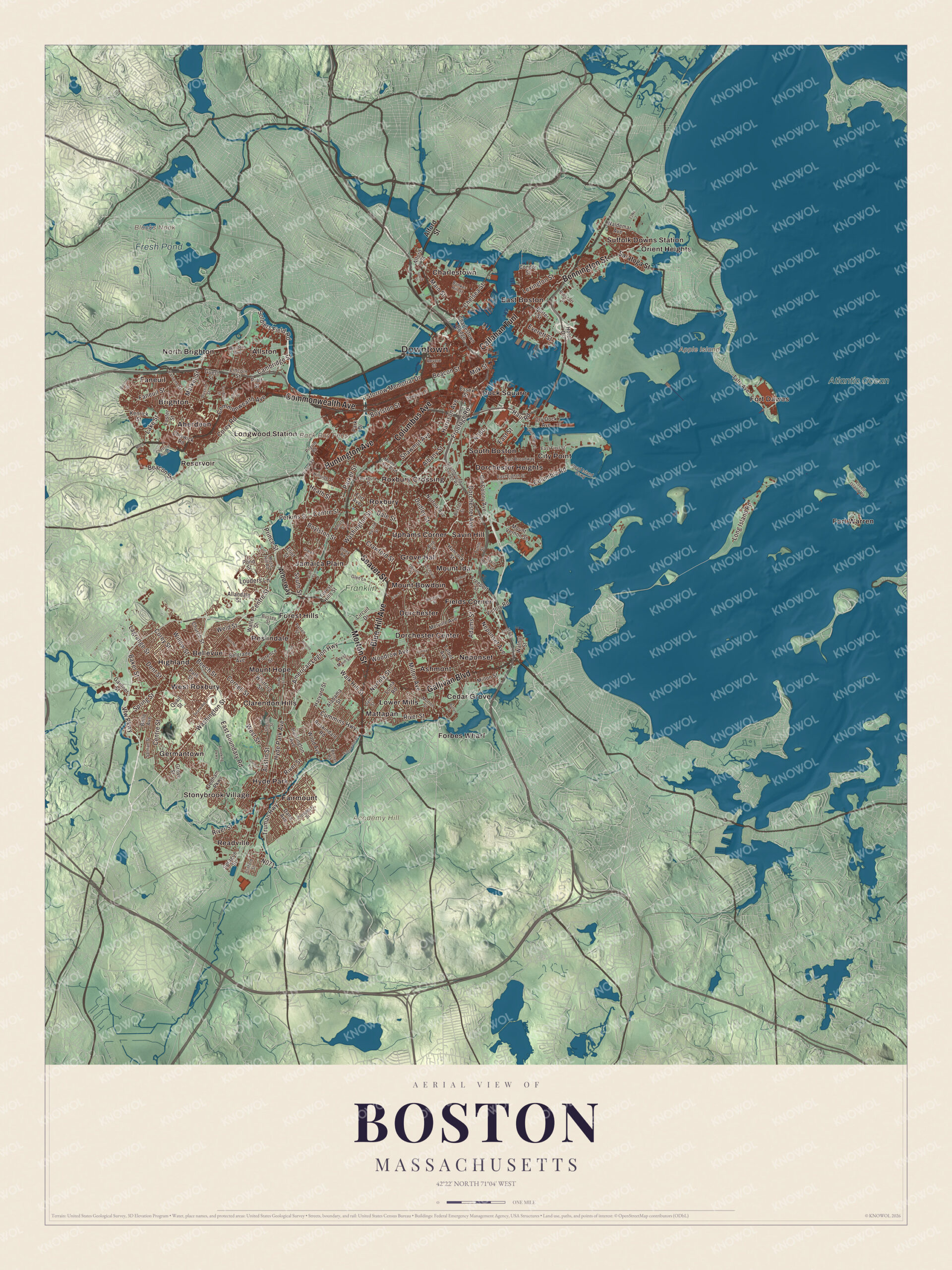
Click to explore a larger preview. The digital watermark does not appear on printed maps.
Names on this map
These names are printed on this map.
Places: Downtown, Academy Hill, Apple Island, Back Bay Fens, Blacks Nook, Fresh Pond, Atlantic Ocean, Franklin Park, Aberdeen, Allston, Ashmont, Bellevue, Brighton, Cedar Grove, Charlestown, City Point, Clarendon Hills, Dock Square, Dorchester, Dorchester Center, Dorchester Heights, East Boston, Fairmount, Faneuil, Fields Corner, Forbes Wharf, Forest Hills, Fort Dawes, Fort Warren, Germantown, Grove Hall, Highland, Hyde Park, Jamaica Plain, Longwood Station, Lower Mills, Mattapan, Mount Bowdoin, Mount Hope, Mount Ida, Neponset, North Brighton, Orient Heights, Readville, Reservoir, Roslindale, Roxbury, Roxbury Crossing, Savin Hill, South Boston, Stonybrook Village, Suffolk Downs Station, Uphams Corner and West Roxbury.
Streets and roads: Columbus Avenue, Morton Street, Gallivan Boulevard, Callahan Tunl, Huntington Avenue, Commonwealth Avenue, Blue Hill Avenue, Seaver Street, Bennington Street, Soldiers Field Road, Storrow Memorial Drive, Beacon Street.
More street names, A to Z
Adams Street, Alabama Street, Albany Street, Alford Street, Allandale Street, Allston Street, American Legion Highway, Amory Street, Arborway, Austin Street, Baker Street, Beech Street, Belgrade Avenue, Belle Avenue, Belnel Road, Bird Street, Boston Street, Bourne Street, Boylston Street, Bunker Hill Street, Burton Street, Bussey Street, Butler Street, Call Street, Cambridge Street, Centre Street, Charlestown Bridge, Chelsea Street, Chestnut Hill Drive, Chiswick Road, Church Street, Circuit Drive, Clifford Street, Columbia Road, Condor Street, Conley Street, Corey Road, Corey Street, Cornell Street, Crawford Street, Cummins Highway, Dale Street, Dana Avenue, Dedham Parkway, Delhi Street, Dent Street, Devon Street, Dorchester Avenue, Dry Dock Avenue, Dudley Street, Dustin Street, East Boundary Road, East Broadway, East Eighth Street, East First Street, East Street, Edgewater Drive, Eliot Street, Enneking Parkway, Erie Street, Essex Street, Everett Street, Faneuil Street, Fletcher Street, Florence Street, Florian Street, Forest Hills Street, Fort Avenue, Foster Street, Freeport Street, Frontage Road, Gardner Street, Glen Lane, Gordon Avenue, Gordon Street, Green Street, Grove Street, Guest Street, Hancock Street, Harold Street, Harrison Avenue, Harvard Street, Haul Road, Head Island Causeway, Heath Street, Hillside Street, Hotel Drive, Hyde Park Avenue, Iffley Road, Kenrick Street, Lagrange Street, Lake Street, Lexington Street, Lincoln Street, Linden Street, Long Island Road, Lorna Road, Louders Lane, Lovell Island Road, Main Street, Market Street, Melnea Cass Boulevard, Melville Avenue, Milk Street, Milton Avenue, Milton Street, More Drive, Moss Hill Road, Mount Vernon Street, Neponset Avenue, Newbury Street, Norfolk Avenue, Norfolk Street, Old Colony Avenue, Park Drive, Parker Street, Park Street, Parsons Street, Patten Street, Perkins Street, Pilgrim Road, Pond Street, Porter Street, Pratt Street, Prescott Street, Prince Street, Prospect Street, Quail Street, Revere Street, Richfield Street, River Street, Riverway, Rowe Street, Roxbury Street, Ruskindale Road, Salman Street, Saratoga Street, Savin Hill Avenue, Searle Road, Shawmut Avenue, Sherrin Street, Southbound Frontage Road, South Street, Sprague Street, Spring Street, Stack Street, Summer Street, Tafts Avenue, Talbot Avenue, Torrey Street, Truman Highway, Tuttle Street, Vfw Parkway, Victory Road, Waldemar Avenue, Walk Hill Street, Walnut Street, Walter Street, Washington Street, Weld Street, Western Avenue, West Main Street, West Street, Westville Street, Whitford Street, Willow Street, Wood Avenue, Woodrow Avenue.
See it on a wall
The Boston map as a framed print. Swipe for more.


Filling the bay, building the necklace
More than two-thirds of inner Boston’s land didn’t exist when the city was founded. Workers leveled the old hills and filled the tidal flats, and gravel brought by train from Needham filled the Back Bay. The city also grew by annexing its neighbors: South Boston in 1804, East Boston in 1836, Roxbury in 1868, Dorchester in 1870, Brighton, West Roxbury and Charlestown in 1874, and Hyde Park in 1912. Brighton, named for the English city, had split from Cambridge in 1807; its Aberdeen section became an architectural conservation district in 2001, and Allston, once part of it, is named for the painter Washington Allston.
Frederick Law Olmsted strung a chain of parks across the new city, the Emerald Necklace, about seven miles from Boston Common to Franklin Park. The Back Bay Fens, established in 1879, turned a foul tidal creek into parkland, and the victory garden planted there in 1941 is now the last continually operating Victory Garden in existence. Commonwealth Avenue’s grassy mall, the narrowest link in the necklace, joins the Public Garden to the Fens. Franklin Park, at 527 acres the city’s biggest park, is named for Boston-born Benjamin Franklin.
Around the map
Start in Aberdeen, then follow Columbus Avenue, Morton Street, Gallivan Boulevard, Huntington Avenue, Commonwealth Avenue and Blue Hill Avenue across the city. Huntington Avenue runs three miles from Copley Square, and in 1998 its middle stretch was named the Avenue of the Arts, for Symphony Hall of 1900, home of the Boston Symphony Orchestra, the New England Conservatory and the Museum of Fine Arts. Morton Street’s parkway runs between Forest Hills Cemetery and Franklin Park, and Gallivan Boulevard carries the parkway east through Dorchester and Ashmont, where All Saints Church, designed by Ralph Adams Cram, was dedicated in 1892. Look outward toward Allston, Ashmont, Bellevue, Brighton and Cedar Grove. Fresh Pond lies just over the line in Cambridge, a reservoir whose ice was once shipped around the world. Apple Island was a ten-acre island in Boston Harbor, and in the 1940s it was filled in for the expansion of what is now Logan International Airport. The Back Bay Fens, Fresh Pond, the Atlantic Ocean, Academy Hill, Blue Hill and Apple Island are all printed on the map.
Boston’s map makes a fine addition to an office, library or den, and it can help teach children the geography and history of the city at the heart of the American Revolution. It’s made for people who call Boston home, from Brighton to Ashmont, and it shows the city as it looks today. Zoom in on the preview above to explore the details, then click here to get your copy of the Boston, Massachusetts map.

Sources
- Boston, Wikipedia
- William Blaxton, Wikipedia
- Boston Common, Wikipedia
- Boston Latin School, Wikipedia
- Boston Public Library, Wikipedia
- Tremont Street subway, Wikipedia
- Freedom Trail, Wikipedia
- African Meeting House, Wikipedia
- Brighton, Boston, Wikipedia
- Allston, Wikipedia
- Emerald Necklace, Wikipedia
- Back Bay Fens, Wikipedia
- Commonwealth Avenue (Boston), Wikipedia
- Franklin Park (Boston), Wikipedia
- Huntington Avenue, Wikipedia
- Morton Street, Wikipedia
- Ashmont, Boston, Wikipedia
- Fresh Pond (Cambridge, Massachusetts), Wikipedia
- Apple Island (Massachusetts), Wikipedia
- City and Town Incorporation and Settlement Dates, Secretary of the Commonwealth of Massachusetts (archived copy)