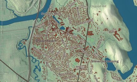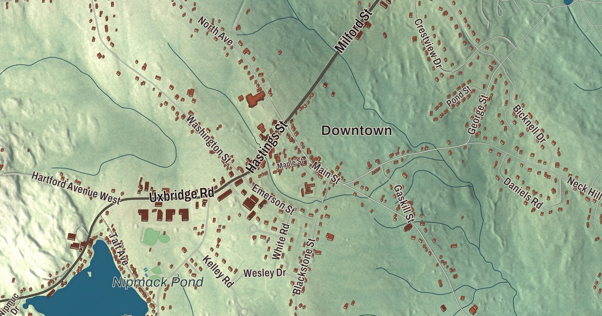
Mendon is sometimes called “Mother Mendon,” since several towns were carved from it, and Founders’ Park marks its first town center, where Main Street, Hastings Street and Milford Street meet. This map prints those three roads with Cape Road, Uxbridge Road and George Street, and with Nipmack Pond, Taft Pond, West River Pond, Bear Hill, Chestnut Hill and Inman Hill. Click here to purchase a print of this map for your wall.
Mendon is in Worcester County.
KNOWOL made this map in 2026 from public survey data and gave it the look of an old atlas. The relief comes from United States Geological Survey elevation data, and the streets and the town line come from the Census Bureau. Mendon covers 18.3 square miles, nearly all of it land, and it lies within the Blackstone River Valley National Heritage Corridor, which Congress created in 1986 and which the town page calls an early center of the Industrial Revolution in the United States. Route 16, the old Middle Post Road from Boston, runs through town. Mendon had 6,228 people at the 2020 census.
Mother Mendon
The Nipmuc people lived here, and Nipmuc Pond is named for them; the name is translated as “small pond place” or “people of the fresh waters.” In September 1662, after a deed was signed with the Nipmuc leaders Great John and Quashaamit, pioneers from Braintree came to take up a grant 8 miles square. The Town of Mendon’s recorded history, in the Secretary of the Commonwealth’s list, dates European settlement to 1660, and Mendon was incorporated as a town in 1667. The town once covered 64 square miles, including at least part of what are now Milford, Bellingham, Hopedale, Uxbridge, Upton, Blackstone, Northbridge and Millville, which is why it’s sometimes called “Mother Mendon.” Benjamin Albee built a water-powered mill on the Mill River in 1664, the first water-powered grist mill in the region. Mendon was largely burned in King Philip’s War and rebuilt in 1680, and it has been part of Worcester County since 1731. The town remains part of Worcester County today.
Milestone 37, set up on the Middle Post Road in 1772 to mark the distance from Boston, still stands. It’s said that in 1789 an innkeeper’s wife turned away President George Washington when he asked for a room on his inaugural journey. The Mendon Center Historic District, roughly bounded by Main, Hastings, Maple, North, Washington and George streets, keeps houses from the 1700s to the mid-1900s around the triangle of Main, Hastings and Maple. Founders’ Park, where Main, Hastings, North and Milford streets meet, marks the original town center and the first meeting house, and the Second Unitarian Church of 1820 is the village’s focal point. The reformer Adin Ballou led Mendon’s Unitarian church from 1831 to 1842, just before he founded the Hopedale Community.
Lydia Taft and the Mendon families
Lydia Chapin was born in Mendon in 1712 and grew up near the Post’s Lane bridge and the Mill River. As Lydia Taft she cast a vote at a town meeting in Uxbridge on October 30, 1756, and her page calls her the first woman known to legally vote in colonial America. Robert Taft Sr. settled in the part of Mendon that became Uxbridge, and the Taft family he started grew into an American political family that included President William Howard Taft. The immigrant George Aldrich began another family here whose descendants included Senator Nelson Aldrich. In more recent times, Lake Nipmuc Park was a popular resort in the early 1900s with music and vaudeville, and Aerosmith played its first show at Nipmuc Regional High School, now Miscoe Hill Middle School, on November 6, 1970. Southwick’s Zoo, on a farm settled in 1803 and opened as a zoo in 1963, covers 300 acres, and its page calls it the largest zoo in New England. The Mendon Twin Drive-In has shown movies since June 14, 1954.
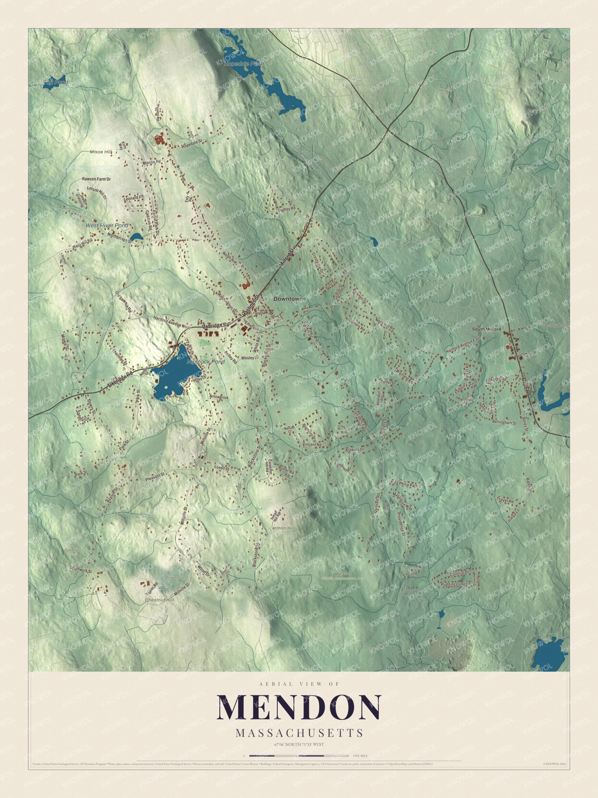
Click to explore a larger preview. The digital watermark does not appear on printed maps.
Names on this map
These names are printed on this map.
Places: Downtown, Bear Hill, Chestnut Hill, Inman Hill, Misoe Hill, Factory Pond, Hopedale Pond, Nipmack Pond, Taft Pond, West River Pond, Cormier Woods, Quisset Wildlife Management Area, Town Forest and South Milford.
Streets and roads: Milford Street, Hastings Street, Cape Road, Uxbridge Road, George Street, Main Street, Providence Street, Millville Street, North Avenue, Crestview Drive, Park Street, Blackstone Street.
More street names, A to Z
Adare Road, Ammidon Road, Ashkins Drive, Asylum Street, Barrows Road, Bates Street, Bellingham Street, Bicknell Drive, Blueberry Drive, Butler Road, Cadman Road, Carpenter Hill Road, Catalpa Lane, Cemetery Street, Chapin Court, Colonial Drive, Daniels Road, Dudley Road, Edwards Road, Emerson Street, Esty Road, Forest Park Drive, Gaskill Street, Hartford Avenue East, Hartford Avenue West, Hopedale Street, Inman Hill Road, Jewell Crossing, Kelley Road, Kims Way, King Philip Path, Kinsley Lane, Leonard Road, Locust Hill Drive, Lovell Street, Lundvall Road, Maple Street, Mary Drive, Massasoit Way, Millbrook Drive, Miscoe Road, Mowry Street, Neck Hill Road, Nelson Court, Nipmuc Drive, Northbridge Street, Old Sawmill Road, Parker Road, Pine Needle Drive, Pleasant Street, Pond Street, Powers Road, Puddingstone Lane, Puffer Drive, Quissett Road, Rawson Farm Drive, Resthaven Road, Sandra Circle, Southwick Street, Strawberry Lane, Stymast Drive, Taft Avenue, Talbott Farm Drive, Teresa Drive, Thayer Road, Thornton Street, Tower Road, Trask Road, Vincent Road, Warfield Road, Washington Street, Wesley Drive, West Hill Road, White Road, Willowbrook Lane, Wood Drive.
Around the map
Start with South Milford, then follow Milford Street, Hastings Street, Cape Road, Uxbridge Road, George Street and Main Street across town. Hopedale Pond, Nipmack Pond, Taft Pond, West River Pond, Town Forest, Bear Hill, Chestnut Hill, Inman Hill and Factory Pond are all printed on the map, and every one of those names is right there on the artwork. Hopedale Pond lies in the neighboring town of Hopedale, near its town center, where it’s surrounded by the Parklands, a 275-acre nature reserve laid out in 1899 by a firm run by Frederick Law Olmsted.
The Mendon map makes a fine addition to an office, library or den, and it can help teach children the geography and history of the mother town of the Blackstone Valley. It’s made for people who call Mendon home, from South Milford to the town center, and it shows the town as it looks today. Zoom in on the preview above to explore the details, then click here to get your copy of the Mendon, Massachusetts map.

We made a map for every town and city in Massachusetts. Explore the complete Massachusetts map collection and find your town.
Sources
- Mendon, Massachusetts, Wikipedia
- Mendon Center Historic District, Wikipedia
- Lydia Taft, Wikipedia
- Southwick’s Zoo, Wikipedia
- Mendon Twin Drive-In, Wikipedia
- Hopedale, Massachusetts, Wikipedia
- City and Town Incorporation and Settlement Dates, Secretary of the Commonwealth of Massachusetts (archived copy)