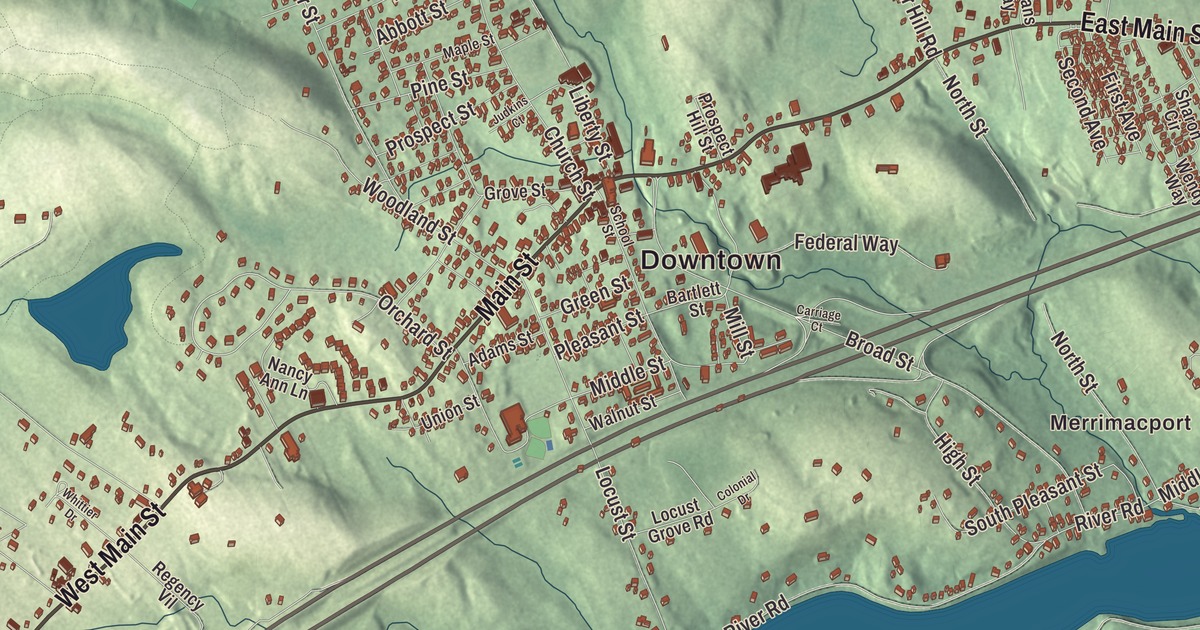
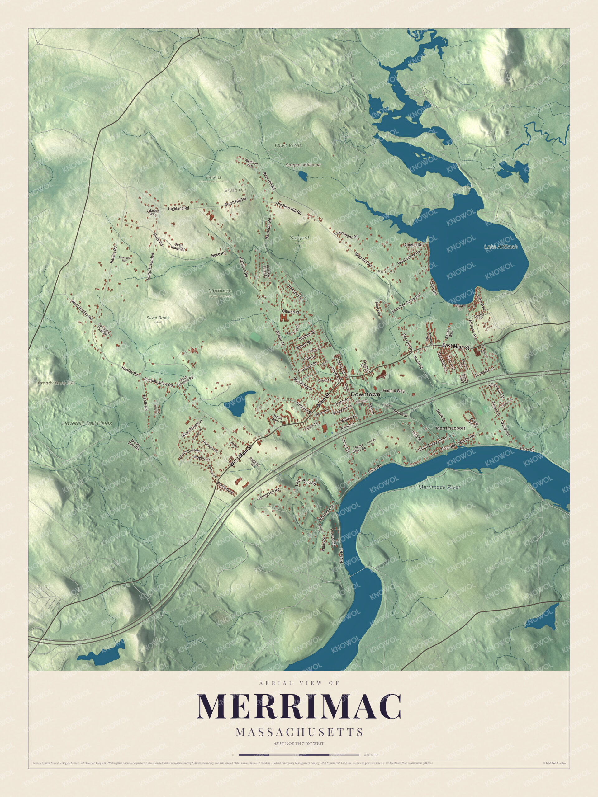
Merrimac sits on the north bank of the Merrimack River, a small, roughly diamond-shaped town on the New Hampshire line. This map prints Main Street, East Main Street, West Main Street, Hadley Road, West Hadley Road and Birchmeadow Road, with Lake Attitash, the Merrimack River, Bear Hill, Brandy Brow Hill and Brush Hill. Click here to purchase a print of this map for your wall.
Merrimac is in Essex County.
KNOWOL made this map in 2026 from public survey data and gave it the look of an old atlas. The relief comes from United States Geological Survey elevation data, and the streets and the town line come from the Census Bureau. Merrimac covers 8.8 square miles, mostly small, wooded hills, and before the twentieth century the land was mostly pasture. Amesbury and Lake Attitash lie to the northeast, West Newbury to the southeast and Haverhill to the southwest, with Newton, South Hampton and Plaistow in New Hampshire to the north and west. Boston is 34 miles away, and the town had 6,723 people at the 2020 census.
West Amesbury
The town and the river are both believed to be named for the Native people who lived in the valley, and “Merrimac” is translated as “swift water place.” The Town of Merrimac’s recorded history, in the Secretary of the Commonwealth’s list, dates European settlement to 1638, when the English settled the riverside village of Merrimacport as part of Salisbury. It later belonged to Amesbury, and after Amesbury split from Salisbury in 1666 it was called the West Parish of Amesbury, or simply West Amesbury. Through the 1600s and 1700s it was a farming and fishing community with a little shipbuilding. When Massachusetts and New Hampshire settled their border in 1741, the parts of Amesbury farther from the river went to the new town of Newton, New Hampshire.
After slavery ended in Massachusetts, a formerly enslaved man known as Forte became known around town for his fiddling. Ephraim Morse, born in West Amesbury in 1823, farmed and taught school here until 1848, when he left for the California gold rush; he became an early settler of San Diego and proposed what became Balboa Park.
The carriage town
In the nineteenth century, benefiting from the manufacturing boom that followed the founding of nearby Lawrence and Lowell, Merrimac became known worldwide for building horse-drawn carriages. The town center grew up around Merrimac Square, apart from the older village of Merrimacport, and its brick buildings and Victorian architecture date from the late 1800s. In 1876 Merrimac, Merrimacport included, separated from Amesbury, and Merrimac was incorporated as a town on April 11, 1876. The town remains part of Essex County today. Early in the twentieth century the region’s industry moved to the Midwest, and Merrimac grew again in the 1990s as a largely residential town. Each year it holds the Merrimac Santa Parade and Merrimac Old Home Days.
Click to explore a larger preview. The digital watermark does not appear on printed maps.
Names on this map
These names are printed on this map.
Places: Downtown, Merrimacport, Bear Hill, Brandy Brow Hill, Brush Hill, Sargent Millpond, Lake Attitash, Merrimack River, Haverhill Well Fields, Town Wells, Merrimac Town Forest, Perkins Conservation Area, Sargent Farm and Silver Brook Farm.
Streets and roads: East Main Street, West Main Street, Main Street, Hadley Road, West Hadley Road, Birchmeadow Road, Middle Road, Bear Hill Road, Orchard Street, Middle Street, River Road, Highland Road.
More street names, A to Z
Abbey Road, Abbott Street, Adams Street, Alnette Road, Attitash Avenue, Bartlett Street, Battis Extended, Belmore Road, Birch Meadow Road, Bisson Lane, Brandy Brow Road, Broad Street, Brush Hill Road, Burnside Lane, Carriage Court, Champion Street, Chase Crescent, Chestnut Street, Church Street, Clement Place, Colonial Drive, Dunvegan Drive, Emery Street, Equestrian Way, Farrington Field Road, Federal Way, First Avenue, Green Street, Grove Street, Gunnison Drive, Hansom Drive, Harriman Road, Heath Brook Road, Heath Road, High Street, Hillside Avenue, Huse Road, Jakobek Way, Judkins Court, Lake Avenue, Lakewoods Drive, Lane Ten Acres Road, Liberty Street, Little Pond Road, Locust Grove Road, Locust Street, Madison Way, Maple Street, Merrimac Street, Mill Street, Mythical Street, Nancy Ann Lane, Nichols Street, North Street, Noyes Lane, Old Bear Hill Road, Pine Street, Pleasant Street, Poplar Hill Circle, Prospect Hill Street, Prospect Street, Quail Ridge Road, Red Oak Acres Street, Regency Vil, School Street, Second Avenue, Sharon Circle, Shore Road, Skunk Road, South Pleasant Street, Spring Hill Road, Sunset Terrace, Trailerland, Union Street, Valley Street, Veterans Way, Wallace Way, Walnut Street, Wendy Way, West Parish Lane, West Shore Road, Whittier Drive, Willowdale Drive, Winter Street, Woodland Street.
See it on a wall
The Merrimac map as a framed print. Swipe for more.


Around the map
Start with Merrimacport, then follow East Main Street, West Main Street, Main Street, Hadley Road, West Hadley Road and Birchmeadow Road across town. Merrimacport, the oldest part of town, began as a fishing village on the river, and Interstate 495 now divides it from the rest of Merrimac. Lake Attitash, the Merrimack River, Bear Hill, Brandy Brow Hill and Brush Hill are all printed on the map, and every one of those names is right there on the artwork. Lake Attitash, a 360-acre great pond once called Kimball’s Pond, lies on the Amesbury line; its name is a reputed Native word for huckleberry, and Merrimac’s beach there is Indian Head Park. No bridge crosses the Merrimack directly into town; the Rocks Village Bridge is just to the south in Haverhill.
The Merrimac map makes a fine addition to an office, library or den, and it can help teach children the geography and history of a Merrimack River carriage town. It’s made for people who call Merrimac home, from Merrimacport to Merrimac Square, and it shows the town as it looks today. Zoom in on the preview above to explore the details, then click here to get your copy of the Merrimac, Massachusetts map.

Sources