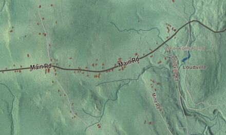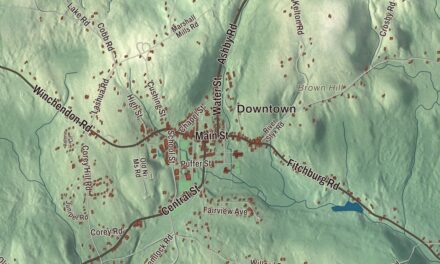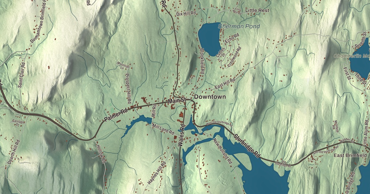
Three times a year Brimfield hosts the biggest outdoor antiques show in New England, and the rest of the year it’s a small town on the old post road west, with its common at Main Street and Warren Road. This map prints Main Street, Palmer Road, Sturbridge Road, Warren Road, Wales Road and Dunhamtown Palmer Road, with Dean Pond, Sherman Pond, Baker Pond, Holland Pond, Chamberlin Mountain, Cooks Mountain and Dearth Hill. Click here to purchase a print of this map for your wall.
Brimfield is in Hampden County, 22 miles from Springfield and 25 from Worcester.
KNOWOL made this map in 2026 from public survey data and gave it the look of an old atlas. The relief comes from United States Geological Survey elevation data, and the roads and the town line come from the Census Bureau. Brimfield covers 35.2 square miles, with Sturbridge to the east, Holland and Wales to the south, Monson and Palmer to the west and Warren to the north. Route 20 and Route 19 run through it, and the Massachusetts Turnpike cuts across its northern part. The town had 3,694 people at the 2020 census.
The common on the post road
The Town of Brimfield’s recorded history, in the Secretary of the Commonwealth’s list, dates European settlement to 1706, and the town page agrees; the historic district’s page says permanent settlement came in 1721. That year the town common and the cemetery were laid out, at the junction of Main Street and Warren Road, on an east-west Native American trail. The trail became Main Street, part of the main post road west from Boston to Springfield, and today it carries Route 20. Warren Road and Brookfield Road lead north to the towns they’re named for, and Wales Road heads south toward Connecticut. Brimfield was incorporated as a town in 1731. It belonged to Hampshire County until 1812, and the town remains part of Hampden County today.
The railroads passed Brimfield by, and most of its industries grew up away from the center. The Brimfield Center Historic District, listed in 2006, runs out from the common along Main Street and the Brookfield, Wales, Sturbridge and Warren roads. Its oldest house is believed to be the ell of about 1738 on the Converse House at 7 Brookfield Road. The architect Elias Carter lived in town and designed a number of its Federal-era houses, including the Hitchcock House of about 1823 at 15 Wales Road, with its porch of giant Doric columns, and the Hitchcock Free Academy of 1855. The Greek Revival First Congregational Church on the common dates from 1848, and the Stick-style town hall from the late 1870s.
A library from the dog tax
The Brimfield Public Library got its start from the town’s dog tax. The money sat in the treasury until it reached $709.19, and on April 9, 1877, the town voted to spend it on a free public library, with a room fitted out for it in the new town house.
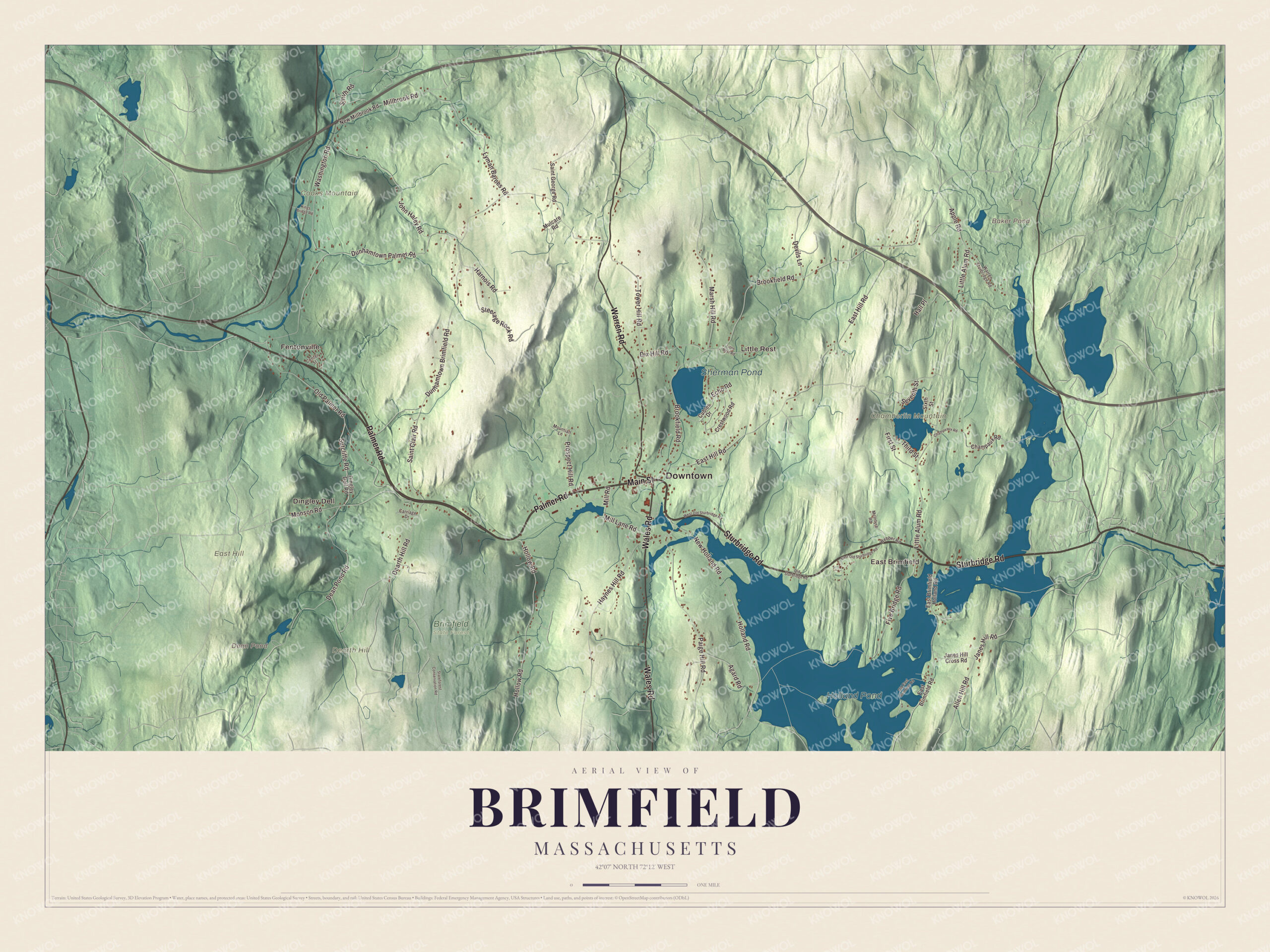
Click to explore a larger preview. The digital watermark does not appear on printed maps.
Names on this map
These names are printed on this map.
Places: Downtown, Fentonville, East Brimfield, Dingley Dell, Little Rest, Chamberlin Mountain, Cooks Mountain, Dearth Hill, East Hill, Baker Pond, Dean Pond, Holland Pond, Sherman Pond and Brimfield State Forest.
Streets and roads: Palmer Road, Sturbridge Road, Main Street, Warren Road, Wales Road, Dunhamtown Palmer Road, Brookfield Road, Monson Road, Paige Hill Road, Sutcliffe Road, Janes Hill Road, Dunhamtown Brimfield Road.
More street names, A to Z
Agard Road, Allen Hill Road, Apple Road, Carriage Drive, Center Street, Champaux Road, Champeaux Road, Crestwood Road, Cubles Drive, Dean Pond Road, Dearth Hill Road, Devils Lane, Dingley Dell Road, Dix Hill Road, East Brimfield Holland Road, East Brimfield Road, East Hill Road, East Old Sturbridge Road, Echo Road, First Street, Five Bridge Road, Hall Place, Harnois Road, Haynes Hill Road, Holland Road, Hollow Road, Janes Hill Cross Road, John Haley Road, Kings Bridge Road, Little Alum Road, Little Rest Road, Lyman Barnes Road, Marsh Hill Road, McIntyre Road, Millbrook Road, Mill Lane Road, Mill Road, Mountian Lane, Mulcare Road, New Holland Road, New Millbrook Road, Old East Brimfield Road, Old Palmer Road, Old Sturbridge Road, Prospect Hill Road, Saint Clair Road, Saint George Road, Seventh Street, Sixth Street, Smith Road, Stateforest Conservation Road, Steerage Rock Road, Third Street, Tower Hill Road, Warren Sturbridge Road, Washington Road, Webber Road, West Old Sturbridge Road.
The antique show
The Brimfield Antique Show is the largest outdoor antiques show in New England. It runs for six days three times a year, in May, July and September, and the fields it fills near the center have helped keep newer building away from the old village.
Around the map
Start in Fentonville, then follow Palmer Road, Sturbridge Road, Main Street, Warren Road, Wales Road and Dunhamtown Palmer Road across town, and look outward toward East Brimfield, Dingley Dell and Little Rest. Brimfield State Forest includes the Dean Pond Recreation Area, with a 100-foot swimming beach and more than 20 miles of roads and trails for hiking, riding and skiing. The East Brimfield Reservoir lies in Brimfield and Sturbridge behind a flood control dam the Army Corps of Engineers finished in 1960, and the Quinebaug River begins its 69-mile course there. A five-mile canoe route on the Quinebaug, a National Recreation Trail, runs down from Holland, and Holland Pond lies in the neighboring town of Holland. The Brimfield Trail follows the dam’s flood-control land for two miles. Baker Pond, Dean Pond, Holland Pond, Sherman Pond, Chamberlin Mountain, Cooks Mountain and Dearth Hill are all printed on the map.
Brimfield’s map makes a fine addition to an office, library or den, and it can help teach children the geography and history of the town on the old post road. It’s made for people who call Brimfield home, from Fentonville to Little Rest, and it shows the town as it looks today. Zoom in on the preview above to explore the details, then click here to get your copy of the Brimfield, Massachusetts map.

We made a map for every town and city in Massachusetts. Explore the complete Massachusetts map collection and find your town.
Sources
- Brimfield, Massachusetts, Wikipedia
- Brimfield Center Historic District, Wikipedia
- Brimfield Antique Show, Wikipedia
- Brimfield State Forest, Wikipedia
- East Brimfield Dam, Wikipedia
- Quinebaug River, Wikipedia
- City and Town Incorporation and Settlement Dates, Secretary of the Commonwealth of Massachusetts (archived copy)