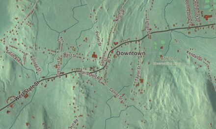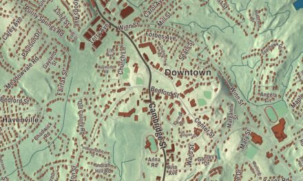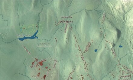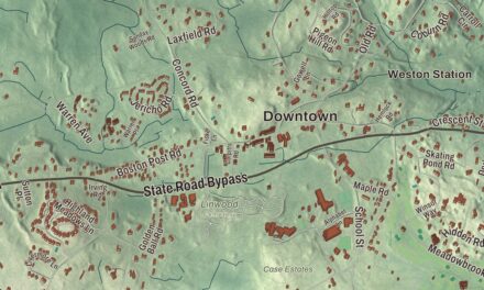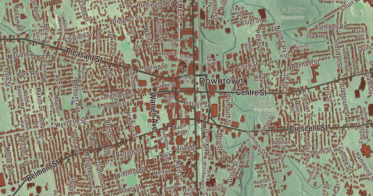
They call Brockton the City of Champions, and if you grew up here you know why: Rocky Marciano and Marvin Hagler both came out of Brockton High. This map prints Main Street, Montello Street, North Montello Street, Pleasant Street, Warren Avenue and Reynolds Memorial Highway, with Waldo Lake, the Brockton Reservoir, Ames Pond, Cleveland Pond, Bigney Pond and Stonehouse Hill. Click here to purchase a print of this map for your wall.
Brockton is in Plymouth County, 22 miles south of Boston.
KNOWOL made this map in 2026 from public survey data and gave it the look of an old atlas. The relief comes from United States Geological Survey elevation data, and the streets and the city line come from the Census Bureau. Brockton covers 21.6 square miles along the Salisbury Plain River, which once powered its shoe factories, with Avon, Holbrook, Abington, Whitman, East Bridgewater, West Bridgewater, Easton and Stoughton around it. It’s one of the two county seats of Plymouth County, the sixth-largest city in Massachusetts, and it had 105,643 people at the 2020 census.
North Bridgewater becomes Brockton
In 1649 the Wampanoag leader Ousamequin, known as Massasoit, sold the land called Saughtucket to Myles Standish as an addition to Duxbury, and the English renamed it Bridgewater. The City of Brockton’s recorded history, in the Secretary of the Commonwealth’s list, dates European settlement to 1700. On June 15, 1821, the northern part of the Bridgewater township became the town of North Bridgewater, and 1821 is the year the state’s list gives for Brockton’s incorporation as a town.
By the 1870s the town’s leaders wanted a distinctive name to match its growing industry and draw customers and business. Ira Copeland, an inventor and trolley-car magnate, heard a Canadian conductor call out the station at Brockville, Ontario, while on a business trip, and thought “Brockton” would suit. In a town vote with several other names on the ballot, Brockton won 1,081 votes, about 72 percent, and North Bridgewater became Brockton on May 5, 1874. It was incorporated as a city in 1881, on April 9.
Shoes and freedom
During the Civil War, Brockton was America’s largest producer of shoes, and the shoe and leather trade stayed large here until late in the 20th century. W. B. Mason, the office supply company, was founded here in 1898 selling rubber stamps and stencils to the shoe industry, and it still has its headquarters in Brockton. Before the war, several Brockton homes were stops on the Underground Railroad, helping people escape slavery in the South, and Frederick Douglass spoke to a crowd at the Liberty Tree in Brockton. In 2020 Brockton became the first city in New England with a majority-Black population.
Edison’s city
On October 1, 1883, Thomas Edison threw the switch on Brockton’s three-wire underground electric system, the first in the world. The power station at 70 School Street, one of the earliest Edison built, opened that day with three dynamos for about 1,600 lamps. On Pleasant Street, at number 40, the Central Fire Station of 1884 to 1885 became the nation’s first electrified firehouse, fed by an underground cable from a nearby power plant built under Edison’s supervision. The City Theater, opened in 1894, was the first theater in the world on a three-wire system, and in 1896 Brockton became the first city in the country to do away with its railroad grade crossings. Even the department store Santa Claus started here, the city page says: James Edgar of Edgar’s Department Store first put on the suit in December 1890. Click here to learn more about the history of Brockton.
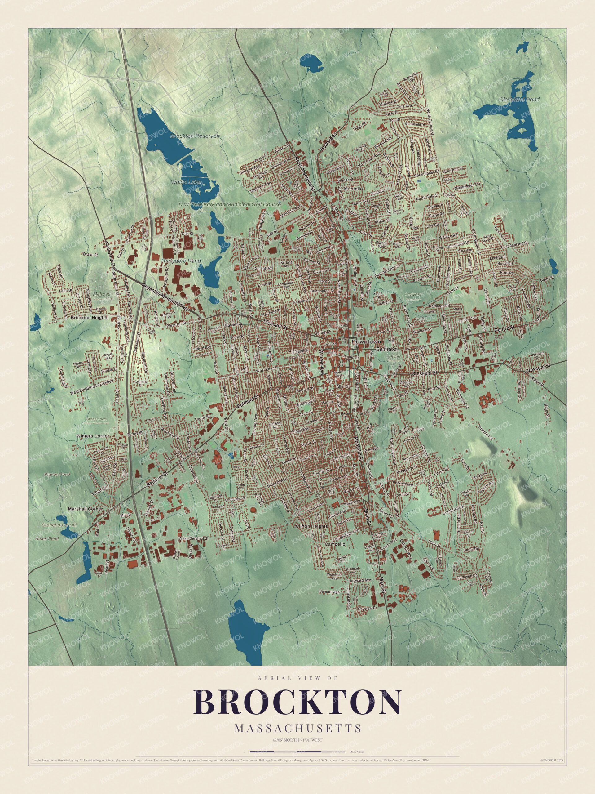
Click to explore a larger preview. The digital watermark does not appear on printed maps.
Names on this map
These names are printed on this map.
Places: Downtown, Stonehouse Hill, Ames Pond, Bigney Pond, Cleveland Pond, Brockton Reservoir, Waldo Lake, Thirtyacre Pond, D W Field Park and Municipal Golf Course, Calvary Cemetery, Melrose Cemetery, Stone Farm Conservation Area, Union Cemetery, Brockton Heights, Campello, Clifton Heights, Marshall Corner, Montello, Winters Corner and Beacon Park.
Streets and roads: North Montello Street, Montello Street, Pleasant Street, Main Street, Warren Avenue, Reynolds Memorial Highway, Belmont Street, Centre Street, Crescent Street, Howard Street, West Elm Street, North Pearl Street.
More street names, A to Z
Adams Street, Addison Avenue, Albany Street, Albert Street, Alexandra's Way, Alger Street, Allen Street, Alphonse Road, Amark Road, Ames Street, Anawan Street, Annadea Road, Anne Marie Drive, Appleby Street, Ardsley Circle, Ardsley Street, Armiston Street, Arthur Street, Ashfield Drive, Ash Street, Aspen Street, Athens Drive, Auburn Street, Auna Drive, Backlund Drive, Baker Street, Baldwin Road, Baltic Avenue, Bartlett Street, Bates Road, Bates Street, Battles Farm Drive, Battles Street, Battles Street Extended, Belair Street, Belcher Avenue, Belding Circle, Bellevue Avenue, Belmont Avenue, Belmont Court, Benham Street, Berglund Avenue, Bernard Road, Bernice Avenue, Blendall Street, Bonney Street, Boundary Street, Bourne Street, Bouve Avenue, Boylston Street, Bradley Avenue, Braemoor Road, Breer Circle, Breer Street, Brett Street, Brian Drive, Briarcliff Road, Broad Street, Brookfield Drive, Brookside Avenue, Brookville Avenue, Brown Street, Bunker Avenue, Burke Drive, Burkeside Avenue, Burrill Avenue, Burroughs Road, Byron Avenue, Calmar Street, Calvin Street, Cambo Street, Campanelli Industrial Drive, Candy Lane, Cappy's Way, Carl Avenue, Carlisle Street, Carrlyn Road, Carroll Avenue, Cary Street, Central Street, Chatham Road, Chatham West Drive, Cherry Street, Christopher Road, Christy's Drive, Clarendon Avenue, Cleveland Avenue, Clifford Avenue, Clifton Avenue, Clinton Street, Coe Road, Colantha Avenue, Colleen Drive, College Drive, Colonel Bell Drive, Commercial Yard, Connell Avenue, Copeland Street, Coral Street, Cottage Grove Avenue, Cottage Street, Country Club Lane, Court Street, Coweeset Drive, Crestfield Drive, Crickett Road, Cross Road, Cross Street, Curve Street, Cypress Drive, Dagmar Drive, Darby Road, Darren Drive, Dartmouth Terrace, Davids Street, Day Avenue, Deanna Road, Debbie Road, Deed Circle, Dewey Avenue, Digby Avenue, Division Street, Dixon Road, Donald Street, Doris Avenue, Dover Street, Downey Road, Drake Street, Drew Avenue, Dudley Avenue, Dunham Street, Dyer Street, Earle Street, East Ashland Street, East Avenue, East Battles Street, East Street, East Union Street, Echo Street, Edgar Street, Edson Street, Edward Street, Electric Avenue, Eleventh Avenue, Ellen Road, Elliot Street, Ellsworth Street, Elm Avenue, Elsie Road, Emerson Avenue, Emmet Street, Emory Street, Errol Road, Ettrick Street, Fairfield Street, Fairview Avenue, Falconer Avenue, Fern Avenue, Fern Street, Ferris Avenue, Fields Avenue, Field Street, Finny's Way, First Street, Fitzpatrick Avenue, Florence Street, Foothill Road, Ford Street, Forest Avenue, Forest Road, Forest Street, Fortin Drive, Foster Street, Franklin Street, Freight Street, Frost Street, Galen Street, Gay Street, George Street, Gerald Avenue, Geralynn Drive, Gladstone Street, Gladys Road, Glen Avenue, Glenwood Street, Gloucester Street, Goldfinch Drive, Grafton Street, Granite Street, Greenbriar Road, Green Place, Green Street, Grove Street, Guild Road, Hammond Street, Hancock Avenue, Harlan Circle, Harold Street, Harvard Street, Hatchfield Drive, Haverhill Street, Hayward Avenue, Healey Terrace, Hermon Street, Herrod Avenue, Hervey Street, Highfield Drive, Highland Street, High Street, Hillberg Avenue, Hillcrest Avenue, Hill Street, Holmes Street, Hoover Avenue, Hope Street, Hopkins Road, Hovendon Avenue, Howland Street, Hubbard Avenue, Hudson Street, Huntington Street, Huntress Avenue, Ida Avenue, Intervale Street, Irene Circle, Irma Road, Ithica Road, Jonathan Drive, Jon Drive, Julie Avenue, Juneau Road, Kame Street, Kathleen Road, Keene Street, Keith Avenue, Kennedy Drive, Kent Street, Keswick Road, Kevin Road, Kingman Street, Knapp Center, Kurland Avenue, Lawson Terrace, Leach Avenue, Leah Drive, Leahy Road, Lenox Street, Lester Road, Lewiston Street, Libby Street, Liberty Street, Lilly Avenue, Lincoln Street, Linden Street, Linnea Avenue, Linwood Street, Lisa Drive, Litchfield Street, Livoli Road, Locust Street, Longwood Avenue, Longworth Avenue, Lookoff Street, Loring Street, Lucy Lane, Lyman Street, Lyndall Avenue, Lynn Road, Magnolia Avenue, Magoun Avenue, Maguire Road, Malden Street, Malvern Road, Manley Street, Manners Avenue, Manomet Street, Maple Avenue, Maplewood Circle, Margery Road, Marie Avenue, Market Street, Martin Street, Martland Avenue, Mass Avenue, Maxim Street, May Avenue, Melrose Street, Menlo Street, Mercedes Road, Miller Avenue, Mill Street, Milton Street, Monson Street, Montauk Road, Montvale Road, Moraine Street, Morse Avenue, Mulberry Street, Myrtle Street, Newbury Street, Nicholson Drive, Nilsson Street, Norman Road, North Ash Street, North Avenue, North Bassett Road, North Cary Street, North Leyden Street, North Main Street, North Quincy Street, North Warren Avenue, Noyes Avenue, Nye Avenue, Oakdale Street, Oak Hill Way, Oakland Street, Oak Lane, Oak Street, Oscar Avenue, Otis Street, Overton Street, Owens Avenue, Parker Avenue, Parker Street, Park Road, Park Street, Patterson Avenue, Paula Road, Pearl Street, Pearl Way, Perkins Avenue, Perkins Street, Peterson Avenue, Pine Avenue, Pine Grove Drive, Pine Street, Plain Street, Plymouth Street, Pondview Circle, Poplar Road, Porter Street, Portland Street, Prospect Street, Quincy Avenue, Quincy Street, Rainbow Circle, Raintree Drive, Rainville Street, Randolph Avenue, Rangeley Avenue, Reservoir Street, Richard Street, Ridge Street, River Street, Riverview Street, Roan Court, Roberta Avenue, Rockford Street, Rockland Drive, Rockland Street, Royal Road, Rutland Street, Samuel Avenue, Santee Road, Sargent's Way, Sawtell Avenue, Shaw Road, Sheridan Street, Sherman Street, Short Street, Sinclair Road, Skyview Drive, Snell Avenue, Snow Avenue, Snow Street, Sophia Avenue, Southfield Drive, Southland Terrace, Spark Street, Spring Avenue, Spring Street, Stearns Avenue, Stebbins Avenue, Stephen Drive, Sterling Road, Studley Avenue, Sully Road, Summer Street, Sumner Street, Sunset Drive, Sylvan Street, Taber Avenue, Taft Avenue, Talbot Street, Taylor Avenue, Teele Street, Temi Road, Thatcher Street, Thayer Avenue, Thayer Street, Thomas Street, Thorny Lea Terrace, Thurber Avenue, Tiffany Drive, Tilton Avenue, Tina Avenue, Toby Road, Torrey Avenue, Torrey Street, Tosca Drive, Tremont Street, Tribou Street, Trudy Terrace, Tupelo Street, Turner Street, Tyler Street, Union Street, Upland Road, Upton Street, Van Cliff Avenue, Vfw Parkway, Village Way, Vinedale Road, Volpe Drive, Waldo Street, Waleco Road, Walnut Street, West Avenue, West Chestnut Street, West Elm Street Extended, Westgate Drive, Westland Street, Weston Street, West Street, Wilder Street, Wilson Street, Winter Street, Winthrop Street, Woodland Avenue, Woodside Avenue, Wyman Street.
See it on a wall
The Brockton map as a framed print. Swipe for more.


City Hall, a Romanesque Revival building of 1892 to 1894 at 45 School Street, has murals of the Civil War in its grand hall. The Snow Fountain and Clock, given by George G. Snow in 1902, still stands where North Main and East Main streets meet, its four-faced clock over a fountain and an old horse trough of Quincy granite. Rocky Marciano, raised on the south side of Brockton, retired as the only heavyweight champion to finish his career undefeated, and Marvelous Marvin Hagler reigned as undisputed middleweight champion from 1980 to 1987. Brockton High’s teams are the Boxers in their honor. The Fuller Craft Museum, founded in 1946 with a trust from the Brockton-born geologist Myron Fuller, shows contemporary craft.
Around the map
Start in Brockton Heights, then follow North Montello Street, Montello Street, Pleasant Street, Main Street, Warren Avenue and Reynolds Memorial Highway across the city, and look outward toward Campello, Clifton Heights, Marshall Corner, Montello and Winters Corner. Campello was Plain Village until 1850, and Montello’s station opened in 1884 as Huntington Heights before residents chose the new name. The biggest park in the city is D.W. Field Park, 650 acres left by the businessman Daniel W. Field in 1925, reaching from northern Brockton into Avon. A chain of seven ponds and lakes runs through it along Beaver Brook; Waldo Lake was made in the 1930s as part of the park’s design, and the Brockton Reservoir, with its gatehouse of the 1880s, lies in Avon, by the city page’s account. The fieldstone tower on Tower Hill, built in 1928, opens once a year for Towerfest. Ames Pond, Cleveland Pond, the Brockton Reservoir, Waldo Lake, Stonehouse Hill and Bigney Pond are all printed on the map.
Brockton’s map makes a fine addition to an office, library or den, and it can help teach children the geography and history of the City of Champions. It’s made for people who call Brockton home, from Campello to Montello, and it shows the city as it looks today. Zoom in on the preview above to explore the details, then click here to get your copy of the Brockton, Massachusetts map.

Sources
- Brockton, Massachusetts, Wikipedia
- W. B. Mason, Wikipedia
- Brockton Edison Electric Illuminating Company Power Station, Wikipedia
- Central Fire Station (Brockton, Massachusetts), Wikipedia
- Brockton City Hall, Wikipedia
- Snow Fountain and Clock, Wikipedia
- Rocky Marciano, Wikipedia
- Marvelous Marvin Hagler, Wikipedia
- Brockton High School, Wikipedia
- Fuller Craft Museum, Wikipedia
- Campello station, Wikipedia
- Montello station, Wikipedia
- D.W. Field Park, Wikipedia
- City and Town Incorporation and Settlement Dates, Secretary of the Commonwealth of Massachusetts (archived copy)