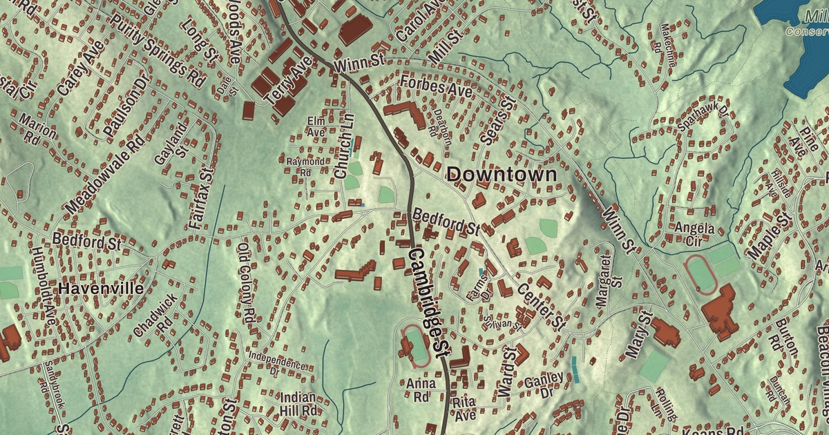
If you grew up in Burlington, you know the town by the Common, the Middlesex Turnpike and the Burlington Mall, and maybe by the trails of the Landlocked Forest out by Route 3. This map prints Cambridge Street, Bedford Street, Wilmington Road, Francis Wyman Road, Peach Orchard Road and the Middlesex Turnpike, with the Landlocked Forest, Mill Pond Reservoir, Butterfield Pond and Greenleaf Mountain. Click here to purchase a print of this map for your wall.
Burlington is in Middlesex County, 12 miles northwest of Boston.
KNOWOL made this map in 2026 from public survey data and gave it the look of an old atlas. The relief comes from United States Geological Survey elevation data, and the streets and the town line come from the Census Bureau. Burlington covers 11.9 square miles on the watersheds of the Ipswich, Mystic and Shawsheen rivers, with Bedford, Billerica, Wilmington, Woburn and Lexington around it. The land is gentle: the highest point is Greenleaf Mountain at 290 feet, and the lowest is the Great Meadow at 150. The town had 26,377 people at the 2020 census.
Farms, hams and hops
The Town of Burlington’s recorded history, in the Secretary of the Commonwealth’s list, dates European settlement to 1641. Burlington was incorporated as a town in 1799, on February 28, and the town remains part of Middlesex County today. The name is believed to come from the English town of Bridlington in Yorkshire, though that has never been confirmed.
For most of its history Burlington was a farm town. It sold hops and rye to Boston and made a little more money in small shoe shops, and from colonial times into the late 19th century mills ran along Vine Brook, which flows from Lexington toward Bedford and the Shawsheen River. The early railroads passed Burlington by, though the Middlesex Turnpike served it, and the town went on curing hams for the Boston market and raising milk, fruit and vegetables.
Several early homesteads still stand. The Francis Wyman House at 56 Francis Wyman Road is dated to 1666 on the town page and to about 1730 on its own page; it was listed on the National Register in 1975, came through a bad fire inside in 1996, and opened to the public for the first time in the summer of 2012. Martha Elizabeth Sewall, born in Burlington in 1858, wrote the town’s history for the History of Middlesex County, played the organ at the Burlington church and became a state lecturer for the Massachusetts Woman Suffrage Association in 1889, speaking across the state for women’s right to vote.
Route 128 changes everything
Then came Route 128. The highway set off an enormous expansion, and from 1955 to 1965 Burlington was the fastest growing town in the state; in one five-year stretch its population tripled. Today it’s a residential and professional hub, home to the Burlington Mall, a Northeastern University satellite campus and company headquarters including Avid Technology and Keurig Dr Pepper, with Lahey Hospital & Medical Center here too.
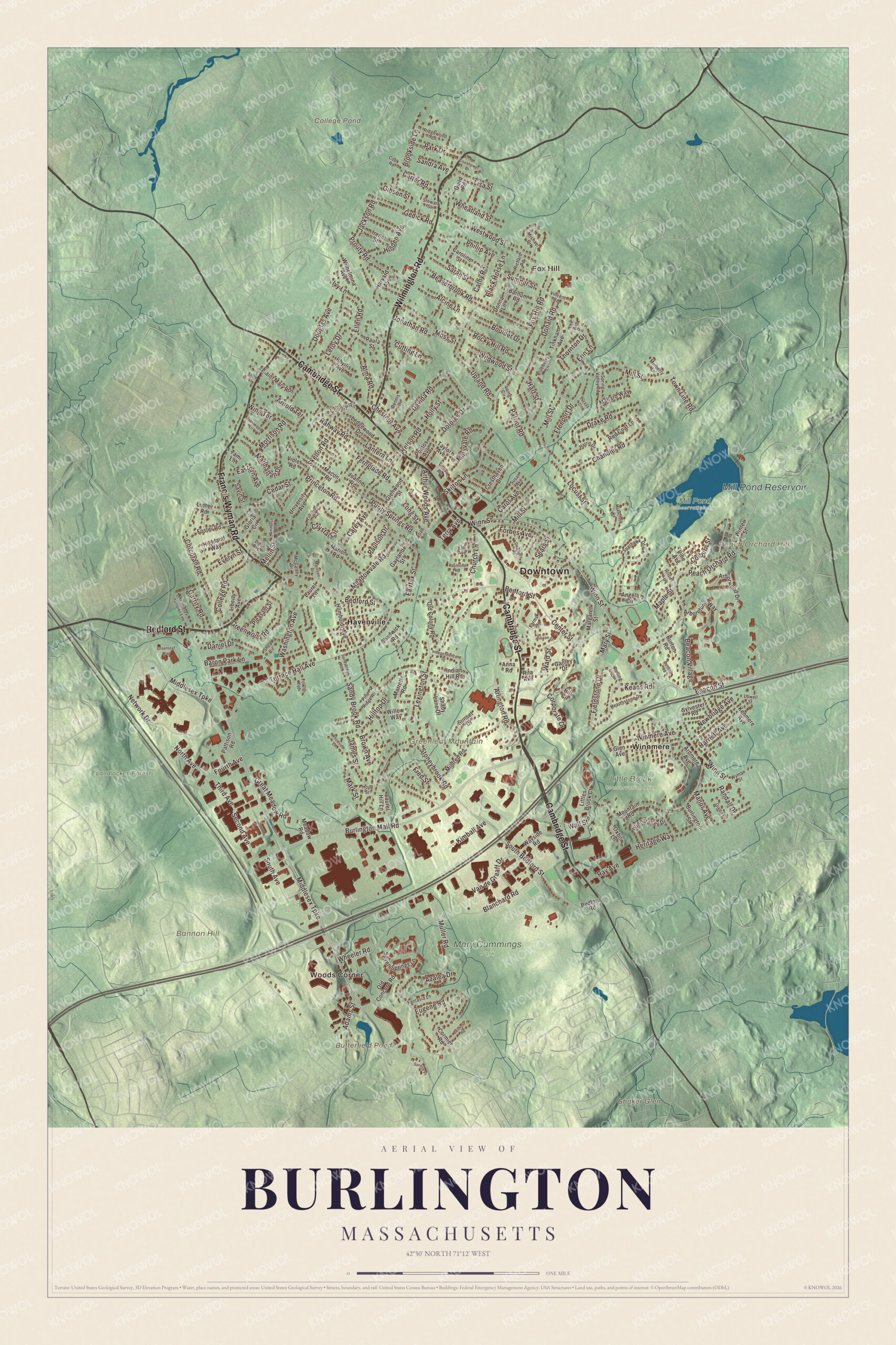
Click to explore a larger preview. The digital watermark does not appear on printed maps.
Names on this map
These names are printed on this map.
Places: Downtown, Woods Corner, Fox Hill, Bannon Hill, Greenleaf Mountain, Peach Orchard Hill, Shaker Glen, Butterfield Pond, College Pond, Mill Pond Reservoir, Landlocked Forest, Little Brook Conservation Area, Mary Cummings Park, Mill Pond Conservation Area, Havenville and Winnmere.
Streets and roads: Cambridge Street, Bedford Street, Wilmington Road, Francis Wyman Road, Middlesex Turnpike, Peach Orchard Road, Beacon Street, Sandy Brook Road, Nelson Road, Davida Road, Fourth Avenue, Keans Road.
More street names, A to Z
Adams Street, Alcine Lane, Alma Road, Amherst Road, Angela Circle, Anna Road, Arboretum Way, Arborwood Drive, Ardmore Avenue, Arlington Road, Arnold Terrace, Arthur Woods Avenue, Azalea Drive, Barnum Road, Baron Park Lane, Beacon Village, Beaverbrook Road, Bedford Road, Belmont Road, Black Horse Lane, Blanchard Road, Blueberry Lane, Boulder Drive, Brantwood Lane, Brookside Lane, Brown Avenue, Burlington Mall Road, Burlington Street, Burton Road, Carey Avenue, Carol Avenue, Caroline Street, Carter Road, Cathy Road, Cedar Street, Center Street, Chadwick Road, Chandler Road, Chestnut Avenue, Church Lane, Colburn Street, College Road, Cook Road, Corcoran Road, Cormier Road, Corporate Drive, County Road, Cresthaven Drive, Crystal Circle, Cutting Lane, Dale Street, Daniel Drive, Dearborn Road, Dennis Drive, Dolores Drive, Donald Road, Donna Lane, Douglas Avenue, Drake Road, Duncan Road, Eastern Avenue, Eisenhower Drive, Ellen Road, Elm Avenue, Erin Lane, Eugene Road, Evelyn Street, Evergreen Avenue, Fairfax Street, Fantasia Lane, Farms Drive, Fernglade Road, Fieldstone Drive, Forbes Avenue, Foster Road, Fowler Terrace, Fox Hill Road, Fred Street, Freeport Drive, Ganley Drive, Garrity Road, Gayland Street, Gedick Road, Gibson Street, Given Drive, Glen Avenue, Glenwood Street, Gloria Circle, Great Meadow Road, Greenleaf Way, Greenwood Road, Guild Road, Harriett Avenue, Harris Drive, Hart Street, Harvard Avenue, Hearthstone Drive, Heritage Way, Highland Way, Hill Circle, Hillside Avenue, Hilltop Drive, Holden Avenue, Holly Street, Hope Street, Humboldt Avenue, Independence Drive, Indian Hill Road, Irene Street, Ivy Lane, Jackson Road, James Street, Joanne Road, Jonathan Road, Kenmere Avenue, Kimball Avenue, Laing Circle, Lantern Lane, Laurel Hill Lane, Laurel Lane, Ledgewood Drive, Lee Avenue, Leroy Drive, Lexington Street, Liberty Avenue, Lido Avenue, Lisa Street, Littles Brook Court, Locust Street, Long Street, Lowell Street, Lucaya Circle, Luther Road, Macon Road, Makechnie Road, Mallard Way, Manhattan Drive, Manor Avenue, Maple Street, Margaret Street, Marion Road, Mark Street, Marrett Road, Mary Street, Maryvale Road, Maureen Drive, McCarthy Drive, Meadow Road, Meadowvale Road, Mellin Street, Michael Drive, Middlesex Turnpike Extension, Mildred Road, Mill Street, Morrison Road, Moss Street, Mountain Road, Mulberry Lane, Muller Road, Murray Avenue, Network Drive, Newbridge Avenue, North Avenue, Old Colony Road, Old Concord Road, Oxbow Lane, Park Drive, Patriot Road, Pattison Road, Paula Street, Paulson Drive, Phillip Avenue, Phyllis Avenue, Pine Avenue, Pine Ridge Road, Pleasant Street, Pontos Avenue, Princeton Road, Prouty Road, Purity Springs Road, Rahway Road, Randall Drive, Ray Avenue, Raymond Road, Red Coat Lane, Richard Road, Ridgewood Lane, Rita Avenue, Rocky Hill Road, Rolling Lane, Saint Mary Road, Sandra Avenue, Sandybrook Road, Sarah Street, Savin Street, Sears Street, Second Avenue, Seven Springs Lane, Shady Lane Drive, Shea Circle, Short Street, Skelton Road, Skilton Lane, Sorelle Place, South Avenue, South Bedford Street, Sparhawk Drive, Spring Valley Road, Stewart Street, Stoneybrook Road, Sullivan Street, Sumner Street, Sunset Drive, Susan Avenue, Sylvester Road, Tami Lane, Taylor Avenue, Terrace Hall Avenue, Terry Avenue, Third Avenue, Thornton Drive, Tinkham Avenue, Town Line Road, University Avenue, Upland Road, Van de Graaff Drive, Vincent Road, Violet Road, Wall Street, Ward Street, Washington Avenue, Wayside Road, Westwood Street, Wheatland Street, Wheeler Road, Wildwood Street, Wilhelmina Avenue, Willow Way, Wing Terrace, Winmere Avenue, Winn Street, Winn Valley Drive, Winter Street, Woodside Lane, Wyman Street.
Woods and water
Burlington still keeps big pieces of open land. The Landlocked Forest, about 270 acres across the Burlington, Bedford and Lexington lines, has 12 miles of trails, vernal pools, old stone walls, meadows and old-growth forest. The town took most of it by eminent domain in 1985, and after neighbors formed the Friends of the Burlington Landlocked Forest to stop a sale to a developer, Town Meeting voted in 2017 to rezone it as open space. In the east, the Mill Pond Conservation Area covers over 140 acres of rolling and steep ground on the Woburn and Wilmington lines. The Mill Pond inside it feeds one of Burlington’s two water treatment plants, and the rope swing on the pond’s island draws plenty of locals. The Mill Pond Reservoir, in the eastern part of town, is Burlington’s largest body of water, holding 500 million gallons. Mary Cummings Park, 216 acres of old farm and estate on the Woburn line, was left to the City of Boston to be kept “forever open as a public pleasure ground”; the Trustees of Reservations now manage it.
Around the map
Start at Woods Corner, then follow Cambridge Street, Bedford Street, Wilmington Road, Francis Wyman Road, the Middlesex Turnpike and Peach Orchard Road across town, and look outward toward Fox Hill, Havenville and Winnmere. The Town Common and Simonds Park sit in the center, with the public library on Sears Street beside the Common, the Burlington Historical Museum on Bedford Street where it meets Cambridge Street, and the Meeting House of the Second Parish in Woburn on Lexington Street, just off the Common. Vine Brook runs north through Butterfield Pond on the Lexington line and under the malls, staying beside the Middlesex Turnpike for a way. Butterfield Pond, College Pond, Mill Pond Reservoir, Mill Pond, the Landlocked Forest, Bannon Hill, Greenleaf Mountain, Peach Orchard Hill and Shaker Glen are all printed on the map.
Burlington’s map makes a fine addition to an office, library or den, and it can help teach children the geography and history of a farm town that grew up fast. It’s made for people who call Burlington home, and it shows the town as it looks today. Zoom in on the preview above to explore the details, then click here to get your copy of the Burlington, Massachusetts map.

We made a map for every town and city in Massachusetts. Explore the complete Massachusetts map collection and find your town.
Sources