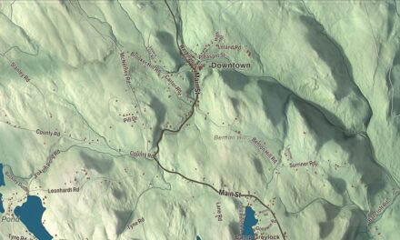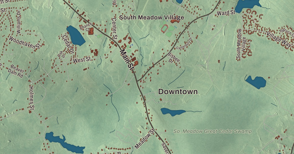
In Carver the landmarks are cranberry bogs, pine woods and ponds, along with the jousting at King Richard’s Faire every fall and Edaville’s lights at Christmas. This map prints Tremont Street, Main Street, North Main Street, South Main Street, South Meadow Road and Red Tail Lane, with Sampson Pond, Federal Pond, the Annasnappet Brook Reservoir, the A Godfrey Bog Reservoir and Federal Hill. Click here to purchase a print of this map for your wall.
Carver is in Plymouth County, about 45 miles south-southeast of Boston.
KNOWOL made this map in 2026 from public survey data and gave it the look of an old atlas. The relief comes from United States Geological Survey elevation data, and the roads and the town line come from the Census Bureau. Carver covers 40 square miles, with Plympton, Kingston, Plymouth, Wareham and Middleborough around it. It’s a land of small brooks, rivers and ponds, most draining toward Buzzards Bay, with pine and cedar woods, a large cedar swamp in the middle of town and part of Myles Standish State Forest in the southeast corner. The town had 11,645 people at the 2020 census.
Nine thousand years at Annasnappet
Archaeologists digging ahead of the new Route 44 found that people lived at the Annasnappet Pond Site in Carver for some 9,000 years, from about 10,000 to 1,000 years ago. They recovered up to 100,000 stone flakes and 1,600 stone tools, more Archaic artifacts than any other site in the Northeast, and a burial about 7,570 years old, the oldest found in Massachusetts.
The Town of Carver’s recorded history, in the Secretary of the Commonwealth’s list, dates European settlement to 1660. Settlers lived in the villages of South Carver, North Carver and Wenham, later called East Carver; North Carver was also known as Colchester and Lakenham, and people settled in the area called South Meadow. Each village had at least one schoolhouse. Carver was incorporated as a town in 1790, splitting from Plympton because many residents lived too far away to get to church there. It’s named for John Carver, the first governor of Plymouth Colony, who is credited with writing the Mayflower Compact and was its first signer. The town remains part of Plymouth County today.
Iron, then cranberries
Carver’s swamps held iron ore, and by the 1730s it was being made into cooking tools. The first iron works, Pope’s Point Furnace, was built in 1732 and ran for a century on the bogs and Sampson’s Pond. Sampson Pond itself, 310 acres in South Carver, was once a marsh that was dug out for its ore, which explains the rusty color of its water. Money from iron built several mansions that still stand. As the iron trade faded late in the 19th century, Carver turned its swamps into cranberry bogs. Farmers started growing cranberries in the 1870s, and by 1900 Carver’s growers raised a fifth of all the cranberries grown in the United States. By the 1940s the town’s harvest was the largest in the world, and it’s still a major business here.
Carver also has a road with a claim to fame. Savery’s Avenue, opened to the public in 1860 by William Savery, is the first divided highway in America, by the town page’s account. The trees between and beside its two roadways were to be left for “shade and ornament for man and beast,” and both roadbeds were paved with macadam in 1907.
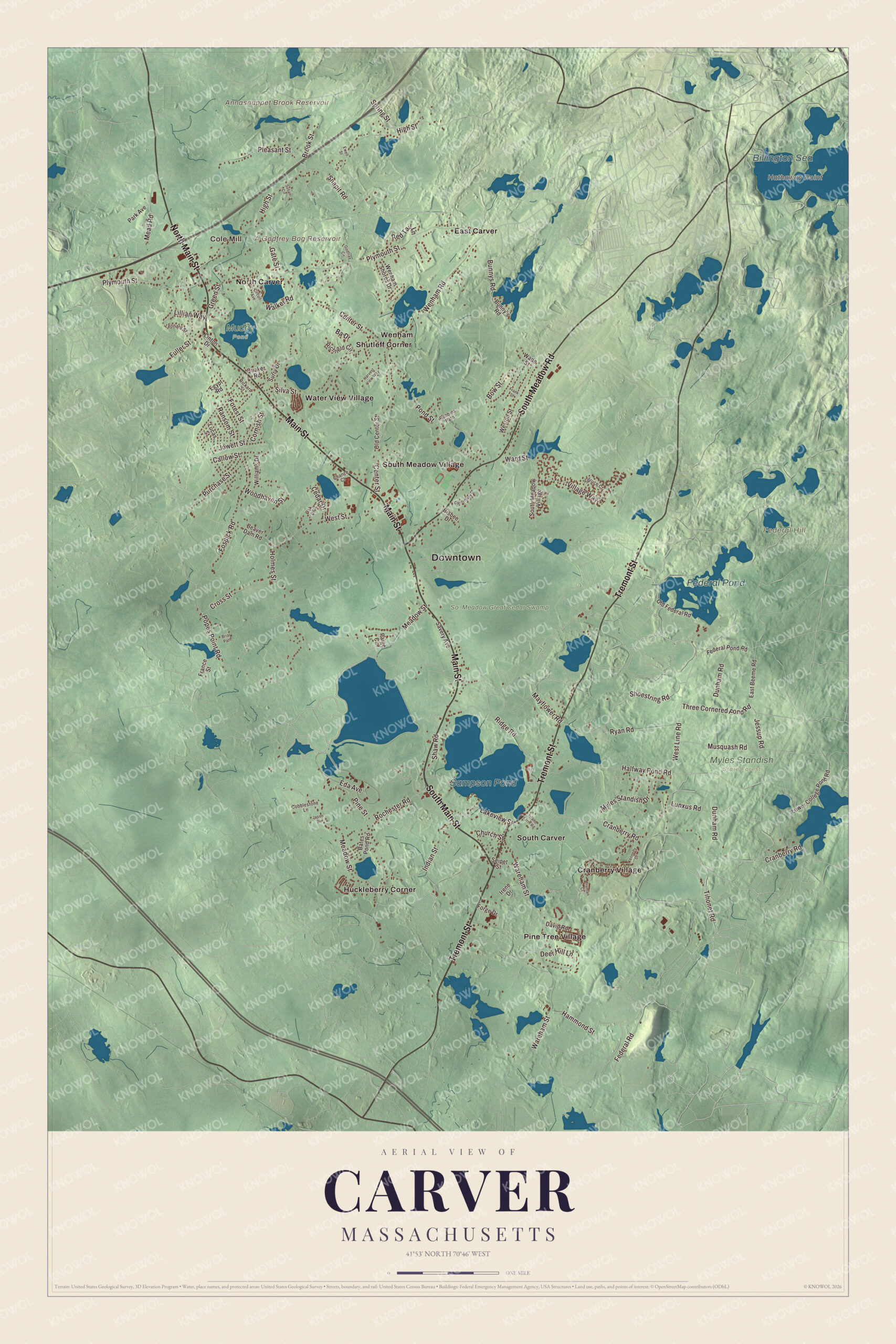
Click to explore a larger preview. The digital watermark does not appear on printed maps.
Names on this map
These names are printed on this map.
Places: Downtown, Cole Mill, Federal Hill, Hathaway Point, A Godfrey Bog Reservoir, Annasnappet Brook Reservoir, Sampson Pond, Billington Sea, Federal Pond, Muddy Pond, Myles Standish State Forest, So. Meadow Great Cedar Swamp, Cranberry Village, East Carver, Huckleberry Corner, North Carver, Pine Tree Village, Shutleff Corner, South Carver, South Meadow Village, Water View Village and Wenham.
Streets and roads: Tremont Street, Main Street, South Meadow Road, North Main Street, South Main Street, Red Tail Lane, Fuller Street, Meadow Street, Plymouth Street, High Street, Federal Road, Cranberry Road.
More street names, A to Z
Ba Drive, Bates Pond Road, Beaver Dam Road, Bisbee Drive, Bow Street, Briar Path, Brook Street, Bunny's Road, Bunnys Road, Callow Street, Canterbury Drive, Cedar Drive, Center Street, Chance Court, Church Street, Circuit Avenue, Cobblestone Lane, Cornish Street, Cross Street, David Road, Deer Hill Lane, Dunham Road, East Beeme Road, Eda Avenue, Egypt Road, Ewell Street, Federal Pond Road, Forest Street, Forge Drive, Fosdick Road, France Street, Frank Street, Gate Street, Godfray Circle, Green Street, Halfway Pond Road, Hammond Street, Harvest View Way, Holmes Street, Indian Street, Irene Drive, Island Farm Road, Jason Drive, Jessup Road, Jowett Street, Kennedy Drive, Lakeview Street, Leonard Street, Lillian Way, Linton Drive, Lower College Pond Road, Lucas Street, Lunxus Road, Mayflower Road, Mead Road, Musquash Road, Myles Standish Drive, Oak Drive, Old Center Street, Old Federal Road, Paige Circle, Park Avenue, Pine Street, Pleasant Street, Pond Street, Popes Point Road, Purchase Street, Quaker Road, Ransom Street, Richfield Circle, Rickard Street, Ridge Road, Robbins Path, Rochester Road, Ryan Road, Savery Avenue, Seipet Street, Shaw Road, Shoestring Road, Silva Street, Snapit Road, Spring Street, Spruce Court, Surry Drive, Susan Circle, Three Cornered Pond Road, Tihonet Road, Truman Court, Village Way, Wade Street, Walker Road, Ward Street, Wareham Street, Wenham Road, Wenham Shores Drive, West Line Road, Weston Street, West Street, Williams Drive, Woodhaven Street.
See it on a wall
The Carver map as a framed print. Swipe for more.


Trains in the bogs
Ellis D. Atwood, whose initials gave Edaville its name, bought narrow gauge locomotives and cars from Maine railroads that were shutting down, and after the 1945 harvest his crew laid 5.5 miles of track along the levees of his 1,800-acre cranberry farm in South Carver to haul sand and berries. His neighbors loved the little railroad. Atwood gave rides for free at first, then charged a nickel, and it turned into a tourist attraction. The town page dates its opening to 1949 and its own page to 1947. Edaville is best known for its festival of lights at Christmastime, and it came back from near closing after it was sold in 1991.
King Richard’s Faire, founded in 1982, recreates a 16th-century English marketplace on 80 acres of pine forest, with eight stages and knights jousting on horseback. It’s the largest and longest-running Renaissance fair in New England, open on weekends through September and October. In 2025 its new owners announced it would move to the Edaville grounds.
Around the map
Start at Cole Mill, then follow Tremont Street, Main Street, South Meadow Road, North Main Street, South Main Street and Red Tail Lane across town, and look outward toward Cranberry Village, East Carver, Huckleberry Corner, North Carver and Pine Tree Village. U.S. Route 44, a divided highway, crosses the north of town. Federal Pond, 129 acres on the Plymouth line, touches Myles Standish State Forest at its northeastern shore. The forest, 26 square miles of pitch pine and scrub oak in Plymouth and Carver, is the largest publicly owned recreation area in this part of the state, and its paved “Bicycle Trails of Carver” made the state’s list of 1000 great places in Massachusetts. A Godfrey Bog Reservoir, Annasnappet Brook Reservoir, Sampson Pond, Federal Pond, So. Meadow Great Cedar Swamp and Federal Hill are all printed on the map.
Carver’s map makes a fine addition to an office, library or den, and it can help teach children the geography and history of cranberry country. It’s made for people who call Carver home, from North Carver to South Carver, and it shows the town as it looks today. Zoom in on the preview above to explore the details, then click here to get your copy of the Carver, Massachusetts map.

Sources
- Carver, Massachusetts, Wikipedia
- Annasnappet Pond Site, Wikipedia
- John Carver (governor), Wikipedia
- Sampsons Pond, Wikipedia
- Edaville Railroad, Wikipedia
- King Richard’s Faire, Wikipedia
- Federal Pond, Wikipedia
- Myles Standish State Forest, Wikipedia
- City and Town Incorporation and Settlement Dates, Secretary of the Commonwealth of Massachusetts (archived copy)