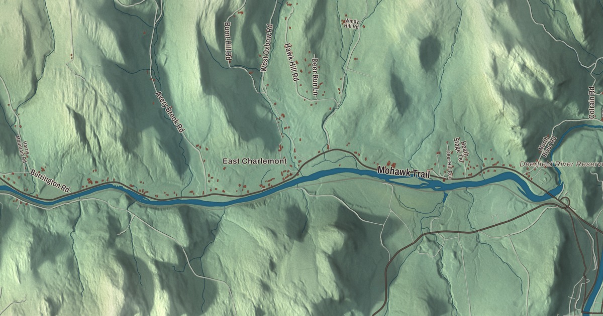
Charlemont lives along the Deerfield River and the Mohawk Trail: whitewater rafts on the river, skiers on Berkshire East, and the statue at Mohawk Park facing the sunrise. This map prints the Mohawk Trail, Main Street, North Heath Road, West Hawley Road, Tea Street and Tatro Road, with the Deerfield River, McLeod Pond, Bald Mountain, Blueberry Peak and Burnt Hill. Click here to purchase a print of this map for your wall.
Charlemont is in Franklin County, 18 miles west of Greenfield.
KNOWOL made this map in 2026 from public survey data and gave it the look of an old atlas. The relief comes from United States Geological Survey elevation data, and the roads and the town line come from the Census Bureau. The town covers 26.4 square miles in the eastern Berkshires, with Todd Mountain and the Mohawk Trail State Forest in the west and Bald Mountain and Westfield Mountain north of the center. The Deerfield River flows east through the middle of town to meet the North River at the eastern line, and most of Charlemont lies north of it. The town had 1,185 people at the 2020 census.
Boston Township Number 1
The land was set off in 1735 by the General Court as Boston Township Number 1. The Town of Charlemont’s recorded history, in the Secretary of the Commonwealth’s list, dates European settlement to 1742, and on April 23, 1743, Moses Rice bought 2,200 acres of it and became the first colonist. It was the distant frontier then, and the settlement was the target of several raids. Charlemont was incorporated as a town in 1765, most likely named for the town of Charlemont in County Armagh, in Ulster, and it remains part of Franklin County today.
Charlemont’s church once had a long standoff. The Rev. Jonathan Leavitt, a Yale graduate from Walpole, New Hampshire, came in 1767, just as Charlemont was turning against British rule, and his Loyalist leanings grated on his flock. By 1777 he was refusing to take his pay in fast-falling colonial money, so the town closed the church and put a constable at the door to keep him out. He simply moved his sermons to the schoolhouse and kept preaching until he was dismissed in 1785, then sued for his salary and won £700.
A station on the Underground Railroad
The minister’s descendants stayed in the valley, and some of them took a stand for freedom. Col. Roger Hooker Leavitt, who represented Charlemont in the Massachusetts House, and his brother Hart Leavitt ran stations on the Underground Railroad, sheltering many people escaping slavery on their way north. Roger’s home in Charlemont became known as a safe place, and Basil Dorsey, who had escaped slavery in Maryland, lived there for nearly six years before settling in Florence. Roger was president of the Franklin County Anti-Slavery Society, and his brother Joshua edited the abolitionist paper The Emancipator. The Revolutionary soldier and historian Lemuel Roberts helped his father start a farm here before he left to fight in the Siege of Boston.
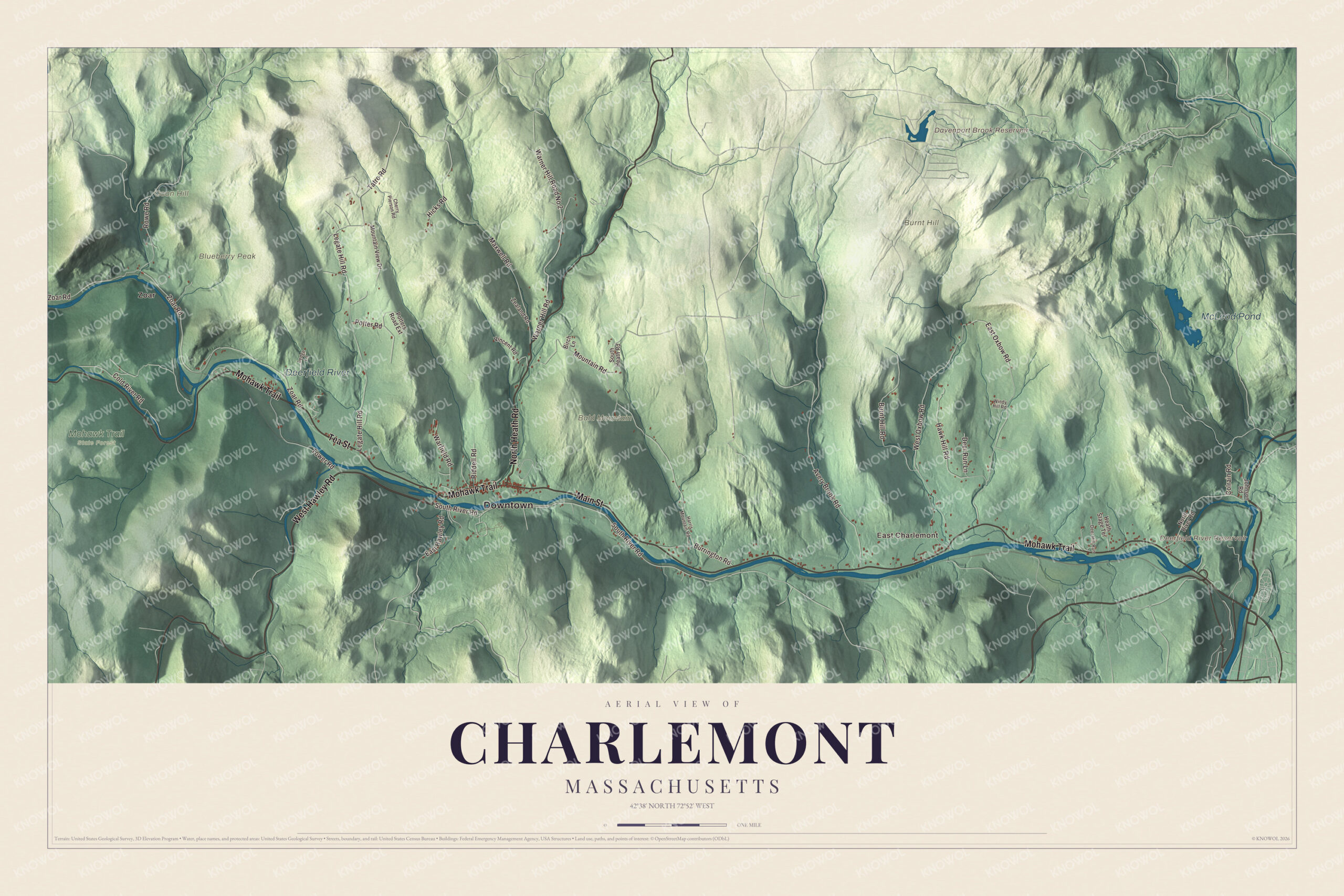
Click to explore a larger preview. The digital watermark does not appear on printed maps.
Names on this map
These names are printed on this map.
Places: Downtown, East Charlemont, Zoar, Bald Mountain, Blueberry Peak, Burnt Hill, Coon Hill, Davenport Brook Reservoir, Deerfield River Reservoir, McLeod Pond, Deerfield River and Mohawk Trail State Forest.
Streets and roads: North Heath Road, Mohawk Trail, Tea Street, West Hawley Road, Main Street, Tatro Road, Zoar Road, South River Road, Legate Hill Road, Mountain Road, West Oxbow Road, East Oxbow Road.
More street names, A to Z
Avery Brook Road, Birch Lane, Burnt Hill Road, Burrington Road, Cherry Pierson Road, Cold River Road, Colrain Road, Deer Hill Run, Deer Run Lane, East Hawley Road, Harris Mountain Road, Hawk Hill Road, Heath Stage Terrace, Hicks Road, Johnson Road, Ledge Lane, Maxwell Road, Mountain View Drive, North River Road, Potter Road, Potters Road Extension, Riddell Road, Rowe Road, South Heath Road, Tower Road, Vincent Road, Warfield Road, Warner Hill Road, Warner Hill Road No 2, Windy Hill Road, Zealand Road.
The Mohawk Trail
Farming was Charlemont’s main business until the railroad came through on its way to the Hoosac Tunnel, and freight trains still run along the river’s south bank toward the tunnel in neighboring Florida. Through most of town, the Deerfield is followed by the Mohawk Trail, Route 2, which began as a Native American trade route linking the Atlantic tribes with those of upstate New York. In Mohawk Park beside the road stands Hail to the Sunrise, a bronze statue by Joseph Pollia unveiled before more than 2,000 people on October 1, 1932, facing east with its arms extended; it was put up in memory of the Mohawk, though its own page notes the area was historically home to the Mohicans.
Today tourism keeps the town busy. Berkshire East, on Mount Institute, had 45 trails as of 2008, and in 2011 it became the first ski area in the world powered entirely by its own renewable energy, its page says. Whitewater rafting on the Deerfield is popular, there are zip line canopy tours, and the Mohawk Trail State Forest, created in 1921, keeps more than 7,700 acres of ridges, gorges and old-growth forest, with hemlocks approaching 500 years old and some of the tallest trees in Massachusetts.
Around the map
Start in East Charlemont, then follow North Heath Road, the Mohawk Trail, Tea Street, West Hawley Road, Main Street and Tatro Road across town, and look outward toward Zoar. Near the center, Route 2 shares a short stretch with Route 8A, and a covered bridge, the Bissell Bridge, crosses Mill Brook. Davenport Brook Reservoir, McLeod Pond, the Deerfield River, Bald Mountain, Blueberry Peak, Burnt Hill and the Deerfield River Reservoir are all printed on the map.
Charlemont’s map makes a fine addition to an office, library or den, and it can help teach children the geography and history of a river town on the Mohawk Trail. It’s made for people who call Charlemont home, from East Charlemont to Zoar, and it shows the town as it looks today. Zoom in on the preview above to explore the details, then click here to get your copy of the Charlemont, Massachusetts map.

We made a map for every town and city in Massachusetts. Explore the complete Massachusetts map collection and find your town.
Sources
- Charlemont, Massachusetts, Wikipedia
- Roger Hooker Leavitt, Wikipedia
- Mohawk Trail, Wikipedia
- Hail to the Sunrise, Wikipedia
- Berkshire East Ski Resort, Wikipedia
- Mohawk Trail State Forest, Wikipedia
- Bissell Bridge, Wikipedia
- City and Town Incorporation and Settlement Dates, Secretary of the Commonwealth of Massachusetts (archived copy)