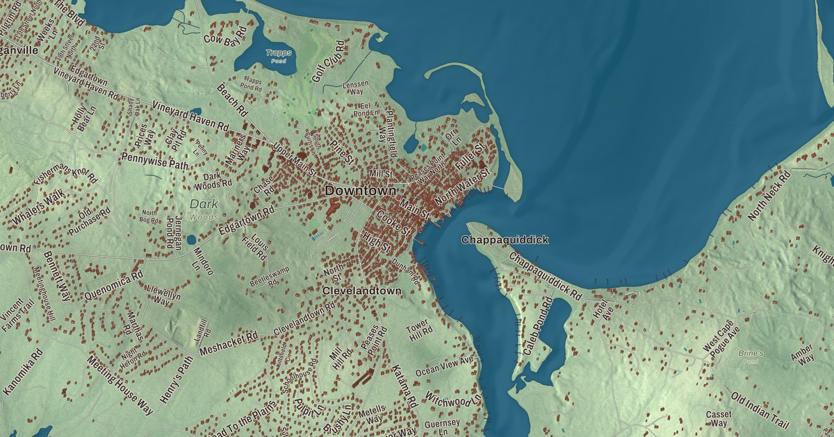
Edgartown is the old whaling port at the eastern end of Martha’s Vineyard, where captains’ houses line Water Street and a ferry runs across to Chappaquiddick. This map prints North Water Street, Main Street, Pine Street, Vineyard Haven Road, Mattakesett Way and Pohogonot Road, with Edgartown Great Pond, Crackatuxet Cove, Pocha Pond and the Wasque Reservation. Click here to purchase a print of this map for your wall.
Edgartown is in Dukes County, and it’s the county seat.
KNOWOL made this map in 2026 from public survey data and gave it the look of an old atlas. The relief comes from United States Geological Survey elevation data, and the roads and the town line come from the Census Bureau. Edgartown covers 122.7 square miles, but only 27 of them are land, and it’s the largest town by land area in Dukes County. Nantucket Sound lies to the northeast and east, the Atlantic Ocean to the south, West Tisbury to the west and Oak Bluffs to the north. The town had 5,168 people at the 2020 census.
Great Harbor
The Wampanoag lived on the island they called Noepe long before the English came. The Town of Edgartown’s recorded history, in the Secretary of the Commonwealth’s list, dates European settlement to 1642, when Thomas Mayhew, who had bought the island, sent his son Thomas Mayhew Jr. with a group of families to start a colony at a place they called Great Harbor. Edgartown was incorporated as a town in 1671, on July 8, as “Edgar Towne,” named for Edgar, son of the future King James II; the people who chose the name didn’t know the boy had died a month earlier, at the age of three. With Tisbury, it was one of the two original towns on Martha’s Vineyard, and the town remains part of Dukes County today.
The younger Mayhew went on to become the first church-planting Protestant missionary, and his partner in founding churches in the Native communities was Hiacoomes, a Wampanoag man who lived nearby. In 1643 Hiacoomes became the first of his people on the island to become a Christian, learned to read, and went on to be a leading preacher to the Wampanoag. Chappaquiddick, whose name comes from a Native word for “separated island,” was long the home of the Chappaquiddick band of the Wampanoag, who still hold a reservation of about 100 acres in its interior.
Whaling captains and widow’s walks
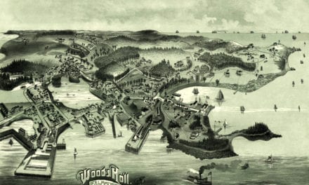
In the 1800s Edgartown was one of the main ports of the whaling industry. Ships from all over the world anchored in its sheltered harbor, and captains built grand houses with small rooftop rooms called widow’s walks. The story that wives kept watch from them for ships coming home is a myth, its page says; they were often built around the chimney, so sand could be poured down to put out a chimney fire. As cheaper fuels came along, whaling faded, and by the start of the 20th century it no longer shaped the town. Many of those “Captain’s Homes” still line both sides of Water Street, inside the Edgartown Village Historic District with the Dukes County Courthouse and the Whaling Church, now a performing arts center. The Edgartown Harbor Light, at the end of North Water Street, marks the entrance to the harbor and Katama Bay. The first light went up just offshore in 1828, and the wooden causeway built out to it in 1830 was called the “Bridge of Sighs,” for the islanders who stood there watching whaling ships leave on voyages of up to five years. The present iron tower dates to 1939.
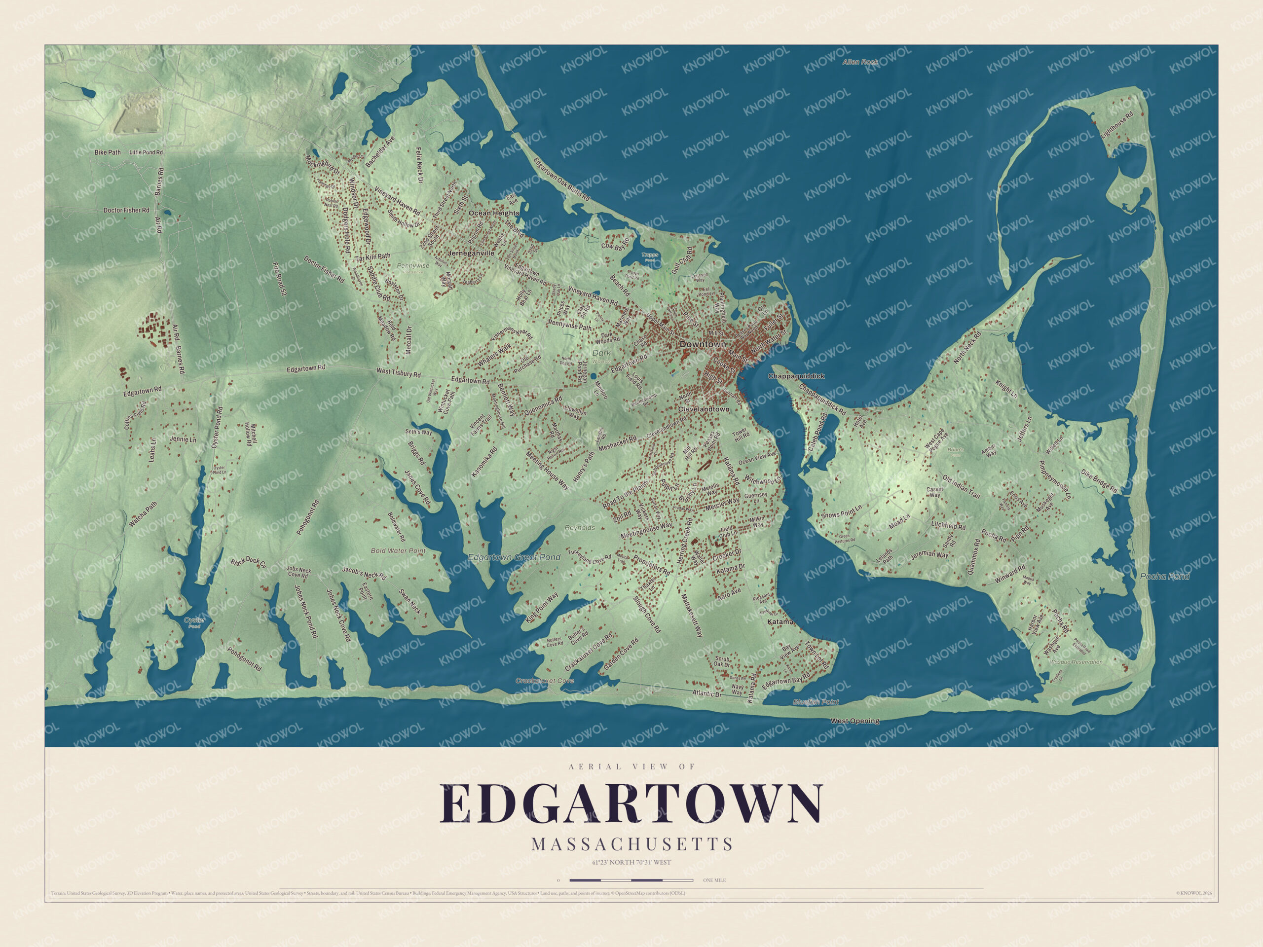
Click to explore a larger preview. The digital watermark does not appear on printed maps.
Names on this map
These names are printed on this map.
Places: Downtown, Allen Rock, Bluefish Point, Bold Water Point, Crackatuxet Cove, Edgartown Great Pond, Pocha Pond, Brine's Pond, Dark Woods, Oyster Pond, Pennywise Preserve, Reynolds, Trapps Pond, Wasque Reservation, Chappaquiddick, Clevelandtown, Jerneganville, Katama, Ocean Heights and West Opening.
Streets and roads: Vineyard Haven Road, Main Street, Pine Street, North Water Street, Mattakesett Way, Pohogonot Road, Proprietors Road, Pennywise Path, Meshacket Road, The Boulevard, Jacob's Neck Road, Dike Bridge Road.
More street names, A to Z
13th Street North, 19th Street North, 22nd Street, 22nd Street South, Aero Avenue, Air Road, Amber Way, Arbutus Way, Atlantic Drive, Bachelder Avenue, Barnes Road, Bay View Avenue, Beach Road, Beetleswamp Road, Bennett Way, Bike Path, Black Duck Cv, Bold Meadow Road, Boldwater Road, Boylston Drive, Briggs Road, Brushy Lane, Butler's Cove Road, Butlers Cove Road, Caleb Pond Road, Casset Way, Chappaquiddick Road, Chase Road, Clay Pit Road, Clevelandtown Road, Coffins Field Road, Cooke Street, Cow Bay Road, Crackatuxet Cove Road, Crocker Drive, Dark Woods Road, Doctor Fisher Road, Dodgers Hole Road, Dunes Road, Dunham Road, Earl Avenue, Eastern Point, Edgartown Bay Road, Edgartown Oak Bluffs Road, Edgartown Road, Edgartown Vineyard Haven Road, Edgewood Drive, Eel Pond Lane, Enos Avenue, Faulkner Drive, Felix Neck Drive, Field Club Lane, Fire Road 52, Fishermans Knot Road, Flamingo Drive, Fuller Street, Garden Cove Road, Golf Club Road, Green Pastures Road, Guernsey Lane, Harbor View Avenue, Henry's Path, Herring Creek Road, High Street, Holly Bear Lane, Hotel Avenue, Janes Cove Road, Jeffers Lane, Jennie Lane, Jeremiah Way, Jernegan Pond Road, Jobes Neck Cove Road, Jobes Neck Pond Road, Jobs Neck Cove Road, Kane Lane, Kanomika Road, Katama Drive, Katama Road, King Point Way, Kittsfield Circle, Knight Lane, Landfill Road, Leahs Lane, Lelands Path, Lenssen Way, Lighthouse Road, Litchfield Road, Little Pond Road, Llewellyn Way, Louis Field Road, Maqua Way, Mariners Way, Marthas Road, Mead Lane, Meetinghouse Hill, Meeting House Way, Meetinghouse Way, Mercier Way, Metcalf Drive, Metells Way, Milkin Way, Mill Hill Road, Mill Street, Mindoro Lane, Mitchell Hollow Road, Mockingbird Drive, Morgan Way, Motick Trail, Muskeget Avenue, Myober Lane, Navy Way, Night Heron Road, North Bog Road, North Neck Road, North Street, Ocean View Avenue, Old Indian Trail, Old Purchase Road, Old Wintucket Way, Orr Lane, Oyster Pond Lane, Oyster Pond Road, Pamela Way, Peases Point Road, Peases Point Way North, Penny Lane, Pilgrim Road, Pimpneymouse Lane, Pipn Road, Plantingfield Way, Pleasant Avenue, Pocha Road, Pocha Road Extended, Pradas Way, Prices Way, Pulpit Lane, Quammox Road, Quenomica Road, Road To the Plains, Robins Nest Road, Saddle Club Road, Sandy Road, Schoolhouse Road, Scrub Oak Drive, Seth's Way, Shady Oak Lane, Sixth Street, Slough Cove Road, Smith Hollow Drive, Snows Point Lane, South Curtis Lane, Sutton Way, Swan Neck, Tar Kiln Path, Teaberry Lane, Thaxter Lane, Third Street North, Tower Hill Road, Town Lot Road, Trapps Pond Road, Trustees Lane, Turkeyland Cove Road, Upper Main Street, Vickers Way, Vincent Farms Trail, Waller Way, Washque Avenue, Watcha Path, Weeks Lane, West Cape Pogue Avenue, West Tisbury Road, Whalers Walk, Willett Lane, Windsor Drive, Wintucket Cove Path, Winward Road, Witchwood Lane, Woodhaven Drive, Zoll Road.
See it on a wall
The Edgartown map as a framed print. Swipe for more.


Chappaquiddick and the south shore
Chappaquiddick sits across the harbor and Katama Bay, tied to the rest of the island at times by Norton Point, a barrier beach that storms sometimes break through. On its south shore is Wasque, a 200-acre Trustees of Reservations property since 1967, with a beach Travel + Leisure named the best in New England. On its northeast tip stands Cape Poge Light, a 35-foot wooden tower from 1893 that in 1987 became the first lighthouse moved by helicopter. South of the town center, Katama has a beach, the Katama Airpark and farms, and South Beach runs along the ocean from Edgartown toward Aquinnah, quieter out near Edgartown Great Pond. Edgartown was also the main filming location for the town of Amity in Steven Spielberg’s Jaws, and many of the places in the film can still be seen.
Around the map
Start with Chappaquiddick, then follow Vineyard Haven Road, Main Street, Pine Street, North Water Street, Mattakesett Way and Pohogonot Road across town, and look outward toward Clevelandtown, Jerneganville, Katama, Ocean Heights and West Opening. Half of the Manuel F. Correllus State Forest lies in Edgartown and the rest in West Tisbury. Crackatuxet Cove, Edgartown Great Pond, Pocha Pond and the Wasque Reservation are all printed on the map.
The Edgartown map makes a fine addition to an office, library or den, and it can help teach children the geography and history of an old Vineyard whaling port. It’s made for people who call Edgartown home, from Katama to Chappaquiddick, and it shows the town as it looks today. Zoom in on the preview above to explore the details, then click here to get your copy of the Edgartown, Massachusetts map.

Sources
- Edgartown, Massachusetts, Wikipedia
- Thomas Mayhew, Wikipedia
- Hiacoomes, Wikipedia
- Chappaquiddick Island, Wikipedia
- Edgartown Village Historic District, Wikipedia
- Edgartown Harbor Light, Wikipedia
- Wasque, Wikipedia
- Cape Poge Light, Wikipedia
- City and Town Incorporation and Settlement Dates, Secretary of the Commonwealth of Massachusetts (archived copy)