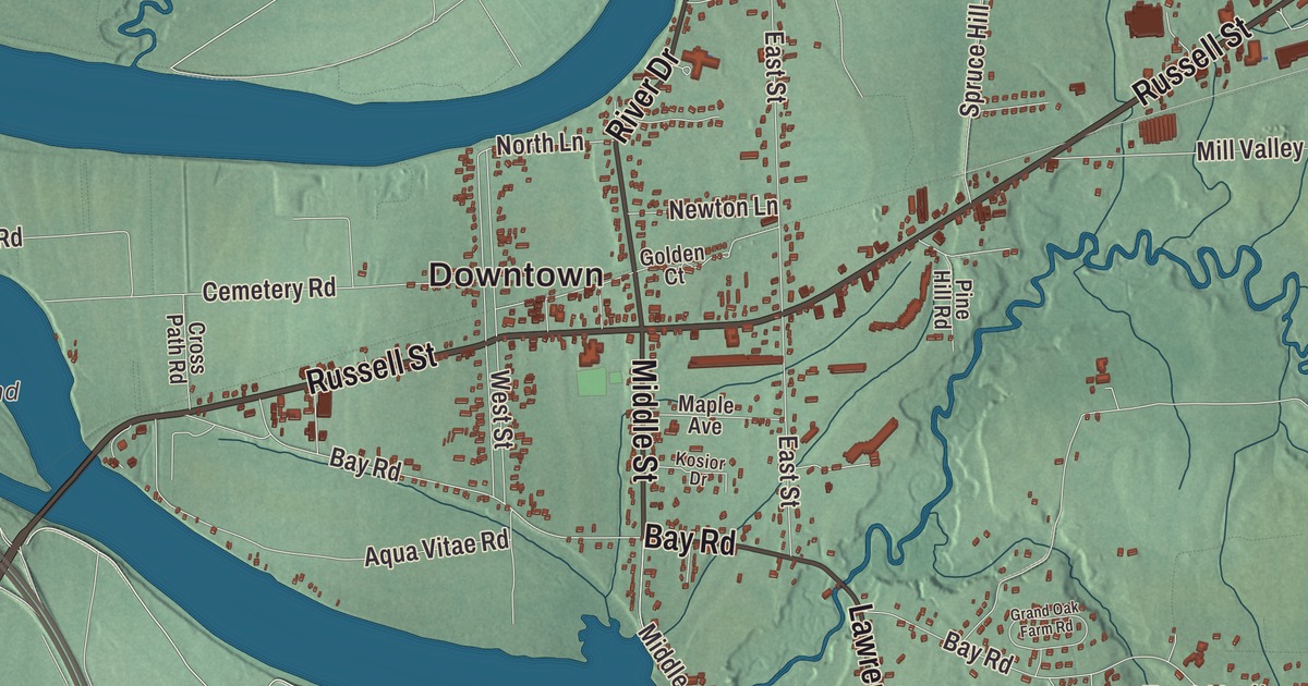
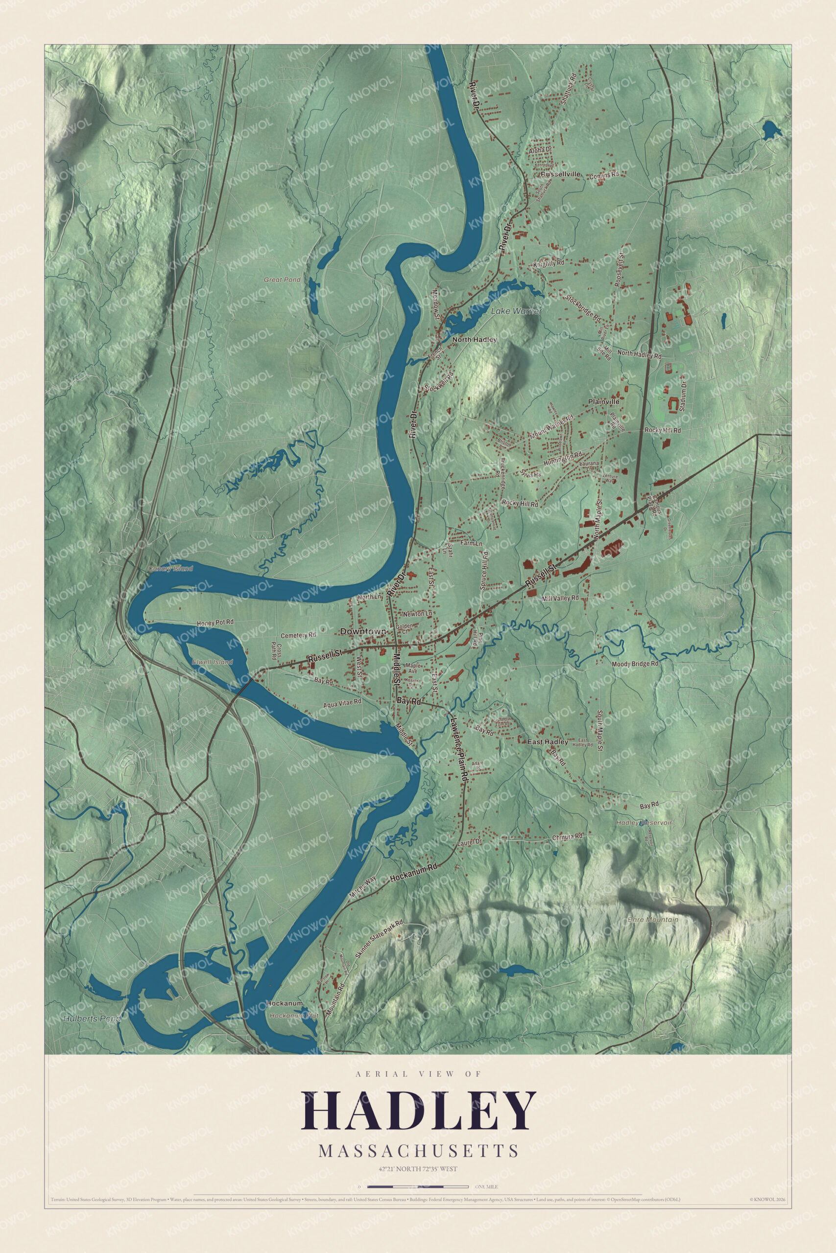
Hadley keeps a rare open-field farming landscape along the Connecticut River, a style from New England’s earliest settlements, with the Mount Holyoke Range on its southern line. This map prints Russell Street, Bay Road, Middle Street, River Drive, Hockanum Road and Lawrence Plain Road, with Lake Warner, Great Pond, Hulberts Pond, the Hadley Reservoir, Bare Mountain, Canary Island and Elwell Island. Click here to purchase a print of this map for your wall.
Hadley is in Hampshire County.
KNOWOL made this map in 2026 from public survey data and gave it the look of an old atlas. The relief comes from United States Geological Survey elevation data, and the streets and the town line come from the Census Bureau. Hadley covers 24.6 square miles on the east bank of the Connecticut, between Sunderland, Amherst and South Hadley, with Hatfield, Northampton, Easthampton and Holyoke across the river. Its highest point is on Mount Hitchcock in the Mount Holyoke Range, and part of the University of Massachusetts Amherst lies inside the town. Hadley had 5,325 people at the 2020 census.
Norwottuck becomes Hadley
The Town of Hadley’s recorded history, in the Secretary of the Commonwealth’s list, dates European settlement to 1659, and Hadley was incorporated as a town in 1661, the same two years the town page gives. The old Norwottuck was renamed for Hadleigh in Suffolk. Its settlers were mostly families from Hartford and Wethersfield, Connecticut, who left after a church dispute and came north under John Russell. Nathaniel Dickinson, the first settler, surveyed the streets of what are now Hadley, Hatfield and Amherst. Early Hadley stretched across both sides of the river, and Hatfield, Amherst, South Hadley, Granby and Belchertown were all later carved from it. The town remains part of Hampshire County today.
Two Puritan generals hunted for their part in the execution of Charles I of England, Edward Whalley and William Goffe, hid in Hadley in the minister John Russell’s house, and a monument marks the spot. Out of their story grew the legend of the Angel of Hadley, built on accounts that Goffe helped turn back an attack during King Philip’s War, a tale Goffe’s page calls disputed.
Schools, farms and a general
Hopkins Academy was founded in 1664 with money left by Edward Hopkins, a governor of the Connecticut Colony, and the people of Hadley gave land to build up the trust. The town page lists it as the fourth oldest school in the United States, and the academy’s page says the Hopkins Trust is the oldest charitable fund in continuous use in the country. Today it’s Hadley’s public middle and high school. Joseph Hooker, the Civil War general, was born in Hadley in 1814 and went to Hopkins Academy. Levi Stockbridge, a Hadley farmer and scientist, helped found the Massachusetts Agricultural College, now the University of Massachusetts Amherst, and served as its first professor of agriculture and later its president.
Much of Hadley’s landscape is open-field farming, a pattern used only in the earliest New England settlements and mostly gone by the 1700s, and in 2010 the World Monuments Fund put the “Cultural Landscape of Hadley” on its Watch List to help protect it. A wide variety of farms here benefit from the area’s Hadley loam.
River Drive and Hockanum
On River Drive, Route 47, between the road and the Connecticut, stands the Porter-Phelps-Huntington House, known as Forty Acres. Built in 1752, it was home to one family for nearly two hundred years until a member of the eighth generation turned it into a museum in the 1940s, and the original diary of Elizabeth Porter Phelps survives among the family archives at UMass Amherst. The Hockanum Rural Historic District runs along the river and up to the summit ridge of Mount Holyoke, taking in the farmland of the valley and the historic Summit House. Timothy Dwight’s writing and Thomas Cole’s paintings made the view from Mount Holyoke known in the 1800s, and Joseph Skinner later gave his holdings there to the state to form Skinner State Park. The Norwottuck Rail Trail crosses Hadley on its way from Northampton to Belchertown, over its own bridge on the Connecticut.
Click to explore a larger preview. The digital watermark does not appear on printed maps.
Names on this map
These names are printed on this map.
Places: Downtown, Hockanum, Bare Mountain, Canary Island, Elwell Island, Hockanum Flat, Great Pond, Hadley Reservoir, Hulberts Pond, Lake Warner, East Hadley, North Hadley, Plainville and Russellville.
Streets and roads: Russell Street, Lawrence Plain Road, Bay Road, Middle Street, Hockanum Road, River Drive, Meadow Street, Roosevelt Street, North Maple Street, North Lane, Shattuck Road, Rocky Hill Road.
More street names, A to Z
Adare Place, Aloha Drive, Aqua Vitae Road, Barstow Lane, Breckenridge Road, Bristol Lane, Campus Plaza Road, Cemetery Road, Chmura Road, Comins Road, Cross Path Road, Crystal Lane, East Hadley Road, East Street, Farm Lane, French Street, Golden Court, Grand Oak Farm Road, Greenleaves Drive, Hawley Road, Honey Pot Road, Huntington Road, Kennedy Drive, Knightly Road, Kosior Drive, Laurana Lane, Laurel Drive, Maple Avenue, Mill River Lane, Mill Site Road, Mill Valley Road, Mitchs Way, Moody Bridge Road, Mountain Road, Mount Warner Road, Newton Lane, North Hadley Road, Old Mountain Road, Pine Hill Road, Plainville Road, Reservoir Road, Skinner State Park Road, South Maple Street, South Shattuck Road, Spruce Hill Road, Stadium Drive, Stockbridge Road, Stockwell Road, Sylvia Heights, Szafir Lane, Venture Way, Wampanoag Drive, West Street, Woodlawn Road.
Around the map
Start with Hockanum, then follow Russell Street, Lawrence Plain Road, Bay Road, Middle Street, Hockanum Road and River Drive across town. Look outward toward East Hadley, North Hadley, Plainville and Russellville. Great Pond, the Hadley Reservoir, Hulberts Pond, Lake Warner, Bare Mountain, Canary Island and Elwell Island are all printed on the map. Bare Mountain stands mostly in Amherst and South Hadley, with part of its northeastern flank in Hadley.
The Hadley map makes a fine addition to an office, library or den, and it can help teach children the geography and history of a town that still farms its old open fields. It’s made for people who call Hadley home, from Hockanum to North Hadley, and it shows the town as it looks today. Zoom in on the preview above to explore the details, then click here to get your copy of the Hadley, Massachusetts map.

We made a map for every town and city in Massachusetts. Explore the complete Massachusetts map collection and find your town.
Sources
- Hadley, Massachusetts, Wikipedia
- William Goffe, Wikipedia
- Hopkins Academy, Wikipedia
- Joseph Hooker, Wikipedia
- Levi Stockbridge, Wikipedia
- Porter-Phelps-Huntington House, Wikipedia
- Hockanum Rural Historic District, Wikipedia
- Norwottuck Branch Rail Trail, Wikipedia
- Bare Mountain (Massachusetts), Wikipedia
- City and Town Incorporation and Settlement Dates, Secretary of the Commonwealth of Massachusetts (archived copy)